Those mid-summer post-breeding wanders continue to delight birders throughout the Mid-Atlantic States. One colorful denizen of ponds and wetlands that has yet to put in an appearance in the Lower Susquehanna River Watershed this year is the Black-bellied Whistling Duck. You might remember this species from earlier posts describing the fortieth anniversary of your editor’s journey to the Lower Rio Grande Valley of Texas. Like many other birds, the Black-bellied Whistling Duck has been extending its range north from Texas, Florida, and other states along the Gulf Coastal Plain. Populations of these waterfowl are chiefly resident birds with some short-distance movement to find suitable habitat for feeding and nesting. They are not usually migratory, so summertime wandering may be the mechanism for their discovery of new habitats advantageous for nesting in areas north of their current home.
Presently, at least two dozen Black-bellied Whistling Ducks are being seen regularly at a stormwater retention pond in a housing subdivision along Amalfi Drive west of Smyrna, Delaware. This small population of avian tourists has spent at least two summers in the area. Just yesterday, Black-bellied Whistling Ducks were seen and photographed about ten miles to the east at Bombay Hook National Wildlife Refuge. Nine were counted there while 27 were being watched simultaneously at the Amalfi site. Earlier this week, a single Black-bellied Whistling Duck visited the John Heinz National Wildlife Refuge in Philadelphia, indicating that the influx of these vagrants has transited the entire Delmarva Peninsula and entered Pennsylvania. So while you’re out watching for those first southbound migrants of the year, be on the lookout for wayward wanderers too—wanderers like Black-bellied Whistling Ducks!
Black-bellied Whistling Ducks in a stormwater retention pond west of Smyrna, Delaware.Summertime exploration of new areas outside their resident turf may enable Black-bellied Whistling Ducks to find favorable habitats for extending their breeding range north.Black-bellied Whistling Ducks favor vegetated ponds, pools, and wetlands for feeding and nesting.Did you remember to go to the post office and buy a Federal Duck Stamp? Your purchase helps provide habitat for Black-bellied Whistling Ducks and so many other magnificent birds. And don’t forget, it’s your ticket for admission to our National Wildlife Refuges for an entire year!
Have you purchased your 2023-2024 Federal Duck Stamp? Nearly every penny of the 25 dollars you spend for a duck stamp goes toward habitat acquisition and improvements for waterfowl and the hundreds of other animal species that use wetlands for breeding, feeding, and as migration stopover points. Duck stamps aren’t just for hunters, purchasers get free admission to National Wildlife Refuges all over the United States. So do something good for conservation—stop by your local post office and get your Federal Duck Stamp.
Your Federal Duck Stamp is your admission ticket for entry into many of the country’s National Wildlife Refuges including Bombay Hook National Wildlife Refuge on Delaware Bay near Smyrna, Delaware.
Still not convinced that a Federal Duck Stamp is worth the money? Well then, follow along as we take a photo tour of Bombay Hook National Wildlife Refuge. Numbers of southbound shorebirds are on the rise in the refuge’s saltwater marshes and freshwater pools, so we timed a visit earlier this week to coincide with a late-morning high tide.
This pair of Northern Bobwhite, a species now extirpated from the Lower Susquehanna River Watershed and the rest of Pennsylvania, escorted us into the refuge. At Bombay Hook, they don’t waste your money mowing grass. Instead, a mosaic of warm-season grasses and early successional growth creates ideal habitat for Northern Bobwhite and other wildlife.Twice each day, high tide inundates mudflats in the saltwater tidal marshes at Bombay Hook prompting shorebirds to move into the four man-made freshwater pools. Birds there can often be observed at close range. The auto tour route through the refuge primarily follows a path atop the dikes that create these freshwater pools. Morning light is best when viewing birds on the freshwater side of the road, late-afternoon light is best for observing birds on the tidal saltwater side.A Great Blue Heron at high tide on the edge of a tidal creek that borders Bombay Hook’s tour route at Raymond Pool.Semipalmated Sandpipers stream into Raymond Pool to escape the rising tide in the salt marsh.More Semipalmated Sandpipers and a single Short-billed Dowitcher (Limnodromus griseus) arrive at Raymond Pool.Two more Short-billed Dowitchers on the way in.Recent rains have flooded some of the mudflats in Bombay Hook’s freshwater pools. During our visit, birds were often clustered in areas where bare ground was exposed or where water was shallow enough to feed. Here, Short-billed Dowitchers in the foreground wade in deeper water to probe the bottom while Semipalmated Sandpipers arrive to feed along the pool’s edge. Mallards, American Avocets, and egrets are gathered on the shore.More Short-billed Dowitchers arriving to feed in Raymond Pool.Hundreds of Semipalmated Sandpipers gathered in shallow water where mudflats are usually exposed during mid-summer in Raymond Pool.Hundreds of Semipalmated Sandpipers, several Short-billed Dowitchers, and some Forster’s Terns (Sterna forsteri) crowd onto a mud bar at Bear Swamp Pool.A zoomed-in view of the previous image showing a tightly packed crowd of Semipalmated Sandpipers, Forster’s Terns, and a Short-billed Dowitcher (upper left).Short-billed Dowitchers wading to feed in the unusually high waters of Raymond Pool.Short-billed Dowitchers, American Avocets, and a Snowy Egret in Raymond Pool. A single Stilt Sandpiper (Calidris himantopus) can been seen flying near the top of the flock of dowitchers just below the egret.Zoomed-in view of a Stilt Sandpiper (Calidris himantopus), the bird with white wing linings.American Avocets probe the muddy bottom of Raymond Pool.Among these Short-billed Dowitchers, the second bird from the bottom is a Dunlin. This sandpiper, still in breeding plumage, is a little bit early. Many migrating Dunlin linger at Bombay Hook into October and even November.This Least Sandpiper found a nice little feeding area all to itself at Bear Swamp Pool.Lesser Yellowlegs at Bear Swamp Pool.Lesser Yellowlegs at Bear Swamp PoolA Greater Yellowlegs at Bear Swamp Pool.A Caspian Tern patrolling Raymond Pool.The chattering notes of the Marsh Wren’s (Cistothorus palustris) song can be heard along the tour road wherever it borders tidal waters.This dome-shaped Marsh Wren nest is supported by the stems of Saltwater Cordgrass (Sporobolus alterniflorus), a plant also known as Smooth Cordgrass. High tide licks at the roots of the cordgrass supporting the temporary domicile.By far the most common dragonfly at Bombay Hook is the Seaside Dragonlet (Erythrodiplax berenice). It is our only dragonfly able to breed in saltwater. Seaside Dragonlets are in constant view along the impoundment dikes in the refuge.Red-winged Blackbirds are still nesting at Bombay Hook, probably tending a second brood.Look up! A migrating Bobolink passes over the dike at Shearness Pool.Non-native Mute Swans and resident-type Canada Geese in the rain-swollen Shearness Pool.A pair of Trumpeter Swans (Cygnus buccinator) as seen from the observation tower at Shearness Pool. Unlike gregarious Tundra and Mute Swans, pairs of Trumpeter Swans prefer to nest alone, one pair to a pond, lake, or sluggish stretch of river. The range of these enormous birds was restricted to western North America and their numbers were believed to be as low as 70 birds during the early twentieth century. An isolated population consisting of several thousand birds was discovered in a remote area of Alaska during the 1930s allowing conservation practices to protect and restore their numbers. Trumpeter Swans are slowly repopulating scattered east coast locations following recent re-introduction into suitable habitats in the Great Lakes region.A Great Egret prowling Shearness Pool.A Snowy Egret in Bear Swamp Pool.Wood Ducks in Bear Swamp Pool.A Bombay Hook N.W.R. specialty, a Black-necked Stilt and young at Bear Swamp Pool.
As the tide recedes, shorebirds leave the freshwater pools to begin feeding on the vast mudflats exposed within the saltwater marshes. Most birds are far from view, but that won’t stop a dedicated observer from finding other spectacular creatures on the bay side of the tour route road.
Bombay Hook National Wildlife Refuge protects a vast parcel of tidal salt marsh and an extensive network of tidal creeks. These areas are not only essential wildlife habitat, but are critical components for maintaining water quality in Delaware Bay and the Atlantic.The shells of expired Atlantic Horseshoe Crabs were formerly widespread and common among the naturally occurring flotsam along the high tide line on Delaware Bay. We found just this one during our visit to Bombay Hook. Man has certainly decimated populations of this ancient crustacean during recent decades.As the tide goes out, it’s a good time for a quick walk into the salt marsh on the boardwalk trail opposite Raymond Pool.Among the Saltmarsh Cordgrass along the trail and on the banks of the tidal creek there, a visitor will find thousands and thousands of Atlantic Marsh Fiddler Crabs (Minuca pugnax).Atlantic Marsh Fiddler Crabs and their extensive system of burrows help prevent the compaction of tidal soils and thus help maintain ideal conditions for the pure stands of Saltwater Cordgrass that trap sediments and sequester nutrients in coastal wetlands.A male Atlantic Marsh Fiddler Crab peers from its den.Herons and egrets including this Great Egret are quite fond of fiddler crabs. As the tide goes out, many will venture away from the freshwater pools into the salt marshes to find them.A Green Heron seen just before descending into the cordgrass to find fiddler crabs for dinner.A juvenile Clapper Rail (Rallus crepitans crepitans) emerges from the cover of the cordgrass along a tidal creek to search for a meal.Glossy Ibis leave their high-tide hiding place in Shearness Pool to head out into the tidal marshes for the afternoon.Great Black-backed Gulls, Herring Gulls, and possibly other species feed on the mudflats exposed by low tide in the marshes opposite Shearness Pool.An Osprey patrols the vast tidal areas opposite Shearness Pool.
No visit to Bombay Hook is complete without at least a quick loop through the upland habitats at the far end of the tour route.
Indigo Buntings nest in areas of successional growth and yes, that is a Spotted Lanternfly on the grape vine at the far right side of the image.Blue Grosbeaks (Passerina caerulea) are common nesting birds at Bombay Hook. This one was in shrubby growth along the dike at the north end of Shearness Pool.These two native vines are widespread at Bombay Hook and are an excellent source of food for birds. The orange flowers of the Trumpet Vine are a hummingbird favorite and the Poison Ivy provides berries for numerous species of wintering birds.The Pileated Woodpecker is one of the numerous birds that supplements its diet with Poison Ivy berries. The tree this individual is visiting is an American Sweetgum (Liquidambar styraciflua), a species native to the Atlantic Coastal Plain in Delaware. The seed balls are a favorite winter food of goldfinches and siskins.Finis Pool has no frontage on the tidal marsh but is still worth a visit. It lies along a spur road on the tour route and is located within a deciduous coastal plain forest. Check the waters there for basking turtles like this giant Northern Red-bellied Cooter (Pseudemys rubiventris) and much smaller Painted Turtle.The White-tailed Deity is common along the road to Finis Pool.Fowler’s Toads (Anaxyrus fowleri) breed in the vernal ponds found in the vicinity of Finis Pool and elsewhere throughout the refuge.The National Wildlife Refuge System not only protects animal species, it sustains rare and unusual plants as well. This beauty is a Turk’s Cap Lily (Lilium superbum), a native wildflower of wet woods and swamps.Just as quail led us into the refuge this morning, this Wild Turkey did us the courtesy of leading us to the way out in the afternoon.
We hope you’ve been convinced to visit Bombay Hook National Wildlife Refuge sometime soon. And we hope too that you’ll help fund additional conservation acquisitions and improvements by visiting your local post office and buying a Federal Duck Stamp.
The gasoline and gunpowder gang’s biggest holiday of the year has arrived yet again. Where does all the time go?
In observance of this festive occasion, we’ve decided to take a look at all the stuff that’s floating around in the atmosphere before all the motor travel, celebratory fires, and exciting explosions get underway.
We’ll start with the smoke from wildfires in Canada…
In the margins between the water vapor clouds, a smoky haze can be seen across the Mid-Atlantic States this morning. To warn residents of the potential health impacts, air quality alerts have been issued by numerous state and local agencies. (NOAA/GOES image)Near the top of this image, ember-red areas denote the locations of some of the hottest forest fires presently burning in remote portions of northern Quebec. (NOAA/GOES Fire Temperature Composite image)Wildfires are now burning in every province in Canada. Note the smoky haze that is visible between the water vapor clouds as it drifts from Alberta, Manitoba, and Saskatchewan through the Great Lakes and into the Mid-Atlantic States. (NOAA/GOES image)
If you think that smoke accounts for all the particulate matter now obscuring skies in the northern half of the western hemisphere, then have a gander at this…
As it often does at this time of year, dust from the Sahara Desert in northern Africa is blowing into the Caribbean Islands and Amazonia. This morning’s full-disk satellite image shows both the smoke from wildfires in Canada and a well-defined earth-tone cloud of desert dust streaming west across the Atlantic from Africa. (NOAA/GOES image)
As you can see, natural processes are currently providing a plentiful load of particulates in our skies. There’s no real need to aggravate yourself and the situation by sitting in traffic or burning your groceries on the barbecue. And you can let those cult-like homeowner chores for later. After all, running the mower, whacker, and blower will only add to the airborne pollutants. While celebrating this Fourth of July, why risk mangling fingers on your throwing hand or catching the neighbor’s house on fire when you could just relax and quietly eat ice cream or watermelon? Yeah, that’s more like it.
Here’s a look at some native plants you can grow in your garden to really help wildlife in late spring and early summer.
The showy bloom of a Larger Blue Flag (Iris versicolor) and the drooping inflorescence of Soft Rush (Juncus effusus). These plants favor moist soils in wetlands and damp meadows where they form essential cover and feeding areas for insects, amphibians, and marsh birds. Each is an excellent choice for helping to absorb nutrients in a rain garden or stream-side planting. They do well in wet soil or shallow water along the edges of garden ponds too.The fruits of Smooth Shadbush (Amelanchier laevis), also known as Allegheny Serviceberry, Smooth Serviceberry, or Smooth Juneberry, ripen in mid-June and are an irresistible treat for catbirds, robins, bluebirds, mockingbirds, and roving flocks of Cedar Waxwings.Also in mid-June, the fragrant blooms of Common Milkweed attract pollinators like Eastern Carpenter Bees,……Honey Bees,……and butterflies including the Banded Hairstreak (Satyrium calanus). In coming weeks, Monarch butterflies will find these Common Milkweed plants and begin laying their eggs on the leaves. You can lend them a hand by planting milkweed species (Asclepias) in your garden. Then watch the show as the eggs hatch and the caterpillars begin devouring the foliage. Soon, they’ll pupate and, if you’re lucky, you’ll be able to watch an adult Monarch emerge from a chrysalis!
Nearly a full hour before it set below the western horizon, the sun faded into the clouds of Canadian wildfire smoke filling the skies of the lower Susquehanna valley and was gone. Look closely…the haze filtered the sun’s glare so completely that several sunspots are visible.
The smoky haze from forest fires burning to our north in Canada is about to cast a yet darker orange-brown shadow. A very dense plume is, at the moment of this writing, quickly approaching the Lower Susquehanna River Watershed. Low pressure to our northeast is concentrating this 400-mile-wide wall of airborne particulates and steering it in our direction. (NOAA/GOES image)
Watch the cloud on the move—click here for a GIF animation of this image.
Are you worried about your well running dry this summer? Are you wondering if your public water supply is going to implement use restrictions in coming months? If we do suddenly enter a wet spell again, are you concerned about losing valuable rainfall to flooding? A sensible person should be curious about these issues, but here in the Lower Susquehanna River Watershed, we tend to take for granted the water we use on a daily basis.
This Wednesday, June 7, you can learn more about the numerous measures we can take, both individually and as a community, to recharge our aquifers while at the same time improving water quality and wildlife habitat in and around our streams and rivers. From 5:30 to 8:00 P.M., the Chiques Creek Watershed Alliance will be hosting its annual Watershed Expo at the Manheim Farm Show grounds adjacent to the Manheim Central High School in Lancaster County. According to the organization’s web page, more than twenty organizations will be there with displays featuring conservation, aquatic wildlife, stream restoration, Honey Bees, and much more. There will be games and custom-made fish-print t-shirts for the youngsters, plus music to relax by for those a little older. Look for rain barrel painting and a rain barrel giveaway. And you’ll like this—admission and ice cream are free. Vendors including food trucks will be onsite preparing fare for sale.
And there’s much more.
To help recharge groundwater supplies, you can learn how to infiltrate stormwater from your downspouts, parking area, or driveway…
Does your local stream flood every time there’s a downpour, then sometimes dry up during the heat of summer? Has this problem gotten worse over the years? If so, you may be in big trouble during a drought. Loss of base flow in a stream or river is a sure sign of depleted groundwater levels in at least a portion of its drainage basin. Landowners, both public and private, in such a watershed need to start infiltrating stormwater into the ground instead of allowing it to become surface runoff.You can direct the stormwater from your downspout, parking area, or driveway into a rain garden to help recharge the aquifer that supplies your private or public well and nearby natural springs. Displays including this model provided by Rapho Township show you how.
…there will be a tour of a comprehensive stream and floodplain rehabilitation project in Manheim Memorial Park adjacent to the fair grounds…
Have you seen banks like these on your local stream? On waterways throughout the Lower Susquehanna River Watershed, mill dams have trapped accumulations of sediments that eroded from farm fields prior to the implementation of soil conservation practices. These legacy sediments channelize creeks and disconnect them from their now buried floodplains. During storms, water that would have been absorbed by the floodplain is now displaced into areas of higher ground not historically inundated by a similar event.Adjacent to the Manheim Farm Show grounds, the Chiques Creek Stream Restoration Project in Manheim Memorial Park has reconnected the waterway to its historic floodplain by removing a dam and the legacy sediments that accumulated behind it.Chiques Creek in Manheim following removal of hundreds of truck loads of legacy sediments. High water can again be absorbed by the wetlands and riparian forest of the floodplain surrounding this segment of stream. There are no incised banks creating an unnatural channel or crumbling away to pollute downstream waters with nutrients and sediment. Projects similar to this are critical to improving water quality in both the Susquehanna River and Chesapeake Bay. Closer to home, they can help municipalities meet their stormwater management (MS4) requirements.Mark Metzler of Rettew Associates guides a tour of the Chiques Creek rehabilitation. Here, cross vanes, stone structures that provide grade control along the stream’s course, were installed to gently steer the center of the channel away from existing structures. Cross vanes manipulate the velocity of the creek’s flow across its breadth to dissipate potentially erosive energy and more precisely direct the deposition of gravel and sediment.
…and a highlight of the evening will be using an electrofishing apparatus to collect a sample of the fish now populating the rehabilitated segment of stream…
Matt Kofroth, Lancaster County Conservation District Watershed Specialist, operates a backpack electrofishing apparatus while the netting crew prepares to capture the temporarily stunned specimens. The catch is then brought to shore for identification and counting.
…so don’t miss it. We can hardly wait to see you there!
Back in late May of 1983, four members of the Lancaster County Bird Club—Russ Markert, Harold Morrrin, Steve Santner, and your editor—embarked on an energetic trip to find, observe, and photograph birds in the Lower Rio Grande Valley of Texas. What follows is a daily account of that two-week-long expedition. Notes logged by Markert some four decades ago are quoted in italics. The images are scans of 35 mm color slide photographs taken along the way by your editor.
DAY SEVEN—May 27, 1983
“Bentsen State Park”
“6 A.M. alarm rang. After breakfast we walked an hour or more. At 8:15 we phoned Father Tom for more information. We next went back to Anzalduas County Park in hopes of seeing a Hook-billed Kite. It is now 11:30 and NO luck. Steve got his first lifer — Red-billed Pigeon. We parked on a dirt dike and they went walking. I took a nap.”
Based on new tips from Father Tom, we had back-tracked east along the Rio Grande to look for Hook-billed Kite, Red-billed Pigeon (Patagioenas flavirostris), and other species before continuing west toward Falcon Dam in coming days. The pigeon was yet another specialty with a range that extends north from Central America into the subtropical riparian forests of the Lower Rio Grande Valley.
Anzalduas County Park is located along the Rio Grande at the Anzalduas Diversion Dam, part of a network of flood control projects initiated in the 1930s to reign in the “untamed river”. Construction on this particular dam began in 1956 and was completed in 1960. Operation of diversion and flood control dams on the Rio Grande has functionally eliminated stream meander along its present course, thus the delta that is the Lower Rio Grande Valley will cease to experience the morphological changes that create wetlands, resacas, and other natural features in the floodplain. Thought to be excellent ideas at the time, most of these projects were based on a blurred vision of the connection between streams, their floodplains, and the watershed’s aquifer. This condition has manifested itself as a blindness to the finite nature of water supplies, particular where consumption rates are still sharply rising while groundwater recharge is diminishing.
The Anzalduas Diversion Dam redirects water from the Rio Grande to supply an irrigation canal on the Mexico side of the river. In addition, the Anzalduas Reservoir supplies domestic water for Reynosa, Matamoros, and other towns south of the border. To control flooding on the river downstream, a spillway on the north side of the reservoir created by the dam diverts high water into a seventy-mile-long dike-lined interior floodway that discharges the excess flow into the Gulf of Mexico. A portion of the floodway utilizes the channel of the Arroyo Colorado through the Harlingen area. On the map, irrigated lands are shaded green and urban space is yellow. (International Boundary Water Commission-United States Section base image)
In addition to the Red-billed Pigeon, we found Brown-headed Cowbirds at Anzalduas County Park. Flying over the adjacent reservoir/river there were Caspian Terns. We identified some turtles too—Red-eared Sliders.
Back in 1983, we saw very few people in any of the parks or refuges along the Rio Grande. From atop the flood control levee, I photographed this lone rider having a look around the interior floodway adjacent to Anzalduas County Park. Today, this area is at times bustling with border patrol activity that includes the use of armored vehicles and mounted officers. Shallow waters on the downstream side of the dam provide a busy crossing point for migrants and smugglers and the park itself was used as a migrant camp during the SARS-CoV-2 outbreak. Border barrier design follows the levee as well as parts of the interior floodway itself. As a result, many of these parks and refuges will be bisected or left entirely on the south side of the wall, a “no man’s land ” between it and the river.
“After my nap, I took pictures of the place and of the men coming back. Then to the McAllen Sewage Ponds where we had some luck — Eared Grebe and others.”
The McAllen Sewage Ponds were like a little oasis for waterbirds. Though not a specialty of the Lower Rio Grande Valley, the Eared Grebe (Podiceps nigricollis) was a western species we were happy to have seen. A Gulf Coast species, Mottled Duck (Anas fulvigula), was another welcome find. Other sightings included Least Grebe, 100 Ruddy Ducks, Northern Shoveler, Mallard, Black-bellied Whistling Duck, American Coot, Common Gallinule, Spotted Sandpiper, White-faced Ibis (Plegadis chihi), Black-necked Stilt, Franklin’s Gull, Least Tern (Sternula antillarum), Scissor-tailed Flycatcher, Great-tailed Grackle, and Bronzed Cowbird.
Swimming around in the McAllen Sewage Ponds was a Nutria (Myocastor coypus), also known as the Coypu, a mammal resembling a giant muskrat—remember, things really are bigger in Texas.
“Next to the Time Out Camp Ground to check with a couple I met in February. They had moved, their space was empty. Back to Bentsen State Park. On the way we bought a watermelon for supper’s dessert. Rain almost all P.M. Raining now 8:00 P.M. Before supper we checked again for the Tropical Parula with no luck. The watermelon was very good for dessert.”
Details received this morning from Father Tom suggested we check the area of the Bentsen Rio Grande Valley State Park campground near a large Spanish Moss-draped tree for the nesting Tropical Parulas. I don’t recall what kind of tree it was, but the paved road circled the area surrounding it indicating that those who had designed the campground had purposely preserved this massive specimen as something unique. Despite its prominence, no sights or sounds of the Tropical Parulas were found. We reached the conclusion that we were a little late; they were gone for the year. To soothe our sorrows, we ate watermelon—very refreshing!
Back in late May of 1983, four members of the Lancaster County Bird Club—Russ Markert, Harold Morrrin, Steve Santner, and your editor—embarked on an energetic trip to find, observe, and photograph birds in the Lower Rio Grande Valley of Texas. What follows is a daily account of that two-week-long expedition. Notes logged by Markert some four decades ago are quoted in italics. The images are scans of 35 mm color slide photographs taken along the way by your editor.
DAY FOUR—May 24, 1983
“AOK Campground—South of Kingsville, Texas”
“Arose at 6:30 A.M. to the tune of Common Nighthawks. After breakfast, we headed for Harlingen. While driving south we saw six pairs of Black-bellied Whistling Ducks. At Harlingen we phoned Father Tom, who is an expert birder for the area.”
As we drove south to Harlingen, much our 100-mile route was through the Laureles division of the King Ranch, the largest ranch in the United States. It covers over 800,000 acres and is larger than the state of Rhode Island. The road there was as straight as an arrow with wire fences on both sides and scrubland as far as the eye could see. Things really are bigger in Texas.
Once in Harlingen, we did two things no one needs to do anymore:
Find a coin-operated telephone to place a call to Father Tom.
Ask Father Tom for the latest tips on the locations of rare and/or target birds.
Today, nearly everyone traveling such distances to find birds is carrying a cellular phone and many can use theirs to access internet sites and databases such as eBird to get current sighting information. Back in 1983, Father Tom Pincelli was a dear friend to birders visiting the Lower Rio Grande Valley. Few places had a person who was willing to answer the phone and field inquiries regarding the latest whereabouts of this or that bird. To remain current, he also had to religiously (forgive me for the pun) collect sighting information from the observers with whom he had contact. For locations elsewhere across the country, a birder in 1983 was happy just to have a phone number for a hotline with a tape-recorded message listing the unusual sightings for its covered region. If you were lucky, the volunteer logging the sightings would be able to update the tape once a week. For those who dialed his number, Father Tom provided an exceptionally personal experience.
Since 1983, Father Tom Pincelli, also known as “Father Bird”, has tirelessly promoted birding and conservation throughout the Lower Rio Grande Valley. His efforts have included hosting a P.B.S. television program and writing columns for local newspapers. He has been instrumental in developing the annual Rio Grande Valley Birding Festival. The public sentiment he has generated for the birding paradise that is the Lower Rio Grande Valley has helped facilitate the acquisition and/or protection of many key parcels of land in the region.
“After receiving information on locations of Tropical Parula, Ferruginous Pygmy Owl, Hook-billed Kite, Brown Jay, and Clay-colored Robin, we went on to check out the Brownsville Airport where we will meet Harold and Steve Thursday noon.”
If we were going to see these five species in the American Birding Association listing area, then we would have to see them in the Lower Rio Grande Valley. All five were target birds for each of us, including Harold who had few other possibilities for new species on the trip. Father Tom provided us with tips for finding each.
I noticed as we began moving around Harlingen and Brownsville that Russ was swiftly getting his bearings—he had been here before and was starting to remember where things were. His ability to navigate his way around allowed us to keep moving and see a lot in a short time.
In Harlingen, we easily found Mourning Doves and the non-native Rock Pigeons, species we see regularly in Pennsylvania. We became more enthusiastic about doves and pigeons soon after when we saw the first of the several other species native to south Texas, the fragile little Inca Dove (Columbina inca), also known as the Mexican Dove.
“Next, to the Brownsville Dump to see the White-necked Ravens — Then to Mrs. Benn’s in Brownsville for the Buff-bellied Hummingbird. Both lifers for Larry.”
For birders wanting to see a White-necked Raven in the Lower Rio Grande Valley, the Brownsville Dump was the place to go. With very little effort—excluding a trip of nearly 2,000 miles to get there—we found them. Today, birders still go to the Brownsville Dump to find White-necked Ravens, though the dump is now called the Brownsville Landfill and the bird is known as the Chihuahuan Raven (Corvus cryptoleucus).
Mrs. Benn’s home was in a verdant residential neighborhood in Brownsville. She welcomed birders to come and see the Buff-bellied Hummingbirds that visited her feeder filled with sugar water. I don’t recall whether or not she kept a guest book for visitors to sign, but if she did, it would have included hundreds—maybe thousands—of names of people from all over North America who came to her garden to get a look at a Buff-bellied Hummingbird. After arriving, we waited a short time and sure enough, we watched a Buff-bellied Hummingbird (Amazilia yucatanensis) sipping Mrs. Benn’s home-brewed nectar from her glass feeder. This emerald hummingbird is primarily a Mexican species with a breeding range that extends north into the Lower Rio Grande Valley of Texas. When not breeding, a few will wander north and east along the Gulf Coastal Plain as far as Florida.
Other finds at Mrs Benn’s included White-winged Dove (Zenaida asiatica), Ash-throated Flycatcher (Myiarchus cinerascens), Brown-crested Flycatcher (Myiarchus tyrannulus), and Black-crested Titmouse (Baeolophus atricristatus), a species also known as Mexican Titmouse.
We identified this White-winged Dove at Mrs. Benn’s house in Brownsville.In Mrs. Benn’s lush subtropical garden beneath a canopy of tall trees we found this male Green Anole (Anolis carolinensis) displaying its red throat patch. (Vintage 35 mm image)
The Lower Rio Grande Valley from Rio Grande City east to the Gulf of Mexico is actually the river’s outflow delta. At least six historic channels have been delineated in Texas on the north side of the river’s present-day course. An equal number may exist south of the border in Mexico. Hundreds of oxbow lakes known as “resacas” mark the paths of the former channels through the delta. Many resacas are the centerpieces of parks, wildlife refuges, and housing developments. Still others are barely detectable after being buried in silt deposits left by the meandering river. Channelization, land disturbances related to agriculture, and a boom in urbanization throughout the valley have disconnected many of the most recently formed resacas from the river’s floodplain, preventing them from absorbing the impact of high-water events. These alterations to natural morphology can severely aggravate flooding and water pollution problems.
The Lower Rio Grande Valley is the site of a boom in urbanization. Undeveloped private holdings and government lands including numerous parks and refuges provide sanctuary for some of the valley’s unique wildlife. The parcels colored dark blue on the map are units of the Lower Rio Grande Valley National Wildlife Refuge. (United States Fish and Wildlife Service base image)
“On to Santa Ana National Wildlife Refuge. We walked to Pintail Lake and saw 6 Black-bellied Whistling Ducks and 2 Mississippi Kites and 1 Pied-billed Grebe. We drove the route thru the park with great results—Anhingas, Least Grebe, and more Black-bellied Whistling Ducks.
Santa Ana National Wildlife Refuge on the Rio Grande is not only a birder’s mecca, 300 species of butterflies have been identified there. That’s half the species known to occur in the United States! Its subtropical riparian forest and resaca lakes provide habitat for hundreds of migratory and resident bird species including many Central and South American species that reach the northern limit of their range in the Lower Rio Grande Valley. Two endangered cats occur in the park—the Ocelot (Leopardus pardalis) and the Jaguarundi (Herpailurus yagouaroundi).
In the Lower Rio Grande Valley, the secretive Ocelot, like the Jaguarundi, is at the northern limit of its eastern range. Time will tell how urban development including construction of the border wall will impact the distribution and survival of these and other terrestrial species there. (A modern digital image)Jaguarundi. (United States Fish and Wildlife Service image)
We saw no cats at Santa Ana, but did quite well with the birds. Our list included the species listed above plus Cattle Egret (Bubulcus ibis); Louisiana Heron, now known as Tricolored Heron (Egretta tricolor); Plain Chachalacas; Purple Gallinule; Common Gallinule (Gallinula galeata); American Coot; Killdeer; Greater Yellowlegs; the coastal Laughing Gull (Leucophaeus atricilla); and its close relative of the central flyway and continental interior, the Franklin’s Gull (Leucophaeus pipixcan). Others finds were White-winged Dove, Mourning Dove, Inca Dove, Yellow-billed Cuckoo, Golden-fronted Woodpecker, Ladder-backed Woodpecker (Dryobates scalaris), Brown-crested Flycatcher, Altamira Oriole, Great-tailed Grackle, and House Sparrow. A real standout was the colorful Green Jay (Cyanocorax luxosus), yet another tropical Central American species found north only as far as the Lower Rio Grande Valley.
During spring (April-May) and fall (August-September), Mississippi Kites migrate by the thousands through the skies of the Lower Rio Grande Valley. Both Santa Ana and nearby Bentsen-Rio Grande State Park have hosted formal hawk counts in recent years. (Vintage 35 mm image)A Black-necked Stilt at Santa Ana N.W.R. (Vintage 35 mm image)A Least Grebe (Tachybaptus dominicus) with young in a man-made canal that mimics flooded resaca habitat at Santa Ana National Wildlife Refuge. (Vintage 35 mm image)Black-bellied Whistling Ducks take off from a pond at Santa Ana National Wildlife Refuge. (Vintage 35 mm image)The spectacular colors of Altamira Orioles (Icterus gularis) dazzled us every time we saw them. This was my first, seen soon after arriving at Santa Ana N.W.R. where the checklist still had the species listed under its former name, Lichtenstein’s Oriole. The Altamira Oriole ranges north of Mexico only into the Lower Rio Grande Valley. (Vintage 35 mm image)
“We were unlucky not to find a campground at McAllen, so we went on to Bentsen State Park where we got a camp spot. After a sauerkraut supper, we birded till dark, then showered and wrote up the log. Very hot today.”
Bentsen-Rio Grande Valley State Park, like the Santa Ana National Wildlife Refuge, is located along the Rio Grande river and features dense subtropical riparian forest that grows in the naturally-deposited silt levees of the floodplain surrounding several lake-like oxbow resacas. Montezuma Bald Cypress (Taxodium mucronatum) is a native specialty found there but nowhere north of the Lower Rio Grande Valley. During our visit, we marveled at the epiphyte Spanish Moss (Tillandsia usneoides) adorning many of the more massive trees in the park. Willows lined much of the river shoreline.
Over time, flood control projects such as man-made dams, drainage ditches, and levees have impaired stormwater capture and aquifer recharge in the floodplain. These alterations to watershed hydrology have resulted in drier soils in many sections of the Lower Rio Grande Valley’s riparian forests. Where drier conditions persist, xeric (dry soil) scrubland plants are slowly overtaking the moisture-dependent species. As a result, the park’s woodlands are composed of trees with a variety of microclimatic requirements—Anaqua (Ehretia anacua), Cedar Elm (Ulmus crassifolia), Texas Ebony (Ebenopsis ebano), hackberry, mesquite, Mexican Ash (Fraxinus berlandieriana), retama, and tepeguaje are the principle species. The park’s subtropical Texas Wild Olive (Cordia boissieri) grows in the wild nowhere north of the Lower Rio Grande Valley.
While a majority of birders visiting Benten-Rio Grande State Park come to see the more tropical specialties of the riparian woods, searching the brushy habitat of the park’s scrubland can afford one the opportunity to see species typical of the southwestern United States and deserts of Mexico. This scrubland of the Lower Rio Grande Valley is part of the Tamaulipan Mezquital ecoregion, an area of xeric (dry soil) shrublands and deserts that extends northwest from the delta through most of south Texas and into the bordering provinces of northeastern Mexico.
Our campsite was located in prime birding habitat. We were a short walk away from one of the park’s flooded oxbow resacas and vegetation was thick along the roadsides. It was no surprise that the place abounded with birds. An evening stroll yielded Plain Chachalaca, White-winged Dove, Mourning Dove, White-fronted Dove, Golden-fronted Woodpecker, Brown-crested Flycatcher, Green Jay, Altamira Oriole, Great-tailed Grackle, and Bronzed Cowbird (Molothrus aeneus). At nightfall, we listened to the calls of an Eastern Screech Owl (Megascops asio), Common Nighthawks, and Common Pauraque (Nyctidromus albicollis), a nightjar of Central and South America that nests only as far north as the Lower Rio Grande Valley. The Common Pauraque is the tropical counterpart of the Eastern Whip-poor-will, a Neotropical migrant that nests in scattered forest locations throughout eastern North America.
The Plain Chachalaca (Ortalis vetula), a pheasant-like wildfowl of the dense riparian forest and scrubland at Bentsen-Rio Grande Valley State Park. (Vintage 35 mm image)Seldom did we see a Plain Chachalaca alone, there were always others nearby. (Vintage 35 mm image)Like the chachalacas, this White-fronted Dove was attracted to some birdseed scattered on a big log behind our campsite. This species is now known as White-tipped Dove (Leptotila verreauxi) and is at the northern tip of its range in the Lower Rio Grande Valley.
I would note that we saw no “snowbirds”—long-term vacationers from the northern states and Canada who fill the park through the cooler months of fall, winter, and spring. They were gone for the summer. But for a few other friendly folks, we had the entire campground to ourselves for the duration of our stay.
During the spare time you have on a rainy day like today, you may have asked yourself, “Just how much water do people collect with those rain barrels they have attached to their downspouts?” That’s a good question. Let’s do a little math to figure it out.
First, we need to determine the area of the roof in square feet. There’s no need to climb up there and measure angles, etc. After all, we’re not ordering shingles—we’re trying to figure out the surface area upon which rain will fall vertically and be collected. For our estimate, knowing the footprint of the building under roof will suffice. We’ll use a very common footprint as an example—1,200 square feet.
40′ x 30′ = 1,200 sq. ft.
By dividing the area of the roof by 12, we can calculate the volume of water in cubic feet that is drained by the spouting for each inch of rainfall…
1,200 ÷ 12 = 100 cu. ft. per inch of rainfall
Next, we multiply the volume of water in cubic feet by 7.48 to convert it to gallons per inch of rainfall…
100 x 7.48 = 748 gallons per inch of rainfall
That’s a lot of water. Just one inch of rain could easily fill more than a single rain barrel on a downspout. Many homemade rain barrels are fabricated using recycled 55-gallon drums. Commercially manufactured ones are usually smaller. Therefore, we can safely say that in the case of a building with a footprint of 1,200 square feet, an array of at least 14 rain barrels is required to collect and save just one inch of rainfall. Wow!
Why send that roof water down the street, down the drain, down the creek, or into the neighbors property? Wouldn’t it be better to catch it for use around the garden? At the very least, shouldn’t we be infiltrating all the water we can into the ground to recharge the aquifer? Why contribute to flooding when you and I are gonna need that water some day? Remember, the ocean doesn’t need the excess runoff—it’s already full.
As your editor here at susquehannawildlife.net, I’d like to take a moment to thank all the volunteers who gave of their valuable time today to pick up litter, plant trees, and take other civic actions in observance of Earth Day. Your hard work has not gone unnoticed.
Special appreciation goes out to the anonymous crew that worked its way through the area surrounding our headquarters to pick up the trash on the rental and business properties in the neighborhood. My personal thanks is extended to you.
If you’ve never lived in an urban or downtown area, you’re probably unaware of the environmental damage and decline in the quality of life that occurs when “investors” start buying up the houses near you. The first things to go are the trees and shrubs—less maintenance that way. Next, more paving is installed to park more cars. That leads to more stormwater runoff, so look out if you happen to live downstream. Then the long-term neglect begins. The absentee “slumlords” show up only to collect the rent, if at all. Unless the tenants are conscientious enough to do a little sweeping, the rubbish begins to accumulate. It’s a funny thing, when there’s a bunch of junk lying around, people feel compelled to start dumping more. So to you volunteers who today helped nip the problem in the bud with your efforts, I want you to know that you’re the best! As for you greedy landlords—shame on you.
Have you noticed a purple haze across the fields right now? If so, you may have wondered, “What kind of flowers are they?”
A purple haze of color stretches across fields not already green with cold-season crops like winter wheat.
Say hello to Purple Dead Nettle (Lamium purpureum), a non-native invasive species that has increased its prevalence in recent years by finding an improved niche in no-till cropland. Purple Dead Nettle, also known as Red Dead Nettle, is native to Asia and Europe. It has been a familiar early spring “weed” in gardens, along roadsides, and in other disturbed ground for decades.
Purple Dead Nettle owes its new-found success to the timing of its compressed growing season. Its tiny seeds germinate during the fall and winter, after crops have been harvested and herbicide application has ended for the season. The plants flower early in the spring and are thus particularly attractive to Honey Bees and other pollinators looking for a source of energy-rich nectar as they ramp up activity after winter lock down. In many cases, Purple Dead Nettle has already completed its flowering cycle and produced seeds before there is any activity in the field to prepare for planting the summer crop. The seeds spend the warmer months in dormancy, avoiding the hazards of modern cultivation that expel most other species of native and non-native plants from the agricultural landscape.
Flowering Purple Dead Nettle as a volunteer cover crop among last year’s corn stubble in a no-till field.Like the flowers of orchids, Purple Hedge Nettle blossoms are described as yoke shaped or bilateral (zygomorphic). Psychedelic experiences are produced only through observation, not by ingestion. A member of the mint family, its edible young leaves and tops have nutritional value, making a unique addition to salads and soups.We call them “weeds”, but what do we know? Purple Dead Nettle, Common Dandelion, and Shepherd’s Purse (Capsella bursa-pastoris), three edible non-native invasive species with similar life cycles seen here flowering along a rural road among fields where intensive farming is practiced. Shepard’s Purse, like many members of the mustard family, is already producing seeds at the bottom of the flower cluster by the time the uppermost buds open for business.In preparation for seeding of a warm-season crop, herbicide is applied on a no-till field to kill Shepherd’s Purse and other cool-season plants. To help prevent sediment and nutrient discharge from lands where high-intensity agriculture is practiced, no-till methods are used to reduce runoff from the areas of bare soil that would otherwise be created by traditional plowing.
While modern farming has eliminated a majority of native plant and animal species from agricultural lands of the lower Susquehanna valley, its crop management practices have simultaneously invited vigorous invasion by a select few non-native species. High-intensity farming devotes its acreage to providing food for a growing population of people—not to providing wildlife habitat. That’s why it’s so important to minimize our impact on non-farm lands throughout the remainder of the watershed. If we continue subdividing, paving, and mowing more and more space, we’ll eventually be living in a polluted semi-arid landscape populated by little else but non-native invasive plants and animals. We can certainly do better than that.
This linear grove of mature trees, many of them nearly one hundred years old, is a planting of native White Oaks (Quercus alba) and Swamp White Oaks (Quercus bicolor).
Imagine the benefit of trees like this along that section of stream you’re mowing or grazing right now. The Swamp White Oak in particular thrives in wet soils and is available now for just a couple of bucks per tree from several of the lower Susquehanna’s County Conservation District Tree Sales. These and other trees and shrubs planted along creeks and rivers to create a riparian buffer help reduce sediment and nutrient pollution. In addition, these vegetated borders protect against soil erosion, they provide shade to otherwise sun-scorched waters, and they provide essential wildlife habitat. What’s not to love?
Autumn leaf of a Swamp White Oak
The following native species make great companions for Swamp White Oaks in a lowland setting and are available at bargain prices from one or more of the County Conservation District Tree Sales now underway…
The Red Maple is an ideal tree for a stream buffer project. They do so well that you should limit them to 10% or less of the plants in your project so that they don’t overwhelm slower-growing species.The River Birch (Betula nigra) is a multi-trunked tree of lowlands. Large specimens with arching trunks help shade waterways and provide a source of falling insects for surface-feeding fish. Its peeling bark is a distinctive feature.The Common Winterberry with its showy red winter-time fruit is a slow-growing shrub of wet soils. Only female specimens of this deciduous holly produce berries, so you need to plant a bunch to make sure you have both genders for successful pollination.An American Robin feeding on Common Winterberry.Common Spicebush is a shrub of moist lowland soils. It is the host plant for the Spicebush Swallowtail butterfly and produces small red berries for birds and other wildlife. Plant it widely among taller trees to provide native vegetation in the understory of your forest.Common Spicebush foliage and berries in the shade beneath a canopy of tall trees.The Common Pawpaw a small shade-loving tree of the forest understory.Common Pawpaw is a colony-forming small tree which produces a fleshy fruit. It is the host plant for the caterpillars of the Zebra Swallowtail.The Buttonbush is a shrub of wet soils. It produces a round flower cluster, followed by this globular seed cluster.And don’t forget the Eastern Sycamore, the giant of the lowlands. At maturity, the white-and-tan-colored bark on massive specimens makes them a spectacular sight along stream courses and river shores. Birds ranging from owls, eagles, and herons to smaller species including the Yellow-throated Warbler rely upon them for nesting sites.Yellow-crowned Night Herons, an endangered species in Pennsylvania, nesting in an Eastern Sycamore.
So don’t mow, do something positive and plant a buffer!
Act now to order your plants because deadlines are approaching fast. For links to the County Conservation District Tree Sales in the Lower Susquehanna River Watershed, see our February 18th post.
County Conservation District Tree Sales are underway throughout the Lower Susquehanna River Watershed. Now is the time to order for pickup in April. The prices are a bargain and the selection is fabulous. For species descriptions and more details, visit each tree sale web page (click the sale name highlighted in blue). And don’t forget to order bundles of evergreens for planting in mixed clumps and groves to provide winter shelter and summertime nesting sites for our local birds. They’re only $12.00 for a bundle of 10—can’t beat that deal!
Pickup on: Thursday, April 20, 2023 or Friday, April 21, 2023
Don’t mow it. Plant a meadow or pollinator garden instead.Both Cumberland and Perry Counties are offering a native warm-season grass and wildflower seed mix for planting your own meadow or pollinator garden. Perry County is also taking orders for a seed mix specifically formulated to grow plants for attracting hummingbirds and butterflies.
Pickup on: Thursday, April 20, 2023 or Friday, April 21, 2023
The Eastern Hemlock, Pennsylvania’s official state tree, is an excellent choice for addition to your landscape or reforestation project. It tolerates rocky soils and its cones are an prime source of food for birds ranging from chickadees to finches.
The handsome yet underused Northern Red Oak is a sturdy long-lived native tree that is ideal for street-side, lawn, and reforestation plantings. In spring, it can be a magnet for migrating Neotropical birds when its flowers attract a wide variety of tiny insects to its upper reaches. Unlike many other oaks, this species is a relatively fast grower.
In autumn, even after the bright red foliage is gone, the berries of mature Black Gum (Nyssa sylvatica) trees attract a wide variety of birds like this Pileated Woodpecker. The Lebanon County Conservation District is offering Black Gum, also known as Black Tupelo, during their 2023 tree sale. Why not order and plant a half dozen or more?
The Perry County Conservation District is not only offering plants during this year’s sale, you can also purchase bluebird nest boxes for just $12.00 each!For less than the cost of one year of mowing, this stream corridor in Conewago Township, Dauphin County was reforested by the owner with hundreds of native trees, the majority purchased through County Conservation District Tree Sale events spanning a period of several years. By replacing bare soil and mowed areas, the riparian buffer created by these plantings has significantly reduced the nutrient and sediment loads that were polluting the small stream therein known as Brill’s Run. With determination and not a lot of money, you can do it too.But don’t forget the Eastern White Pines!
This stream restoration project is currently underway along a one-mile-long segment of Lancaster Conservancy lands along Conewago Creek. The mountain of dirt is one of several stockpiles of legacy sediments removed to reestablish the floodplain’s historic geomorphology. After eroding from cropland during the years prior to soil conservation, legacy sediments accumulated behind mill dams on waterways throughout the lower Susquehanna watershed. After removal of the dams, creeks were left trapped within the sediment-choked bottomlands, incising steep muddy banks as they cut a new path through the former mill ponds. Excavating legacy sediments from these sites eliminates creek banks and allows floodwaters to again spill directly into wetlands along the stream course. With floodplain and wetland functions restored, nutrients are sequestered, high water is infiltrated to recharge aquifers, sediment loads from collapsing banks are eliminated, and much-needed habitat is created for native plants and animals.
To learn more about this project and others, you’ll want to check out the LandStudies website.
At this very moment, your editor is comfortably numb and is, if everything is going according to plans, again having a snake run through the plumbing in his body’s most important muscle. It thus occurs to him how strange it is that with muscles as run down and faulty as his, people at one time asked him to come speak about and display his marvelous mussels. And some, believe it or not, actually took interest in such a thing. If the reader finds this odd, he or she would not be alone. But the peculiarities don’t stop there. The reader may find further bewilderment after being informed that the editor’s mussels are now in the collection of a regional museum where they are preserved for study by qualified persons with scientific proclivities. All of this show and tell was for just one purpose—to raise appreciation and sentiment for our mussels, so that they might be protected.
Click on the “Freshwater Mussels and Clams” tab at the top of this page to see the editor’s mussels, and many others as well. Then maybe you too will want to flex your muscles for our mussels. They really do need, and deserve, our help.
The Pennsylvania Department of Environmental Protection has issued a “drought watch” for much of the state’s Susquehanna basin including Dauphin, Lebanon, and Perry Counties—plus those counties to their north. Residents are asked to conserve water in the affected areas.
Water conservation measures are voluntary during a drought watch, and most consumers try to cut back on nonessential use. For many though, threats to water supply and water quality generate little concern. This evening, on this farm along a Dauphin County waterway undergoing restoration, we shouldn’t be too surprised to see lots of water being pumped from the creek to soak down liquid manure that was spread on the fields earlier in the week. This happens to be the only property along a five-mile segment of stream that still allows cattle and draft horses to wade, defecate, and urinate in the water. It is the only parcel for nearly seven miles that has eroding banks of legacy sediments that are maintained denuded of nearly all vegetation. Despite some beneficial practices like the use of cover crops, it’s a polluter. And now its operator appears to be engaged in something new: “stream dewatering”. With three irrigation guns in operation, this farmer was easily pumping and removing up to one half or more of the creek’s flow, which at the time, according to a United States Geological Survey gauge less than a mile upstream, was only about 3 cubic feet per second or 1,100 gallons per minute (G.P.M.). That doesn’t let much for the municipalities downstream that rely upon this waterway as a supplemental source of drinking water, does it? Such a large reduction in base flow can threaten the survival of fish and other aquatic inhabitants in the creek, particular during hot summer weather when dissolved oxygen levels can be at their lowest of the year. Water is like a lot of other necessities, no one really gives it a second thought until they don’t have it; and as long as I have mine, that’s all that really matters.
Those who happen to come upon it might think this football-sized gelatinous blob is a sure sign of pollution. A freshwater bryozoan (Pectinatella magnifica) colony is composed of a single microscopic founder and its many clones. Despite its bizarre appearance, the “moss animal” is an indicator of good water quality. Pectinatella magnifica is found in clear lentic (still) waters of streams, lakes, and ponds where each individual in the colony feeds by extending a disk of sticky tentacles, called a lophophore, from within its protective sheath to capture single-celled algae (e.g., diatoms) and other plankton. From now through autumn, these bryozoans are reproducing by means of cell-filled statoblasts, durable little seedlike pods which can survive the harsh conditions of both winter and drought and sometimes be transported by animals, wind, or water currents to new areas. Spring weather and/or rehydration of a dried-up lentic pool stimulates a statoblast to open, the cells contained therein then develop into a zooid that attempts to start a new colony by cloning itself.
Spectacular annual wildflowers in bloom along a border separating a fitness trail from a field of maize in Hershey, Pennsylvania. Such plantings can provide vital habitat for pollinators that otherwise find no sustenance among monocultures of neonicotinoid-treated crops like corn and soybeans.
This month, the International Union for Conservation of Nature (I.U.C.N.) added the Migratory Monarch Butterfly (Danaus plexippus plexippus) to its “Red List of Threatened Species”, classifying it as endangered. Perhaps there is no better time than the present to have a look at the virtues of replacing areas of mowed and manicured grass with a wildflower garden or meadow that provides essential breeding and feeding habitat for Monarchs and hundreds of other species of animals.
A recently arrived Monarch visits a cluster of fragrant Common Milkweed flowers in the garden at the susquehannawildlife.net headquarters. Milkweeds included among a wide variety of plants in a garden or meadow habitat can help local populations of Monarchs increase their numbers before the autumn flights to wintering grounds commence in the fall. Female Monarchs lay their eggs on milkweed leaves, then, after hatching, the larvae (caterpillars) feed on them before pupating.
If you’re not quite sure about finally breaking the ties that bind you to the cult of lawn manicuring, then compare the attributes of a parcel maintained as mowed grass with those of a space planted as a wildflower garden or meadow. In our example we’ve mixed native warm season grasses with the wildflowers and thrown in a couple of Eastern Red Cedars to create a more authentic early successional habitat.
* Particularly when native warm-season grasses are included (root depth 6′-8′)
Still not ready to take the leap. Think about this: once established, the wildflower planting can be maintained without the use of herbicides or insecticides. There’ll be no pesticide residues leaching into the soil or running off during downpours. Yes friends, it doesn’t matter whether you’re using a private well or a community system, a wildflower meadow is an asset to your water supply. Not only is it free of man-made chemicals, but it also provides stormwater retention to recharge the aquifer by holding precipitation on site and guiding it into the ground. Mowed grass on the other hand, particularly when situated on steep slopes or when the ground is frozen or dry, does little to stop or slow the sheet runoff that floods and pollutes streams during heavy rains.
What if I told you that for less than fifty bucks, you could start a wildflower garden covering 1,000 square feet of space? That’s a nice plot 25′ x 40′ or a strip 10′ wide and 100′ long along a driveway, field margin, roadside, property line, swale, or stream. All you need to do is cast seed evenly across bare soil in a sunny location and you’ll soon have a spectacular wildflower garden. Here at the susquehannawildllife.net headquarters we don’t have that much space, so we just cast the seed along the margins of the driveway and around established trees and shrubs. Look what we get for pennies a plant…
Some of the wildflowers and warm-season grasses grown from scattered seed in the susquehannawildlife.net headquarters garden.
Here’s a closer look…
Lance-leaved Coreopsis (Coreopsis lanceolata), a perennial.Black-eyed Susan, a biennial or short-lived perennial.“Gloriosa Daisy”, a variety of Black-eyed Susan, a biennial or short-lived perennial.Purple Coneflower, an excellent perennial for pollinators. The ripe seeds provide food for American Goldfinches.A short variety of Common Sunflower, an annual and a source of free bird seed.Another short variety of Common Sunflower, an annual.
All this and best of all, we never need to mow.
Around the garden, we’ve used a northeast wildflower mix from American Meadows. It’s a blend of annuals and perennials that’s easy to grow. On their website, you’ll find seeds for individual species as well as mixes and instructions for planting and maintaining your wildflower garden. They even have a mix specifically formulated for hummingbirds and butterflies.
When planted in spring and early summer, annuals included in a wildflower mix will provide vibrant color during the first year. Many varieties will self-seed to supplement the display provided by biennials and perennials in subsequent years.A northeast wildflower mix from American Meadows. There are no fillers. One pound of pure live seed easily plants 1,000 square feet.
Nothing does more to promote the spread and abundance of non-native plants, including invasive species, than repetitive mowing. One of the big advantages of planting a wildflower garden or meadow is the opportunity to promote the growth of a community of diverse native plants on your property. A single mowing is done only during the dormant season to reseed annuals and to maintain the meadow in an early successional stage—preventing reversion to forest.
For wildflower mixes containing native species, including ecotypes from locations in and near the Lower Susquehanna River Watershed, nobody beats Ernst Conservation Seeds of Meadville, Pennsylvania. Their selection of grass and wildflower seed mixes could keep you planting new projects for a lifetime. They craft blends for specific regions, states, physiographic provinces, habitats, soils, and uses. Check out these examples of some of the scores of mixes offered at Ernst Conservation Seeds…
Pipeline Mixes
Pasture, Grazing, and Hay Mixes
Cover Crops
Pondside Mixes
Warm-season Grass Mixes
Retention Basin Mixes
Wildlife Mixes
Pollinator Mixes
Wetland Mixes
Floodplain and Riparian Buffer Mixes
Rain Garden Mixes
Steep Slope Mixes
Solar Farm Mixes
Strip Mine Reclamation Mixes
We’ve used their “Showy Northeast Native Wildflower and Grass Mix” on streambank renewal projects with great success. For Monarchs, we really recommend the “Butterfly and Hummingbird Garden Mix”. It includes many of the species pictured above plus “Fort Indiantown Gap” Little Bluestem, a warm-season grass native to Lebanon County, Pennsylvania, and milkweeds (Asclepias), which are not included in their northeast native wildflower blends. More than a dozen of the flowers and grasses currently included in this mix are derived from Pennsylvania ecotypes, so you can expect them to thrive in the Lower Susquehanna River Watershed.
Swamp Milkweed, a perennial species, is included in the Ernst Seed “Butterfly and Hummingbird Garden Mix”. It is a favorite of female Monarchs seeking a location to deposit eggs.A Monarch larva (caterpillar) feeding on Swamp Milkweed.Butterfly Weed (Asclepias tuberosa) is included in the Ernst Seed “Butterfly and Hummingbird Garden Mix”. This perennial is also known as Butterfly Milkweed.Eastern Tiger Swallowtails are among the dozens of species of pollinators that will visit Butterfly Weed.
In addition to the milkweeds, you’ll find these attractive plants included in Ernst Conservation Seed’s “Butterfly and Hummingbird Garden Mix”, as well as in some of their other blends.
The perennial Wild Bergamot, also known as Bee Balm, is an excellent pollinator plant, and the tubular flowers are a favorite of hummingbirds.Oxeye is adorned with showy clusters of sunflower-like blooms in mid-summer. It is a perennial plant.Plains Coreopsis (Coreopsis tinctoria), also known as Plains Tickseed, is a versatile annual that can survive occasional flooding as well as drought.Gray-headed Coneflower (Ratibida pinnata), a tall perennial, is spectacular during its long flowering season.Goldenrods are a favorite nectar plant for migrating Monarchs in autumn. They seldom need to be sown into a wildflower garden; the seeds of local species usually arrive on the wind. They are included in the “Butterfly and Hummingbird Garden Mix” from Ernst Conservation Seeds in low dose, just in case the wind doesn’t bring anything your way.Is something missing from your seed mix? You can purchase individual species from the selections available at American Meadows and Ernst Conservation Seeds. Partridge Pea is a good native annual to add. It is a host plant for the Cloudless Sulphur butterfly and hummingbirds will often visit the flowers. It does really well in sandy soils.Indiangrass is a warm-season species that makes a great addition to any wildflower meadow mix. Its deep roots make it resistant to drought and ideal for preventing erosion.
Why not give the Monarchs and other wildlife living around you a little help? Plant a wildflower garden or meadow. It’s so easy, a child can do it.
Volunteers sow a riparian buffer on a recontoured stream bank using wildflower and warm-season grass seed blended uniformly with sand. By casting the sand/seed mixture evenly over the planting site, participants can visually assure that seed has been distributed according to the space calculations.The same seeded site less than four months later.A Monarch pupa from which the adult butterfly will emerge.
On these hot and steamy days of summer, I get to thinking about how great it would be to have a swimming pool. Maybe I would take a little dip, you know, just to cool down. But when I really get to thinking about it, I just might do what the professor has done with his pool.
Is it the latest image from NASA’s new Webb Space Telescope? Nope, it’s the globular flower cluster of the Buttonbush, a native shrub species found throughout the Lower Susquehanna River Watershed. Buttonbush thrives in wet soil and seldom grows taller than 10 feet in height. Try it along stream banks, in stormwater retention basins, and in rain gardens fed by surface runoff or the outflow from your downspouts.
With the gasoline and gunpowder gang’s biggest holiday of the year now upon us, wouldn’t it be nice to get away from the noise and the enduring adolescence for just a little while to see something spectacular that isn’t exploding or on fire? Well, here’s a suggestion: head for the hills to check out the flowers of our native rhododendron, the Great Rhododendron (Rhododendronmaximum), also known as Rosebay.
The Great Rhododendron is an evergreen shrub found growing in the forest understory on slopes with consistently moist (mesic) soils. The large, thick leaves make it easy to identify. During really cold weather, they may droop and curl, but they still remain green and attached to the plant.
Thickets composed of our native heathers/heaths (Ericaceae) including Great Rhododendron, Mountain Laurel, and Pinxter Flower (Rhododendron periclymenoides), particularly when growing in association with Eastern Hemlock and/or Eastern White Pine, provide critical winter shelter for forest wildlife. The flowers of native heathers/heaths attract bees and other pollinating insects and those of the deciduous Pinxter Flower, which blooms in May, are a favorite of butterflies and Ruby-throated Hummingbirds.
A close relative of the Great Rhododendron is the Pinxter Flower, also known as the Pink Azalea.
Forests with understories that include Great Rhododendrons do not respond well to logging. Although many Great Rhododendrons regenerate after cutting, the loss of consistent moisture levels in the soil due to the absence of a forest canopy during the sunny summertime can, over time, decimate an entire population of plants. In addition, few rhododendrons are produced by seed, even under optimal conditions. Great Rhododendron seeds and seedlings are very sensitive to the physical composition of forest substrate and its moisture content during both germination and growth. A lack of humus, the damp organic matter in soil, nullifies the chances of successful recolonization of a rhododendron understory by seed. In locations where moisture levels are adequate for their survival and regeneration after logging, impenetrable Great Rhododendron thickets will sometimes come to dominate a site. These monocultures can, at least in the short term, cause problems for foresters by interrupting the cycle of succession and excluding the reestablishment of native trees. In the case of forests harboring stands of Great Rhododendron, it can take a long time for a balanced ecological state to return following a disturbance as significant as logging.
Ruffed Grouse (Bonasa umbellus) may be particularly sensitive to the loss of winter shelter and travel lanes provided by thickets of Great Rhododendron and other members of the heather/heath family. (Vintage 35 mm image)
In the lower Susquehanna region, the Great Rhododendron blooms from late June through the middle of July, much later than the ornamental rhododendrons and azaleas found in our gardens. Set against a backdrop of deep green foliage, the enormous clusters of white flowers are hard to miss.
Great Rhododendrons sport an attractive blossom cluster. The colors of the flower, especially the markings found only on the uppermost petal, guide pollinators to the stamens (male organs) and pistil (female organ).To this Bumble Bee (Bombus species), the yellowish spots on the uppermost petal of the Great Rhododendron may appear to be clumps of pollen and are thus an irresistible lure.
In the Lower Susquehanna River Watershed, there are but a few remaining stands of Great Rhododendron. One of the most extensive populations is in the Ridge and Valley Province on the north side of Second Mountain along Swatara Creek near Ravine (just off Interstate 81) in Schuylkill County, Pennsylvania. Smaller groves are found in the Piedmont Province in the resort town of Mount Gretna in Lebanon County and in stream ravines along the lower river gorge at the Lancaster Conservancy’s Ferncliff and Wissler’s Run Preserves. Go have a look. You’ll be glad you did.
Great Rhododendron along Route 125 along the base of the north slope of Second Mountain north of Ravine, Schuylkill County, Pennsylvania.Great Rhododendrons beginning to bloom during the second week of July along Swatara Creek north of Ravine, Schuylkill County, Pennsylvania. Note how acid mine drainage has stained the rocks in the upper reaches of this tributary of the lower Susquehanna. Mitigation of leachate pollutants from legacy mines has facilitated the return of over two dozen species of fish to this waterway, but the telltale discoloration of the stream substrate will remain for some time.
Fifty years ago this week, the remnants of Hurricane Agnes drifted north through the Susquehanna River basin as a tropical storm and saturated the entire watershed with wave after wave of torrential rains. The storm caused catastrophic flooding along the river’s main stem and along many major tributaries. The nuclear power station at Three Mile Island, then under construction, received its first major flood. Here are some photos taken during the climax of that flood on June 24, 1972. The river stage as measured just upstream of Three Mile Island at the Harrisburg gauge crested at 33.27 feet, more than 10 feet above flood stage and almost 30 feet higher than the stage at present. At Three Mile Island and Conewago Falls, the river was receiving additional flow from the raging Swatara Creek, which drains much of the anthracite coal region of eastern Schuylkill County—where rainfall from Agnes may have been the heaviest.
1972- From the river’s east shore at the mouth of Conewago Creek, Three Mile Island’s “south bridge” crosses the Susquehanna along the upstream edge of Conewago Falls. The flood crested just after covering the roadway on the span. Floating debris including trees, sections of buildings, steel drums, and rubbish began accumulating against the railings on the bridge’s upstream side, leading observers to speculate that the span would fail. When a very large fuel tank, thousands of gallons in capacity, was seen approaching, many thought it would be the straw that would break the camel’s back. It wasn’t, but the crashing sounds it made as it struck the bridge then turned and began rolling against the rails was unforgettable. (Larry L. Coble, Sr. image)1972- In this close-up of the preceding photo, the aforementioned piles of junk can be seen along the upstream side of the bridge (behind the sign on the right). The fuel tank struck and was rolling on the far side of this pile. (Larry L. Coble, Sr. image)2022- Three Mile Island’s “south bridge” as it appeared this morning, June 24,2022.1972- The railroad along the east shore at Three Mile Island’s “south bridge” was inundated by rising water. This flooded automobile was one of many found in the vicinity. Some of these vehicles were overtaken by rising water while parked, others were stranded while being driven, and still others floated in from points unknown. (Larry L. Coble, Sr. image)2022- A modern view of the same location.1972- At the north end of Three Mile Island, construction on Unit 1 was halted. The completed cooling towers can be seen to the right and the round reactor building can be seen behind the generator building to the left. The railroad grade along the river’s eastern shore opposite the north end of the island was elevated enough for this train to stop and shelter there for the duration of the flood. (Larry L. Coble, Sr. image)2022- Three Mile Island Unit 1 as it appears today: shut down, defueled, and in the process of deconstruction.1972- In March of 1979, the world would come to know of Three Mile Island Unit 2. During Agnes in June of 1972, flood waters surrounding the plant resulted in a delay of its construction. In the foreground, note the boxcar from the now defunct Penn Central Railroad. (Larry L. Coble, Sr. image)2022- A current look at T.M.I. Unit 2, shut down since the accident and partial meltdown in 1979.
Pictures capture just a portion of the experience of witnessing a massive flood. Sometimes the sounds and smells of the muddy torrents tell us more than photographs can show.
Aside from the booming noise of the fuel tank banging along the rails of the south bridge, there was the persistent roar of floodwaters, at the rate of hundreds of thousands of cubic feet per second, tumbling through Conewago Falls on the downstream side of the island. The sound of the rapids during a flood can at times carry for more than two miles. It’s a sound that has accompanied the thousands of floods that have shaped the falls and its unique diabase “pothole rocks” using abrasives that are suspended in silty waters after being eroded from rock formations in the hundreds of square miles of drainage basin upstream. This natural process, the weathering of rock and the deposition of the material closer to the coast, has been the prevailing geologic cycle in what we now call the Lower Susquehanna River Watershed since the end of the Triassic Period, more than two hundred million years ago.
More than the sights and sounds, it was the smell of the Agnes flood that warned witnesses of the dangers of the non-natural, man-made contamination—the pollution—in the waters then flowing down the Susquehanna.
Because they float, gasoline and other fuels leaked from flooded vehicles, storage tanks, and containers were most apparent. The odor of their vapors was widespread along not only along the main stem of the river, but along most of the tributaries that at any point along their course passed through human habitations.
Blended with the strong smell of petroleum was the stink of untreated excrement. Flooded treatment plants, collection systems overwhelmed by stormwater, and inundated septic systems all discharged raw sewage into the river and many of its tributaries. This untreated wastewater, combined with ammoniated manure and other farm runoff, gave a damaging nutrient shock to the river and Chesapeake Bay.
Adding to the repugnant aroma of the flood was a mix of chemicals, some percolated from storage sites along watercourses, and yet others leaking from steel drums seen floating in the river. During the decades following World War II, stacks and stacks of drums, some empty, some containing material that is very dangerous, were routinely stored in floodplains at businesses and industrial sites throughout the Susquehanna basin. Many were lifted up and washed away during the record-breaking Agnes flood. Still others were “allowed” to be carried away by the malicious pigs who see a flooding stream as an opportunity to “get rid of stuff”. Few of these drums were ever recovered, and hundreds were stranded along the shoreline and in the woods and wetlands of the floodplain below Conewago Falls. There, they rusted away during the next three decades, some leaking their contents into the surrounding soils and waters. Today, there is little visible trace of any.
During the summer of ’72, the waters surrounding Three Mile Island were probably viler and more polluted than at any other time during the existence of the nuclear generating station there. And little, if any of that pollution originated at the facility itself.
The Susquehanna’s floodplain and water quality issues that had been stashed in the corner, hidden out back, and swept under the rug for years were flushed out by Agnes, and she left them stuck in the stinking mud.
Rising prices, an exhausted workforce, political polarization, and pandemic fatigue—times are tough. Product shortages have the consumer culture in a near panic. Some say the future just isn’t what it used to be.
Well, Uncle Tyler Dyer reminds us that things could be worse. He shares with us this observation, “Man, as long as people are spending money poisoning the weeds on their lawns instead of eating them, things aren’t that bad.”
Uncle Ty is particularly fond of the Common Dandelion (Taraxacum officinale), “Check it out. Roasted dandelion roots can make a coffee substitute, the blossoms a wine, and the leaves used to create my favorites, nutrient-dense salads or green vegetable dishes.”
The Common Dandelion is despised by many as a “weed”. To others it is a beautiful flowering plant that happens to be quite edible. Native to Europe and Asia, North American varieties of Common Dandelion are an escape from cultivation, originally imported as a food crop. Uncle Ty’s great-grandparents never would have dreamed of killing them with herbicides instead of harvesting them.Uncle Ty Dyer’s lunch, fresh dandelion greens and hot bacon dressing.
So have a homegrown salad and remember, maybe things aren’t that bad after all.
The remnants of Hurricane Ida are on their way to the Lower Susquehanna River Watershed. After making landfall in Louisiana as a category 4 storm, Ida is on track to bring heavy rain to the Mid-Atlantic States beginning tonight.
Tropical Depression Ida moving slowly toward the northeast. (NOAA/GOES image)
Rainfall totals are anticipated to be sufficient to cause flooding in the lower Susquehanna basin. As much as six to ten inches of precipitation could fall in parts of the area on Wednesday.
Rainfall forecasts from the National Hurricane Center. (NOAA/National Hurricane Center image)
Now would be a good time to get all your valuables and junk out of the floodways and floodplains. Move your cars, trucks, S.U.V.s, trailers, and boats to higher ground. Clear out the trash cans, playground equipment, picnic tables, and lawn furniture too. Get it all to higher ground. Don’t be the slob who uses a flood as a chance to get rid of tires and other rubbish by letting it just wash away.
Vehicles parked atop fill that has been dumped into a stream’s floodplain are in double trouble. Fill displaces water and exasperates flooding instead of providing refuge from it. Better move these cars, trucks, and trailers to higher ground, posthaste.
Flooding not only has economic and public safety impacts, it is a source of enormous amounts of pollution. Chemical spills from inundated homes, businesses, and vehicles combine with nutrient and sediment runoff from eroding fields to create a filthy brown torrent that rushes down stream courses and into the Susquehanna. Failed and flooded sewage facilities, both municipal and private, not only pollute the water, but give it that foul odor familiar to those who visit the shores of the river after a major storm. And of course there is the garbage. The tons and tons of waste that people discard carelessly that, during a flood event, finds its way ever closer to the Susquehanna, then the Chesapeake, and finally the Atlantic. It’s a disgraceful legacy.
Now is your chance to do something about it. Go out right now and pick up the trash along the curb, in the street, and on the sidewalk and lawn—before it gets swept into your nearby stormwater inlet or stream. It’s easy to do, just bend and stoop. While you’re at it, clean up the driveway and parking lot too.
Secure your trash and pick up litter before it finds its way into the storm sewer system and eventually your local stream. It’ll take just a minute.This is how straws and other plastics find their way to the ocean and the marine animals living there, so pick that stuff up! Did you know that keeping stormwater inlets clean can prevent street flooding and its destructive extension into the cellars of nearby homes and businesses?There’s another straw. Pick it and the rest of that junk up now, before the storm. Don’t wait for your local municipality or the Boy Scouts to do it. You do it, even if it’s not your trash.
We’ll be checking to see how you did.
And remember, flood plains are for flooding, so get out of the floodplain and stay out.
You say you really don’t want to take a look back at 2020? Okay, we understand. But here’s something you may find interesting, and it has to do with the Susquehanna River in 2020.
As you may know, the National Weather Service has calculated the mean temperature for the year 2020 as monitored just upriver from Conewago Falls at Harrisburg International Airport. The 56.7° Fahrenheit value was the highest in nearly 130 years of monitoring at the various stations used to register official climate statistics for the capital city. The previous high, 56.6°, was set in 1998.
Though not a prerequisite for its occurrence, record-breaking heat was accompanied by a drought in 2020. Most of the Susquehanna River drainage basin experienced drought conditions during the second half of the year, particularly areas of the watershed upstream of Conewago Falls. A lack of significant rainfall resulted in low river flows throughout late summer and much of the autumn. Lacking water from the northern reaches, we see mid-river rocks and experience minimal readings on flow gauges along the lower Susquehanna, even if our local precipitation happens to be about average.
Back in October, when the river was about as low as it was going to get, we took a walk across the Susquehanna at Columbia-Wrightsville atop the Route 462/Veteran’s Memorial Bridge to have a look at the benthos—the life on the river’s bottom.
As we begin our stroll across the river, we quickly notice Mallards and a Double-crested Cormorant (far left) feeding among aquatic plants. You can see the leaves of the vegetation just breaking the water’s surface, particularly behind the feeding waterfowl. Let’s have a closer look.An underwater meadow of American Eelgrass (Vallisneria americana) as seen from atop the Veteran’s Memorial Bridge at Columbia-Wrightsville. Also known as Freshwater Eelgrass, Tapegrass, and Wild Celery, it is without a doubt the Susquehanna’s most important submerged aquatic plant. It grows in alluvial substrate (gravel, sand, mud, etc.) in river segments with moderate to slow current. Water three to six feet deep in bright sunshine is ideal for its growth, so an absence of flooding and the sun-blocking turbidity of muddy silt-laden water is favorable.Plants in the genus Vallisneria have ribbon-like leaves up to three feet in length that grow from nodes rooted along the creeping stems called runners. A single plant can, over a period of years, spread by runners to create a sizable clump or intertwine with other individual plants to establish dense meadows and an essential wildlife habitat.An uprooted segment of eelgrass floats over a thick bed of what may be parts of the same plant. Eelgrass meadows on the lower Susquehanna River were decimated by several events: deposition of anthracite coal sediments (culm) in the late-nineteenth and early-twentieth centuries, dredging of the same anthracite coal sediments during the mid-twentieth century, and the ongoing deposition of sediments from erosion occurring in farm fields, logged forests, abandoned mill ponds, and along denuded streambanks. Not only has each of these events impacted the plants physically by either burying them or ripping them out by the roots, each has also contributed to the increase in water turbidity (cloudiness) that blocks sunlight and impairs their growth and recovery.A submerged log surrounded by beds of eelgrass forms a haven for fishes in sections of the river lacking the structure found in rock-rich places like Conewago Falls. A period absent of high water and sediment runoff extended through the growing season in 2020 to allow lush clumps of eelgrass like these to thrive and further improve water quality by taking up nutrients, particularly nitrogen and phosphorus. Nutrients used by vascular plants including eelgrass become unavailable for feeding detrimental algal blooms in downstream waters including Chesapeake Bay.Small fishes and invertebrates attract predatory fishes to eelgrass beds. We watched this Smallmouth Bass leave an ambush site among eelgrass’s lush growth to shadow a Common Carp as it rummaged through the substrate for small bits of food. The bass would snatch up crayfish that darted away from the cover of stones disturbed by the foraging carp.Sunfishes are among the species taking advantage of eelgrass beds for spawning. They’ll build a nest scrape in the margins between clumps of plants allowing their young quick access to dense cover upon hatching. The abundance of invertebrate life among the leaves of eelgrass nourishes feeding fishes, and in turn provides food for predators including Bald Eagles, this one carrying a freshly-caught Bluegill.
These improvements in water quality and wildlife habitat can have a ripple effect. In 2020, the reduction in nutrient loads entering Chesapeake Bay from the low-flowing Susquehanna may have combined with better-than-average flows from some of the bay’s lesser-polluted smaller tributaries to yield a reduction in the size of the bay’s oxygen-deprived “dead zones”. These dead zones typically occur in late summer when water temperatures are at their warmest, dissolved oxygen levels are at their lowest, and nutrient-fed algal blooms have peaked and died. Algal blooms can self-enhance their severity by clouding water, which blocks sunlight from reaching submerged aquatic plants and stunts their growth—making quantities of unconsumed nutrients available to make more algae. When a huge biomass of algae dies in a susceptible part of the bay, its decay can consume enough of the remaining dissolved oxygen to kill aquatic organisms and create a “dead zone”. The Chesapeake Bay Program reports that the average size of this year’s dead zone was 1.0 cubic miles, just below the 35-year average of 1.2 cubic miles.
Back on a stormy day in mid-November, 2020, we took a look at the tidal freshwater section of Chesapeake Bay, the area known as Susquehanna Flats, located just to the southwest of the river’s mouth at Havre de Grace, Maryland. We wanted to see how the restored American Eelgrass beds there might have fared during a growing season with below average loads of nutrients and life-choking sediments spilling out of the nearby Susquehanna River. Here’s what we saw.
We followed the signs from Havre de Grace to Swan Harbor Farm Park.Harford County Parks and Recreation’s Swan Harbor Farm Park consists of a recently-acquired farming estate overlooking the tidal freshwater of Susquehanna Flats.Along the bay shore, a gazebo and a fishing pier have been added. Both provide excellent observation points.The shoreline looked the way it should look on upper Chesapeake Bay, a vegetated buffer and piles of trees and other organic matter at the high-water line. There was less man-made garbage than we might find following a summer that experienced an outflow from river flooding, but there was still more than we should be seeing.Judging by the piles of fresh American Eelgrass on the beach, it looks like it’s been a good year. Though considered a freshwater plant, eelgrass will tolerate some brackish water, which typically invades upper Chesapeake Bay each autumn due to a seasonal reduction in freshwater inflow from the Susquehanna and other tributaries. Saltwater can creep still further north when the freshwater input falls below seasonal norms during years of severe drought. The Susquehanna Flats portion of the upper bay very rarely experiences an invasion by brackish water; there was none in 2020.As we scanned the area with binoculars and a spotting scope, a raft of over one thousand ducks and American Coots (foreground) could be seen bobbing among floating eelgrass leaves and clumps of the plants that had broken away from their mooring in the mud. Waterfowl feed on eelgrass leaves and on the isopods and other invertebrates that make this plant community their home.While coots and grebes seemed to favor the shallower water near shore, a wide variety of both diving and dabbling ducks were widespread in the eelgrass beds more distant. Discernable were Ring-necked Ducks, scaup, scoters, Long-tailed Ducks, Redheads, American Wigeons, Gadwall, Ruddy Ducks, American Black Ducks, and Buffleheads.
We noticed a few Canvasbacks (Aythya valisineria) on the Susquehanna Flats during our visit. Canvasbacks are renowned as benthic feeders, preferring the tubers and other parts of submerged aquatic plants (a.k.a. submersed aquatic vegetation or S.A.V.) including eelgrass, but also feeding on invertebrates including bivalves. The association between Canvasbacks and eelgrass is reflected in the former’s scientific species name valisineria, a derivitive of the genus name of the latter, Vallisneria.
Canvasbacks on Chesapeake Bay. (United States Fish and Wildlife Service image by Ryan Hagerty)
The plight of the Canvasback and of American Eelgrass on the Susquehanna River was described by Herbert H. Beck in his account of the birds found in Lancaster County, Pennsylvania, published in 1924:
“Like all ducks, however, it stops to feed within the county less frequently than formerly, principally because the vast beds of wild celery which existed earlier on broads of the Susquehanna, as at Marietta and Washington Borough, have now been almost entirely wiped out by sedimentation of culm (anthracite coal waste). Prior to 1875 the four or five square miles of quiet water off Marietta were often as abundantly spread with wild fowl as the Susquehanna Flats are now.”
Beck quotes old Marietta resident and gunner Henry Zink:
“Sometimes there were as many as 500,000 ducks of various kinds on the Marietta broad at one time.”
The abundance of Canvasbacks and other ducks on the Susquehanna Flats would eventually plummet too. In the 1950s, there were an estimated 250, 000 Canvasbacks wintering on Chesapeake Bay, primarily in the area of the American Eelgrass, a.k.a. Wild Celery, beds on the Susquehanna Flats. When those eelgrass beds started disappearing during the second half of the twentieth century, the numbers of Canvasbacks wintering on the bay took a nosedive. As a population, the birds moved elsewhere to feed on different sources of food, often in saltier estuarine waters.
Canvasbacks were able to eat other foods and change their winter range to adapt to the loss of habitat on the Susquehanna River and Chesapeake Bay. But not all species are the omnivores that Canvasbacks happen to be, so they can’t just change their diet and/or fly away to a better place. And every time a habitat like the American Eelgrass plant community is eliminated from a region, it fragments the range for each species that relied upon it for all or part of its life cycle. Wildlife species get compacted into smaller and smaller suitable spaces and eventually their abundance and diversity are impacted. We sometimes marvel at large concentrations of birds and other wildlife without seeing the whole picture—that man has compressed them into ever-shrinking pieces of habitat that are but a fraction of the widespread environs they once utilized for survival. Then we sometimes harass and persecute them on the little pieces of refuge that remain. It’s not very nice, is it?
By the end of 2020, things on the Susquehanna were getting back to normal. Near normal rainfall over much of the watershed during the final three months of the year was supplemented by a mid-December snowstorm, then heavy downpours on Christmas Eve melted it all away. Several days later, the Susquehanna River was bank full and dishing out some minor flooding for the first time since early May. Isn’t it great to get back to normal?
The rain-and-snow-melt-swollen Susquehanna from Chickies Rock looking upriver toward Marietta during the high-water crest on December 27th.Cresting at Columbia as seen from the Route 462/Veteran’s Memorial Bridge. A Great Black-backed Gull monitors the waters for edibles.All back to normal on the Susquehanna to end 2020.Yep, back to normal on the Susquehanna. Maybe 2021 will turn out to be another good year, or maybe it’ll just be a Michelin or Firestone.
SOURCES
Beck, Herbert H. 1924. A Chapter on the Ornithology of Lancaster County, Pennsylvania. The Lewis Historical Publishing Company. New York, NY.
White, Christopher P. 1989. Chesapeake Bay, Nature of the Estuary: A Field Guide. Tidewater Publishers. Centreville, MD.
After threading its way through waves of Saharan dust plumes, Tropical Storm Isaias, or the remnants thereof, is making a run up the eastern seaboard toward the lower Susquehanna watershed.
Isaias formed just off the northernmost tip of the South American continent. It drifted north in a narrow pocket between two waves of the Saharan dust plume and, on July 30, strengthened to tropical storm status while in the vicinity of Puerto Rico. (CIRA/NOAA image)In this image taken on Friday, note the position of the fast-moving dust plume that was to the southeast of Isaias just a day earlier. With the storm now clear of the dry Saharan air, it strengthens to become Hurricane Isaias. (CIRA/NOAA image)On Friday, the National Hurricane Center issues advisors expecting the strengthening Isaias to sweep the Atlantic coasts of Florida, Georgia, and South Carolina as a hurricane with winds of 74 miles per hour or greater. (NOAA/National Hurricane Center image)Then on Saturday, Isaias appears to be back in the dirt. Did the counterclockwise rotation of the atmosphere around Isaias draw in Saharan dust and dry air to weaken the storm? Whatever the cause, Isaias is downgraded to a strong tropical storm with maximum sustained winds of 70 miles per hour. (CIRA/NOAA image)The latest image of Tropical Storm Isaias. (CIRA/NOAA image)The latest forecast projects Isaias will briefly reach hurricane status later today before making landfall in South Carolina and again weakening. (NOAA/National Hurricane Center image)Tropical Storm Isaias is expected to bring heavy rain to the lower Susquehanna valley and the Cheapeake Bay region tomorrow (Tuesday). (NOAA/National Hurricane Center image)
Heavy rain and flooding appears likely, particularly east of the Susquehanna. Now might be a good time to clean up the trash and garbage that could clog nearby storm drains or otherwise find its way into your local waterway. NOW is the time to get all your stuff out of the floodplain! The car, the camper, the picnic table, the lawn furniture, the kid’s toys, the soda bottles, the gas cans, the lawn chemicals, the Styrofoam, and all that other junk you’ve piled up. Get that stuff cleaned up and out of the floodway. And of course, get you and your pets out of the there too!
After nearly a full week of record-breaking cold, including two nights with a widespread freeze, warm weather has returned. Today, for the first time this year, the temperature was above eighty degrees Fahrenheit throughout the lower Susquehanna region. Not only can the growing season now resume, but the northward movement of Neotropical birds can again take flight—much to our delight.
A rainy day on Friday, May 8, preceded the arrival of a cold arctic air mass in the eastern United States. It initiated a sustained layover for many migrating birds.
Bobolinks (Dolichonyx oryzivorus) in flocks of as many as fifty birds gathered in weedy meadows and alfalfa fields for the week.A Bobolink sheltering in a field of Sweet Vernal Grass (Anthoxanthum odoratum) during the rain on Friday, May 8th.Two of seven Solitary Sandpipers (Tringa solitaria) in a wet field on Friday, May 8. Not-so-solitary after all.Grounded by inclement weather, Rose-breasted Grosbeaks (Pheucticus ludovicianus) made visits to suburban bird feeders in the lower Susquehanna valley. (Charles A. Fox image)
Freeze warnings were issued for five of the next six mornings. The nocturnal flights of migrating birds, most of them consisting of Neotropical species by now, appeared to be impacted. Even on clear moonlit nights, these birds wisely remained grounded. Unlike the more hardy species that moved north during the preceding weeks, Neotropical birds rely heavily on insects as a food source. For them, burning excessive energy by flying through cold air into areas that may be void of food upon arrival could be a death sentence. So they wait.
A freeze warning was issued for Saturday morning, May 9, in the counties colored dark blue on the map. (NOAA/National Weather Service image)This radar image from 3:28 A.M. Saturday morning, May 9, indicates a minor movement of birds in the Great Plains, but there are no notable returns shown around weather radar sites in the freeze area, including the lower Susquehanna valley. (NOAA/National Weather Service image)To avoid the cold wind on Saturday, May 9, this Veery was staying low to the ground within a thicket of shrubs in the forest.This Black-throated Blue Warbler avoided the treetops and spent time in the woodland understory. He sang not a note. With birds conserving energy for the cold night(s) ahead, it was uncharacteristically quiet for the second Saturday in May.A secretive Northern Waterthrush (Parkesia noveboracensis) remained in a wetland thicket.A Scarlet Tanager (Piranga olivacea) tucks his bill beneath a wing and fluffs-up to fight off the cold during a brief May 9th snow flurry.In open country, gusty winds kept Eastern Kingbirds, a species of flycatcher, near the ground in search of the insects they need to sustain them.Horned Larks are one of the few birds that attempt to scratch out an existence in cultivated fields. The application of herbicides and the use of systemic insecticides (including neonicotinoids) eliminates nearly all weed seeds and insects in land subjected to high-intensity farming. For most birds, including Neotropical migrants, cropland in the lower Susquehanna valley has become a dead zone. Birds and other animals might visit, but they really don’t “live” there anymore.Unable to find flying insects over upland fields during the cold snap, swallows concentrated over bodies of water to feed. Some Tree Swallows may have abandoned their nests to survive this week’s cold. Fragmentation of habitats in the lower Susquehanna valley reduces the abundance and diversity of natural food sources for wildlife. For birds like swallows, events like late-season freezes, heat waves, or droughts can easily disrupt their limited food supply and cause brood failure.For this Barn Swallow, attempting to hunt insects above the warm pavement of a roadway had fatal consequences.Another freeze warning was issued for Sunday morning, May 10, in the counties colored dark blue on this map. (NOAA/National Weather Service image)This radar image from 4:58 A.M. Sunday morning, May 10, again indicates the absence of a flight of migrating birds in the area subjected to freezing temperatures. Unlike migrants earlier in the season, the Neotropical species that move north during the May exodus appear unwilling to resume their trek during freezing weather. (NOAA/National Weather Service image)On Sunday evening, May 10, a liftoff of nocturnal migrants is indicated around radar sites along the Atlantic Coastal Plain and, to a lesser degree, in central Pennsylvania. The approaching rain and yet another cold front quickly grounded this flight.After a one day respite, yet another freeze warning was issued for Tuesday morning, May 12. (NOAA/National Weather Service image)And again, no flight in the freeze area. (NOAA/National Weather Service image)The freeze warning for Wednesday morning, May 13. (NOAA/National Weather Service image)And the nocturnal flight: heavy in the Mississippi valley and minimal in the freeze area. (NOAA/National Weather Service image)The freeze on Thursday morning, May 14. (NOAA/National Weather Service image)At 3:08 A.M. on May 14th, a flight is indicated streaming north through central Texas and dispersing into the eastern half of the United States, but not progressing into New England. (NOAA/National Weather Service image)The flight at eight minutes after midnight this morning. Note the stormy cold front diving southeast across the upper Mississippi valley. As is often the case, the concentration of migrating birds is densest in the warm air ahead of the front. (NOAA/National Weather Service image)
Today throughout the lower Susquehanna region, bird songs again fill the air and it seems to be mid-May as we remember it. The flights have resumed.
Indigo Bunting numbers are increasing as breeding populations arrive and migrants continue through. Look for them in thickets along utility and railroad right-of-ways.Common Yellowthroats and other colorful warblers are among the May migrants currently resuming their northward flights.The echoes of the songs of tropical birds are beginning to fill the forests of the lower Susquehanna watershed. The flute-like harmonies of the Wood Thrush are among the most impressive.Ovenbirds are ground-nesting warblers with a surprisingly explosive song for their size. Many arrived within the last two days to stake out a territory for breeding. Listen for “teacher-teacher-teacher” emanating from a woodland near you.
It’s interesting to watch germophobes—and now coronaphobes—in action.
Some germophobes are very sanitary. They’ve practiced aseptic measures for most of their lives and have learned how clean and disinfect themselves and their surroundings quite well. Good for them.
Then there are those germophobes who are really bad at it. They’ve had years and years of practice, but they still can’t get it right. The public restroom is their absolute worst terror. They’ll empty the soap and sanitizer bottles into the mounds of paper towels they’ve stripped from the dispensers on the wall. Then they’ll wipe and scrub the privacy walls, flushable fixture, counter top, and sink they intend to use. (They don’t seem to bother with cleaning the mirrors though; I guess they’re too busy.) The puddles of dripped water leave a trail from the sink to their chosen stall of comfort. Then more paper towels are hauled off to try to dry the sloppy mess they’ve made. Then comes the clincher—not daring to get near a dirty trash can, they flush the giant wad of paper down the toilet and clog it. In frustration, they flush again and again until finally, they flood the entire restroom with sewer water. Then they panic and scurry away without ever finishing the business they started, if you know what I mean. How does your editor know these things? Well, for several years your friendly editor was a repairman in a series of very busy travel terminals, and it was he who got the call to undo the damage. It was an absolute nightmare, and it happened almost every day.
Now that we’re under don’t-call-it-martial-law-martial-law and compliant types are wearing masks while they work or cure their uncontrollable cravings to shop, it’s getting difficult to separate the germophobes from all these coronaphobes and other mask newbies.
I suspect that the handful of people I see in public using a mask as it was designed and then disposing of it properly upon removal have had some sort of medical or laboratory experience sometime in their lives—or they’re one of the skilled master germophobes. Good for them.
The real challenge comes when trying to separate the bumbling germophobe from the new recruits—the sloppy coronaphobes and the not-so-inspired mask-wearers who have been coerced into donning a rag so that they can work or get food. They all share a set of common practices that make telling them apart impossible. First, they’re fussing with the mask. They’ve got their hands on it. They’re pulling it up. Then they’re pulling it down, moving it to their left, then to their right. Crud on their hands gets on the mask, and the creepy crawlies from the mask get on their hands. Mask to hands to everything they touch. It’s almost the equivalent of having their hands in their mouth before pulling them out to grab the door handle, merchandise, or money. Then there’s this common sight—they pull the mask down around their neck for a while, just to smear the stuff that’s inside the mask onto the outside surface, and vice versa. It’s a microbiologists dream (or nightmare) by now. Then they’ll walk around with the mask down over their mouth without it covering their nose, maybe for a half hour or so. Breathing all over the outside before reaching up and pulling it over their nose again. On and on this goes, sometimes for hours or maybe even the whole day. Best of all though is the removal of the mask. It doesn’t go into the trash. Nope, might need it again sooner or later. It’s on the desk, the papers, and the keyboard. Then, it’s hanging over the chair for a while to dry off a little bit. It’s on the dashboard, the car seat, or hanging around the rear view mirror. Look, the dog’s playing with it. Isn’t that cute. Yeah, swell. It might even end up in the grocery bag, but never ever in the trash. And for the life of me, I can’t tell if I’m watching a really fouled-up germophobe or a new amateur in action.
The new sign of a slob in local parking lots. Is it a coronaphobe or just a ticked-off shopper who is sick of being coerced into wearing these things?It’s a pretty good bet that someone tossing a mask and a pair of gloves before darting away is a coronaphobe.
Let’s face it—the use of masks by the general public is a placebo. They aren’t being used correctly and because of it, they offer minimal, if any, protection. Despite rhetoric to the contrary, people wearing masks voluntarily wear them in an attempt to protect themselves, number one, numero uno. These are the coronaphobes. They want to coerce others into wearing masks so that they themselves might be protected. The Republicrats, Democans, bureaucrats, and corporations running “Operation Boxer Shorts” (Objective: cover your @&&) have ignored the advice of researchers on the matter to go along with this silliness—to protect and/or further their own enterprise no doubt. The Centers for Disease Control say they reversed their own advice on masks-for-all not because there’s sound evidence that their effect outweighs their misuse, but because asymptomatic cases of Wuhan flu were discovered. As Foster Brooks used to say, “cockypop!” But okay, fine, so we’ll wear a mask, even though it’s more of a placebo than a prophylactic. We’ll do it just to make you happy. But could you at least pick up after yourself and wash your hands? Oh, and put the masks and gloves in the trash, don’t flush em’ down the commode. Thanks!
I keep wondering how all of this is gonna shake out in Sweden. You know, Sweden, where they didn’t have a lock-down to eviscerate small business and labor while fighting the flu. Yeah, Sweden, where they’re trying a defensive-offensive strategy—protect the most vulnerable (the defense) while allowing natural resistance to develop among enough members of the population to cripple transmission of SARS-CoV-2 (the offense). I’ve been very interested in that strategy. I’ll be watching.
Just in case anybody feels the need, here, again, are the sources on mask wearing.
SOURCES THAT APPARENTLY NOBODY READS
Broseau, Lisa M., and Margaret Seitsema. 2020. “Commentary: Masks-for-all for COVID-19 Not Based on Sound Data”. University of Minnesota Center for Infectious Disease Policy https://www.cidrap.umn.edu/news-perspective/2020/04/commentary-masks-all-covid-19-not-based-sound-data Accessed April 10, 2020.
Davies, Anna, Katy-Anne Thompson, Karthika Giri, George Kafatos, Jimmy Walker, and Alan Bennett. 2013. “Testing the Efficacy of Homemade Masks: Would They Protect in an Influenza Pandemic?”. Disaster Medicine and Public Health Preparedness. 7:4. pp. 413-418.
MacIntyre, C. Raina, Holly Seale, Tham Chi Dung, Nguyen Tran Hien, Phan Thi Nga, Abrar Ahmad Chughtai, Bayzidur Rahman, Dominic E. Dwyer, and Quanyi Wang. 2015. A Cluster Randomized Trial of Cloth Masks Compared with Medical Masks in Healthcare Workers. BMJ Open. 5:e006577. doi:10.1136/bmjopen-2014-006577.
Nothing says Happy Valentine’s Day like a really bad poem, so here it is…
FOR THE LOVE OF DUCKS
I like to feed the duckies
Try it and you’ll see
Aren’t they really lucky?
Relying just on me
My neighbors are complainin’
I can hear them talk
The mallards eat their garden
Let surprises on their walk
Dung stains on the carpets
They tracked it in the house
It’s from those ducks and not the pets
Can’t blame it on the spouse
I like to feed the duckies
Try it and you’ll see
Aren’t they really lucky?
Relying just on me
Tamed with bread and crackers
I gave them as a treat
I soon found maimed dead quackers
Lying in the street
A driver who intended
To miss the hens and drakes
Had their car rear-ended
When they hit the brakes
I like to feed the duckies
Try it and you’ll see
Aren’t they really lucky?
Relying just on me
The flock is very wasteful
Each bird a pound a day
Web-foots in a cesspool
Pollute the waterway
There are some kids playing
In that filthy ditch
Soon they’ll be displaying
The rash of Swimmer’s Itch
I like to feed the duckies
Try it and you’ll see
Aren’t they really lucky?
Relying just on me
These ducks they do not migrate
They’re here day in, day out
Aquatic life they decimate
No plants, no fish, no trout
Hurry! Hurry! Heed my call
Before it starts to rain
Ten more ducklings took a fall
And are stranded in a drain
I like to feed the duckies
Try it and you’ll see
Aren’t they really lucky?
Relying just on me
Have you people lost your minds?
I see you by your fence
These ducks are cute and I am kind
It’s you who’ve lost your sense
Beggars from the handouts
My God what have I done?
Their senseless habits leave no doubt
Their instincts are all gone
I like to feed the duckies
Try it and you’ll see
Aren’t they really lucky?
Relying just on me
Now I know just what to do
Like one would teach a child
I’ll feed the ducks at the zoo
And let the rest live wild
So if you feed the duckies
Beware of the spell
Or you will do the same as me
Loving ducks to death as well
—Ducks Anonymous, LLC
They’re cute, but if you really love waterfowl, then please refrain from feeding them. Hand-fed ducks soon lose their survival instincts. These clueless birds do dumb things like loiter in traffic and, perhaps worst of all, omit migration from their yearly life cycle. Daily plundering by year-round congregations of Canada Geese, Mute Swans, polygamous Mallards (seen here), and domestic waterfowl is decimating native plant and animal populations in waterways, wetlands, ponds, and lakes throughout the Lower Susquehanna River Watershed. For aquatic food chains and fisheries to recover, people must stop feeding (and releasing) these highly-impressionable birds.
Late this afternoon, despite a cold bone-chilling rain, news media and crowds of onlookers gathered along the Susquehanna shoreline upstream of Three Mile Island at the small town of Royalton to catch a glimpse of the removal of a downed aircraft from the river. Back on October 4, a single-engine Piper PA46 Malibu was on the final leg of an approach to runway 31 at Harrisburg International Airport when it lost power. The pilot and passenger were uninjured during the emergency “splashdown” in the shallow water just short of the runway.
Recovery crews begin installing a set of slings around the downed plane’s fuselage. It rests on York Haven Diabase bedrock in water about three feet deep. Today’s heavy rains could raise the river level and float the plane into deeper water, so there is some urgency to complete its removal.The Sikorsky S-61 recovery helicopter arrived just as the rain subsided. Its hoist cables were quickly attached to the rigging that had been placed around the plane.Slack in the hoist cable and harness assembly was taken up.Then the aircraft was lifted slowly.The flooded fuselage was allowed to drain before proceeding, greatly reducing the aircraft’s weight and the load on the helicopter and hardware.The plane was transported to its original destination, Harrisburg International Airport, located just one mile away. The timing of the recovery was impeccable. Soon after its completion, a gusty wind swept down the river valley. Colder air is expected to blow in throughout the remainder of the evening and through the morrow. Meteorologists are calling the developing weather system a “bomb cyclone”.Not everything that finds its way into the river generates as much effort to recover it. It’s a case of no deposit/no return I suppose.


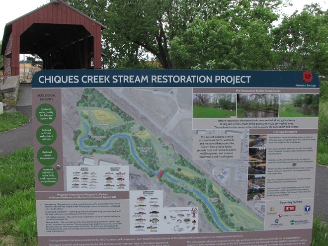


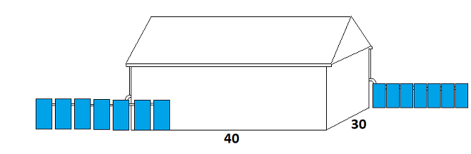
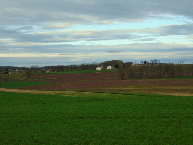


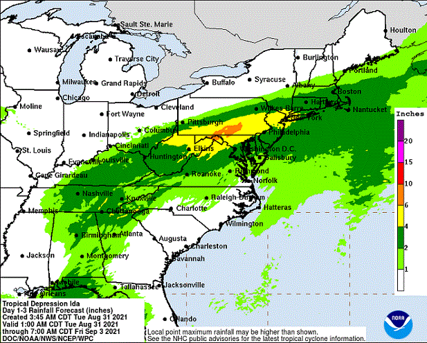

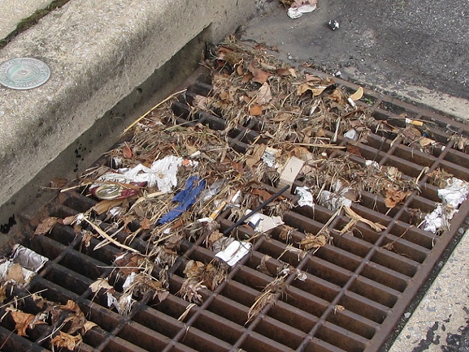
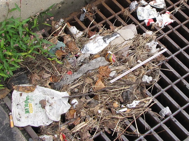


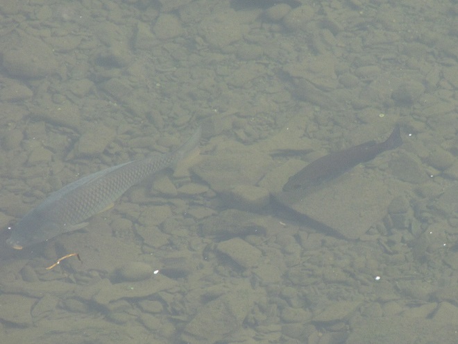

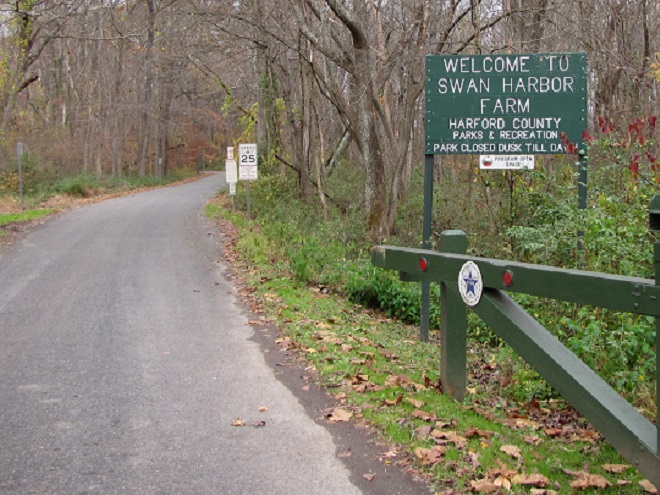


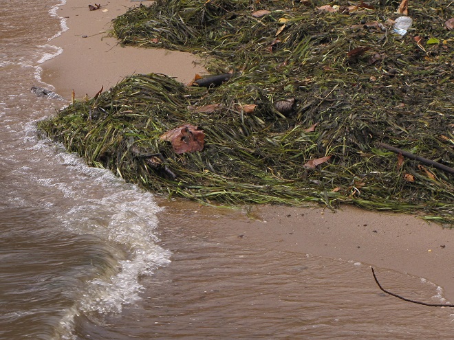
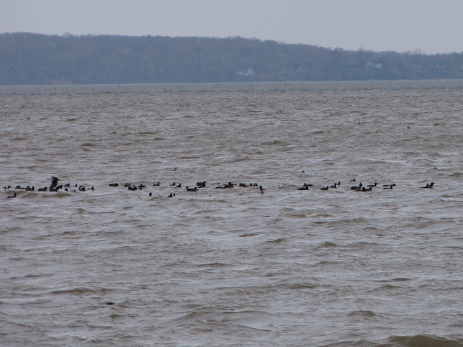
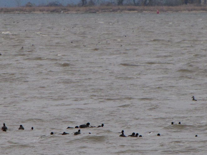


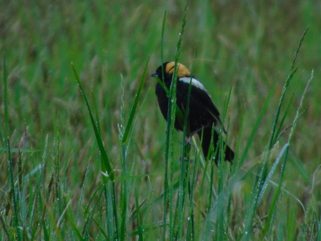
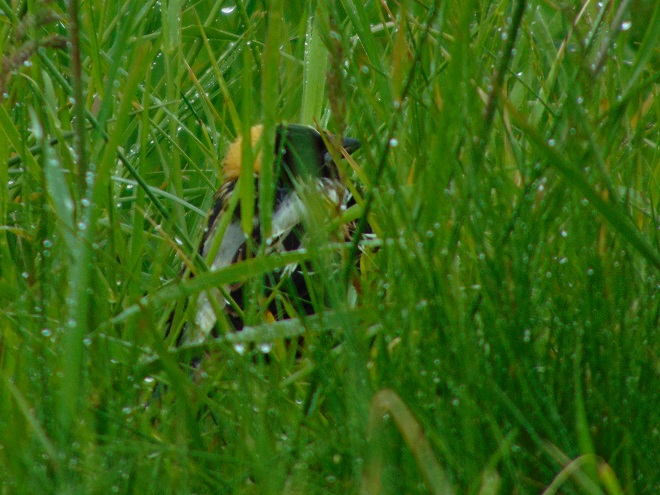
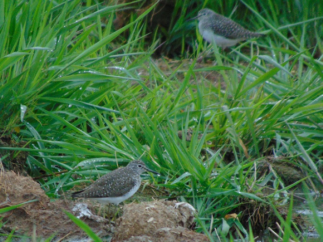
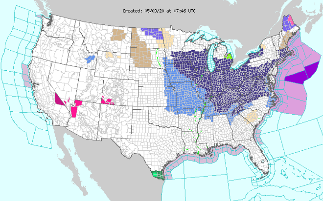
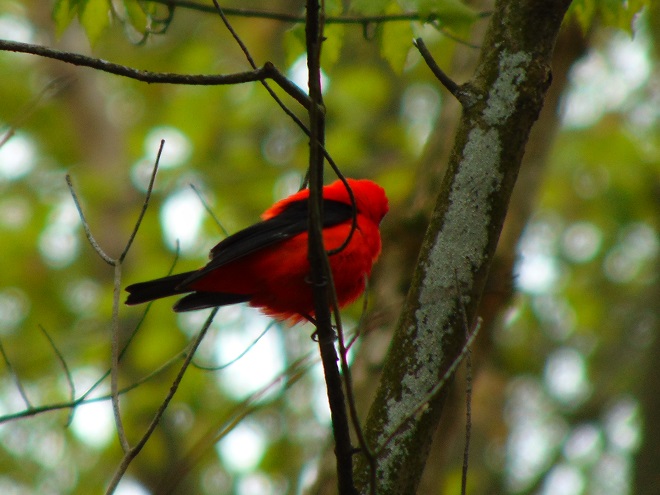

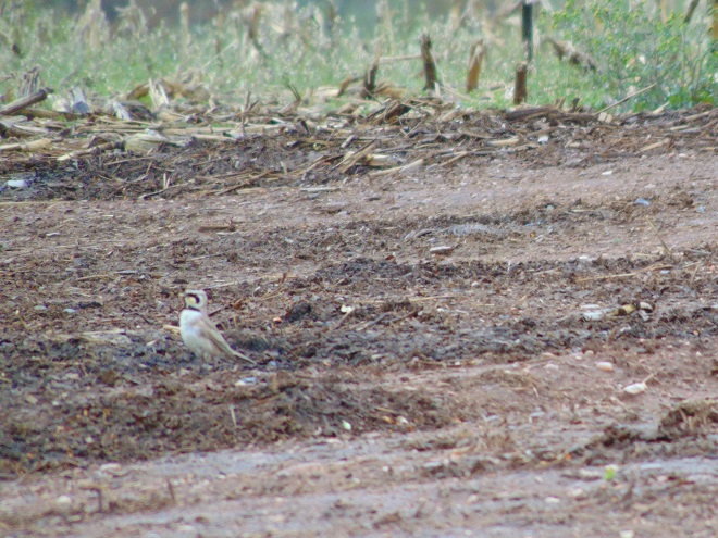
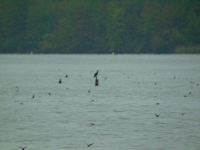
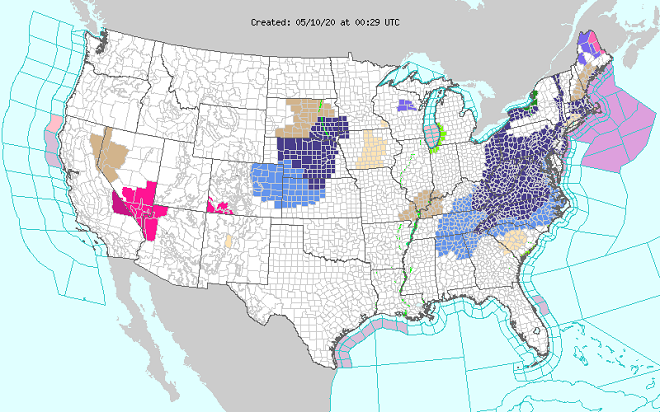
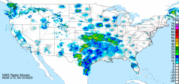

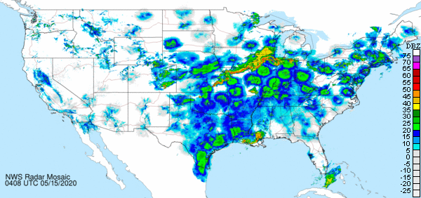
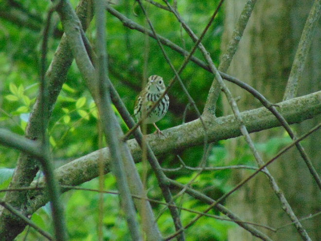


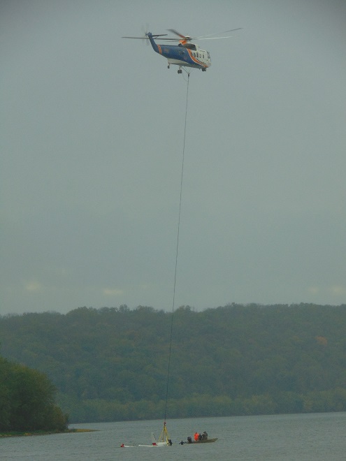


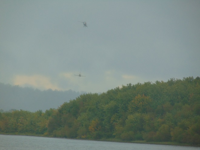