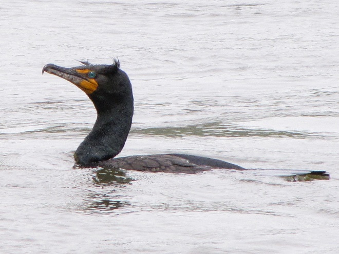
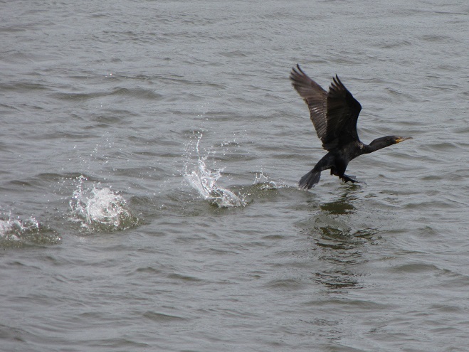
Meet the Double-crested Cormorant, a strangely handsome bird with a special talent for catching fish. You see, cormorants are superb swimmers when under water—using their webbed feet to propel and maneuver themselves with exceptional speed in pursuit of prey.
Like many species of birds that dive for their food, Double-crested Cormorants run across the surface of the water to gain speed for a takeoff. Smaller wings may make it more difficult to get airborne, but when folded, they provide improved streamlining for submerged swimming.
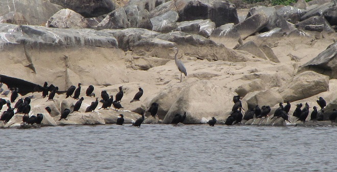
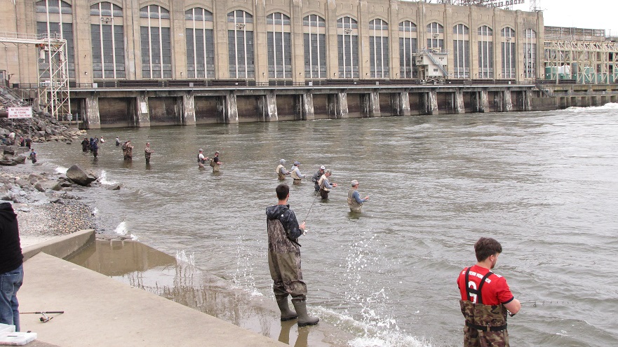
Double-crested Cormorants, hundreds of them, are presently gathered along with several other species of piscivorous (fish-eating) birds on the lower Susquehanna River below Conowingo Dam near Rising Sun, Maryland. Fish are coming up the river and these birds are taking advantage of their concentrations on the downstream side of the impoundment to provide food to fuel their migration or, in some cases, to feed their young.
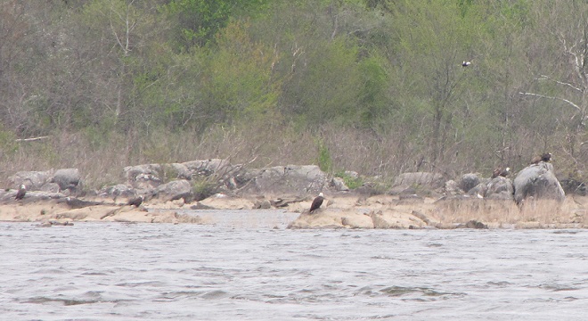
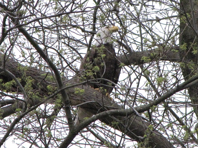
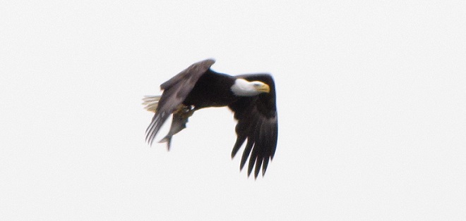
Double-crested Cormorants, mostly adult birds migrating toward breeding grounds to the north, are gathered on the rocks on the east side of the river channel below Conowingo Dam. A Great Blue Heron from a nearby rookery can be seen at the center of the image.Bald Eagles normally gather in large numbers at Conowingo Dam in the late fall and early winter. Presently there are more than 50 there, and the majority of them are breeding age adults. Presumably they are still on their way north to nest. Meanwhile, local pairs are already feeding young, so it seems these transient birds are running a bit late. Many of them can be seen on the rocks along the east side of the river channel,……on the powerline trestles on the island below the dam……in the trees along the east shore,……and in the trees surrounding Fisherman’s Park on the west shore.
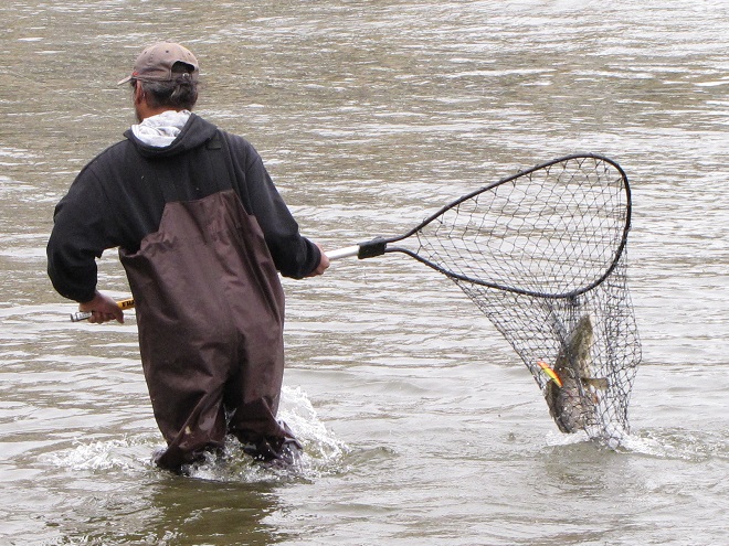
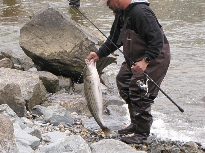
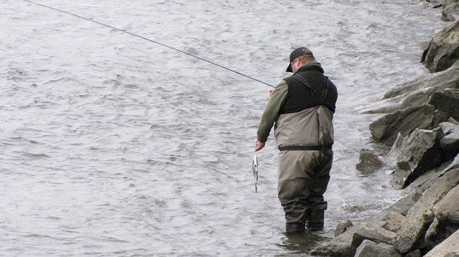
In addition to the birds, the movements of fish attract larger fish, and even larger fishermen.
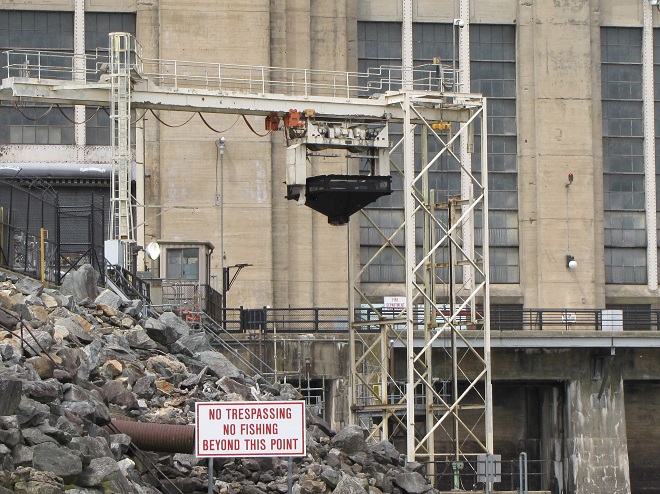
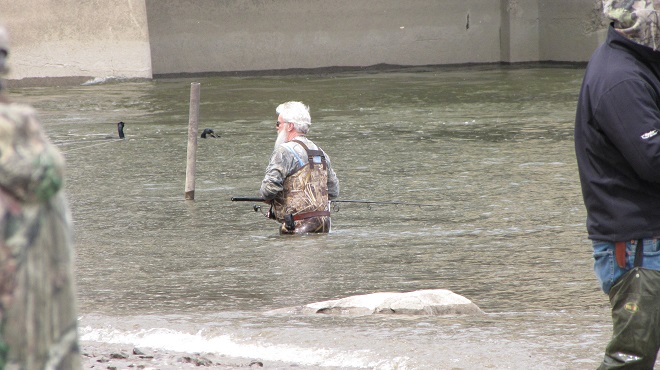
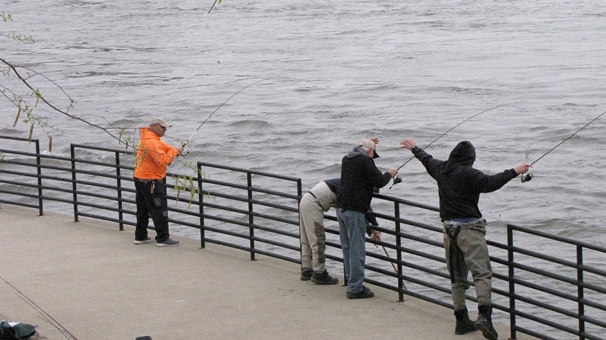
Anglers gather to fish the placid waters below the dam’s hydroelectric powerhouse . Only a few of the generating turbines are operating, so the flow through the dam is minimal.Some water is being released along the west shoreline to attract migratory river herring to the west fish lift for sorting and retention as breeding stock for a propagation program. The east lift, the passage that hoists American Shad (Alosa sapidissima) to a trough that allows them to swim over the top of the dam to waters upriver, will begin operating as soon as these larger migratory fish begin arriving.
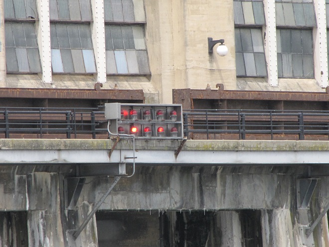
The excitement starts when the sirens start to wail and the red lights begin flashing. Yes friends, it’s showtime.
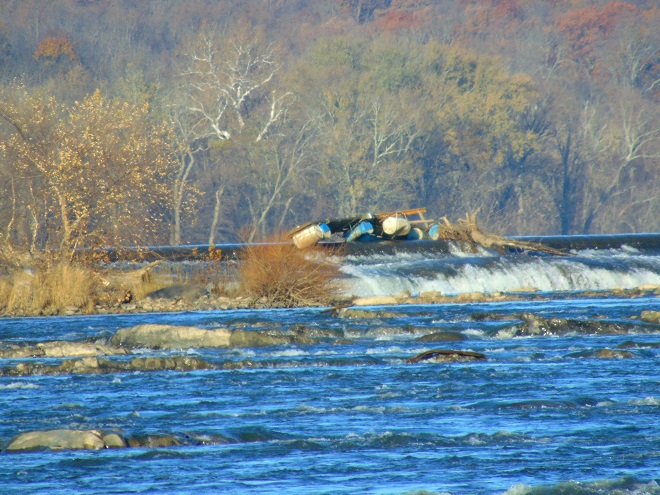
Red lights and sirens are a warning that additional flow is about to be released from the dam. Boaters should anticipate rough water and persons in and along the river need to seek higher ground immediately.Gates are opened at mid-river to release a surge of water through the dam.The wake from the release quickly reaches the shoreline, raising the water level in moments.Experienced anglers know that the flow through the dam gets fish moving and can improve the catch significantly, especially in spring when many species are ascending the river.
Within minutes of the renewed flow, birds are catching fish.
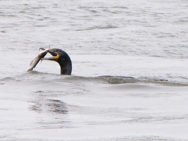
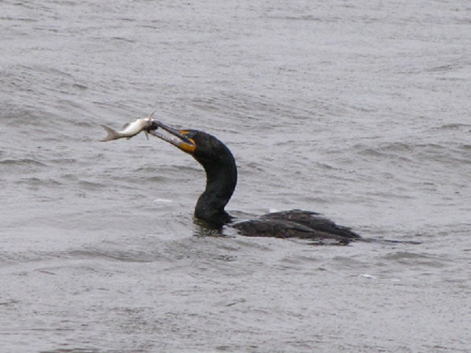
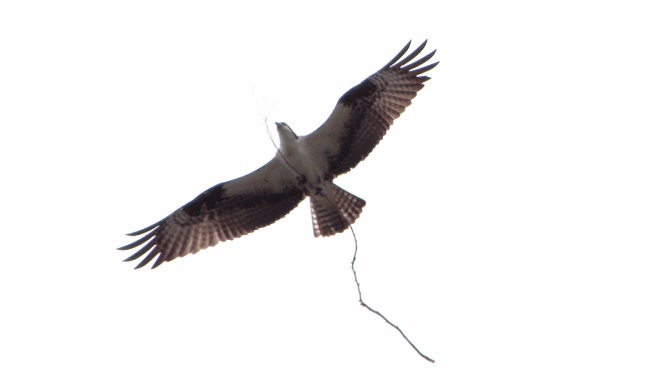
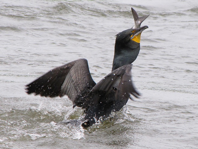
A Double-crested Cormorant with a young Channel Catfish (Ictalurus punctatus).A Double-crested Cormorant fleeing others trying to steal its Channel Catfish.Another Double-crested Cormorant eating a Channel Catfish. Did you realize that Channel Catfish were an introduced species in the Susquehanna River system?An Osprey with a stick, it’s too busy building a nest right now to fish.Great Blue Herons swallow their prey at the spot of capture, then fly back to the nest to regurgitate a sort of “minced congealed fish product” to their young.
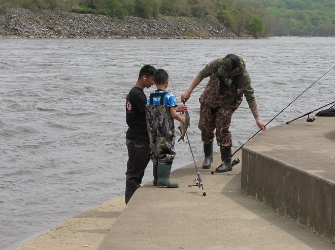
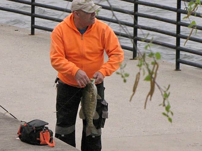
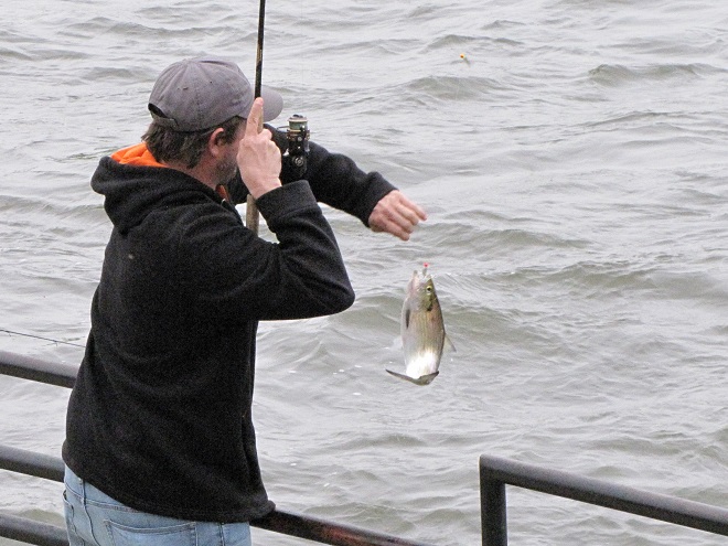
Then the anglers along the wave-washed shoreline began catching fish too.
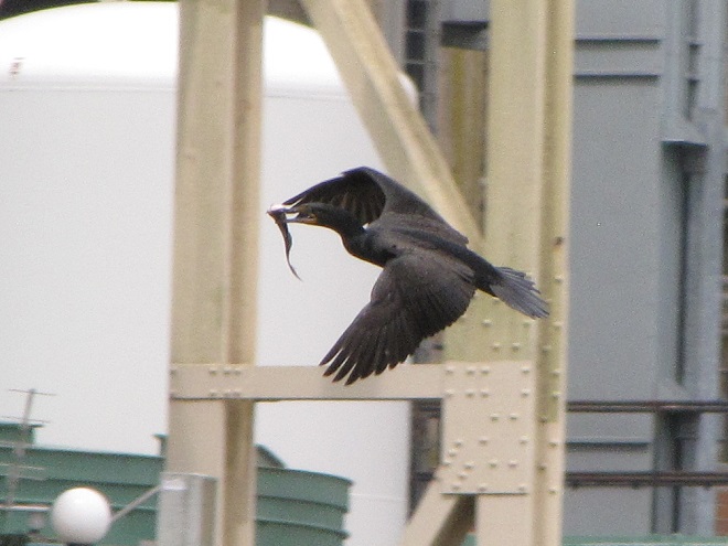
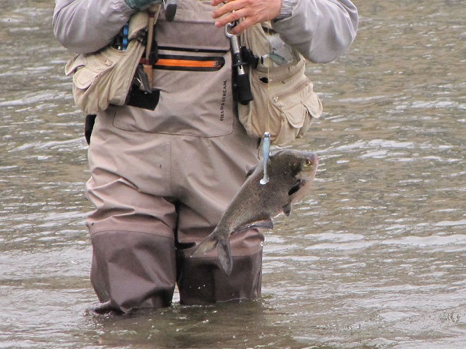
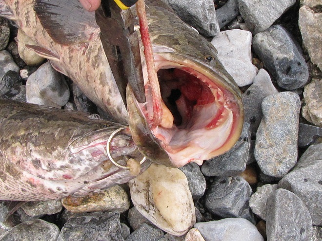
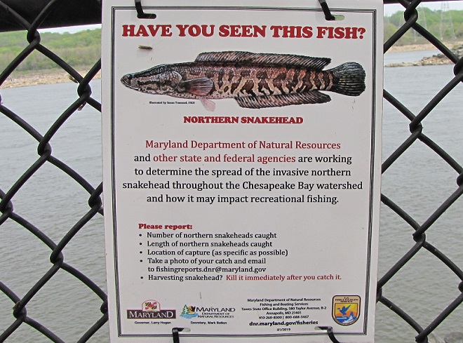
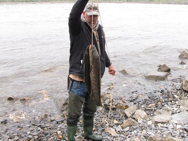
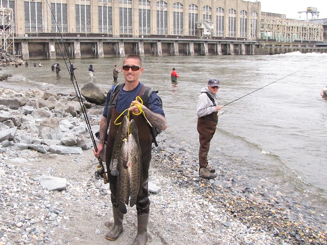
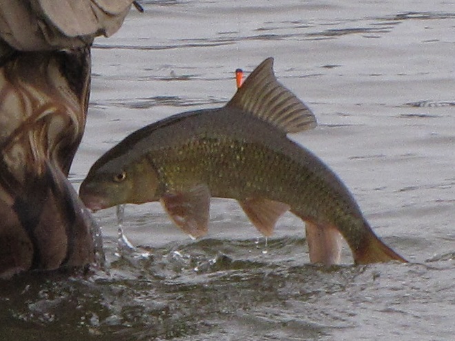
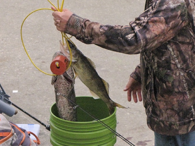
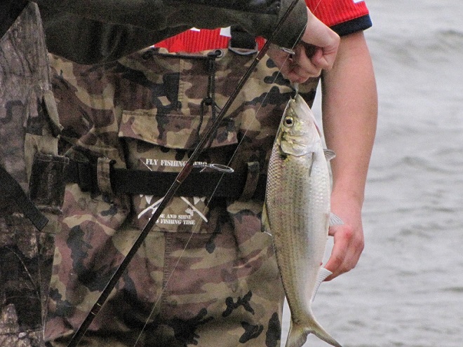
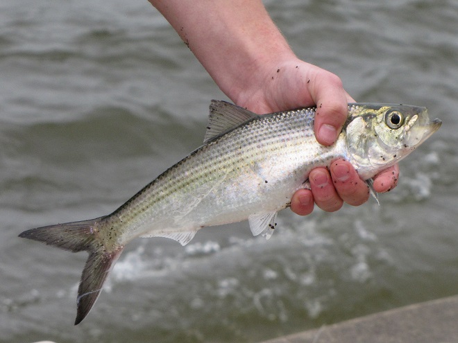
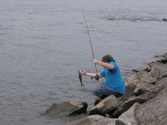
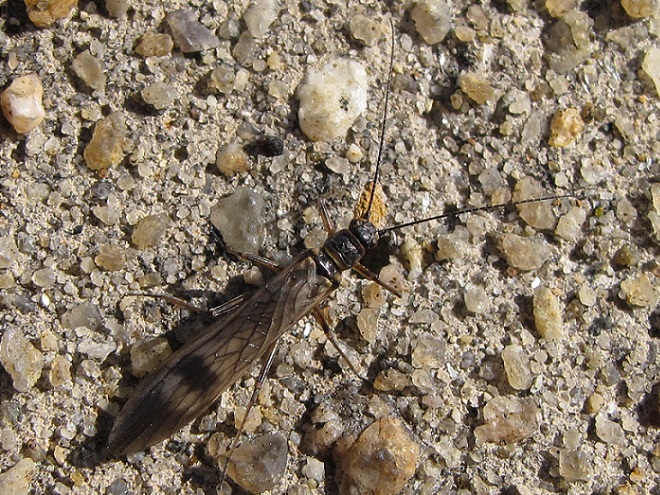
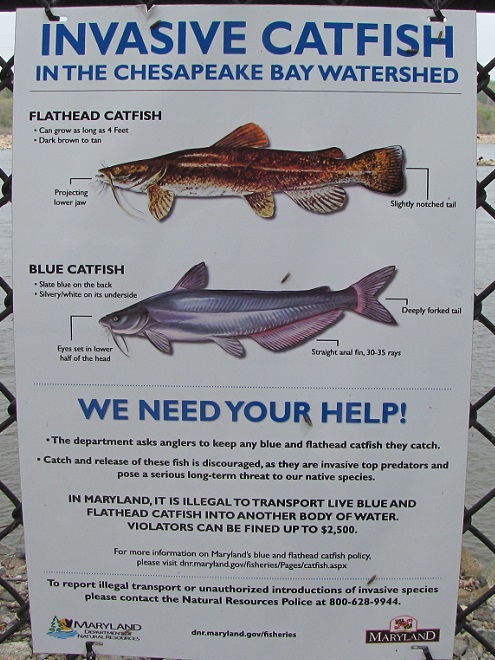
This young man led off a flurry of catches that would last for the remainder of the afternoon.Though Gizzard Shad are filter feeders that don’t readily take baits and lures, they are regularly foul-hooked and reeled in from the large schools that ascend the river in spring.Gizzard Shad are very abundant in the lower Susquehanna, providing year-round forage for many species of predatory animals including Bald Eagles.A Double-crested Cormorant swallowing a Gizzard Shad.This angler soon helped another fisherman by landing his large catch, a Northern Snakehead (Channa argus).The teeth of a Northern Snakehead are razor sharp. It is an aggressive non-native invasive species currently overtaking much of the Lower Susquehanna River Watershed. Anglers are encouraged to fish for them, catch them, keep them, and kill them at the site of capture. Never transport a live Northern Snakehead anywhere at any time. It is illegal in both Maryland and Pennsylvania to possess a live snakehead. Northern Snakehead advisory sign posted at Exelon Energy’s Conowingo Fishermen’s Park.A stringer of Northern Snakeheads. This species was imported from Asia as a food fish, so it has excellent culinary possibilities. It’s better suited for a broiler or frying pan than a river or stream.Another stringer of Northern Snakeheads. It’s pretty safe to say that they have quickly become one of the most abundant predatory fish in the river. Their impact on native species won’t be good, so catch and eat as many as you can. Remember, snakeheads swim better in butter and garlic than in waters with native fish.This foul-hooked Shorthead Redhorse (Moxostoma macrolepidotum), a native species of sucker, was promptly released.Striped Bass are anadromous fish that leave the sea in spring to spawn in fresh water. They ascend the Susquehanna in small numbers, relying upon the operation of the fish passages at the Conowingo, Holtwood, Safe Harbor, and York Haven Dams to continue their journey upstream. During spring spawning, Striped Bass in the Susquehanna River and on the Susquehanna Flats portion of the upper Chesapeake Bay are not in season and may not be targeted, even for catch-and-release. This accidental catch was immediately turned loose.After removal from the hook, this hefty Smallmouth Bass was returned to the river. Many anglers are surprised to learn that Smallmouth Bass are not native to the Susquehanna basin.This angler’s creel contains a Northern Snakehead (left) and a Walleye (right). Did you know that the Walleye (Sander vitreus) is an introduced species in the Susquehanna watershed?By late afternoon, anglers using shad darts began hooking into migrating Hickory Shad (Alosa mediocris), a catch-and-release species in Maryland.Hickory Shad are recognized by their lengthy lower jaw. They are anadromous herring that leave the sea to spawn in freshwater streams. Hickory Shad ascend the Susquehanna as far as Conowingo Dam each year, but shy away from the fish lifts. Downriver from the dam, they do ascend Deer Creek along the river’s west shore and Octoraro Creek on the east side. In Pennsylvania, the Hickory Shad is an endangered species.A Hickory Shad angled on a dual shad dart rig. During the spring spawning run, they feed mostly on small fish, and are the most likely of the Susquehanna’s herring to take the hook.Simultaneous hook-ups became common after fours hours worth of release water from the dam worked its way toward the mouth of the river and got the schools moving. Water temperatures in the mid-to-upper-fifties trigger the ascent of Hickory Shad. On the Susquehanna, those temperatures were slow to materialize in the spring of 2021, so the Hickory Shad migration is a bit late.Catch-and-release fishing for Hickory Shad appears to be in full swing not only at the dam, but along the downstream shoreline to at least the mouth of Deer Creek at Susquehanna State Park too.Many Hickory Shad could be seen feeding on some of the millions of caddisflies (Trichoptera) swarming on the river. These insects, along with earlier hatches of Winter Stoneflies (Taeniopterygidae), not only provide forage for many species of fish, but are a vital source of natural food for birds that migrate up the river in March and April each year. Swallows, Ring-billed Gulls, and Bonaparte’s Gulls are particularly fond of snatching them from the surface of the water.A Winter Stonefly (Taeniopterygidae) from an early-season hatch on the Susquehanna River at the Veteran’s Memorial Bridge at Columbia/Wrightsville, Pennsylvania. (March 3, 2021)Just below Conowingo Dam, a lone fly fisherman was doing a good job mimicking the late-April caddisfly hatch, successfully reeling in numerous surface-feeding Hickory Shad.You may have noticed the extraordinary number of introduced fish species listed in this account of a visit to Conowingo Dam. Sorry to say that there are two more: the Flathead Catfish (Pylodictis olivaris) and the Blue Catfish (Ictalurus furcatus). Like the Northern Snakehead, each has become a plentiful invasive species during recent years. Unlike the Northern Snakehead, these catfish are “native transplants”, species introduced from populations in the Mississippi River and Gulf Slope drainages of the United States. So if you visit the area, consider getting a fishing license and catching a few. Like the snakeheads, they too are quite palatable.
The arrival of migrating Hickory Shad heralds the start of a movement that will soon include White Perch, anadromous American Shad, and dozens of other fish species that swim upstream during the springtime. Do visit Fisherman’s Park at Conowingo Dam to see this spectacle before it’s gone. The fish and birds have no time to waste, they’ll soon be moving on.
To reach Exelon’s Conowingo Fisherman’s Park from Rising Sun, Maryland, follow U.S. Route 1 south across the Conowingo Dam, then turn left onto Shuresville Road, then make a sharp left onto Shureslanding Road. Drive down the hill to the parking area along the river. The park’s address is 2569 Shureslanding Road, Darlington, Maryland.
A water release schedule for the Conowingo Dam can be obtained by calling Exelon Energy’s Conowingo Generation Hotline at 888-457-4076. The recording is updated daily at 5 P.M. to provide information for the following day.
And remember, the park can get crowded during the weekends, so consider a weekday visit.
Within the last few years, the early-summer emergence of vast waves of mayflies has caused great consternation among residents of riverside towns and motorists who cross the bridges over the lower Susquehanna. Fishermen and others who frequent the river are familiar with the phenomenon. Mayflies rise from their benthic environs where they live for a year or more as an aquatic larval stage (nymph) to take flight as a short-lived adult (imago), having just one night to complete the business of mating before perishing by the following afternoon.
In 2015, an emergence on a massive scale prompted the temporary closure of the mile-long Columbia-Wrightsville bridge while a blizzard-like flight of huge mayflies reduced visibility and caused road conditions to deteriorate to the point of causing accidents. The slimy smelly bodies of dead mayflies, probably millions of them, were removed like snow from the normally busy Lincoln Highway. Since then, to prevent attraction of the breeding insects, lights on the bridge have been shut down from about mid-June through mid-July to cover the ten to fourteen day peak of the flight period of Hexagenia bilineata, sometimes known as the Great Brown Drake, the species that swarms the bridge.
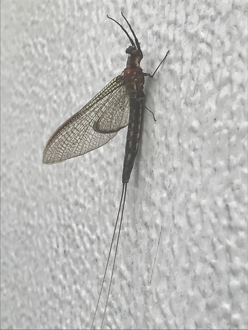
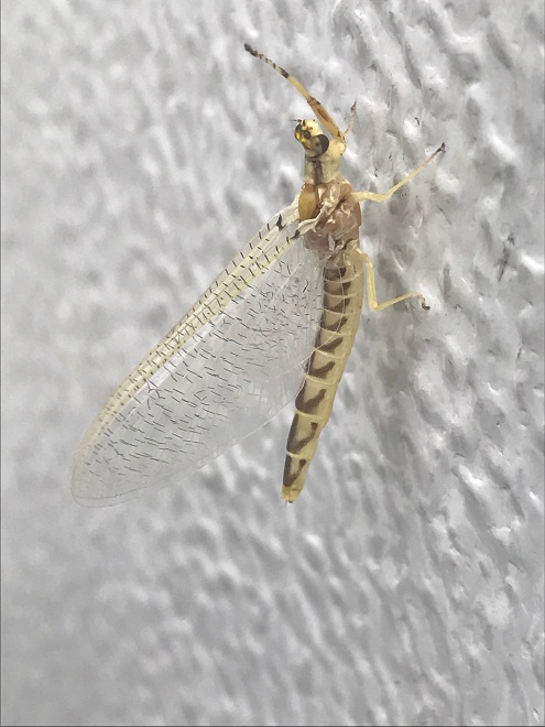
An adult (imago) male Great Brown Drake (Hexagenia bilineata) burrowing mayfly. Adult mayflies are also known as spinners.A sub-adult (based on the translucence of the wings) female burrowing mayfly (Hexagenia species). The sub-adult (subimago or dun) stage lasts less than a day. Normally within 18 hours of leaving the water and beginning flight, it will molt into an adult, ready to breed during its final night of life.
After so many years, why did the swarms of these mayflies suddenly produce the enormous concentrations seen on this particular bridge across the lower Susquehanna? Let’s have a look.
Following the 2015 flight, conservation organizations were quick to point out that the enormous numbers of mayflies were a positive thing—an indicator that the waters of the river were getting cleaner. Generally, assessments of aquatic invertebrate populations are considered to be among the more reliable gauges of stream health. But some caution is in order in this case.
Prior to the occurrence of large flights several years ago, Hexagenia bilineata was not well known among the species in the mayfly communities of the lower Susquehanna and its tributaries. The native range of the species includes the southeastern United States and the Mississippi River watershed. Along segments of the Mississippi, swarms such as occurred at Columbia-Wrightsville in 2015 are an annual event, sometimes showing up on local weather radar images. These flights have been determined to be heaviest along sections of the river with muddy bottoms—the favored habitat of the burrowing Hexagenia bilineata nymph. This preferred substrate can be found widely in the Susquehanna due to siltation, particularly behind dams, and is the exclusive bottom habitat in Lake Clarke just downstream of the Columbia-Wrightsville bridge.
Native mayflies in the Susquehanna and its tributaries generally favor clean water in cobble-bottomed streams. Hexagenia bilineata, on the other hand, appears to have colonized the river (presumably by air) and has found a niche in segments with accumulated silt, the benthic habitats too impaired to support the native taxa formerly found there. Large flights of burrowing mayflies do indicate that the substrate didn’t become severely polluted or eutrophic during the preceding year. And big flights tell us that the Susquehanna ecosystem is, at least in areas with silt bottoms, favorable for colonization by the Great Brown Drake. But large flights of Hexagenia bilineata mayflies don’t necessarily give us an indication of how well the Susquehanna ecosystem is supporting indigenous mayflies and other species of native aquatic life. Only sustained recoveries by populations of the actual native species can tell us that. So, it’s probably prudent to hold off on the celebrations. We’re a long way from cleaning up this river.
In the absence of man-made lighting, male Great Brown Drakes congregate over waterways lit often by moonlight alone. The males hover in position within a swarm, often downwind of an object in the water. As females begin flight and pass through the swarm, they are pursued by the males in the vicinity. The male response is apparently sight motivated—anything moving through their field of view in a straight line will trigger a pursuit. That’s why they’re so pesky, landing on your face whenever you approach them. Mating takes place as males rendezvous with airborne females. The female then drops to the water surface to deposit eggs and later die—if not eaten by a fish first. Males return to the swarm and may mate again and again. They die by the following afternoon. After hatching, the larvae (nymphs) burrow in the silt where they’ll grow for the coming year. Feathery gills allow them to absorb oxygen from water passing through the U-shaped refuge they’ve excavated.
Several factors increase the likelihood of large swarms of Great Brown Drakes at bridges. Location is, of course, a primary factor. Bridges spanning suitable habitat will, as a minimum, experience incidental occurrences of the flying forms of the mayflies that live in the waters below. Any extraordinarily large emergence will certainly envelop the bridge in mayflies. Lights, both fixed and those on motor vehicles, enhance the appearance of movement on a bridge deck, thus attracting hovering swarms of male Hexagenia bilineata and other species from a greater distance, leading to larger concentrations. Concrete walls along the road atop the bridge lure the males to try to hover in a position of refuge behind them, despite the vehicles that disturb the still air each time they pass. The walls also function as the ultimate visual attraction as headlamp beams and shadows cast by moving vehicles are projected onto them over the length of the bridge. Vast numbers of dead, dying, and maimed mayflies tend to accumulate along these walls for this reason.
The absence of illumination from fixed lighting on the deck of the bridge reduces the density of Great Brown Drake swarms. Some communities take mayfly countermeasures one step further. Along the Mississippi, some bridges are fitted with lights on the underside of the deck to attract the mayflies to the area directly over the water, concentrating the breeding mayflies and fishermen alike. The illumination below the bridge is intended to draw mayflies away from light created by headlamps on motor vehicles passing by on the otherwise dark deck above. Lights beneath the bridge also help prevent large numbers of mayflies from being drawn away from the water toward lights around businesses and homes in neighborhoods along the shoreline—where they can become a nuisance.
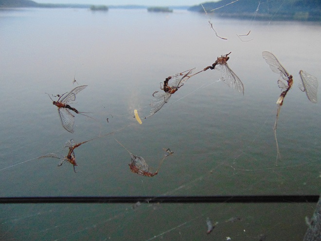
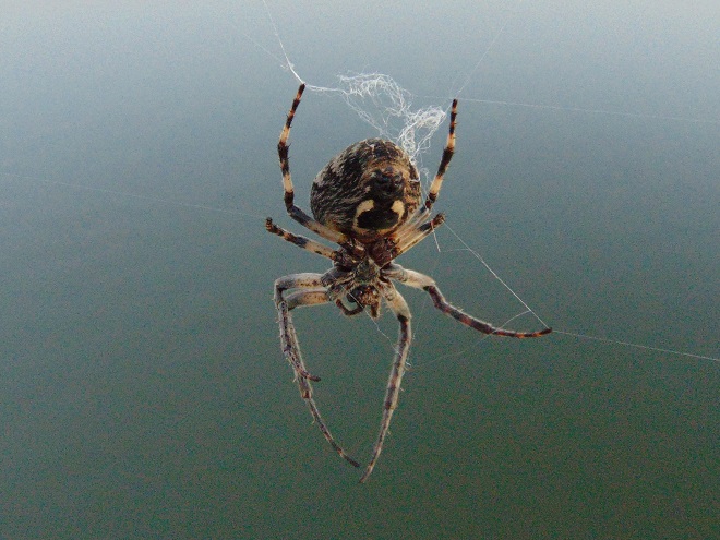
Lights out on the Columbia-Wrightsville bridge. Dousing the lights to eliminate fixed illumination on bridges is an effective method of reducing the density of Hexagenia bilineata swarms.With the bridge lights darkened, male Great Brown Drakes, their cellophane-like wings illuminated by headlamps to appear as white spots on the road, number in the hundreds instead of hundreds of thousands in swarms on the bridge near the east and west shorelines.Swarms of Great Brown Drake mayflies are still present at the Columbia-Wrightsville bridge, they’re just not concentrated there in enormous numbers. Evidence includes their bodies found in cobwebs along the entire length of the span.The aptly-named Bridge Orb Weaver (Larinioides sclopetarius) constructs webs along the entire length of the Columbia-Wrightsville bridge, and on many of the buildings at both ends. The abundance of victims tangled in silk must overwhelm their appetite, or maybe they actually consume only the smaller insects. They have their choice. Of the Bridge Orb Weaver, Uncle Ty Dyer says, “When you live along the river, it’s your friendly neighborhood spider, man.”The native Eastern Dobsonfly (Corydalus cornutus) is among the reliable indicators of stream quality in the Susquehanna at the Columbia-Wrightsville bridge. Winged adults, which live for about a week, are clumsy fliers attracted to lights. The aquatic larvae are known as hellgrammites, which require clean flowing water over rocky or pebbly substrate to thrive. Two adults were found on the bridge last evening. It would be encouraging to find more. Maybe we’ll stop back to have another look when the lights are back on.
SOURCES
Edsall, Thomas A. 2001. “Burrowing Mayflies (Hexagenia) as Indicators of Ecosystem Health.” Aquatic Ecosystem Health and Management. 43:283-292.
Fremling, Calvin R. 1960. Biology of a Large Mayfly, Hexagenia bilineata (Say), of the Upper Mississippi River. Research Bulletin 482. Agricultural and Home Economics Experiment Station, Iowa State University. Ames, Iowa.
McCafferty, W. P. 1994. “Distributional and Classificatory Supplement to the Burrowing Mayflies (Ephemeroptera: Ephimeroidea) of the United States.” Entomological News. 105:1-13.
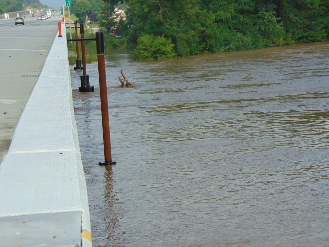
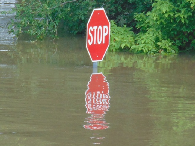
It was a routine occurrence in many communities along tributaries of the lower Susquehanna River during the most recent two months. The rain falls like it’s never going to stop—inches an hour. Soon there is flash flooding along creeks and streams. Roads are quickly inundated. Inevitably, there are motorists caught in the rising waters and emergency crews are summoned to retrieve the victims. When the action settles, sets of saw horses are brought to the scene to barricade the road until waters recede. At certain flood-prone locations, these events are repeated time and again. The police, fire, and Emergency Medical Services crews seem to visit them during every torrential storm—rain, rescue, rinse, and repeat.
We treat our local streams and creeks like open sewers. Think about it. We don’t want rainwater accumulating on our properties. We pipe it away and grade the field, lawn, and pavement to roll it into the neighbor’s lot or into the street—or directly into the waterway. It drops upon us as pure water and we instantly pollute it. It’s a method of diluting all the junk we’ve spread out in its path since the last time it rained. A thunderstorm is the big flush. We don’t seem too concerned about the litter, fertilizer, pesticides, motor fluids, and other consumer waste it takes along with it. Out of sight, out of mind.
Failure to retain and infiltrate stormwater to recharge aquifers can later result in well failures and reduced base flow in streams. (Conoy Creek’s dry streambed in June, 2007)
Perhaps our lack of respect for streams and creeks is the source of our complete ignorance of the function of floodplains.
Floodplains are formed over time as hydraulic forces erode bedrock and soils surrounding a stream to create adequate space to pass flood waters. As floodplains mature they become large enough to reduce flood water velocity and erosion energy. They then function to retain, infiltrate, and evaporate the surplus water from flood events. Microorganisms, plants, and other life forms found in floodplain wetlands, forests, and grasslands purify the water and break down naturally-occurring organic matter. Floodplains are the shock-absorber between us and our waterways. And they’re our largest water treatment facilities.
Why is it then, that whenever a floodplain floods, we seem motivated to do something to fix this error of nature? Man can’t help himself. He has a compulsion to fill the floodplain with any contrivance he can come up with. We dump, pile, fill, pave, pour, form, and build, then build some more. At some point, someone notices a stream in the midst of our new creation. Now it’s polluted and whenever it storms, the darn thing floods into our stuff—worse than ever before. So the project is crowned by another round of dumping, forming, pouring, and building to channelize the stream. Done! Now let’s move all our stuff into our new habitable space.
Natural Floodplain- Over a period of hundreds or thousands of years, the stream (dark blue) has established a natural floodplain including wetlands and forest. In this example, buildings and infrastructure are located outside the zone inundated by high water (light blue) allowing the floodplain to function as an effective water-absorbing buffer.Impaired Floodplain- Here the natural floodplain has been filled for building (left) and paved for recreation area parking (right). The stream has been channelized. Flood water (light blue) displaced by these alterations is likely to inundate areas not previously impacted by similar events. Additionally, the interference with natural flow will create new erosion points that could seriously damage older infrastructure and properties.
The majority of the towns in the lower Susquehanna valley with streams passing through them have impaired floodplains. In many, the older sections of the town are built on filled floodplain. Some new subdivisions highlight streamside lawns as a sales feature—plenty of room for stockpiling your accoutrements of suburban life. And yes, some new homes are still being built in floodplains.
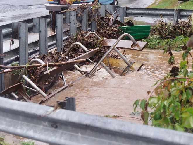
When high water comes, it drags tons of debris with it. The limbs, leaves, twigs, and trees are broken down by natural processes over time. Nature has mechanisms to quickly cope with these organics. Man’s consumer rubbish is another matter. As the plant material decays, the embedded man-made items, particularly metals, treated lumber, plastics, Styrofoam, and glass, become more evident as an ever-accumulating “garbage soil” in the natural floodplains downstream of these impaired areas. With each storm, some of this mess floats away again to move ever closer to Chesapeake Bay and the Atlantic. Are you following me? That’s our junk from the curb, lawn, highway, or parking lot bobbing around in the world’s oceans.
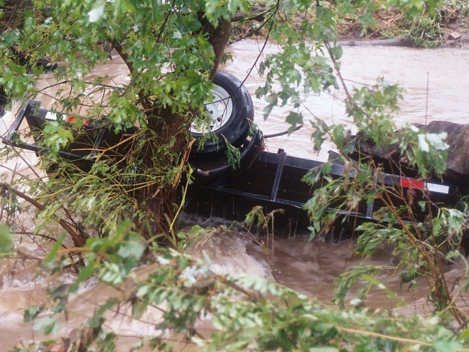
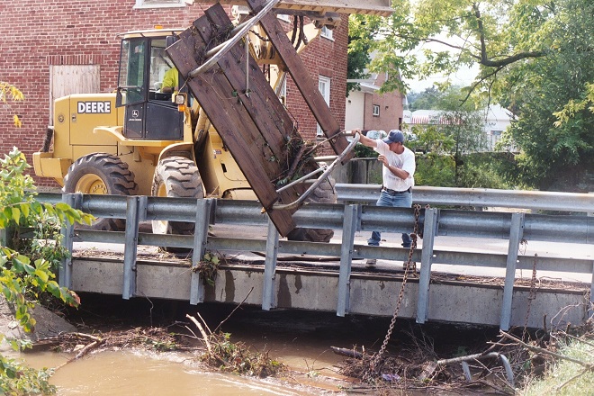
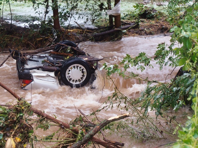
A shed, mobile home, or house can be inundated or swept away during a flood. Everything inside (household chemicals, gasoline, fuel oil, pesticides, insulation, all those plastics, etc.) instantly pollutes the water. Many communities that rely on the Susquehanna River for drinking water are immediately impacted, including Lancaster, PA and Baltimore, MD. This dumpster was swept away from a parking lot in a floodplain. It rolled in the current, chipping away at the bridge before spilling the rubbish into the muddy water. After the flood receded, the dumpster was found a mile downstream. Its contents are still out there somewhere.Floodplains along the lower Susquehanna River are blanketed with a layer of flotsam that settles in place as high water recedes. These fresh piles can be several feet deep and stretch for miles. Nature decomposes the organic twigs and driftwood to build soil-enriching humus. However, the plastics and other man-made materials that do not readily decay or do not float away toward the sea during the next flood are incorporated into the alluvium and humus creating a “garbage soil”. Over time, the action of abrasives in the soil will grind small particles of plastics from the larger pieces. These tiny plastics can become suspended in the water column each time the river floods. What will be the long-term impact of this type of pollution?Anything can be swept away by the powerful hydraulic forces of flowing water. Large objects like this utility trailer can block passages through bridges and escalate flooding problems.The cost of removing debris often falls upon local government and is shared by taxpayers.Here, a junked boat dock is snagged on the crest of the York Haven Dam at Conewago Falls. Rising water eventually carried it over the dam and into the falls where it broke up. This and tons of other junk are often removed downstream at the Safe Harbor Dam to prevent damage to turbine equipment. During periods of high water, the utility hauls debris by the truck-load to the local waste authority for disposal. For the owners of garbage like this dock, it’s gone and it’s somebody else’s problem now.Motor vehicles found after floating away from parking areas in floodplains can create a dangerous dilemma for police, fire, and E.M.S. personnel, particularly when no one witnesses the event. Was someone driving this car or was it vacant when it was swept downstream? Should crews be put at risk to locate possible victims?
Beginning in 1968, participating municipalities, in exchange for having coverage provided to their qualified residents under the National Flood Insurance Program, were required to adopt and enforce a floodplain management ordinance. The program was intended to reduce flood damage and provide flood assistance funded with premiums paid by potential victims. The program now operates with a debt incurred during severe hurricanes. Occurrences of repetitive damage claims and accusations that the program provides an incentive for rebuilding in floodplains have made the National Flood Insurance Program controversial.
In the Lower Susquehanna River Watershed there are municipalities that still permit new construction in floodplains. Others are quite proactive at eliminating new construction in flood-prone zones, and some are working to have buildings removed that are subjected to repeated flooding.
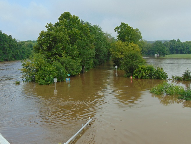
Another Wall— Here’s an example of greed by the owner, engineer, and municipality… placing their financial interests first. The entire floodplain on the north side of this stream was filled, then the wall was erected to contain the material. A financial institution’s office and parking lot was constructed atop the mound. This project has channelized the stream and completely displaced half of the floodplain to a height of 15 to 20 feet. Constructed less than five years ago, the wall failed already and has just been totally reconstructed. The photo reveals how recent flooding has begun a new erosion regime where energy is focused along the base of the wall. Impairment of a floodplain to this degree can lead to flooding upstream of the site and erosion damage to neighboring infrastructure including roads and bridges.The floodplain along this segment of the lower Swatara Creek in Londonderry Township, Dauphin County is free to flood. Ordinances prohibit new construction here and 14 older houses that repeatedly flooded were purchased, dismantled, and removed using funding from the Federal Emergency Management Agency (F.E.M.A). A riparian buffer was planted and some wetland restorations were incorporated into stormwater management installations along the local highways. When the waters of the Swatara rise, the local municipality closes the roads into the floodplain. Nobody lives or works there anymore, so no one has any reason to enter. There’s no need to rescue stubborn residents who refused advice to evacuate. Sightseers can park and stand on the hill behind the barricades and take all the photographs they like.A new Pennsylvania Turnpike bridge across Swatara Creek features wide passage for the stream below. Water flowing in the floodplain can pass under the bridge without being channelized toward the path where the stream normally flows in the center. The black asterisk-shaped floats spin on the poles to help deflect debris away from the bridge piers. (flood crest on July 26, 2018)People are curious when a waterway floods and they want to see it for themselves. Wouldn’t it be wise to anticipate this demand for access by being ready to accommodate these citizens safely? Isn’t a parking lot, picnic area, or manicured park safer and more usable when overlooking the floodplain as opposed to being located in it? Wouldn’t it be a more prudent long-term investment, both financially and ecologically, to develop these improvements on higher ground outside of flood zones?Now would be a good time to stop the new construction and the rebuilding in floodplains. Aren’t the risks posed to human life, water quality, essential infrastructure, private property, and ecosystems too great to continue?Isn’t it time to put up the white flag and surrender the floodplains to the floods? That’s why they’re there. Floodplains are for flooding.
There are two Conewago Creek systems in the Lower Susquehanna River Watershed. One drains the Gettysburg Basin west of the river, mostly in Adams and York Counties, then flows into the Susquehanna at the base of Conewago Falls. The other drains the Gettysburg Basin east of the river, flowing through Triassic redbeds of the Gettysburg Formation and York Haven Diabase before entering Conewago Falls near the south tip of Three Mile Island. Both Conewago Creeks flow through suburbia, farm, and forest. Both have their capacity to support aquatic life impaired and diminished by nutrient and sediment pollution.
This week, some of the many partners engaged in a long-term collaboration to restore the east shore’s Conewago Creek met to have a look at one of the prime indicators of overall stream habitat health—the fishes. Kristen Kyler of the Lower Susquehanna Initiative organized the effort. Portable backpack-mounted electrofishing units and nets were used by crews to capture, identify, and count the native and non-native fishes at sampling locations which have remained constant since prior to the numerous stream improvement projects which began more than ten years ago. Some of the present-day sample sites were first used following Hurricane Agnes in 1972 by Stambaugh and Denoncourt and pre-date any implementation of sediment and nutrient mitigation practices like cover crops, no-till farming, field terracing, stormwater control, nutrient management, wetland restoration, streambank fencing, renewed forested stream buffers, or modernized wastewater treatment plants. By comparing more recent surveys with this baseline data, it may be possible to discern trends in fish populations resulting not only from conservation practices, but from many other variables which may impact the Conewago Creek Warmwater Stream ecosystem in Dauphin, Lancaster, and Lebanon Counties.
So here they are. Enjoy these shocking fish photos.
Matt Kofroth, Watershed Specialist with the Lancaster County Conservation District, operates the electrofishing wand in Conewago Creek while his team members prepare to net and collect momentarily-stunned fish. Three other electrofishing units operated by staff from the Susquehanna River Basin Commission and aided by teams of netters were in action at other sample locations along the Conewago on this day.Really big fish, such as this Common Carp (Cyprinus carpio), were identified, counted, and immediately returned to the water downstream of the advancing electrofishing team. Other fish, such as the Swallowtail Shiner, Redbreast Sunfish (Lepomis auritus), Fallfish, and suckers seen here, were placed in a sorting tank.Fallfish (Semotilus corporalis) are very active and require plenty of dissolved oxygen in the water to survive. Fallfish, Rainbow Trout (Oncorhynchus mykiss), and Smallmouth Bass (Micropterus dolomieu) were quickly identified and removed from the sorting tank for release back into the stream. Other larger, but less active fish, including suckers, quickly followed.Small fish like minnows were removed from the sorting tank for a closer look in a hand-held viewing tank. This Fathead Minnow (Pimephales promelas) was identified, added to the tally sheet, and released back into the Conewago. The Fathead Minnow is not native to the Susquehanna drainage. It is the minnow most frequently sold as bait by vendors.A breeding condition male Bluntnose Minnow (Pimephales notatus).The Cutlips Minnow (Exoglossum maxillingua) is a resident of clear rocky streams. Of the more than 30 species collected during the day, two native species which are classified as intolerant of persisting stream impairment were found: Cutlips Minnow and Swallowtail Shiner.The Central Stoneroller (Campostoma anomalum) is a benthic feeder in creeks over gravel and sand.The Eastern Blacknose Dace (Rhinichthys atratulus) is found in clear water over pebble and stone substrate.The Longnose Dace (Rhinichthys cataractae) is another species of pebbly rocky streams.A juvenile Golden Shiner (Notemigonus crysoleucas). Adults lack the side stripe and grow to the size of a sunfish.A Swallowtail Shiner (Notropis procne) and a very young White Sucker (Catostomus commersonii) in the upper left of the tank.A probable Spotfin Shiner (Cyprinella spiloptera).A breeding male Cyprinella shiner, probably a Spotfin Shiner. Show-off!The Margined Madtom (Noturus insignis) is a small native catfish of pebbly streams.The Banded Killifish (Fundulus diaphanus) is adept at feeding upon insects, including mosquitos.A young Rock Bass (Ambloplites rupestris). This species was introduced to the Susquehanna and its tributaries.The Greenside Darter (Etheostoma blennioides) is not native to the Susquehanna basin. The species colonized the Conewago Creek (east) from introduced local populations within the last five years.The Tessellated Darter (Etheostoma olmstedi) is a native inhabitant of the Susquehanna and its tributaries.The stars of the day were the American Eels (Anguilla rostrata).After collection, each eel was measured and weighed using a scale and dry bucket. This specimen checked in at 20 inches and one pound before being released.Prior to the construction of large dams, American Eels were plentiful in the Susquehanna and its tributaries, including the Conewago. They’ve since been rarities for more than half a century. Now they’re getting a lift.American Eels serve as an intermediate host for the microscopic parasitic glochidia (larvae) of the Eastern Elliptio (Elliptio complanata), a declining native freshwater mussel of the Lower Susquehanna River Watershed. While feeding on their host (usually in its gills), the glochidia cause little injury and soon drop off to continue growth, often having assured distribution of their species by accepting the free ride. Freshwater mussels are filter feeders and improve water quality. They grow slowly and can live for decades.American Eels are a catadromous species, starting life as tiny glass eels in the saltwater of the Atlantic Ocean, then migrating to tidal brackish marshes and streams (males) or freshwater streams (females) to mature. This 20-incher probably attempted to ascend the Susquehanna as an elver in 2016 or 2017. After hitching a ride with some friendly folks, she bypassed the three largest dams on the lower Susquehanna (Conowingo, Holtwood, and Safe Harbor) and arrived in the Conewago where she may remain and grow for ten years or more. To spawn, a perilous and terminally fatal journey to the Sargasso Sea awaits her. (You may better know the area of the Sargasso Sea as The Bermuda Triangle…a perilous place to travel indeed!)
SOURCES
Normandeau Associates, Inc. and Gomez and Sullivan. 2018. Muddy Run Pumped Storage Project Conowingo Eel Collection Facility FERC Project 2355. Prepared for Exelon.
Stambaugh, Jr., John W., and Robert P. Denoncourt. 1974. A Preliminary Report on the Conewago Creek Faunal Survey, Lancaster County, Pennsylvania. Proceedings of the Pennsylvania Academy of Sciences. 48: 55-60.