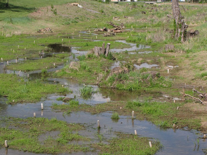
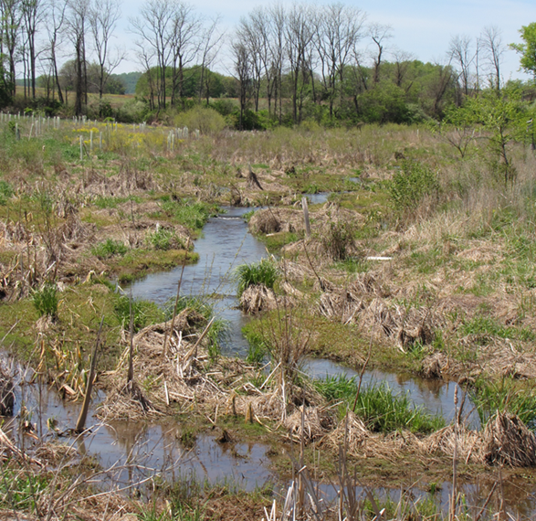
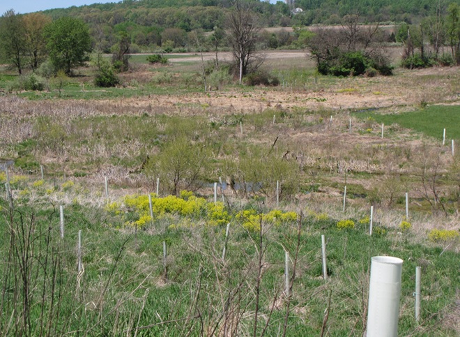
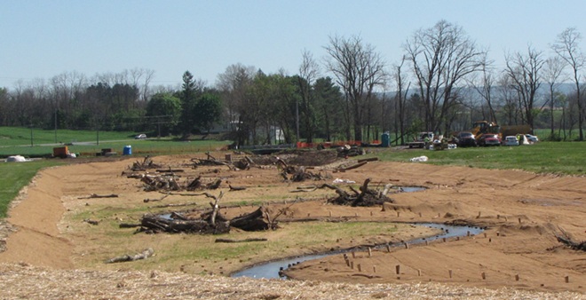
Want to have a peek at the final phase of a conservation and pollution mitigation project that is restoring more than a mile of impaired stream and floodplain? Well, you’re in luck.
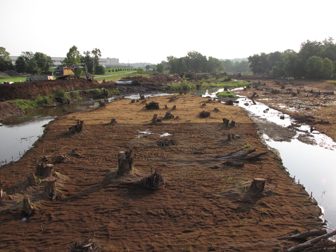
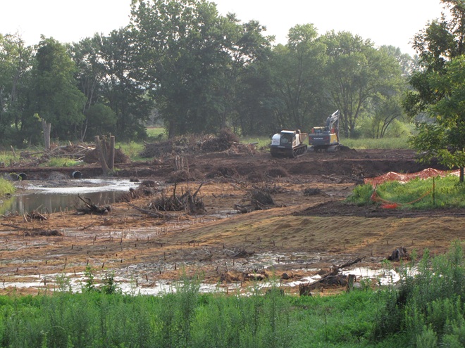
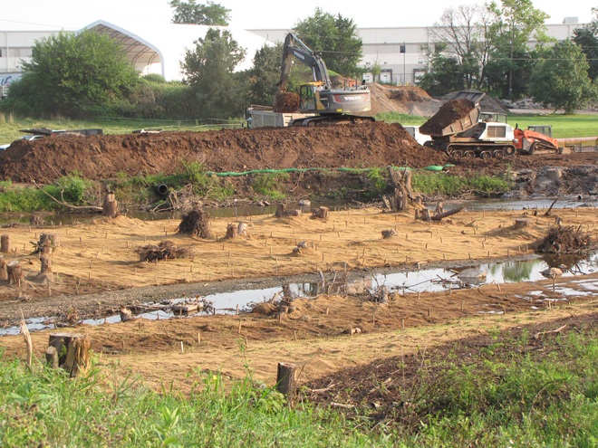
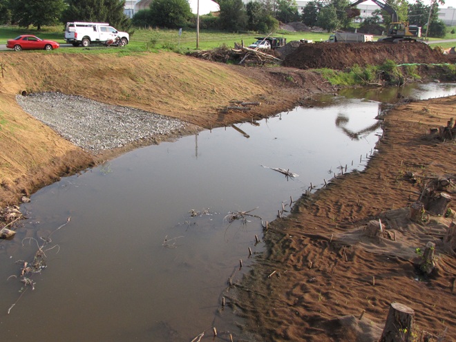
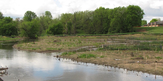
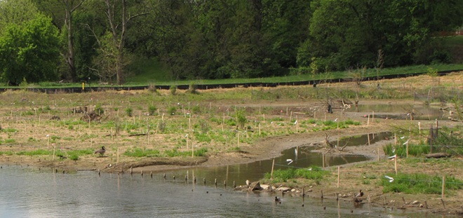
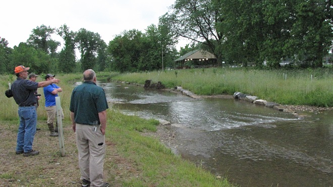
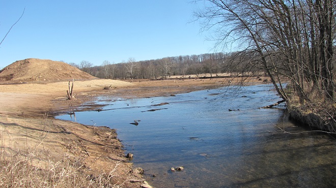
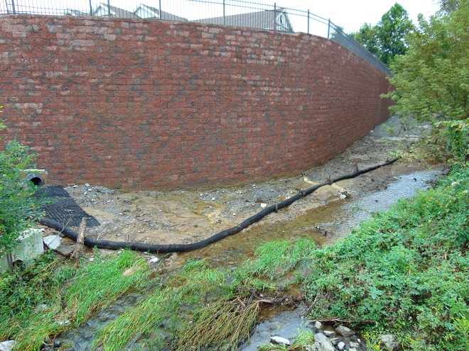
Legacy sediments, those nasty nutrient-loaded soils that accumulated as runoff behind the hundreds of man-made dams in the lower Susquehanna valley, are currently being removed from a segment of the Conewago Creek (east) along the border between Dauphin and Lancaster Counties. Work is presently underway just upstream of PA Route 230 adjacent to the trailhead for the Lancaster County Parks Conewago Recreation Trail. Much of this multi-stage project is located on Lancaster Conservancy property. We donned our safety vests and checked it out from roadside.
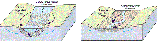
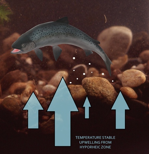
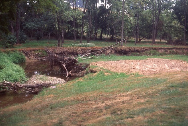
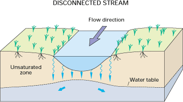
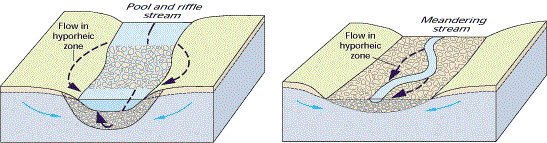
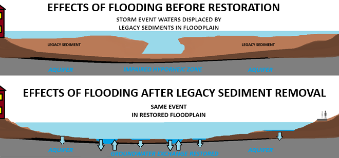
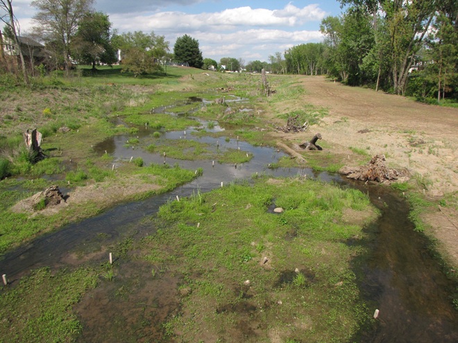
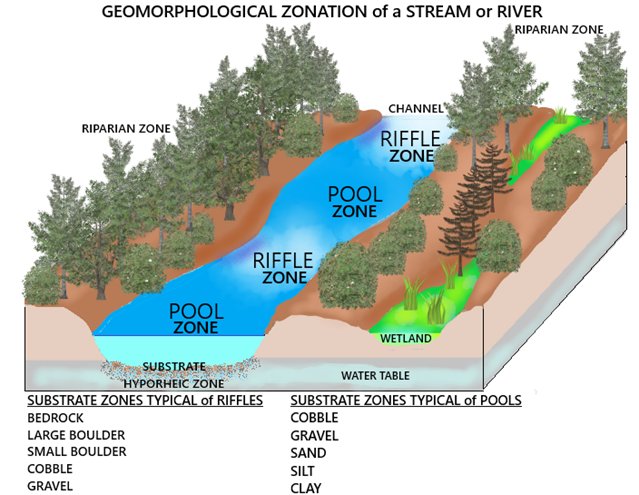
Legacy sediments that for more than a century displaced storm waters into previously unaffected areas of the surrounding landscape are being removed along this stretch of Conewago Creek upstream from PA Route 230 between Middletown and Elizabethtown. Previously trapped between banks of eroding mud, the creek is being restored to a natural braided channel configuration that feeds overflow during storm events into adjoining wetlands that not only sequester nutrients, but return water to the aquifer.The absence of soil conservation practices prior to the 1930s allowed all this nutrient-rich dirt to wash into and choke the floodplain. As it is excavated, the track-equipped dump truck uses the temporary bridge to cross the waterway and haul away legacy sediment, just one load at a time. It’s a big endeavor. Several years ago, more than one thousand loads were removed to restore the stretch of floodplain visible beyond the trees in the background. This phase of the project will do the same.At roadside, nutrient-rich legacy sediment is transferred to road-worthy trucks for transport to a staging area or directly to a place for reuse. Soils recovered from earlier projects have been incorporated into athletic fields, community gardens, backstops at gun ranges, landfill reclamation, and reinvigoration of the farmlands from whence they came.Legacy sediment removal and floodplain restoration can benefit the municipalities where these projects are implemented, helping them meet MS4 (Municipal Separate Storm Sewer System) stormwater regulations. During construction, outflows like the one seen here are withdrawn from the edge of the stream to instead use the floodplain’s wetlands to diffuse discharge energy and potentially purify and infiltrate the runoff.These projects do much more than just reduce the nutrient and sediment loads in waters that flow downstream to the Susquehanna and Chesapeake. For local aquifers and aquatic organisms, removing substrate-choking legacy sediment restores function to the hyporheic zone, the area that allows the bidirectional exchange of groundwater and creek water through porous stream substrates and the soils surrounding the waterway’s pools, riffles, and channels. (United States Geological Survey image)Did you ever walk in a creek or river on a hot summer day and suddenly discover a spot where the temperature of the water feels much cooler than the water surrounding it? That’s a hyporheic upwelling. For their nests, trout, shad, and many other egg-laying fishes seek out areas of pebbly stream substrate where upwelling from hyporheic exchange provides stable temperature conditions and ample oxygen for embryogenesis. Legacy sediment removal that results in the restoration of hyporheic zones often benefits many species of breeding fishes, particularly those requiring coolwater and coldwater conditions for reproduction.
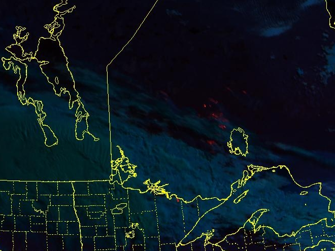
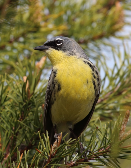
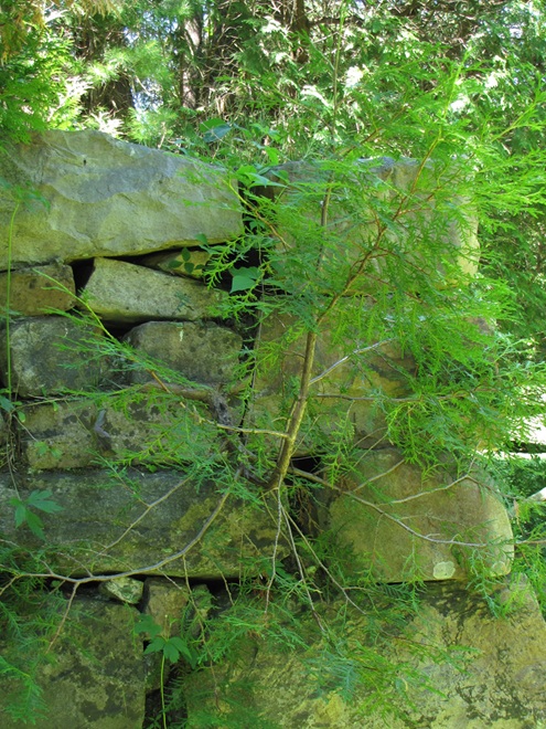
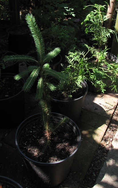
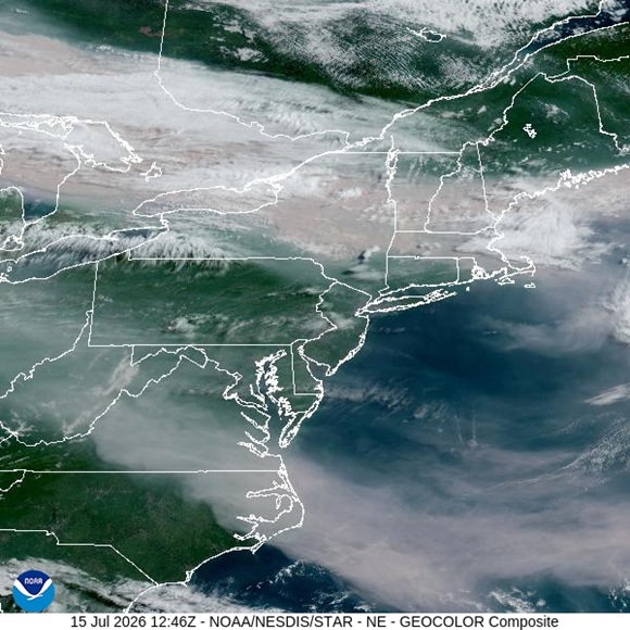
This fire temperature enhancement of this morning’s National Oceanic and Atmospheric Administration satellite image of remote areas in western Ontario shows numerous large wildfires (indicated in red) burning north of Lake Superior. Ablaze is an area of taiga, the boreal conifer and mixed forests that cover much of interior Canada. The trees that grow in these wilderness areas are adapted to the large fires that regularly incinerate vast swaths of timber. Two of the conifers, Black Spruce (Picea mariana) and Jack Pine (Pinus banksiana), require fire for regeneration and are often among the deciduous White Birch (Betula paptrifera) and Quaking Aspen (Populus tremuloides) that first recolonize burned acreage. As succession proceeds, these pioneer species are followed by growth of Balsam Fir (Abies balsamea) and Northern White Cedar (Thuja occidentalis), both of which succeed Tamarack (Larix laricina) and Black Spruce in the sphagnum bogs there. (Cooperative Institute for Research in the Atmosphere/National Oceanic and Atmospheric Administration image)Just to the south of the area currently being impacted by wildfire, the Kirtland’s Warbler (Setophaga kirtlandii) nests only in young stands of Jack Pine in Michigan, Wisconsin, and Ontario. During much of the twentieth century, this Neotropical migrant was in endanger of extinction, taking refuge during the breeding season in several areas of Michigan where large fires had cleared away climax forest and Jack Pines were allowed to regenerate. Prescribed fire and block timber harvesting techniques now manage some lands specifically for Kirtland’s Warbler habitat. The species was delisted from endangered status in 2019. (United States Fish and Wildlife Service image by Vince Cavalieri)The Northern White Cedar is most familiar to residents of the lower Susquehanna valley as the arborvitae, an evergreen landscape tree that includes numerous cultivars and hybrids derived from the wild taiga conifer. In suburbia, this tree is abused, planted in rows to create a fast-growing but short-lived windbreak or privacy screen. How about mixing it up a little bit by adding some variety to those hedgerows? Then, think about using these beautiful trees where they’ll thrive. Northern White Cedar grows like a bonsai artist’s dream among boulders, an inspiration for mimicking their appearance in miniature, and will sometimes naturalize in this rocky terrain under mesic (moist) conditions. Northern White Cedar is a bog species in its native range to our north, so you can give strong consideration to planting scattered specimens in the wet soils of your rain garden, riparian buffer, or other soggy spot. Scatter some around, put a few in clumps, and enjoy the pizazz they can add to a dreary winter day!A look at Northern White Cedars in the susquehannawildlife.net headquarters tree nursery and, in the foreground, a White Spruce (Picea glauca), another common conifer of the boreal forests. In our area, a miniature cultivar of P. glauca known as “Dwarf Alberta Spruce” is routinely planted as a landscape specimen. On occasion, these compact plants will revert to their “wild” form and grow full-size branches to begin looking more like their ancestral parents.The visible satellite image from just before 9 AM shows haze from the Ontario fires streaming into the northeastern United States and the Susquehanna basin. The dense, river-like band of brown smoke seen barreling through New York and New England will shift south into our region during the remainder of the day, so slow down and take it easy. How long will these fires burn? Due to the zero-fire forest management strategies of the twentieth century, some areas of taiga haven’t experienced a burn for over 100 years. The highly combustible fuel load of dry logs, limbs, and needles accumulates in these parcels with each passing year, adding to the threat of a greater frequency of explosive, far-ranging, catastrophic infernos. To reduce the proliferation of fuels and to get the boreal forests back on the every-decade-or-so natural fire regime that keeps these biomes healthy and thriving, blazes in remote wildlands that haven’t been subjected to regeneration by fire for many decades are primarily contained to protect people, infrastructure, and unique native assets, but are mostly allowed to burn. (Cooperative Institute for Research in the Atmosphere/National Oceanic and Atmospheric Administration image)
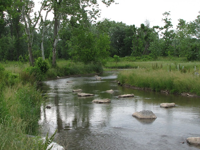
The majority of floodplains in the Lower Susquehanna River Watershed are, to put it mildly, dysfunctional. They are frequently disconnected from the lotic (flowing) streams and rivers that created them and are no longer capable of absorbing, purifying, and infiltrating high water during rain and snow-melt events. They are an ongoing source of nutrient and sediment pollution that impairs both our local waterways and Chesapeake Bay. For the plant and wildlife species that rely upon them for survival, their loss has been catastrophic.
Mill dams once impounded nearly every mile of low-gradient streams in the lower Susquehanna region. During the century or more of their existence prior to the implementation of soil conservation practices during the 1930s, sediments consisting mostly of nutrient-loaded clay, silt, and sand eroded from sloped terrain in storm runoff and accumulated behind these dams, filling many to the brim with mud—six, eight, ten, sometimes twelve feet deep! As the dams fail or are removed, the stream is left channelized, incising a path through a floodplain choked with these “legacy sediments”.
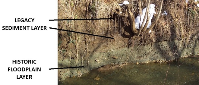
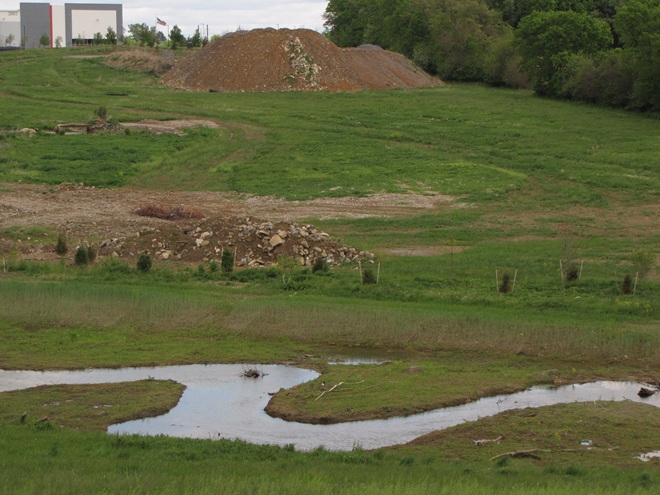
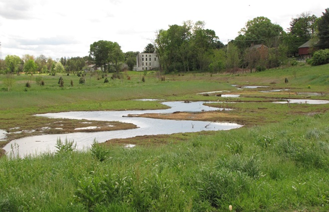
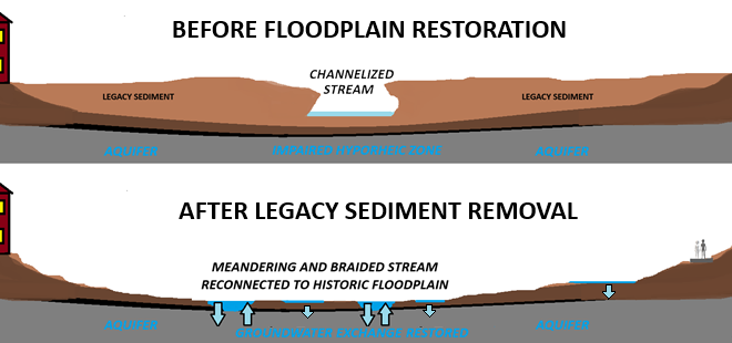
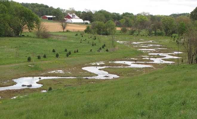
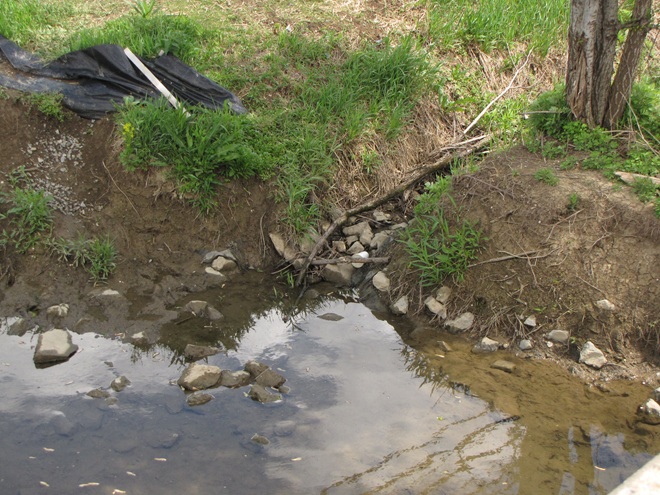
That’s it, a fresh layer of topsoil oughta do it- Landowners have become so accustomed to legacy sediment pollution and channelized creeks, they think it’s how a natural stream and floodplain ecosystem looks and operates. They’ll even replace washed away legacy sediment with dirt, rocks, cinder blocks, old sidewalks, and other construction debris to “shore things up”. It’s a delusional approach to managing a space that functions as a place to store, treat, and percolate precious water.Legacy sediments not only displace flood waters into historically unimpacted lands, they clog the hyporheic zone, the area below and alongside the flowing stream where water is exchanged with the aquifer. (United States Geological Survey image)Restoration of creeks and floodplains impacted by legacy sediment pollution includes the removal of the layer of nutrient-loaded sand, silt, and clay deposited atop the historic stratum of wetland and stream substrates. These lower layers are frequently gray in color and contain gravel from the former stream beds. Within the organic matter contained in this historic layer, seeds of native wetland plants have rested dormant for more than one hundred years. Some are still viable and will germinate upon liberation from the overlying legacy layer.Stockpiles of legacy sediments and larger fill items await transport to upland sites for reuse following removal from the impaired floodplain during a stream restoration project completed during the past year on Swarr Run, a tributary of Little Conestoga Creek in Lancaster County, Pennsylvania. This excavation, part of the project’s phase-two plan, was preceded in 2020 by similar construction completed as phase one on a segment located just upstream.Swarr Run has been returned to a meandering stream course in a floodplain cleared of nutrient-rich legacy sediments. How are legacy sediments repurposed? Those from previous projects in the lower Susquehanna valley have been used to create a community garden, as a top coating on athletic fields, as a safety backstop at a shooting range, and as topsoil on some of the croplands from whence they came all those years ago.Restoring pool and riffle or meandering stream flow regimes also restores water exchange in the adjoining hyporheic zones. (United States Geological Survey image)Removing legacy sediment accumulations from the floodplains of impaired streams allows re-establishment of historic flow regimes and reconnection of the waterway to the nutrient-sequestering functions of fluvial wetlands. In addition, flow into and from the water table is restored.Question: Do you know why nearby businesses have ATMs? Answer: Because there are no longer any banks on this segment of Swarr Run.
For a closer look at the Swarr Run renewal, including early map and aerial photograph views of the site, take a peek at this synopsis illustrating phase one of the project as presented to the North American Association of Wetland Managers by Justin Spangler of LandStudies, designers of the restoration. While perusing the material, be sure to review the significant reductions in nutrient and sediment loads discharged from these sites following the restoration work.
Floodplain restorations that include legacy sediment removal are often designed to reduce the impact of stormwater from sheet runoff, piped discharges, or conveyances such as eroded and excavated ditches like this one. Projects that restore floodplain functions including storing, filtering, and percolating runoff effectively can sometimes help municipalities and property owners meet regulatory stormwater requirements, including those under the Environmental Protection Agency’s MS4 (Municipal Separate Storm Sewer System) program.This floodplain restoration was completed during the past year along a segment of Little Conestoga Creek in Lancaster, Pennsylvania. Here the stream receives a heavy dose of stormwater runoff from shopping malls and other commercial properties with acres upon acres of paved parking space. Because they lack connection to any retention or detention systems, storm drains pipe runoff directly from the pavement into the creek from many of these properties.Legacy sediment removal eliminates the steep banks along the channelized creek. Braided stream courses were added to again connect the Little Conestoga to its historic floodplain and a complex of wetlands to help store, treat, and infiltrate stormwater.Removing legacy sediments brings an end to their practice of forcing detrimental high waters out to roam adjacent neighborhoods, putting floods back in the floodplain where they belong.Completed last year in conjunction with replacement of an aging sanitary sewer interceptor (buried to the right), this floodplain restoration removed legacy sediments and returned Conoy Creek in Lancaster County, Pennsylvania, to a natural, braided stream course.As part of the project, municipal storm drain discharges were withdrawn from the edge of the channelized stream to now flow runoff into the floodplain wetlands for storage, thermal moderation, nutrient sequestering, and infiltration. The braided stream design connects the waterway to these wetlands and helps restore the hyporheic functions between the Conoy and its underlying New Oxford Formation sandstone aquifer. This project helped the local municipality meet its MS4 (Municipal Separate Storm Sewer System) requirements.Following restoration, a braided stream design reconnects Cocalico Creek in Lancaster County, Pennsylvania, to its floodplain wetlands along this 3,867-foot segment near its headwaters. As part of the construction process, twenty-five acres of invasive growth was treated prior to the planting of 12.7 acres of native riparian buffer species. According to the Pennsylvania Department of Environmental Protection’s (DEP) project summary, annual pollutant load reductions resulting from this restoration are calculated to be 862,980 pounds of Total Suspended Sediments/year, 1,641 pounds of Total Nitrogen/year, and 426 pounds of Total Phosphorus/year.The stream and floodplain restoration on Cocalico Creek is beginning its fifth year since completion. It recreates marshlands that purify the stream’s waters while providing prime habitat for native plants and animals. See the LandStudies project summary here.Hammer time- Now under construction: after years of planning and preparations, a floodplain and stream restoration on Hammer Creek near Buffalo Springs in Lebanon County, Pennsylvania, returns this low-gradient segment to a meandering flow regime. Instead of a ditch between fields, it’ll once again be a creek connected to a nutrient-reducing wetland buffer.
Have an impaired stream and a floodplain full of legacy sediments on your land or in your neighborhood? Consider encouraging your municipality, volunteer watershed group, or county conservation district to investigate the possibilities of planning and installing one of these projects. They’re a great enhancement for recreational fisheries, a private refugium, or a community-owned passive park system. Funding assistance may be available, particularly when regulatory or conservation goals can be met by completing restoration.
Clean rainwater flowing from the roofs of our homes and other buildings is a precious resource that is more often than not directed as quickly as possible into streets and storm drains to become contaminated runoff capable of polluting streams and aggravating flooding conditions. The prudent property steward will manage rainfall as the treasured commodity that it is—retaining on site as much of it as possible.
Whether you happen to be obtaining your domestic water from a community distribution system or from a private well, infiltrating the rain that falls on your roof directly into the soil is a good way to make sure it helps recharge the groundwater stored in the aquifer—banking it for future use.
Better yet, rain barrels provide a means of intercepting, storing, and dispensing a share of the precipitation from your downspouts before it is discharged into the ground. Water from rain barrels can be drained to hydrate garden plants, rinse the patio, wash the dog, or, in the event of an emergency, fill the need for non-potable uses that include bathing and flushing toilets. For potable applications such as cooking, drinking, and brushing teeth, roof water must first be filtered and disinfected.
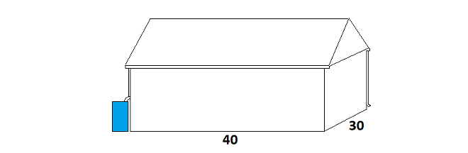
Rain barrels collect and save clean roof water for later use. For every one inch of precipitation, the roof on a house or other building with a footprint of just 1,200 square feet sheds enough to fill about fourteen 55-gallon drums. Live in a home supplied by a well? That’s over 700 gallons of soft water available as you need it, such as during a power outage when the pump won’t operate.
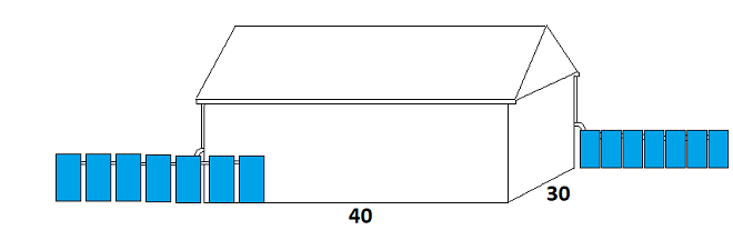
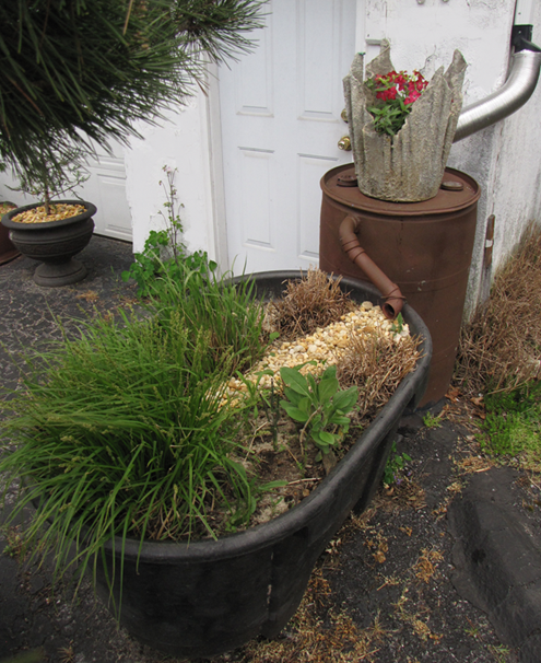
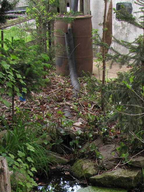
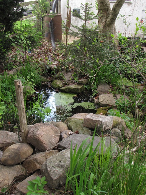
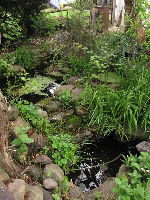
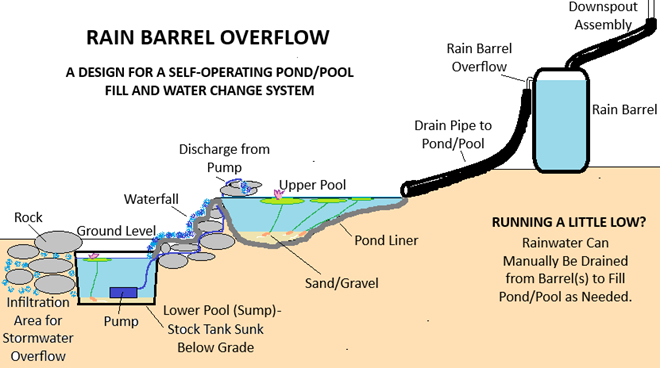
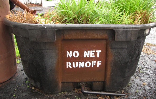
Here at susquehannawildlife.net headquarters, our goal is “no net runoff” from our little urban parcel. We use three rain barrels to catch discharge from the spouting system, then direct the overflow into three different management configurations.
RAIN GARDEN
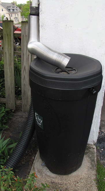
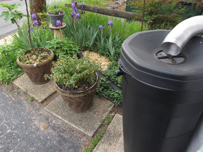
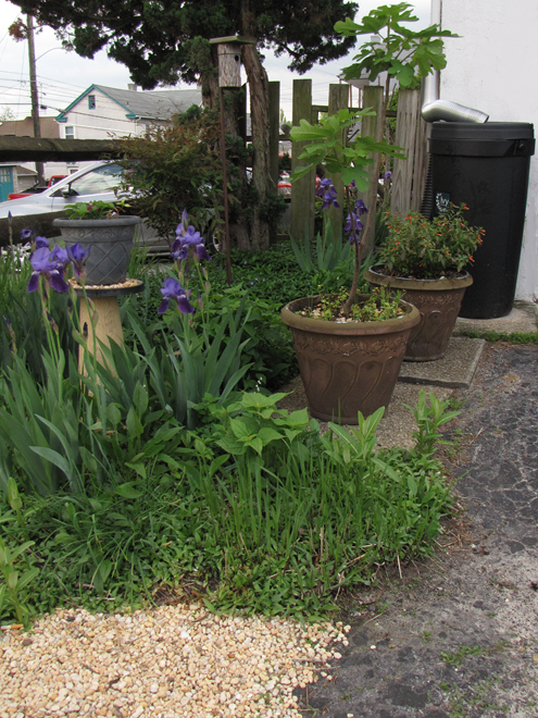
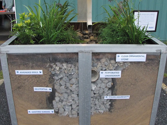
Precipitation from the downspout is captured in this commercially produced rain barrel. The overflow is directed into the black corrugated pipe……and spilled into the gravel bed in the rain garden to both water the plants and infiltrate into the ground to recharge our local aquifer.The gravel beds diffuse energy produced not only by water rushing from the barrel’s overflow, but from sheet runoff entering the garden from the driveway and neighboring street.
STOCK TANK PLANTER
This home-brew rain barrel was fabricated from a 55-gallon drum originally used to ship and store car wash soap. We scrubbed it out, then plumbed it up with the overflow feeding a 100-gallon stock tank fashioned into a planter. The drain from the planter sometimes discharges a trickle of water into a porous area of the pavement where it soon percolates into the ground. In this “container rain garden”, we grow wildflowers, sedges, rushes, and warm-season grasses.
THE GARDEN POND/POOLS
Here’s another rain barrel made from a soap drum. This one discharges its overflow into the upper pool of our garden pond.Upon topping off the barrel, clean roof water spills into the corrugated pipe and tumbles into the upper pool. Outflow from the upper pool cascades through the the riffles/falls……into the lower pool (bottom right). The lower pool consists of a 100-gallon stock tank sunk below grade level and surrounded by rock. Throughout the summer, a pump located in this “sump” circulates water to a spring-like feature in the upper pool. During a downpour, the lower pool will overflow into the encircling boulders, the level often rising half a foot or more above the top rim of the stock tank flooding the cap stones before receding as the excess water slowly infiltrates down through the gravelly soils. It’s a self-automated, hassle-free water change that helps keep our pools and their inhabitants healthy.Our garden pond stormwater management system keeps the pools topped off and the aquatic ecosystem thriving.
Why not give roof water management a try on your property? It’s a great project for exercising your ingenuity and creativity while doing something truly beneficial for the watershed within which you reside. Best of all, it’s really not that expensive to get started.
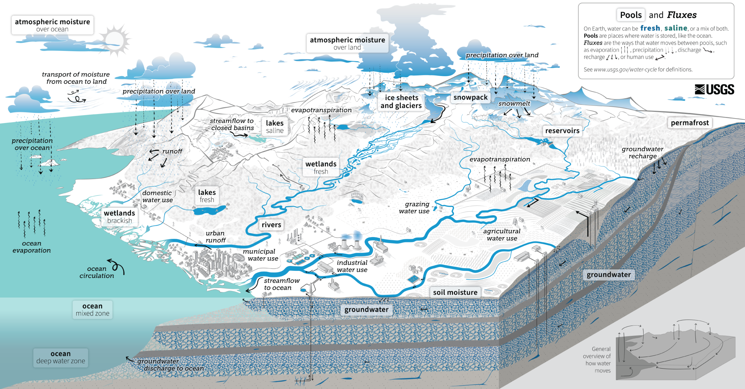
The dynamics of water’s storage and movement on earth, as well as its transitions through the primary states of matter—gas, liquid, and solid—are known as the water cycle. Understanding how life-supporting water progresses through the global biosphere can provide each of us with a greater appreciation of how fragile a resource clean water is in the presence of 8.3 billion wasteful and polluting humans.
This graphic created by the United States Geological Survey illustrates many of the components of the water cycle’s complex processes. Have a look…
The Water Cycle. Click the image for an enlarged view. (United States Geological Survey image)
For a PDF version which includes a more detailed description along the bottom margin, click here. We like it so much, we’ve added it to this webpage’s sidebar for future reference.
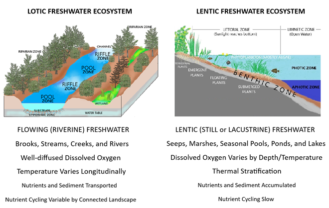
Some comparative attributes of unspoiled lotic vs. lentic freshwater ecosystems. Low-gradient (slow-moving) lotic waters often create, and remain connected to, accompanying riverine wetlands (a lentic freshwater ecosystem). These swamps, marshes, and ditches absorb, purify, and infiltrate flood waters while supporting a diverse number of plant and animal species.
We frequently perceive all waterfowl migration to be synchronized with the conspicuous movements of familiar species like Snow Geese, Tundra Swans, and Canada Geese—big flights coming south in October and November, then a return to the north in late February and March. And we’re all quite aware of the occurrence of large gatherings of some of these migrants while they make stopovers on some of our largest lentic (still) waters—the man-made lakes and reservoirs created by damming local streams. But did you know that there are populations of colorful waterfowl with dynamic migrations that extend throughout the winter and early spring with movements that are often continuous. Under favorable conditions, these birds favor the lotic (flowing) waters of the river and its larger tributaries as they transit the lower Susquehanna valley. That’s because unpolluted lotic freshwater ecosystems support a greater diversity of plants and animals than lentic waters, and therefore offer more opportunities for hungry migrating waterfowl to find food. Let’s have a look at some of the species that visit the river during their seasonal journeys…
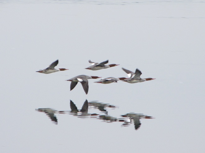
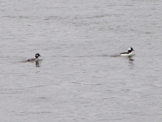
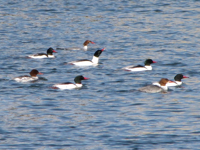
While the urge to head south in the autumn is largely stimulated by the shortening of the photoperiod, it is the presence of ice, particularly on glacial lakes throughout the lands to the north of the lower Susquehanna River basin, that pushes many diving ducks to finally make their way south toward the guarantee of open-water feeding areas along the coast. This movement may occur at anytime between November and late February or, as we have seen during some of the mild winters of recent decades, it may scarcely be noticed at all.Common Mergansers often lead they way when it comes to migratory diving ducks. They regularly move south in conspicuous numbers by late November and December and are regularly pushing north as soon as the ice begins to melt. During a typical year, it is not unusual for some populations of these large diving birds to remain north of us during the winter. Then, in the days after a sudden rush of frigid polar air, an appreciable increase in ice cover will force a mid-winter movement of birds down the Susquehanna.Temperatures in lotic fresh waters vary over the length of the stream or river. They are largely determined by the collective impact of the numerous sources of heat flux depicted in this graphic. (Environmental Protection Agency image)Buffleheads begin passing through the lower Susquehanna region in Novemeber on their way to coastal saltwater bays for the winter. Lingering populations feed by diving in the river’s pools and riffles for benthic invertebrates including snails and insect larvae. Lesser quantities of aquatic plant matter supplement their diet.Many Common Goldeneyes will remain on shallow, ice-free waters of the northern lakes and rivers sculpted by the most recent glacial event, but only until they are forced south into and through the lower Susquehanna valley by the encroachment of freezing conditions. On the river, they are among the dozen or so species of diving ducks we see visiting or passing through during the typical late fall and early river.
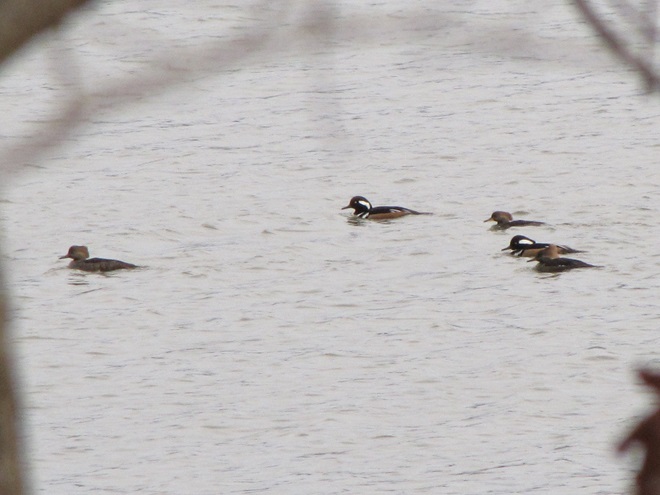
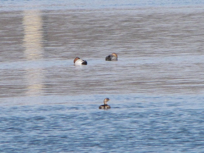
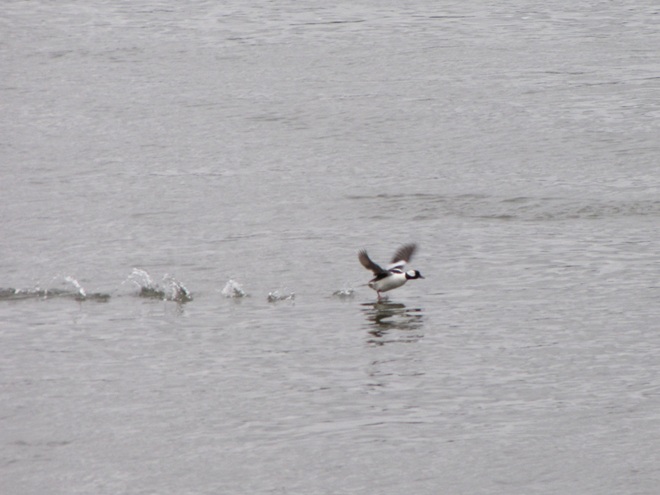
During their visits to the lotic (also known as riverine) fresh waters of the Susquehanna and its largest tributaries, benthic-feeding waterfowl make short dives to take advantage of the plants, small fish, invertebrates, and other food sources inhabiting the stream bottom in the riffles and pools of the free-flowing waterway. Substrates, listed here by size (in descending order), along with other parameters influenced by this flow regime zonation determine the variety and abundance of the forage available to migrating waterfowl and other consumers. Ice or high water and poor visibility due to flooding can render the riffles and pools of the channel unusable for feeding. The birds must then choose to either linger and rest without feeding or leave the lotic freshwater habitat to seek sustenance. During a flood, this may require relocation to a nearby lentic (still) body of fresh water such as a lake or reservoir. The presence of ice will almost invariably force the birds to fly on to the Atlantic Coastal Plain and the tidal waters of its bays and estuaries.Hooded Mergansers are one of the few species of diving ducks likely to utilize flooded shoreline timber and riverine (fluvial) wetlands as refuge from high water on Susquehanna.A Pied-billed Grebe and a pair of Canvasbacks on an ice-free stretch of the lower Susquehanna in mid-winter feed and loaf in a riffle-flanked pool where a large mat of American Eelgrass, a submerged aquatic plant also known as Tapegrass or Wild Celery, grows during the summer. The vast mosaic of riffles and pools in a river this size offers tremendous opportunities for a diverse array of aquatic species to find their niche wherein they can survive and flourish.The presence of ice forces Buffleheads and other diving ducks to gather in turbulent open water, often below a riffle or dam. Another alternative is to continue on toward the salty bays and estuaries of the coast. High water may push these birds into the shallows among the flooded woods to feed, but they seldom utilize heavily forested riparian wetlands as a refuge due to their need for a running start to get airborne.
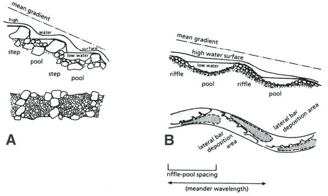
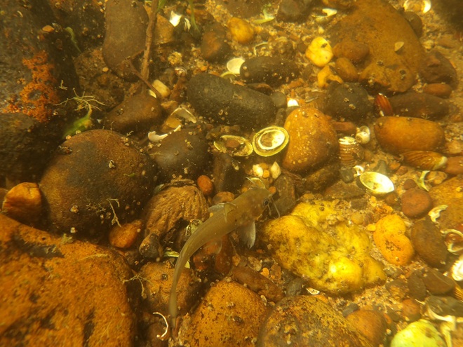
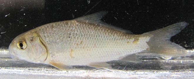
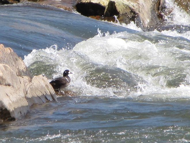
Riffle and Pool Characteristics of High Gradient (A) and Low Gradient (B) Streams. This graphic illustrates the change in deposition characteristics of a stream or river as its gradient decreases. A high-gradient stream (A) has a rapid velocity, often forms falls, and tends to carry away a high volume of all but the largest of particles of potential substrates as they erode from the surrounding landscape. On a low-gradient stream, the loss in water velocity reduces the water column’s ability to transport even the smallest of substrate particles. Deposition of this gravel, sand, silt, and clay forms lateral bars that over time create the familiar meandering path of a naturally flowing lowland stream. (National Park Service image)Benthic substrates in lotic freshwater pools and riffles support an abundance of life forms ranging from colorful diatoms on rocks and cobble, to invertebrates including snails and insect larvae, to fishes like this young Channel Catfish. Free of accumulations of sediment, this river bottom not only provides habitat for a healthy fishery, it facilitates the bidirectional exchange of water between the Susquehanna and its underlying aquifer.On the lower Susquehanna, populations of young Quillback suckers are found almost exclusively in clear, high-gradient pools.The Harlequin Duck winters along the rocky shores and man-made jetties of the Atlantic coast. In summer, they nest on fast-moving, headwater streams well to our north. Very rare on the Susquehanna, this is the first of two individuals found during March and April of 2025. It was observed feeding in the swift waters of the high-gradient riffles and pools where the river cuts through Blue Mountain north of Harrisburg. During previous weeks, Harlequin Ducks were being seen along the coast as far south as the mouth of the Chesapeake at Cape Charles, Virginia. It’s very possible that some of these birds traveled north through the bay area and up the Susquehanna on their way north.
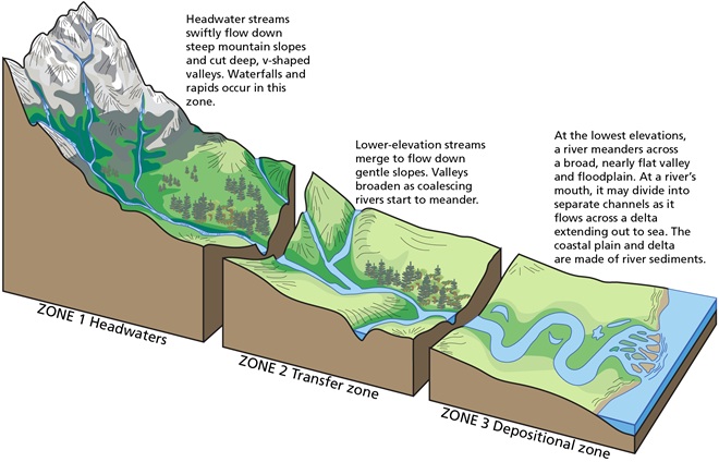
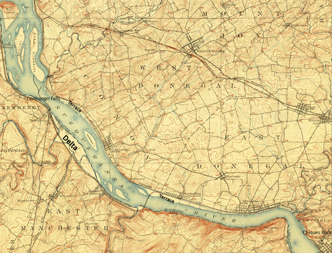
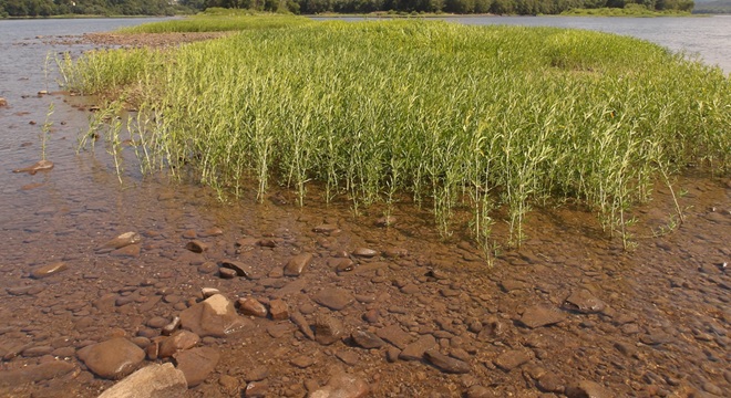
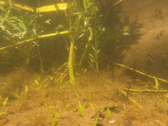
Fluvial Geomorphology of a Stream. Many of the Susquehanna’s tributaries pass through each of these three erosional zones. Along the way, they carry out the process of breaking down the mountains formed by the Allegheny orogeny, the collision of North America and Africa that created the supercontinent Pangea about 325 to 260 million years ago (during portions of both the Carboniferous and Permian periods). Today’s main stem of the lower Susquehanna passes through a transfer zone (Zone 2), carrying eroded materials to a depositional zone (Zone 3) located within the ancient Susquehanna canyon stretching from Havre de Grace, Maryland, to Norfolk Canyon on the edge of the continental shelf. Within this zone, more than a 10,000-year accumulation of post-glacial sediments lies submerged by the rising waters of the Atlantic Ocean and Chesapeake Bay. Although the present-day lower Susquehanna is largely a transfer zone, some deposition occurs along low-gradient segments of the river, particularly where its course parallels the watershed’s ridges both above and below the high-gradient rapids where its path has eroded passage through the highlands. (National Park Service image)Although the present-day lower Susquehanna is largely a transfer zone, some deposition occurs along low-gradient segments of the river, particularly where its course parallels the watershed’s ridges both above and below the high-gradient rapids where its path continues to erode passage through the bedrock. On this 1908 map of the Susquehanna at Conewago Falls, alluvial terraces of gravel, sand, silt, and clay can readily been seen as pale areas nearly lacking brown contour lines along the shorelines and islands of the river. Deposits within most of these terraces date back to the melt period following the most recent glacial event and beyond. The delta shown at the mouth of Conewago Creek (west) includes massive volumes of material deposited by both the creek and the river. This delta is currently known as Brunner Island, much of it developed as the site of a coal/gas-fired electric generating station. Terrace deposits along the Susquehanna’s shorelines created extensive perched marshes and swamps (wooded marshes) fed by rains, high river water, small streams, and springs, the latter often seeping from the base of the rocky escarpments carved by the ancient Susquehanna and defining the present-day inland border of the floodplain. We call these sites “Alluvial Terrace Wetlands”. Few of these critical components of river morphology survive. Those not drained for farmland were obliterated by urbanization and canal, railroad, and highway construction. (United States Geological Survey base image: Middletown, PA, quadrangle, 1908)Water Willow is a familiar emergent plant that colonizes lateral bars and other alluvial deposits in low-gradient segments of the Susquehanna.The fine roots of Water Willow collect sediment and absorb nutrients while creating dense cover for young fish and numerous species of invertebrates including the Virginian River Horn Snails seen here.
Prior to the nineteenth century, the low-gradient flow regime of the river both above and below the riffles at Chiques/Chickies Rock (lower right on map) created prime wildlife habitat. The natural accumulations of nutrients and substrates carried into and through the lotic waterway’s pools and riffles were cycled into an ideal growing medium for extensive mats of American Eelgrass and other aquatic plants. This underwater forest hosted a seemingly endless abundance of invertebrates and fishes (both resident and migratory)—supporting a variety of consumer species including various populations of humans. But soon after the mass clearing of much of the watershed’s land for farming and lumber, the mill ponds created by dams constructed on streams to power saw and grain mills became brimful with sediments eroded from the unprotected ground. During storm events, torrents of these sediments then flowed full bore toward the Susquehanna, and began accumulating in the low-gradient segments of the river.
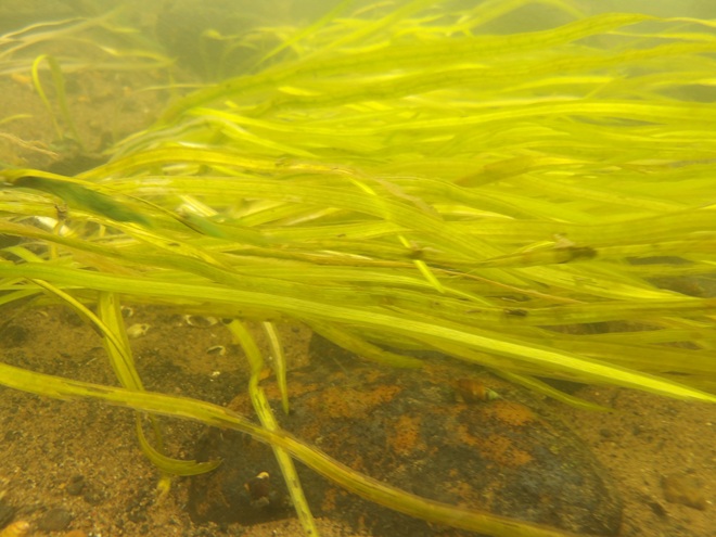
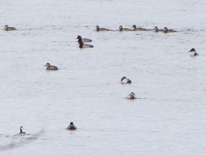
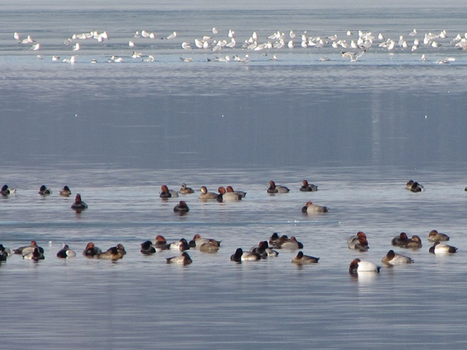
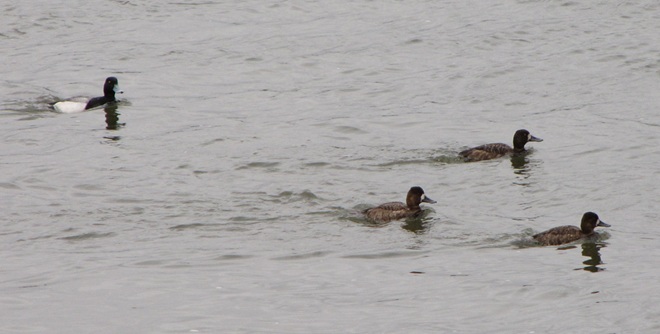
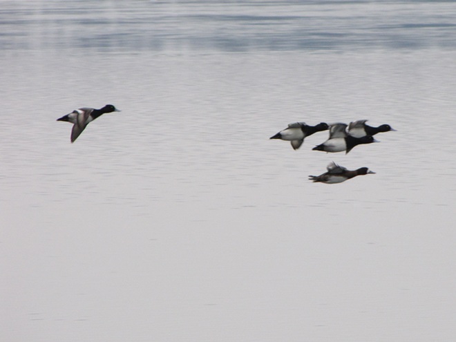
Sediments left behind after the removal of mill dams are known as legacy sediments. They disconnect the stream from its historic floodplain and riverine (fluvial) wetlands, thus intensifying the impact of high water in the surrounding landscape. As these nutrient-charged deposits wash away, they become a source of pollution in the waters of the Susquehanna and Chesapeake.A mat of American Eelgrass growing in the flowing waters of the Susquehanna below Conewago Falls. Eelgrass and other submerged aquatic plants provide essential habitat for a wide variety of small fish and invertebrates while also consuming nutrients deposited in the cobble, gravel, and sand substrate of the river’s pools. Excess quantities of smaller particles of silt and clay can clog the substrate and thus inhibit the hyporheic exchange of water between the stream channel and the underlying aquifer, often diminishing the biomass and diversity of organisms inhabiting this benthic habitat. Buried in these life-choking sediments, the river bottom becomes inhospitable to growth of submerged aquatics including eelgrass.This low-gradient stretch of the Susquehanna at Marietta flows parallel to the Chickies Quartzite “Hellam Hills” before making a sharp right turn to punch through the ridge as a series of rapids at Chiques Rock. Formerly a fully functional lotic ecosystem and a paradise for migrating waterfowl, this river segment is now impaired by accumulations of nutrient-laden sediments from agricultural and urban runoff.Nutrient and sediment-loaded flood waters roar across the diabase boulders at the York Haven Dam and Conewago Falls, a high-gradient segment of the Susquehanna.They continue past Brunner Island (left power plant stacks) and through Haldeman Riffles and the Shocks Mills Railroad Bridge……into the stretch of river known as the “Marietta broads” along the base of the Chickies Quartzite “Hellam Hills”. The low stream gradient here produces a slower current and increased deposition of sediments.As the flood surges through the riffle and pool complex at Chiques Rock, the high stream gradient maintains a velocity in the water column sufficient to keep additional sediments in suspension until they reach the low-gradient river segment just downstream at Washington Boro, site of a naturally occurring lateral bar area known as the Conejohela Flats. These bars now lie within the man-made depositional zone known as “Lake Clarke”. Created nearly a century ago by construction of the Safe Harbor Dam, this impoundment is accumulating astounding volumes of nutrient-loaded sediments that continue to encapsulate the flats within a stream-impairing delta.Anytime from November to April on the lower Susquehanna, a group of Redheads, Canvasbacks (3 birds to right of the middle of the picture), and a Horned Grebe (lower left) is a welcome sight in a riverine pool known to have a summertime growth of American Eelgrass. Noted Dr. Herbert Beck in 1924 when describing the Canvasback, “Like all ducks, …, it stops to feed within the county (Lancaster) less frequently than formerly, principally because the vast beds of wild celery which existed earlier on broads of the Susquehanna, as at Marietta and Washington Borough, have now been almost entirely wiped out by sedimentation of culm. Prior to 1875 the four or five square miles of quiet water off Marietta were often as abundantly spread with wild fowl as the Susquehanna Flats are now. Sometimes there were as many as 500,000 ducks of various kinds on the Marietta broad at one time.”Today, seeing just dozens of Aythya genus ducks (Redheads, Canvasbacks, scaup) on the lower Susquehanna is a notable event. If they happen to be forced down by inclement weather while migrating through, you might get lucky enough to see several hundred.While the recovery of eelgrass/wild celery beds on the Susquehanna is trivial in scale and offers little support for numbers of waterfowl to return to historic levels, restorations on the upper Chesapeake in the vicinity of the Susquehanna Flats between Havre de Grace and Aberdeen Proving Grounds may have helped refuel a gathering of mostly Aythya genus ducks during the final days of February. This mass of ducks, many of which were forced south from the frozen Great Lakes during the previous weeks (some by way of the ice-choked Susquehanna) were apparently making an abrupt turn to make their way back north. Their stay was brief, but estimates by local birders put their numbers as high as one half million. The vast majority of the concentration consisted of Aythya species: Redheads, Canvasbacks, Ring-necked Ducks, and both Lesser and Greater Scaup. It probably included a mix of birds including both northbound migrants from further down the coast and the aforementioned refugees that had just arrived to pay a quick visit while escaping the late-season ice before turning around.During the past two centuries, as food supplies in the Susquehanna grew increasingly compromised for benthic feeders like these Lesser Scaup and other diving ducks, a change in distribution was necessary for survival.As individual species, Lesser Scaup and other waterfowl that fail to adapt to natural or man-made changes in their habitats and food supplies may see their overall global numbers falter.
Despite being located in the transfer zone, the lower Susquehanna has become a significant depositional zone along much of its length, mostly courtesy of the placement of sediment-trapping man-made dams.
Following construction of the mill dams and ponds on nearly every mile of the lower Susquehanna’s low-gradient tributary streams, enterprising parties moved on to the river. The first significant spans were constructed using wide timber cribs filled with large rock. They were placed to create water deep enough to allow canal boats to cross the Susquehanna at both Clark’s Ferry at the mouth of the Juniata River in Dauphin County and at Columbia/Wrightsville. These dams also diverted water into the newly excavated canals—the Pennsylvania Eastern Division Canal (completed in 1833) which followed the river’s east shore from Clark’s Ferry to Columbia, and the Susquehanna and Tidewater Canal (completed in 1840) along the west shore from Wrightsville to Havre de Grace, Maryland. Placement of these sediment-trapping man-made dams began a process of converting vast mileage of the lower Susquehanna from a transfer zone into a deposition zone. In addition, layout of the canals and locks followed the contours along the base of the riverside ridges, seriously altering most of the alluvial terrace wetlands that the river had created as a feature of its floodplain during the post-glacial period.
Construction of the canal dams was just the beginning. During the twentieth century, more massive dams would be added to the main stem of the river for hydroelectric energy production at York Haven, Safe Harbor, Holtwood, and Conowingo. Upon their completion, the days of unassisted anadromous fish migrations were over. On both the river and its tributaries, smaller dams including dangerous low-head dams maintain water levels for boating and recreation. They too create current-diminishing, pseudo-lentic waters that blanket the lotic riffle and pool substrates with polluted sediments.
MAN-MADE DAMS TURN LOTIC WATERS INTO UNFLUSHED TOILETS
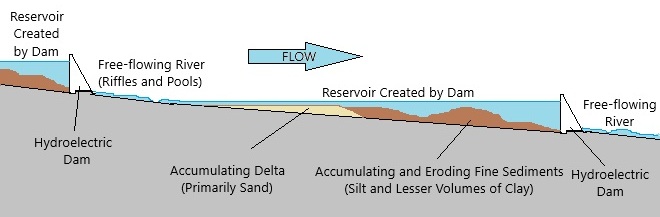
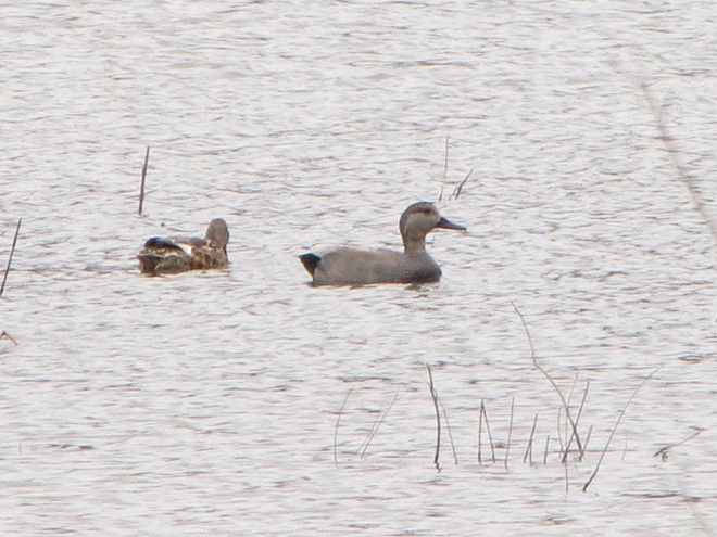
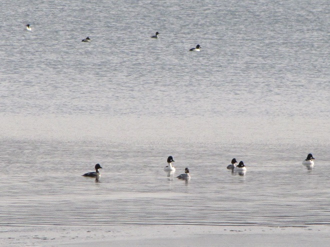
The construction of dams on the lower Susquehanna has converted vast mileage of the river from a lotic freshwater system into a series of man-made lentic freshwater reservoirs. These areas have lost their function as a lotic transfer zone and are now a sort of dysfunctional series of depositional zones collecting vast volumes of sediment containing nutrients and other pollutants. Within each impoundment, the reduced velocity of the river causes it to drop suspended sand first, then the finer particles of silt and clay closer to the dam. The flow regime of riffles and pools is lost and the hyporheic zone that exchanges water between the river and the underlying aquifer is clogged. These impaired segments of river become ripe for eutrophication: algal blooms followed by die offs that can lead to a fatal reduction of dissolved oxygen in the water column.Deposits of lateral bars of sediment in low-gradient segments of the Susquehanna can create shallow water feeding habitat for puddle/dabbling ducks like these Gadwall. Where sediment pollution is severe, benthic foods in these areas often consist mostly of invertebrates and plant matter deposited by the current, the buried substrates devoid of a functioning ecosystem and the waters subject to eutrophication.Common Goldeneyes on a patch of open water on an otherwise ice-covered “Lake Clarke”, the impoundment created by Safe Harbor Dam. While they may find this spot advantageous for loafing, the food supply over the sediment-buried substrate will be limited.
Dredging of sections of the lower Susquehanna for spilled, discarded, and washed-out anthracite coal sediment went on for nearly 100 years and was a particularly active enterprise in the Harrisburg area and in Lake Clarke until 1973. The recurrent substrate disturbances that accompanied waste coal recovery in these segments of the river repetitively damaged habitat for benthic life and may have been the catastrophic factor leading to the extirpation of two species of freshwater mussels: the Eastern Lampmussel (Lampsilis radiata) and the Dwarf Wedgemussel (Alasmidonta heterodon).
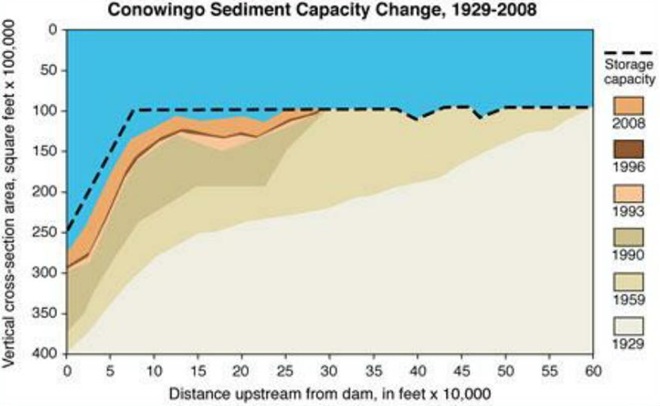
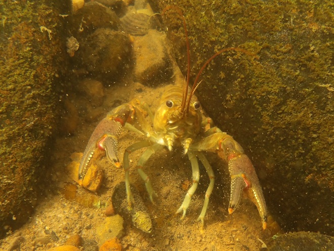
By the end of the twentieth century, accumulations of polluted sediments behind lower Susquehanna dams were nearing capacity. There is no working plan to attenuate the massive release of these pollutants that may be triggered by a catastrophic flood. The effort to reduce nutrient and sediment runoff remains the focus so that new loading is kept to a minimum and won’t add to the capacity problems at the dams or continue downriver to the Chesapeake at full strength when the dams are full. Alleviating the sediment aggregation problem within the river’s impoundments is a tall order and a dilemma not easily solved. (United States Geological Survey image)Common Mergansers will feed where benthic substrate supports the small fish and invertebrates they prefer. They will, however, gather in extraordinary numbers on the “lakes” created by riverine dams. Though they can only feed on what floats in with the current, hundreds or sometimes thousands of Common Mergansers will concentrate on “Conowingo Pond” during the late fall or early winter. There, safety in numbers gives them some guarantee of protection against the multitudes of eagles that simultaneously frequent the vicinity. Another advantage of staging on “Conowingo Pond” is its close proximity to favorable feeding areas on upper Chesapeake Bay and stretches of the Susquehanna where lotic riffles and pools offer abundant opportunities below the river’s dams.Fortunately for everything else living in the benthos, Common Mergansers are big enough to devour invasive, non-native Rusty Crayfish when they find them in our lotic waterways.
TIME TO CLEAN UP OUR ACT
WHERE DOES YOUR STORMWATER GO?
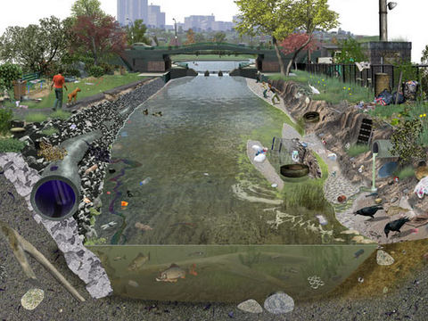
Channelized Urban/Suburban Streams Function as Sewers. They have no attached lowlands or floodplains to absorb, purify, and infiltrate runoff from rain events. Pollutants including litter, pet waste, lawn chemicals, tire-wear particles, hazardous fluids, and sometimes untreated human excrement flush unchecked from the municipal storm drainage system into the waterway. Thermal shock from summer downpours washing across sun-heated pavements can kill temperature sensitive fishes and other aquatic life. Nutrient and sediment loads from these impaired tributaries later accumulate downstream in low-gradient segments of the Susquehanna, turning the river into an open-air cesspool. Aggressively working to implement projects that eliminate these sources of pollution are the only effective way to keep the problem from getting worse. Making things better requires a lot more dedication and effort. (United States Geological Survey image by Frank Ippolito)
RIPARIAN BUFFERS MAKE A DIFFERENCE…WIDER IS BETTER
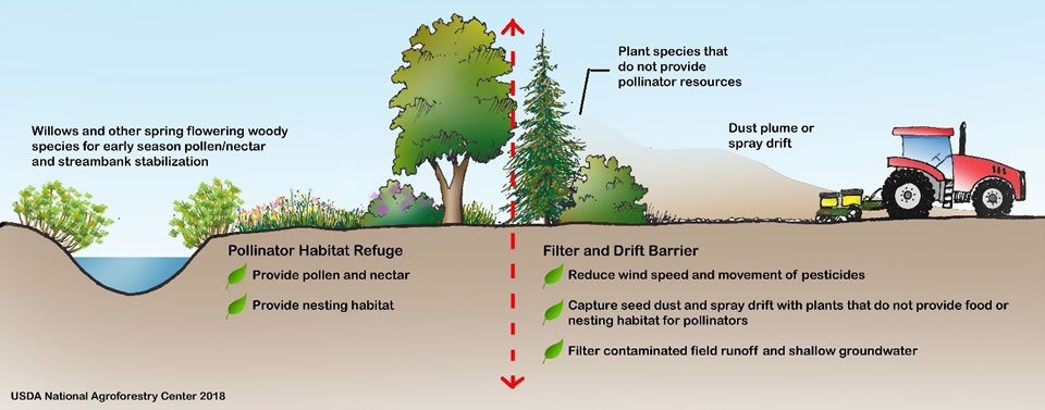
To sequester sediment and cycle nutrients (primarily nitrogen and phosphorus) contained in farm runoff, the U.S.D.A. recommends installing riparian buffers between streams and lands used for grazing and raising crops. To protect pollinating species including bees and butterflies from pesticide drift and eroding soils rich in fertilizers, they further recommend installing a stand of wind-pollinating plants such as conifers, oaks, and birches between the field and streamside plantings. These same conservation practices improve water quality and wildlife habitat on waterways located in residential and commercial areas as well. (United States Department of Agriculture image, click to enlarge)
FLOODPLAIN RESTORATION
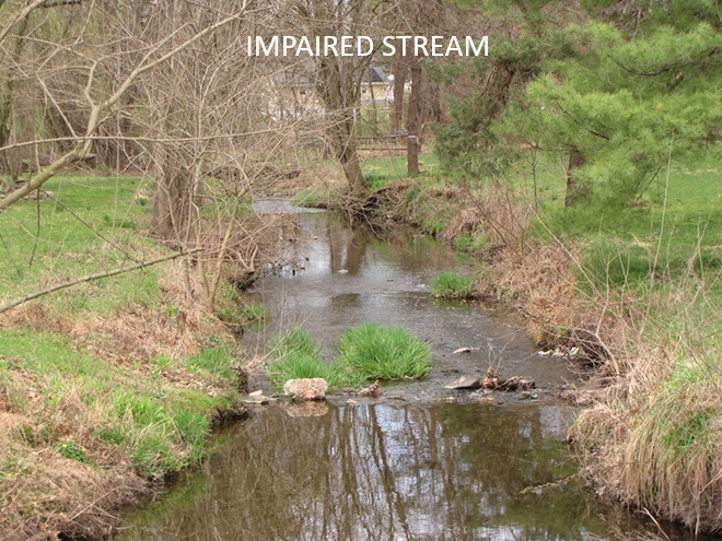
Regardless OF HOW LONG YOU’VE BEEN CONDITIONED TO THINK OTHERWISE, THIS IS A DYSFUNCTIONAL, POLLUTED CREEK—AND IT NEEDS HELP
A channelized low-gradient stream eroding a path through deposits of legacy sediments displaces flood waters into previously unaffected areas and provides a continuing source of nutrient and sediment pollution during storm events. These impaired waters have a diminished capacity for supporting aquatic life including fishes.
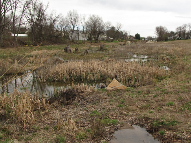
RESTORED TO ITS HISTORIC FUNCTIONS
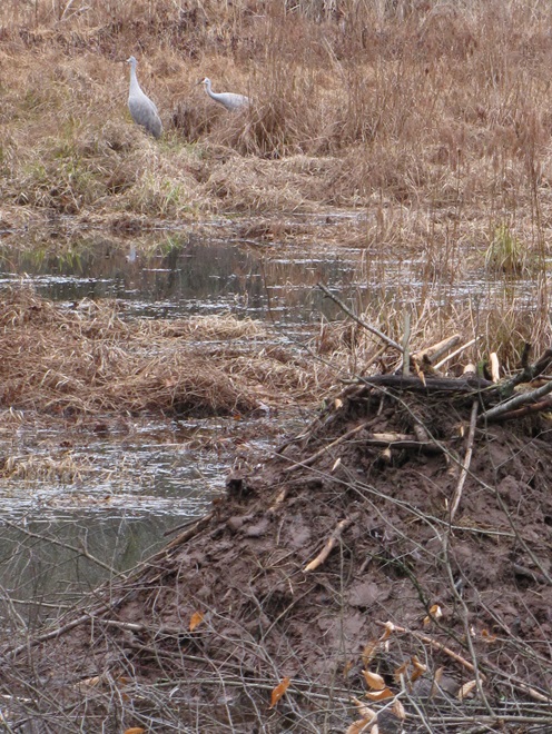
On an adjacent segment of the same creek, this legacy sediment removal project restored a braided meandering channel and connected it to its newly liberated, historic floodplain. In just their second year, the fluvial wetlands are effectively absorbing stormwater and sequestering nutrients as an attached component of the stream’s riffle and pool complex. During our visit earlier this week, we found American Toads, Northern Leopard Frogs (Lithobates pipiens), and Northern Spring Peepers breeding here. It’s just as Castor canadensis would have it!
“STOP HEMMING AND HAWING AROUND ALREADY”
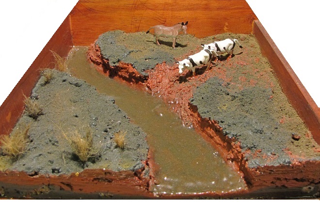
“HEY COWBOY, HOW ‘BOUT GETTIN’ THEM FILTHY LITTLE DOGIES OUTTA DAT CRICK?”
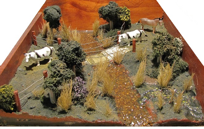
Here’s a polluted stream in a pasture with grazing livestock. The site is a former mill pond within which the creek eroded a channel following removal of the dam. The animals defecate and urinate where access to water is gained at a broken down embankment of the nutrient-loaded legacy sediments deposited in the pond more than a century ago. It’s a haphazard form of animal husbandry and a reminder that all it takes is just one stubborn jackass to foul up the whole waterway.
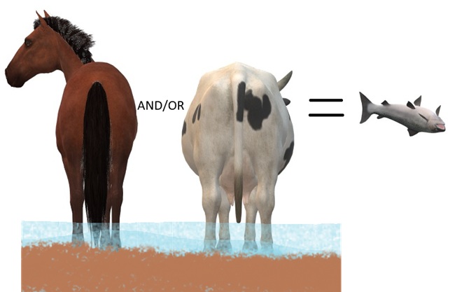
DIRECT SOURCES OF NITROGEN (AMMONIA) POLLUTION IN STREAMS
DID YOU KNOW that a dairy cow produces about 80 pounds of waste (excrement and urine) every day?
DID YOU KNOW that a horse produces about 50 pounds of waste (excrement and urine) every day?
DID YOU KNOW that a human produces about 3 to 4 pounds of waste (excrement and urine) every day? The exceptions, of course, are those who continue to insist that raising farm animals in and alongside a body of water is okey-doke—a harmless practice. These individuals tend to retain the former constituent of human waste and are thus full of it.
“ATTABOY TEX, THAT’S MORE LIKE IT!”
Now that’s better. Legacy sediments have been removed to reconnect the stream to its floodplain. A livestock crossing and exclusion fencing has been installed, and a nutrient-consuming riparian buffer has been planted. This creek segment’s pollution woes have been mitigated. Do you have a neighbor needing this type of remedial work on their farm? Encourage them to contact your local county conservation district office or volunteer waterways restoration organization for assistance. Various programs provide financial assistance covering all or most of the costs of stream improvement as well as monetary incentives for helping to clean up the water.
AND FINALLY
WHEN IT COMES TO BUILDING DAMS ON LOTIC FRESH WATERS…
…LEAVE IT TO THE BEAVERS
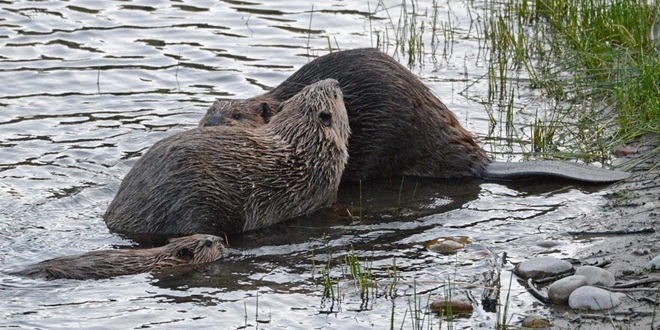
North American Beavers (Castor canadensis) create habitats that connect the riffle and pool regime of a low-gradient stream to a surrounding fluvial wetland that retains sediments, cycles nutrients, and provides essential habitat for hundreds of plant and animal species. Floodplains are for flooding, and if a beaver floods an area, you can be guaranteed that it was already part of a floodplain. You see, beavers don’t encroach upon humans, it’s humans engaging in the encroachment upon beavers. (National Park Service image)
MAD HATTERS
DID YOU KNOW that even before the landscape was cleared for farms and a supply of timber, and before mill dams on local creeks began accumulating soil runoff from the consequently barren hillsides, all the North American Beavers, the keystone species of lower Susquehanna stream ecology, were killed and sold to make hats? It’s no wonder things are fubar!
COMING SOON…
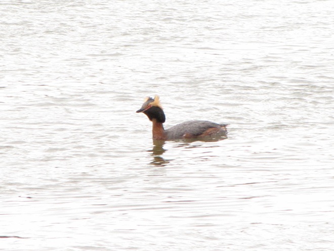
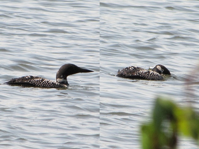
Horned Grebes are regular migrants and sometimes winter residents on ice-free stretches of the lower Susquehanna. They spend their time plying the benthic substrate of the river’s clear riffles and pools for a variety of invertebrates and small fish. Look for them moving north in coming days sporting this beautiful breeding plumage.April and early May are prime time for observing Common Loons on the Susquehanna as they undertake a journey from the Atlantic surf where they spent the winter to nesting sites on northern lakes. For this migrant in breeding plumage, clear water for sighting plenty of benthic life in the river’s riffles and pools assures a successful dive in search of energy-replenishing forage.
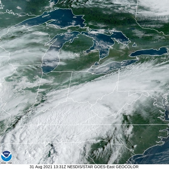
Today’s NOAA/GOES satellite image serves as a little reminder of the big three. That’s right, it’s the three big “natural” disasters—wildfires, inland flooding, and coastal flooding (lucky for us, our region is at present millions of years removed from severe threats posed by the tectonic disasters—earthquakes, volcanoes, and tsunamis—and is not particularly prone to frequent tornadoes). Each continues to cause an increasing volume of property damage and threaten a greater number of lives because of where and how we choose to make our homes and erect our structures.
Earlier today, smoke from forest fires in central Canada sweeps through the skies of the Great Lakes, New England, and the Mid-Atlantic States north of the Mason-Dixon Line. Meanwhile off North Carolina, Tropical Storm Dexter is seen developing over warm ocean waters east of the Gulf Stream. (NOAA/GOES satellite image)
For all of human existence, the dynamics of the atmosphere have been shaping the topography and the ecosystems of the planet. In recent times, we’ve had the advantage of satellite technologies to show us spectacular images of atmospheric events as they happen. And through the various branches of science, we’ve come to understand the impact these events have upon the landscape and the people who live and/or work there.
Forestry sciences have helped us to understand how natural fuels, humidity, temperature, rainfall, soil moisture, wind, and human encroachment influence the frequency and severity of wildfires. These discoveries have led to changes in forest management and implementation of practices such as prescribed burns to reduce accumulated fuel loads. Because human development typically lowers soil moisture and brings along with it additional sources of ignition, many land managers and fire departments have warned of the ever increasing dangers of wildland-urban interface fires. These warnings have gone largely unheeded for more than four decades as millions of homes and other combustible structures have been erected within areas prone to fires capable of uncontrollable growth into disastrous conflagrations. The tinderbox wildlands—they’re a nice place to visit, but we ought not to live there!
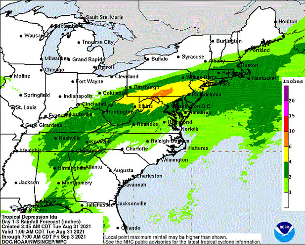
Tropical storms and other sources of heavy precipitation bring about quite the hubbub over flooding. Meteorologists spend a lot of time explaining it all, but it’s almost as if no one pays any mind. For a people who check the weather forecast several times a day, every day of our adult life, just to get a leg up on how that weather is going to change day by day and hour by hour, you would think we would better anticipate the climatic events that happen over the long term. In particular, you would think we would have an awareness of our own individual susceptibility to flooding— a grasp of how, where, and why floods occur. You would think that repeated episodes of flooding would compel society to embrace an ethic that treated water as the valuable commodity it is. Yet, we all seem to follow the same patterns of behavior. First, we drain, dump, pipe, curb, channel, ditch, grade, pave, and pump to get the rain that falls upon our property off of our property. Then, the chump downstream gets really mad that we sent our water his way and flooded him out, so he takes the same measures to send even more water to the next poor slob down the line until finally the now polluted slurry of runoff floods the street, a cellar, a house, a business, or a stream—a stream that has been channelized so it no longer has a floodplain to absorb, hold, purify, and infiltrate the stormwater. Why was the stream channelized? So we could fill in the floodplain and build upon it of course. Two things come to mind here. First, if we’re going to be selfish enough to flood out our neighbors, then why shouldn’t we be totally selfish and keep for ourselves all the water that falls upon our place. After all, we’re going to need that water some day. And second, the floodplain is a nice place to visit, but we ought not to build there. Floodplains are for flooding; thousands of years of erosion have shaped them that way—it’s a gravity thing!
Next, we look at the lessons from geology, more specifically coastal geomorphology. Through these disciplines we know that the coastal plain—the flat land that spent most of the last 35.5 million years (the time since the meteor strike at the present-day mouth of Chesapeake Bay) as a beach or a tidal marsh—today stands mostly less than three dozen feet above sea level. We know that the sands forming barrier islands along the Atlantic seaboard, which are only several feet above sea level, shift their shape and position with the tides. Over the decades and centuries, these islands migrate and compensate for changes in climate and tidal patterns as well as sea levels. Behind their shifting dunes, vast tidal marshes are protected from seasonal storms including the periodic nor’easter or hurricane. Despite the importance of barrier island dynamics to the integrity of the bays and estuaries they protect, and despite their vulnerability to coastal storm surges, winds, and flooding, we choose to build there. In fact, the greatest population densities in the United States, and in many other countries of the world, are on the beach. It’s not because these hundreds of millions of people are fishing or loading/unloading ships for a living—it’s mostly for the view. Despite their importance to fisheries and other coastal life, we continue to alter and destroy the near-tidal areas of the the barrier islands and bays. We go to great expense to “save” for our uses the lands that should be getting inundated by rising sea levels to create new shallow tidewater zones. We waste spectacular amounts of money pumping sand back onto beaches to keep naturally migrating sediments from changing their shape and position in response to the tides. We keep putting more people and more capital at risk by urbanizing these low-lying areas. Building on the beach is absolute madness. It’s an ecological catastrophe from day one and a human catastrophe soon after.
All of the lands impacted by these natural events have two things in common. Each becomes a potential disaster area if people choose to construct their homes or businesses there. And each, if left in its wild state and given a buffer space from human activity, reacts with natural time-derived mechanisms in response to the same events. These mechanisms are often essential for provision of the unique ecosystems required by many of our most threatened wildlife species. Human encroachment into floodplains, wetlands, tidal marshes, beaches, and xeric uplands is a double-edged sword. It first decimates populations of these uncommon species by destroying and fragmenting their specialized habitats. Then, it sets the stage for the fires, floods, and other disasters that endanger the lives and property of the people living there. Considering the ramifications of building in these fire and flood susceptible areas, we can and should live somewhere else, especially when the wildlife requiring these places often can’t.
This evening’s smoky sunset over the Susquehanna at Chiques Rock was courtesy of Canadian wildfires.
Our wildlife has been having a tough winter. The local species not only contend with cold and stormy weather, but they also need to find food and shelter in a landscape that we’ve rendered sterile of these essentials throughout much of the lower Susquehanna valley’s farmlands, suburbs, and cities.
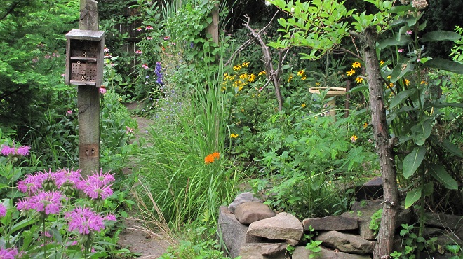
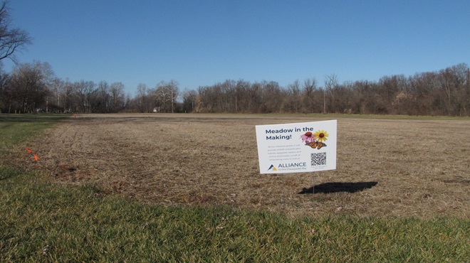
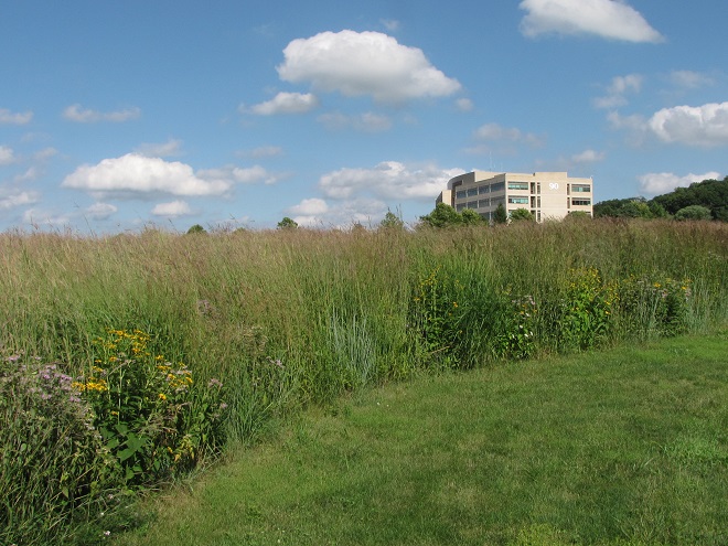
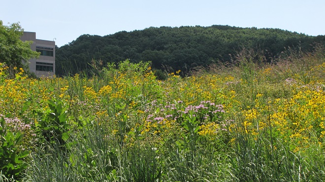
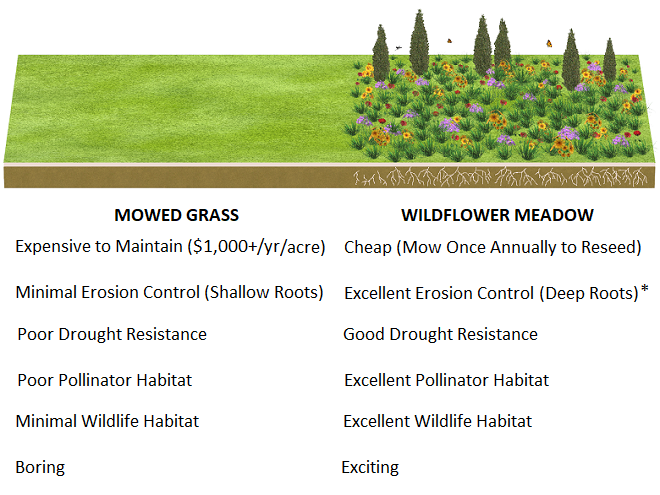
Planting trees, shrubs, flowers, and grasses that benefit our animals can go a long way, often turning a ho-hum parcel of property into a privately owned oasis. Providing places for wildlife to feed, rest, and raise their young can help assure the survival of many of our indigenous species. With a little dedication, you can be liberated from the chore of manicuring a lawn and instead spend your time enjoying the birds, mammals, insects, and other creatures that will visit your custom-made habitat.
What makes some neighborhoods so appealing? It’s the foresight property owners had a half a century or more ago when they planted their lawns and gardens with a variety of sturdy, long-lived trees and shrubs. They’ve not only minimized the need for mowing grass, they’ve provided the present-day residents of their home with added thermal stability during both the blazing heat of summer and the chilling cold of winter.
Fortunately for us, our local county conservation districts are again conducting springtime tree sales offering a variety of native and beneficial cultivated plants at discount prices. Listed here are links to information on how to pre-order your plants for pickup in April. Click away to check out the species each county is offering in 2025!
Pickup on: Thursday, April 24, 2025 or Friday, April 25, 2025
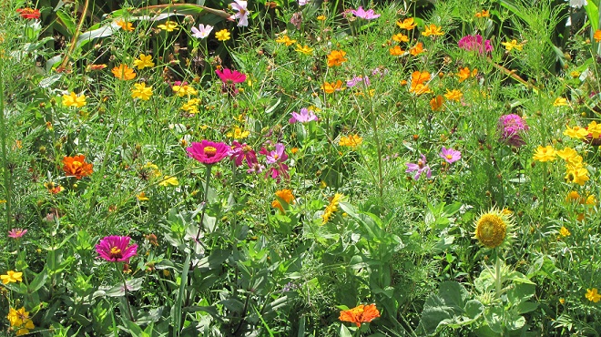
During its 2025 tree seedling sale, the Cumberland County Conservation District is offering Northeast Native Wildflower seed mix for four dollars per ounce. One ounce plants approximately 200 square feet of bare soil. This is a Zebra Swallowtail visiting nectar-rich flowers during July of the first year after sowing this mix at a site along the Susquehanna.
Pickup on: Thursday, April 24, 2025 or Friday, April 25, 2025
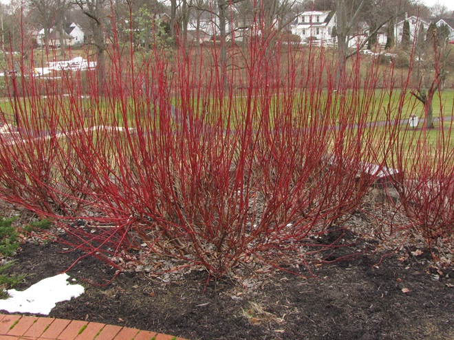
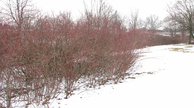
Able to thrive in wet soils, Red-osier and Silky Dogwood shrubs are ideal plants for intercepting and polishing stormwater in swales, detention/retention basins, and rain gardens. With their crimson twigs in winter, they look great along borders among clusters of cedars, pines, spruces, and other evergreens. They make an excellent choice for soil stabilization along the shorelines of streams, ponds, and other bodies of water too. Buy a dozen or more to create a showy mass planting in your soggy spot.
The Franklin County Conservation District is offering American Elm seedlings in bundles of 25 for 36 dollars. Start them in pots for a couple of years to really get ’em going, then find places with damp soil and plenty of room to give ’em a try. During autumn, they look great in the company of spruces, white pines, and other large evergreens.
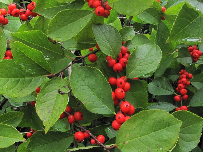
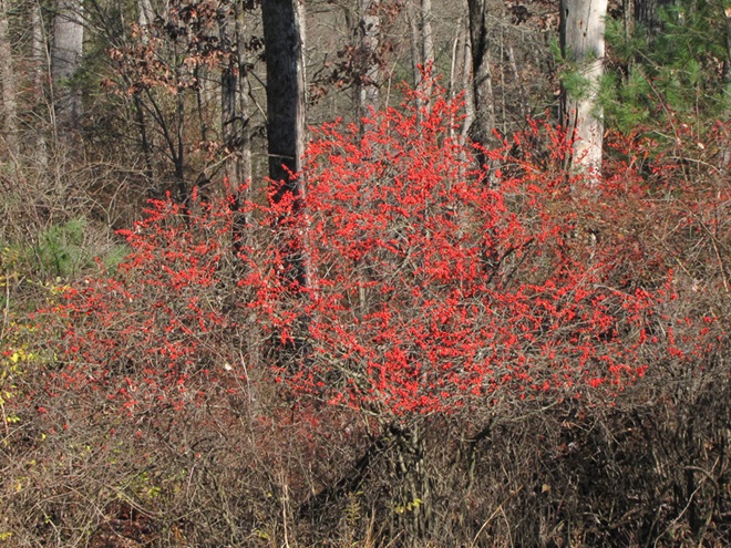
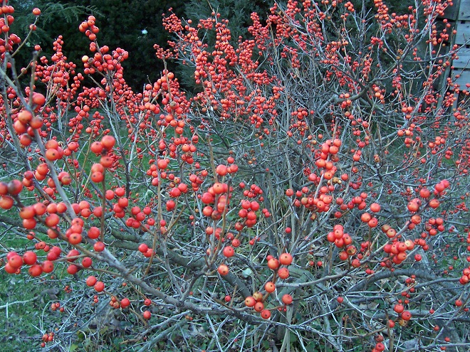
We purchased these Eastern White Pine, Norway Spruce, and Common Winterberry plants from the Lancaster County Conservation District Tree Sale about four years ago. They’re filling in as understory growth in the margins beneath some thirty-year-old Eastern Hemlocks to create dense cover for resident and visiting fauna at susquehannawildlife.net headquarters.
For 2025, the Lebanon County Conservation District is offering Dawn Redwood (Metasequoia glyptostroboides) trees in packs of ten for twelve dollars. Though native to Asia, these adaptable trees present little threat of naturalizing and have many positive attributes in a conservation planting. Given ample space, the Dawn Redwood, a relative of the sequoias, will rapidly grow to a towering giant. They create a particularly dramatic landscape feature when planted in clumps of three to five trees or more. With age, the trunks become stout and very sturdy. Don’t like raking? The finely divided deciduous foliage can be left where it falls in autumn. It usually disintegrates by spring to enrich the soil and promote more growth.The genus Metasequoia was first described in 1941 based upon fossils collected in Jurassic and earlier strata from widespread locations in the northern hemisphere. Metasequoia were believed extinct until just a few years later when a small number of living Dawn Redwoods were first discovered in southern China. Now distributed around the world for cultivation, direct descendants of this wild population of Metasequoia glyptostroboides are available for nearly anyone in a temperate climate to plant and grow to exceptional size. (National Park Service image)The Lebanon County Conservation District is also selling Bald Cypress trees. They’re offered in bundles of ten for ten dollars. These long-lived trees resemble the Dawn Redwood. Both are tolerant of damp ground, but the native Bald Cypress is the species to choose for placement along streams, in wetlands, and on other sites with standing water or saturated soil.Wildlife rich Bald Cypress swamps currently occur on the Atlantic Coastal Plain as far north as Sussex County, Delaware. Just to the south, they’re also found along Chesapeake Bay in areas that, during the last glacial maximum when sea level was 300 to 400 feet below today’s tide lines, were the Lower Susquehanna River Watershed in portions of present-day Maryland and Virginia. The northward post-glacial range extension of Bald Cypresses is now blocked by centuries of human intervention that has eliminated, isolated, or fragmented the wetland habitats where they could potentially become established. Why not lend them a hand? Plant a cypress swamp in your flood-prone bottomland. (National Park Service image by Andrew Bennett)
A privacy planting of sturdy, native Eastern White Pines and Northern Red Oaks thriving around the border of a parking area where they also provide shade from the sun and help infiltrate a share of the stormwater that would otherwise become runoff.This year, the York County Conservation District is offering a Showy Northeast Native Wildflower and Grass seed mix for $19.99 per quarter pound. Sure beats mowing!
If you live in Adams County, Pennsylvania, you may be eligible to receive free trees and shrubs for your property from the Adams County Planting Partnership (Adams County Conservation District and the Watershed Alliance of Adams County). These trees are provided by the Chesapeake Bay Foundation’s Keystone 10-Million Trees Partnership which aims to close a seven-year project in 2025 by realizing the goal of planting 10 million trees to protect streams by stabilizing soils, taking up nutrients, reducing stormwater runoff, and providing shade. If you own property located outside of Adams County, but still within the Chesapeake Bay Watershed (which includes all of the Susquehanna, Juniata, and Potomac River drainages), you still may have an opportunity to get involved. Contact your local county conservation district office or watershed organization for information.
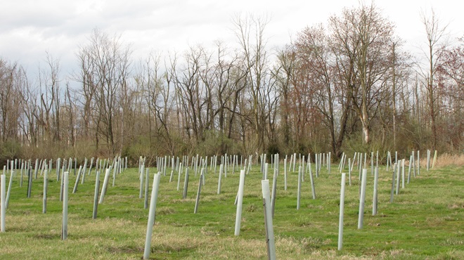
As they mature, tree and shrub plantings along streams return pollution-controlling functions to floodplains and provide critical habitat for wildlife. These riparian buffers not only improve water quality for fisheries, they also create travel corridors that prevent terrestrial animal populations from becoming isolated.Do you own a parcel of streamside or wetland acreage that you’d like to set aside and plant for the benefit of wildlife and water quality? Contact your local county conservation district office and ask them to tell you about CREP (Conservation Reserve Enhancement Program) and other programs that may offer incentives including payment of all or a portion of the costs of plantings and other habitat improvements.
We hope you’re already shopping. Need help making your selections? Click on the “Trees, Shrubs, and Woody Vines” tab at the top of this page to check out Uncle Tyler Dyer’s leaf collection. He has most of the species labelled with their National Wetland Plant List Indicator Rating. You can consult these ratings to help find species suited to the soil moisture on your planting site(s). For example: if your site has sloped upland ground and/or the soils sometimes dry out in summer, select plants with a rating such as UPL or FACU. If your planting in soils that remain moist or wet, select plants with the OBL or FACW rating. Plants rated FAC are generally adaptable and can usually go either way, but may not thrive or survive under stressful conditions in extremely wet or dry soils.
NATIONAL WETLAND PLANT LIST INDICATOR RATING DEFINITIONS
OBL (Obligate Wetland Plants)—Almost always occur in wetlands.
FACW (Facultative Wetland Plants)—Usually occur in wetlands, but may occur in non-wetlands.
FAC (Facultative Wetland Plants)—Occur in wetlands and non-wetlands.
FACU (Facultative Upland Plants)—Usually occur in non-wetlands, but may occur in wetlands.
UPL (Upland Plants)—Almost never occur in wetlands.
Using these ratings, you might choose to plant Pin Oaks (FACW) and Swamp White Oaks (FACW) in your riparian buffer along a stream; Northern Red Oaks (FACU) and White Oaks (FACU) in the lawn or along the street, driveway, or parking area; and Chestnut Oaks (UPL) on your really dry hillside with shallow soil. Give it a try.
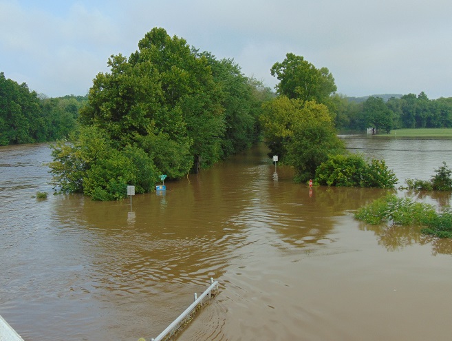
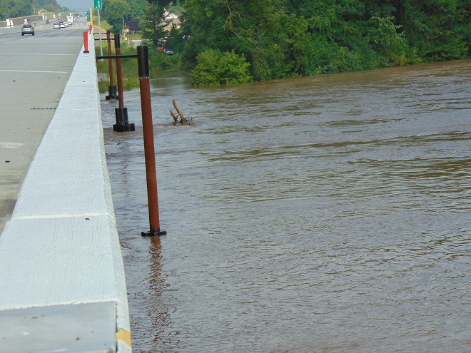
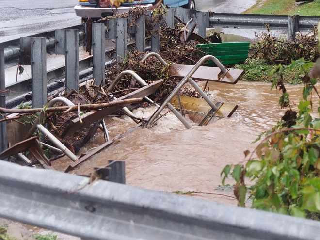
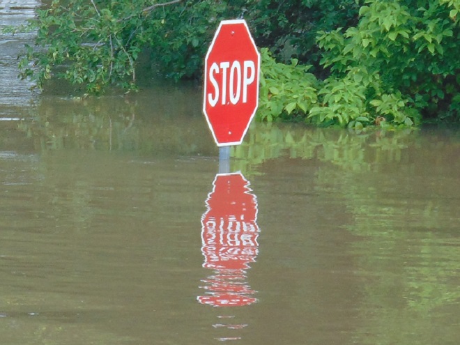
The deluge of rain that soaked the lower Susquehanna watershed during last week is now just a memory. Streams to the west of the river, where the flooding courtesy of the remnants of Hurricane Debby was most severe, have reached their crest and receded. Sliding away toward the Chesapeake and Atlantic is all that runoff, laden with a brew of pollutants including but not limited to: agricultural nutrients, sediment, petroleum products, sewage, lawn chemicals, tires, dog poop, and all that litter—paper, plastics, glass, Styrofoam, and more. For aquatic organisms including our freshwater fish, these floods, particularly when they occur in summer, can compound the effects of the numerous stressors that already limit their ability to live, thrive, and reproduce.
(Environmental Protection Agency image)
One of those preexisting stressors, high water temperature, can be either intensified or relieved by summertime precipitation. Runoff from forested or other densely vegetated ground normally has little impact on stream temperature. But segments of waterways receiving significant volumes of runoff from areas of sun-exposed impervious ground will usually see increases during at least the early stages of a rain event. Fortunately, projects implemented to address the negative impacts of stormwater flow and stream impairment can often have the additional benefit of helping to attenuate sudden rises in stream temperature.
While a row of trees along a creek can help provide protection from the thermal impact of the sun, a vegetative riparian buffer must be much wider to be effective for absorbing, cooling, and treating runoff from fields, lawns, and paved surfaces. This buffer is too narrow to prevent surface runoff from polluting the water.
Of the fishes inhabiting the Lower Susquehanna River Watershed’s temperate streams, the least tolerant of summer warming are the trouts and sculpins—species often described as “coldwater fishes”. Coldwater fishes require water temperatures below 70° Fahrenheit to thrive and reproduce. The optimal temperature range is 50° to 65° F. In the lower Susquehanna valley, few streams are able to sustain trouts and sculpins through the summer months—largely due to the effects of warm stormwater runoff and other forms of impairment.
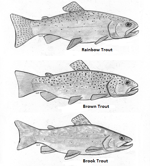
Sculpins, including the Blue Ridge Sculpin (Cottus caeruleomentum) seen here, are native coldwater fishes which, during the 11,000 years since the last glacial maximum, have had the availability of their favored habitat sharply reduced by warming water temperatures and a rising Atlantic. During this interval, seawater has inundated the path of the “Late” Pleistocene lower Susquehanna which passed through the section of flooded river watershed we now call Chesapeake Bay and continued across the continental shelf to what was, during the glacial maximum, the river’s mouth at Norfolk Canyon. Today, cut off from neighboring drainage basins, sculpins survive exclusively in cold headwaters, and only in those where human alterations including pollution, dams, channelization, and reduced base flow haven’t yet eliminated their isolated populations. Formerly believed to be composed of two widespread North American species, the Slimy Sculpin (Cottus cognatus) and the Mottled Sculpin (Cottus bairdii), study in recent decades is discovering that sculpin populations in the present-day lower Susquehanna and neighboring Potomac headwaters consist of at least three newly delineated species: Blue Ridge Sculpin, Potomac Sculpin (Cottus gerardi), and Checkered Sculpin (Cottus sp.), the latter an as yet undescribed species found only in the refugium of limestone springs in the Potomac drainage in West Virginia; Frederick and Washington Counties, Maryland; and Franklin County, Pennsylvania. (United States Geological Survey image)Stare at this for a little while, you’ll figure it out…………More than 11,000 years ago, during the end of the last glacial period, when sea level was about 275 feet lower than it is today, there was no Chesapeake Bay, just a great Susquehanna River that flowed to the edge of the continental shelf and its mouth at Norfolk Canyon. It was a river draining taiga forests of pine, spruce , and fir, and it carried along the waters of all the present-day bay’s tributaries and more. The section of the river’s watershed we presently call the lower Susquehanna was, at the time, the upper Susquehanna watershed. Brook Trout and sculpins had the run of the river and its tributaries back then. And the entire watershed was a coldwater fishery, with limestone and other groundwater springs providing not refuge from summer heat, but a place to escape freezing water. (United States Geological Survey base image)Norfolk Canyon, the mouth of the Susquehanna River during the most recent glacial maximum, now lies more than 275 feet below the surface of the ocean and plunges to more than a mile in depth along the finger of out wash from the gorge. (United States Geological Survey image)Tens of thousands of trout are raised in state-operated and cooperative nurseries for stocking throughout the lower Susquehanna valley. These rearing facilities are located on spring-fed headwaters with sufficient flow to assure cold temperatures year round. While the Rainbow Trout and Brown Trout (Salmo trutta) are the most commonly stocked species, the Brook Trout (Salvelinus fontinalis) is the only one native to American waters. It is the least tolerant of stream warming and still reproduces in the wild only in a few pristine headwaters streams in the region. During spring, all three of these species have been observed on rare occasions entering the fish lift facilities at the hydroelectric dams on the river, presumably returning to the Susquehanna as sea-run trout.
Coldwater fishes are generally found in small spring-fed creeks and headwaters runs. Where stream gradient, substrate, dissolved oxygen, and other parameters are favorable, some species may be tolerant of water warmer than the optimal values. In other words, these temperature classifications are not set in stone and nobody ever explained ichthyology to a fish, so there are exceptions. The Brown Trout for example is sometimes listed as a “coldwater transition fish”, able to survive and reproduce in waters where stream quality is exceptionally good but the temperature may periodically reach the mid-seventies.
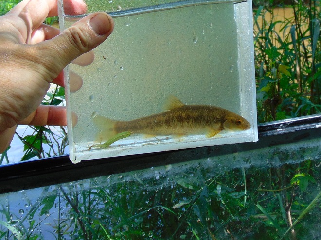
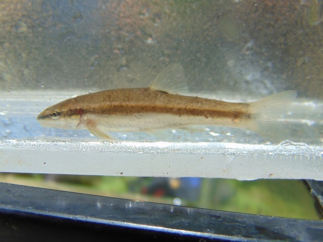
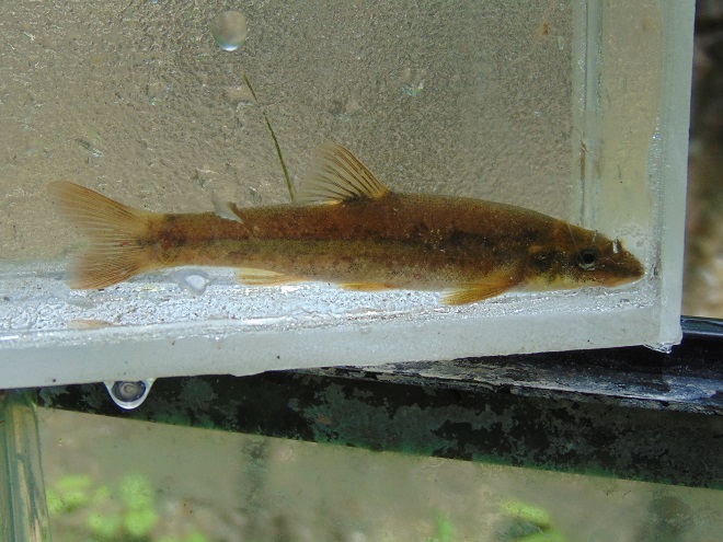
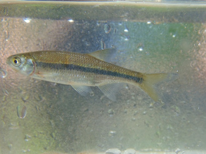
The Eastern Blacknose Dace is sometimes classified as a “coldwater transition fish”. It can be found in headwaters runs as well as in creeks with good water quality.The Longnose Dace is another “coldwater transition fish” known only from clear, clean, flowing waters.
More tolerant of summer heat than the trouts, sculpins, and daces are the “coolwater fishes”—species able to feed, grow, and reproduce in streams with a temperature of less than 80° F, but higher than 60° F. Coolwater fishes thrive in creeks and rivers that hover in the 65° to 70° F range during summer.
The Creek Chub is a familiar species of “coolwater fish” seldom found remaining in waters exceeding 80 degrees Fahrenheit.The Yellow Perch (Perca flavescens) was perhaps the most frequently targeted coolwater “gamefish” in the Lower Susquehanna River Watershed prior to the introduction of the Northern Pike (Esox lucius) and Muskellunge (Esox masquinongy). Today’s prevalence of warmwater streams and the dozens of species of non-native predatory fishes now naturalized within them have left the Yellow Perch populations greatly reduced and all but forgotten by anglers. Out of sight, out of mind. (National Park Service image)
What are the causes of modern-day reductions in coldwater and coolwater fish habitats in the lower Susquehanna River and its hundreds of miles of tributaries? To answer that, let’s take a look at the atmospheric, cosmic, and hydrologic processes that impact water temperature. Technically, these processes could be measured as heat flux—the rate of heat energy transfer per unit area per unit time, frequently expressed as watts per meter squared (W/m²). Without getting too technical, we’ll just take a look at the practical impact these processes have on stream temperatures.
HEAT FLUX PROCESSES IN A SEGMENT OF STREAM
Heat Flux Processes on Stream and River Segments. These processes could be measured as heat flux—the rate of heat energy transfer per unit area per unit time. (Environmental Protection Agency image)
INCOMING TEMPERATURE AND FLOW—The baseline temperature of stream water entering a given segment of waterway is obviously the chief factor determining its temperature when exiting that segment. Incoming temperature and flow also determine the water’s susceptibility to heat absorption or loss while transiting the segment. Lower flows may subject the given volume of water to a greater loss or gain of heat energy during the time needed to pass through the segment than the same volume at a higher flow. Lower flows may also reduce stream velocity and extend a given volume of water’s exposure time to the exchange of heat energy while moving through the segment. Generally speaking…
…the higher the stream flow, the less a given volume of that stream’s water may be impacted by the effects of the heat flux processes within the segment.
…the lower the stream flow, the more a given volume of that stream’s water may be impacted by the effects of the heat flux processes within that segment.
…the temperature and flow rate of precipitation entering the segment are factors that determine the impact of its heat energy transfer to or from a given volume of the stream’s waters.
…the temperature and flow rate of runoff and point-source discharges entering the segment are factors that determine the impact of their heat energy transfer to or from a given volume of the stream’s waters.
Stormwater from impervious surfaces including roads, parking lots, roofs, and lawns quickly impacts temperatures in small creeks. Channelized streams are availed few of the positive attributes provided by many of the heat flux processes we’re about to see. They therefore suffer from severe impairment and are exposed to temperature extremes that few aquatic organisms can survive. Runoff from sun-heated pavement during a summer thunderstorm can often exceed 100 degrees Fahrenheit and can, at sufficient flow rate, quickly raise the temperature of a small stream to well over 90 degrees.Stormwater runoff not only poses a thermal threat to waterways, its a significant source of a wide variety of pollutants.
GROUNDWATER INPUT—In streams connected to the aquifer, the temperature in a flowing segment can be impacted by the influx of cold groundwater. With temperatures ranging from about 52° to 60° Fahrenheit, groundwater will absorb heat from the stream in summer, and warm it in the winter. In warmwater streams, coldwater and coolwater fishes will often seek areas of the substrate where groundwater is entering for use as refugium from the summer heat. Yellow Perch in the lower Susquehanna are known to exhibit this behavior.
Creeks and rivers connected to the aquifer and receiving supplemental flow from it are known as “gaining streams”. These streams frequently feed water into the aquifer as well. (United States Geological Survey image)When flowing through an area experiencing drought or an excessive removal of groundwater (lots of wells, etc.), a waterway can become a “losing stream”, one that surrenders a portion of its flow to recharge the aquifer. Further downstream, the reduced flow can make such a creek or river more susceptible to the effects of heat flux processes. (United States Geological Survey image)Seriously depleted aquifers can lead to a “disconnected stream”. Smaller waterways subjected to these conditions will sometimes lose all their flow to the ground, often causing a catastrophic failure of the aquatic ecosystem supported therein. (United States Geological Survey image)Urban runoff overwhelms this small stream with polluted water than can reach temperatures of 100 degrees or more (left), then lets it high and dry with no baseflow during periods of dry weather (right) as the waterway becomes disconnected from the much-depleted aquifer.Well-designed and properly constructed stormwater retention basins not only recharge groundwater supplies for wells and streams, they can also help prevent thermal pollution in waterways. Planted with native wetland species and allowed to thrive, they can become treasured wildlife islands in otherwise inhospitable environs. The benefits don’t stop there; plants also help sequester nutrients contained in the runoff.
HYPORHEIC EXCHANGE—Related to groundwater input, hyporheic exchange is the slow movement of water through the rock, sand, gravel, and soils composing the streambed, saturated shoreline, shallow aquifer, and connected floodplain of a creek or river. As a heat flux process, hyporheic exchange helps moderate extremes in seasonal water temperatures by conducting energy between the solid materials in the zone and the flowing water. Hyporheic zones are important habitats for many species of aquatic invertebrates and spawning fish. Natural chemical processes within these zones convert ammonia-producing wastes into nitrite, then nitrate, allowing it to be absorbed as food by plants growing in the stream or in the alluvium within the zone. Vegetation removal, channelization, legacy sediments, silt deposits, and man-made walls and dams can negate the benefits of hyporheic exchange.
Exchange of surface and ground water within the hyporheic zone is most directly associated with high-gradient (left) and meandering (right) segments of streams. (United States Geological Survey image)Very common on streams in the lower Susquehanna valley are these accumulations of legacy sediments at the sites of former mill ponds. After the dams were removed, the creeks began eroding their way down through the mire as they tried to reestablish their floodplains and find their native substrate. These trapped waterways are not only cut off from their hyporheic zones, they’re now a major source of nutrient and sediment pollution. Misguided landowners like this one frequently dump fill into these sites to “save their land” and “control flooding”. The fill and materials added to “shore up the banks” do nothing to fix what ails the creek, but instead displace more water to make the impact of flooding even more widespread.Rehabilitation projects that remove legacy sediments help restore hyporheic exchange by reconnecting the stream to its underlying geology, its floodplain, and its wetlands. Rising waters remain in the floodplain where they get a good bio-scrubbing and help replenish the creek and groundwater supply. As the experts say, “floodplains are for flooding.”
ATMOSPHERIC EXCHANGE (CONVECTION, EVAPORATION)—Primarily a process by which a stream loses heat energy and cools its waters, atmospheric exchange is also a means by which a warm air mass can relinquish heat to cooler waters and thus increase their temperature. This phenomenon can be dramatically enhanced when a stream passes through a so-called urban heat island where air temperatures remain warm through the night. Convection, the movement of heat energy through a fluid (liquid or gas), causes warmer, less-dense water to rise to the surface of a stream, particularly where there is minimal turbulence. When the air above is cooler than the water’s surface layer, the stream will conduct heat energy across the water/atmosphere interface causing the warmed air molecules to rise in a convection column. If the atmospheric relative humidity is less than 100%, some surface water will vaporize—a process that expends more of the stream’s heat energy. The rate of convective and evaporative cooling in a given stream segment is directly related to the degree of difference between the water temperature and air temperature, and to the relative humidity in the air mass above the lake, creek, or river. The mechanical action of stream turbulence including rapids, riffles, and falls increases the contact area between air and water to maximize the atmospheric exchange of heat energy. The convective air current we call surface wind has a turbulent wave-producing effect on water that can also maximize atmospheric exchange; think of a cold autumn wind robbing heat energy from a warm lake or river or a hot summer wind imparting its heat to a cooler creek. These exchanges are both conductive in nature (air-to-water/water-to-air) and evaporative, the latter being expedited by the movement of dry air over warm water.
Usually classified as one of the coolwater fishes, the bottom-dwelling Tessellated Darter can thrive in the warmer creeks and in the main stem of the Susquehanna by inhabiting riffles where atmospheric exchange in the form of increased evaporation helps reduce temperatures and convective currents carry the cooler, well-oxygenated water to the streambed.Humans utilize the concept of atmospheric exchange, adopting the phenomena of evaporation and convection to cool the hot waters produced during electric generation and other industrial processes before discharge into a lake or river.
STREAMBED CONDUCTIVE EXCHANGE—In the lower Susquehanna watershed, there may be no better natural example of streambed conductive exchange than the Triassic-Jurassic diabase pothole bedrocks of Conewago Falls on the river at the south end of Three Mile Island.
During sunny days, the massive diabase pothole rocks at Conewago Falls absorb solar (shortwave) radiation, then conduct that heat energy into the flowing water, often continuing to pass the accumulated warmth into the river during the night. On cloudy days, the riverbed collects longwave atmospheric radiation, a heat flux process that yields significantly less energy for conduction into the rapids, riffles, and pools of the falls. During periods of low river flow, the heating effect of streambed conductive exchange can become magnified. Compared to conditions that prevail when torrents of turbid water are rushing through the falls, partially exposed bedrock surrounded by clear water collects radiated energy much more efficiently, then conducts the heat to a greatly reduced volume of passing water. During summer and autumn, this process can create a mix of temperature zones within the falls with warmer water lingering in slow-moving pools and cooler water flowing in the deeper fast-moving channels. Along the falls’ mile-long course, a haven is created for aquatic organisms including warmwater and some coolwater fishes, oft times attracting anglers and a variety of hungry migrating birds as well.Classified as one of our coolwater fishes, the Fallfish finds favorable conditions for feeding, growing, and spawning in the well-oxygenated waters of Conewago Falls.Though the lower Susquehanna River is classified as a warmwater fishery, the Northern Hog Sucker (Hypentelium nigricans), another of our native coolwater fishes, finds the fast-moving waters of Conewago Falls to its liking. Northern Hog Suckers are known to inhabit streams cold enough to host trout. They exhibit remarkable home range fidelity, sometimes spending their entire lives occupying the same several hundred feet of waterway. Northern Hog Suckers are often designated an indicator of good water quality, intolerant of many stream impairment parameters. Their presence in Conewago Falls provides testament to the quality of the warmwater fishery there.An unnatural example. The reduced base flow in this channelized and severely impaired creek has been rendered vulnerable to the negative impacts of several heat flux processes including streambed conductive exchange. Urban stormwater/surfacewater inflow, solar (shortwave) radiation, and heat conducted into the stream from the masonry walls, curbs, and raceway can all conspire to cook aquatic organisms with life-quenching summer water temperatures exceeding 90 degrees Fahrenheit.
SOLAR (SHORTWAVE) RADIATION—The sun provides the energy that fuels the earth’s complex climate. The primary heat flux process that heats our planet is the absorption of solar radiation in the shortwave spectrum, which includes ultraviolet, visible, and infrared frequencies at the upper end of the longwave spectrum. Streams and other bodies of water absorb the greatest amounts of solar (shortwave) radiation during the weeks around summer solstice when the sun at mid-day is closer to zenith than at any other time of the year. However, the heating impact of the radiation may be greatest when the volume of water in the creek, river, or lake is at its minimum for the year—often during early fall.
The rate, measured in watts per square meter, at which solar (shortwave) energy is directly radiated to a given area on the earth’s surface (including streams and other waters) is determined by: solar activity, the angle of the sun in the sky, aspect (slope) of the receiving surface, the opacity of the overlying atmosphere, and the distance of the earth from the sun. The former varies with the year’s seasons, the time of day, and the latitude of a given area. The latter is currently at its annual minimum when earth is at perihelion during the early days of January, thus providing the northern hemisphere with a little bump in radiation during the shortest days of the year when the sun is at its lowest angle in the sky. (NASA image)A varying portion of the solar (shortwave) radiation reaching the earth is reflected back into space by clouds. A smaller share is absorbed by the atmosphere, thus heating it. An even lesser quantity is reflected back into space by water and land. The remainder of the energy is absorbed by the planet’s surfaces, its water and land. (NASA image)
INCIDENT SHORTWAVE RADIATION—Also known as insolation (incoming solar radiation), incident shortwave radiation is the sum total energy of both the direct solar radiation that travels to the earth’s surface unaffected by the atmosphere and the diffuse radiation, waves that have been weakened and scattered by constituents of the atmosphere before reaching the planet’s surface. On a cloudy day, the warming of terrestrial surfaces including streams and other bodies of water is the result of diffuse radiation. On days with any amount of sunshine at all, both direct and diffuse radiation heat our waters and lands.
Warmwater fishes such as the native Pumpkinseed (Lepomis gibbosus) thrive in sun-drenched 70-to-85-degree waters as long as other heat flux processes prevent sudden temperature increases and oxygen depletion.Mowed stream banks offer a waterway no protection from incoming solar (shortwave) radiation, nor terrestrial forms of impairment including nutrient-rich stormwater runoff and silt.
REFLECTED SHORTWAVE RADIATION—known as albedo, reflected solar (shortwave) radiation is energy directed away from the earth’s surface before being absorbed. A surface’s albedo value is basically determined by its color, black having little reflective value, white and silvery surfaces reflecting nearly all solar (shortwave) radiation away. A surface with no reflective properties has an albedo value of 0, while a totally reflective surface has a value of 1. Clean snow with a value of about 0.85 to 0.9 (85% to 90%) is a highly reflective surface; yellow snow isn’t as good. A stream, river, or lake blanketed with ice and snow will absorb very little solar energy and will rely upon other heat flux processes to trigger a melt and thaw. The surface of open water has a varying albedo value determined mostly by the angle of the sun. Solar radiation striking the water’s surface at a low angle is mostly reflected away, while that originating at an angle closer to zenith is more readily absorbed.
To avoid the heating effects of solar (shortwave) and atmospheric longwave radiation, coldwater and coolwater fishes require streams offering protection from full exposure to direct sunlight and cloud cover. Runs and creeks flowing beneath a closed canopy of forest trees are shielded from 25% or more of incoming radiation and are thus able to better maintain thermal stability during the most vulnerable period of the year for temperature-sensitive fishes, May through October.
LONGWAVE RADIATION—Radiation in the longwave spectrum is composed of infrared waves at frequencies lower than those of the shortwave spectrum. Longwave radiation, sometimes just called infrared radiation, is produced by the earth and its atmosphere and is propagated in all directions, day and night. It warms mostly the lower atmosphere which in turn warms the earth’s surface including its waters. Some longwave energy can even be radiated into the waterway from its own streambed—and the stream can return the favor. Other forms of mass surrounding a stream such as a rocky shoreline or a man-made structure such as bridge pier can trade longwave radiation with a waterway. The effect of these latter exchanges is largely trivial and never rivals the heat flux transfer of warm to cold provided by conduction.
Longwave radiation emissions slow as the temperature of the emitting mass decreases, just as they also increase with temperature of the mass. Longwave radiation emissions therefore decrease with altitude along with the temperature of the water vapor, carbon dioxide, methane, and other gases that produce them. As such, the highest reaches of the atmosphere have a greatly reduced capability of shedding longwave radiation into space. At ground level, lakes, creeks, and streams receive their greatest dose of longwave radiation while beneath the cover of low-lying clouds or fog. (NASA image)
CANOPY RADIATION—Trees emit longwave radiation that may have a limited heat flux impact on waterway temperature. This radiation is diffuse, of scattered effect, and scarcely detectable, particularly beneath multilayered dense canopies. Some of the infrared energy transmitted by the tree canopy is radiated skyward as well.
WATER RADIATION—Water, like all earthly matter composed of vibrating molecules, emits longwave radiation. This heat flux process provides an ongoing cooling effect to streams, rivers, lakes, and oceans—warmer ones shedding infrared energy at a faster rate than those that are cold.
Now that we have a basic understanding of the heat flux processes responsible for determining the water temperatures of our creeks and rivers, let’s venture a look at a few graphics from gauge stations on some of the lower Susquehanna’s tributaries equipped with appropriate United States Geological Survey monitoring devices. While the data from each of these stations is clearly noted to be provisional, it can still be used to generate comparative graphics showing basic trends in easy-to-monitor parameters like temperature and stream flow.
Each image is self-labeled and plots stream temperature in degrees Fahrenheit (bold blue) and stream discharge in cubic feet per second (thin blue).
The West Conewago Creek drains much of the Gettysburg Basin’s Triassic redbeds in Adams and northern York Counties in Pennsylvania and includes a small headwaters area in northern Maryland. The gauge station is located just a over a mile upstream from the waterway’s mouth on the Susquehanna just below Conewago Falls. Right through the summer heatwave, this 90-day graph shows a consistent daily pattern of daytime rises in temperature and nighttime cooling. To the right, a rapid cool down can be seen coinciding with two periods of high water, the first from a series of heavy thundershowers, the second from flooding caused by the remnants of Hurricane Debby. Notice that the early August downpours were so heavy that they cooled the hot surface runoff and waterway quickly, without creating a rise in stream temperature at the gauging station. Had this monitoring device been located on a small tributary in an area with an abundance of impervious surfaces, there would probably have been a brief rise in stream temperature prior to the cooldown. (United States Geological Survey image)
The daily oscillations in temperature reflect the influence of several heat flux processes. During the day, solar (shortwave) radiation and convection from summer air, especially those hot south winds, are largely responsible for the daily rises of about 5° F. Longwave radiation has a round-the-clock influence—adding heat to the stream during the day and mostly shedding it at night. Atmospheric exchange including evaporative cooling may help moderate the rise in stream temperatures during the day, and certainly plays a role in bringing them back down after sunset. Along its course this summer, the West Conewago Creek absorbed enough heat to render it a warmwater fishery in the area of the gauging station. The West Conewago is a shallow, low gradient stream over almost its entire course. Its waters move very slowly, thus extending their exposure time to radiated heat flux and reducing the benefit of cooling by atmospheric exchange. Fortunately for bass, catfish, and sunfish, these temperatures are in the ideal range for warmwater fishes to feed, grow, and reproduce—generally over 80° F, and ideally in the 70° to 85° F range. Coolwater fishes though, would not find this stream segment favorable. It was consistently above the 80° F maximum and the 60° to 70° F range preferred by these species. And coldwater fishes, well, they wouldn’t be caught dead in this stream segment. Wait, scratch that—the only way they would be caught in this segment is dead. No trouts or sculpins here.
The Codorus Creek drains primarily the carbonate valleys of York County to the south of the West Conewago watershed. This gauge station is located about a mile upstream from the creek’s mouth on the Susquehanna just below Haldeman Riffles. The graphic pattern is very similar to that of the West Conewago’s: daily heating and cooling cycles and a noticeable drop in stream temperature in early August caused by a day of thundershowers followed by the remnants of Hurricane Debby. (United States Geological Survey image)
Look closely and you’ll notice that although the temperature pattern on this chart closely resembles that of the West Conewago’s, the readings average about 5 degrees cooler. This may seem surprising when one realizes that the Codorus follows a channelized path through the heart of York City and its urbanized suburbs—a heat island of significance to a stream this size. Before that it passes through numerous impoundments where its waters are exposed to the full energy of the sun. The tempering factor for the Codorus is its baseflow. Despite draining a smaller watershed than its neighbor to the north, the Codorus’s baseflow (low flow between periods of rain) was 96 cubic feet per second on August 5th, nearly twice that of the West Conewago (51.1 cubic feet per second on August 5th). Thus, the incoming heat energy was distributed over a greater mass in the Codorus and had a reduced impact on its temperature. Though the Codorus is certainly a warmwater fishery in its lower reaches, coolwater and transitional fishes could probably inhabit its tributaries in segments located closer to groundwater sources without stress. Several streams in its upper reaches are in fact classified as trout-stocked fisheries.
This is a zoomed-in look at the previous graph showing the impact of a rainfall event on the water temperatures in Codorus Creek. Unlike the sharp declines accompanying the deluge of flood waters during the two events in early August, these lesser storms in late June generated just enough runoff to capture heat energy from impervious surfaces and warm the creek, temporarily breaking the daily heating/cooling cycle. Upstream in the immediate area of the runoff, the impact on the stream and/or its tributaries was probably much more dramatic, certainly raising temperatures into the nineties or above. (United States Geological Survey image)Kreutz Creek drains a carbonate bedrock area of York County and flows parallel to the Lincoln Highway (US 30) to enter the Susquehanna at Wrightsville. The gauging station is about one mile upstream from the creek’s mouth. (United States Geological Survey image)
The Kreutz Creek gauge shows temperature patterns similar to those in the West Conewago and Codorus data sets, but notice the lower overall temperature trend and the flow. Kreutz Creek is a much smaller stream than the other two, with a flow averaging less than one tenth that of the West Conewago and about one twentieth of that in the Codorus. And most of the watershed is cropland or urban/suburban space. Yet, the stream remains below 80° F through most of the summer. The saving graces in Kreutz Creek are reduced exposure time and gradient. The waters of Kreutz Creek tumble their way through a small watershed to enter the Susquehanna within twenty-four hours, barely time to go through a single daily heating and cooling cycle. As a result, their is no chance for water to accumulate radiant and convective heat over multiple summer days. The daily oscillations in temperature are less amplified than we find in the previous streams—a swing of about three degrees compared to five. This indicates a better balance between heat flux processes that raise temperature and those that reduce it. Atmospheric exchange in the stream’s riffles, forest cover, and good hyporheic exchange along its course could all be tempering factors in Kreutz Creek. From a temperature perspective, Kreutz Creek provides suitable waters for coolwater fishes.
Muddy Creek drains portions of southern York County through rolling farmland and woodlots. There are no large impoundments or widespread urban impacts in the watershed, which may help explain its slightly lower temperature trends. (United States Geological Survey image)
Muddy Creek is a trout-stocked fishery, but it cannot sustain coldwater species through the summer heat. Though temperatures in Muddy Creek may be suitable for coolwater fishes, silt, nutrients, low dissolved oxygen, and other factors could easily render it strictly a warmwater fishery, inhabited by species tolerant of significant stream impairment.
Chiques Creek drains mostly limestone farmland in northwestern Lancaster County. The gauging station is located near the stream’s mouth on the Susquehanna at Chiques (Chickies) Rock. Oscillations in temperature again resemble the other waterways, but daily highs remain almost entirely below 80 degrees. (United States Geological Survey image)
A significant number of stream segments in the Chiques watershed have been rehabilitated to eliminate intrusion by grazing livestock, cropland runoff, and other sources of impairment. Through partnerships between a local group of watershed volunteers and landowners, one tributary, Donegal Creek, has seen riparian buffers, exclusion fencing, and other water quality and habitat improvements installed along nearly ever inch of its run from Donegal Springs through high-intensity farmland to its mouth on the main stem of the Chiques just above its confluence with the Susquehanna. The improved water quality parameters in the Donegal support native coldwater sculpins and an introduced population of reproducing Brown Trout. While coldwater habitat is limited to the Donegal, the main stem of the Chiques and its largest tributary, the Little Chiques Creek, both provide suitable temperatures for coolwater fishes.
Streams in the Chiques Creek and similar limestone watersheds often pass through areas with significant bedrock formations. Heat flux processes including groundwater input, hyporheic exchange, and streambed conductive exchange can have a greater influence on water temperature along these segments.A breeding condition Eastern Balcknose Dace, one of the coldwater transition fishes found in the Chiques and its tributaries.The Common Shiner (Luxilus cornutus), a fish tolerant of warmwater streams, prefers cool, clear waters for spawning. For protection from late-spring and summer heat, breeding males may seek a section of creek with a streambed inflow of limestone groundwater to defend as their nesting territory.A closeup of the Chiques Creek graph showing what appears to be a little bump in temperature caused by surface runoff during a couple of late-May showers. Stream rehabilitation is an ongoing process and the pressures of land disturbances both old and new present challenges to those who make it their passion to fix the wrongs that have been inflicted upon our local waters. Even the exemplary Donegal Creek faces new threats from urbanization in one of its headwater areas several miles to the northwest of the historic springs. (United States Geological Survey image)Conewago Creek (East) drains primarily Triassic redbed farmlands in Dauphin, Lancaster, and Lebanon Counties. Much of the headwaters area is forested but is experiencing an increasing rate of encroachment by housing and some commercial development. Conewago Creek (East) enters the Susquehanna on the east side of Conewago Falls at Three Mile Island. The watershed is equipped with three U.S.G.S. gauge stations capable of providing temperature data. This first one is located just over a mile upstream of the creek’s mouth. (United States Geological Survey image)
Despite its meander through and receipt of water from high-intensity farmland, the temperature of the lower Conewago (East) maxes out at about 85° F, making it ideal for warmwater fishes and even those species that are often considered coolwater transition fishes like introduced Smallmouth Bass, Rock Bass, Walleye, and native Margined Madtom. This survivable temperature is a testament to the naturally occurring and planted forest buffers along much of the stream’s course, particularly on its main stem. But the Conewago suffers serious baseflow problems compared to other streams we’ve looked at so far. Just prior to the early August storms, flow was well below 10 cubic feet per second for a drainage area of more than fifty square miles. While some of this reduced flow is the result of evaporation, much of it is anthropogenic in origin as the rate of groundwater removal continues to increase and a recent surge in stream withdraws for irrigation reaches its peak during the hottest days of summer.
A juvenile Rock Bass.A juvenile Margined Madtom.A closer look at the Conewago Creek (East) graphic shows the temperature drop associated with a series of thundershowers and the remnants of Hurricane Debby in early August. Despite the baseflow being below five cubic feet per second, the cooling effect of the downpours as measured in the area of the gauge was significant enough to overwhelm any heating of runoff that may have occurred as precipitation drained across hardened soils or man-made impervious surfaces. (United States Geological Survey image)
A little side note—the flow rate on the Conewago at the Falmouth gauge climbed to about 160 cubic feet per second as a result of the remnants of Hurricane Debby while the gauge on the West Conewago at Manchester skyrocketed to about 20,000 cubic feet per second. Although the West Conewago’s watershed (drainage area) is larger than that of the Conewago on the east shore, it’s larger only by a multiple of two or three, not 125. That’s a dramatic difference in rainfall!
The Bellaire monitoring station on Conewago Creek (East) is located on the stream’s main stem just downstream from the mouth of Little Conewago Creek, a tributary with its origins in farmland and woodlots. (United States Geological Survey image)
The temperatures at the Bellaire monitoring station, which is located upstream of the Conewago’s halfway point between its headwaters in Mount Gretna and its mouth, are quite comparable to those at the Falmouth gauge. Although a comparison between these two sets of data indicate a low net increase in heat absorption along the stream’s course between the two points, it also suggests sources of significant warming upstream in the areas between the Bellaire gauge and the headwaters.
Data from the gauge site on the Little Conewago Creek shows a temperature averaging about five degrees cooler than the gauge several miles downstream on the main stem of the Conewago at Bellaire. (United States Geological Survey image)
The waters of the Little Conewago are protected within planted riparian buffers and mature woodland along much of their course to the confluence with the Conewago’s main stem just upstream of Bellaire. This tributary certainly isn’t responsible for raising the temperature of the creek, but is instead probably helping to cool it with what little flow it has.
A stream like the Little Conewago Creek with daily temperatures that remain mostly below 80 degrees and retreat to 75 degrees or less during the night can be suitable for coldwater transition fishes like these juvenile Eastern Blacknose Dace (top) and Longnose Dace.
Though mostly passing through natural and planted forest buffers above its confluence with the Little Conewago, the main stem’s critically low baseflow makes it particularly susceptible to heat flux processes that raise stream temperatures in segments within the two or three large agricultural properties where owners have opted not to participate in partnerships to rehabilitate the waterway. The headwaters area, while largely within Pennsylvania State Game Lands, is interspersed with growing residential communities where potable water is sourced from hundreds of private and community wells—every one of them removing groundwater and contributing to the diminishing baseflow of the creek. Some of that water is discharged into the stream after treatment at the two municipal sewer plants in the upper Conewago. This effluent can become quite warm during processing and may have significant thermal impact when the stream is at a reduced rate of flow. A sizeable headwaters lake is seasonally flooded for recreation in Mount Gretna. Such lakes can function as effective mid-day collectors of solar (shortwave) radiation that both warms the water and expedites atmospheric exchange.
The Conewago Creek (East) Watershed from the Bellaire U.S.G.S. Gauging Station (lower left) upstream to the headwaters in Mount Gretna. (United States Geological Survey image)
Though Conewago Creek (East) is classified as a trout-stocked fishery in its upper reaches in Lebanon County, its low baseflow and susceptibility to warming render it inhospitable to these coldwater fishes by late-spring/early summer.
Despite being considered a warmwater fish, the River Chub (Nocomis micropogon) will ascend streams like the Conewago to seek cooler, gravel-bottomed waters for spawning. Reduced baseflow has probably rendered the stream currently too small for this species on Pennsylvania State Game Lands in Colebrook where this specimen was photographed in 2018.The Golden Shiner, another warmwater fish, often ascends streams to enter cooler water. Juvenile Golden Shiners like this one will move into shallower headwaters not only to seek reduced temperatures, but to escape large predatory fishes as well.Irrigation of agricultural fields using a large portion of the already diminished baseflow in the Conewago Creek (East) just downstream of the Bellaire gauging station. Despite millions of dollars in investment to rehabilitate this Susquehanna valley stream, the riparian buffers and other practices can have little effect when the creek gets sucked down to just a trickle. Low baseflow is a hard nut to crack. It’s best prevented, not corrected.Hammer Creek, a trout-stocked fishery, originates, in part, within Triassic conglomerate in the Furnace Hills of Lebanon County, then flows north into the limestone Lebanon Valley where it picks up significant flow from other tributaries before working its way south back through the Furnace Hills into the limestone farmlands of Lancaster County. From there the stream merges with the Cocalico Creek, then the Conestoga River, and at last the Susquehanna. Note the tremendous daily temperature oscillations on this headwaters stream as it surges about 15 degrees each day before recovering back close to groundwater temperature by sunrise the next day. (United States Geological Survey image)Headwaters of Hammer Creek including Buffalo Springs, a significant source of cold groundwater feeding the western leg of the stream. The large dams on this section that created the Lebanon and Rexmont Reservoirs have been removed. (United States Geological Survey base image)
The removal of two water supply dams on the headwaters of Hammer Creek at Rexmont eliminated a large source of temperature fluctuation on the waterway, but did little to address the stream’s exposure to radiant and convective heat flux processes as it meanders largely unprotected out of the forest cover of Pennsylvania State Game Lands and through high-intensity farmlands in the Lebanon Valley. Moderating the temperature to a large degree is the influx of karst water from Buffalo Springs, located about two miles upstream from this gauging station, and other limestone springs that feed tributaries which enter the Hammer from the east and north. Despite the cold water, the impact of the stream’s nearly total exposure to radiative and other warming heat flux processes can readily be seen in the graphic. Though still a coldwater fishery by temperature standards, it is rather obvious that rapid heating and other forms of impairment await these waters as they continue flowing through segments with few best management practices in place for mitigating pollutants. By the time Hammer Creek passes back through the Furnace Hills and Pennsylvania State Game Lands, it is leaning toward classification as a coolwater fishery with significant accumulations of sediment and nutrients. But this creek has a lot going for it—mainly, sources of cold water. A core group of enthusiastic landowners could begin implementing the best management practices and undertaking the necessary water quality improvement projects that could turn this stream around and make it a coldwater treasure. An organized effort is currently underway to do just that. Visit Trout Unlimited’s Don Fritchey Chapter and Donegal Chapter to learn more. Better yet, join them as a volunteer or cooperating landowner!
The male Creek Chub, one of our coolwater fishes, develops head tubercles and becomes flushed with color during spawning season. Hammer Creek not only provides a home for the Creek Chub, its cold headwaters provide refuge for a population of native Brook Trout too.Like no other example we’ve looked at so far, this closeup of the Hammer Creek graphic shows temperature bumps correlating with the stormwater runoff from early August’s rains. Because the stream flow is small and the precipitation rate was not as great at this location, the effect of heat flux from runoff is more readily apparent. (United States Geological Survey image)Brook Trout adult and juvenile. (United States Fish and Wildlife Service image by Ryan Hagerty)
For coldwater fishes, the thousands of years since the most recent glacial maximum have seen their range slowly contract from nearly the entirety of the once much larger Susquehanna watershed to the headwaters of only our most pristine streams. Through no fault of their own, they had the misfortune of bad timing—humans arrived and found coldwater streams and the groundwater that feeds them to their liking. Some of the later arrivals even built their houses right on top of the best-flowing springs. Today, populations of these fishes in the region we presently call the Lower Susquehanna River Watershed are seriously disconnected and the prospect for survival of these species here is not good. Stream rehabilitation, groundwater management, and better civil planning and land/water stewardship are the only way coldwater fishes, and very possibly coolwater fishes as well, will survive. For some streams like Hammer Creek, it’s not too late to make spectacular things happen. It mostly requires a cadre of citizens, local government, project specialists, and especially stakeholders to step up and be willing to remain focused upon project goals so that the many years of work required to turn a failing stream around can lead to success.
Riparian buffers with fences to exclude livestock can immediately begin improving water quality. With establishment of such vegetative buffers, the effects of stressors that otherwise eliminate coldwater and coolwater fishes from these segments will begin to diminish.Within five to ten years, a riparian buffer planted with native trees is not only helping to reduce nutrient and sediment loads in the stream, it is also shielding the waters from heat flux processes including the solar (shortwave) radiation that raises water temperatures to levels not tolerated by coldwater and coolwater fishes.A well-established riparian buffer.A forested stream.
You’re probably glad this look at heat flux processes in streams has at last come to an end. That’s good, because we’ve got a lot of work to do.
Add one more benefit to the wildflower meadow, it infiltrates stormwater to recharge the aquifer much better than mowed grass. And another related plus, it reduces runoff and its thermal pollution. Besides, you don’t have time to mow grass, because we have work to do!Our native coldwater fishes including the Potomac Sculpin will survive only if we protect and expand the scattered few habitats where they have taken refuge. They have no choice but to live in these seriously threatened places, but we do. So let’s give ’em some space. How ’bout it? (United States Fish and Wildlife Service image by Ryan Hagerty)
It’s that time of year. Your local county conservation district is taking orders for their annual tree sale and it’s a deal that can’t be beat. Order now for pickup in April.
The prices are a bargain and the selection includes the varieties you need to improve wildlife habitat and water quality on your property. For species descriptions and more details, visit each tree sale web page (click the sale name highlighted in blue). And don’t forget to order packs of evergreens for planting in mixed clumps and groves to provide winter shelter and summertime nesting sites for our local native birds. They’re only $12.00 for a bundle of 10.
It’s the most desirable block in town, not because the houses are any different from others built during the post-war years of the mid-twentieth century, but because the first owners of these domiciles had the good taste and foresight to plant long-lived trees on their lots, the majority of them native species. Pin Oak, Northern Red Oak, Yellow Poplar, Flowering Dogwood (Cornus florida), Eastern Red Cedar, Eastern White Pine, Eastern Hemlock, Norway Spruce, and American Holly dominate the landscape and create excellent habitat for birds and other wildlife. These 75-year-old plantings provide an abundance of shade in summer and thermal stability in winter, making it a “cool” place to live or take a stroll at any time of the year.
Pickup on: Thursday, April 18, 2024 or Friday, April 19, 2024
Cumberland County Conservation District is taking orders for Common Winterberry, the ideal small shrub for wet soil anywhere on your property. To get berries, you’ll need both males and females, so buy a bunch and plant them in a clump or scattered group.To live for a century or more like this towering giant, a Pin Oak needs to grow in well-drained soils with adequate moisture. These sturdy shade providers do well along streams and on low ground receiving clean runoff from hillsides, roofs, streets, and parking areas. As they age, Pin Oaks can fail to thrive and may become vulnerable to disease in locations where rainfall is not adequately infiltrated into the soil. Therefore, in drier areas such as raised ground or slopes, avoid the Pin Oak and select the more durable Northern Red Oak for planting. This year, Pin Oaks are available from the Cumberland and Lancaster County Conservation Districts, while Dauphin, Lancaster, Lebanon, and York Counties are taking orders for Northern Red Oaks.The Cumberland County Conservation District is again offering a “Showy Northeast Native Wildflower and Grass Mix” for seeding your own pollinator meadow or garden. It consists of more than twenty species including this perennial favorite, Purple Coneflower.
Pickup on: Thursday, April 18, 2024 or Friday, April 19, 2024
The Eastern Redbud is small tree native to our forest edges, particularly in areas of the Piedmont Province with Triassic geology (Furnace Hills, Conewago Hills, Gettysburg/Hammer Creek Formations, etc.) Also known as the Judas Tree, the redbud’s brilliant flowers are followed by heart-shaped leaves. As seen here, it is suitable for planting near houses and other buildings. Eastern Redbud seedlings are being offered through tree sales in Dauphin, Cumberland, and Lancaster Counties.
The Yellow Poplar, often called Tuliptree or Tulip Poplar for its showy flowers, is a sturdy, fast-growing deciduous tree native to forests throughout the Lower Susquehanna River Watershed. Its pole-straight growth habit in shady woodlands becomes more spreading and picturesque when the plant is grown as a specimen or shade tree in an urban or suburban setting. The Yellow Poplar can live for hundreds of years and is a host plant for the Eastern Tiger Swallowtail butterfly. It is available this year from the Lancaster County Conservation District.The American Sweetgum, also known as Sweet Gum, is a large, long-lived tree adorned with a mix of vibrant colors in autumn.Ever wonder where all the American Goldfinches and particularly the Pine Siskins go after passing through our region in fall? Well, many are headed to the lowland forests of the Atlantic Coastal Plain where they feed on an abundance of seeds contained in spiky American Sweetgum fruits. In the Piedmont and Ridge and Valley Provinces of the Lower Susquehanna River Watershed, American Sweetgum transplants can provide enough sustenance to sometimes lure our friendly finches into lingering through the winter.The American Sweetgum is a versatile tree. It can be planted on upland sites as well as in wet ground along streams, lakes, and rivers. In the beaver pond seen here it is the dominate tree species. This year, you can buy the American Sweetgum from the Lancaster County Conservation District.“Red-twig Dogwood” is a group of similar native shrubs that, in our region, includes Silky Dogwood and the more northerly Red-Osier Dogwood (Cornus sericea). Both have clusters of white flowers in spring and showy red twigs in winter. They are an excellent choice for wet soils. Landscapers often ruin these plants by shearing them off horizontally a foot or two from the ground each year. To produce flowers and fruit, and to preserve winter attractiveness, trim them during dormancy by removing three-year-old and older canes at ground level, letting younger growth untouched.“Red-twig Dogwoods” make ideal mass plantings for streamside buffers and remain showy through winter, even on a gloomy day. They not only mitigate nutrient and sediment pollution, they provide excellent food and cover for birds and other wildlife. Both Silky and Red-osier Dogwoods are available for sale through the Lancaster County Conservation District as part of their special multi-species offers, the former is included in its “Beauty Pack” and the latter in its “Wildlife Pack”. The similar Gray Dogwood (Cornus racemosa) is being offered for sale by the York County Conservation District.
The unique maroon flowers of the Common Pawpaw produce banana-like fruits in summer. These small native trees grow best in damp, well-drained soils on slopes along waterways, where they often form clonal understory patches. To get fruit, plant a small grove to increase the probability of pollination. The Common Pawpaw is a host plant for the Zebra Swallowtail butterfly. It is available through both the Lebanon and Lancaster County sales.The Eastern Red Cedar provides excellent food, cover, and nesting sites for numerous songbirds. Planted in clumps of dozens or groves of hundreds of trees, they can provide winter shelter for larger animals including deer and owls. The Eastern Red Cedar is being offered for purchase through both the Lebanon and Lancaster County Conservation Districts.Care to try your hand at raising some chestnuts? Lebanon County Conservation District has hybrid American Chestnut seedlings for sale.Lebanon County Conservation District is offering Common Winterberry and Eastern White Pine during their 2024 Tree and Plant Sale. Plant them both for striking color during the colder months. Eastern White Pine is also available from the Cumberland, Dauphin, Lancaster, and York County sales.
In addition to a selection of trees and shrubs, the Perry County Conservation District is again selling wildflower seed mixes for starting your own pollinator meadow or garden. For 2024, they have both a “Northeast Perennials and Annuals Mix” and a “Butterfly and Hummingbird Seed Mix” available. Give them a try so you can give up the mower!
Again this year, Perry County is offering bluebird nest boxes for sale. The price?—just $12.00.
Wait, what?,…twelve bucks,…that’s cheaper than renting!
The Buttonbush, a shrub of wet soils, produces a cosmic-looking flower. It grows well in wetlands, along streams, and in rain gardens. Buttonbush seedlings are for sale from both the York and Lancaster County Conservation Districts.
To get your deciduous trees like gums, maples, oaks, birches, and poplars off to a safe start, conservation district tree sales in Cumberland, Dauphin, Lancaster, and Perry Counties are offering protective tree shelters. Consider purchasing these plastic tubes and supporting stakes for each of your hardwoods, especially if you have hungry deer in your neighborhood.
Tree shelters protect newly transplanted seedlings from browsing deer, klutzy hikers, visually impaired mower operators, and other hazards.
There you have it. Be sure to check out each tree sale’s web page to find the selections you like, then get your order placed. The deadlines will be here before you know it and you wouldn’t want to miss values like these!
Here’s something to look forward to in the new year. The good citizens of East Donegal Township in Lancaster County have partnered with Alliance for the Chesapeake Bay to establish an extensive wildflower meadow on what had been a mowed field of turf grass at Riverside Park in the Susquehanna floodplain near Marietta. As the photo shows, the lawn plants have been eliminated in preparation for seeding with a diverse assortment of native grasses and wildflowers to provide habitat for birds and pollinators including butterflies, bees, and other insects. Once established, the meadow’s extensive vegetative growth will help reduce stormwater runoff by better infiltrating rainfall to recharge the aquifer. During flood events, the plantings will provide soil stabilization and increase the ability of the acreage to uptake nutrients, thus reducing the negative impact of major storms on the quality of water in the river and in Chesapeake Bay. Check the project’s progress by stopping by from time to time in 2024!
It may be one of the most treasured plants among native landscape gardeners. The Cardinal Flower (Lobelia cardinalis) blooms in August each year with a startling blaze of red color that, believe it or not, will sometimes be overlooked in the wild.
Cardinal Flower is most often found in wet soil along forested bodies of water. The blooms of this shade-loving species may go unnoticed until rays of sunshine penetrate the canopy to strike their brilliant red petals.
The Cardinal Flower grows in wetlands as well as in a variety of moist soils along streams, rivers, lakes, and ponds. Shady locations with short periods of bright sun each day seem to be favored for an abundance of color.
Cardinal Flower in bloom in a riparian forest along the Susquehanna. To its right is its close relative, Great Lobelia, a plant sometimes known as Great Blue Lobelia or Blue Cardinal Flower.Cardinal Flower in a wet bottomland woods.The Cardinal Flower can find favorable growing conditions along stream, river, and lake shores. Even though they are perennial plants, their presence along such waters often seems temporary. Changing conditions cause them to suddenly disappear from known locations, then sometimes reappear at the same place or elsewhere nearby. Some of this phenomenon may be due to the fact that stressed plants can fail to bloom, so they easily escape notice. When producing flowers during favorable years, the plants seem to mysteriously return.Cardinal Flowers along a wave-swept shoreline light up the greenery of erosion-controlling riparian vegetation with glowing red color.
The Cardinal Flower can be an ideal plant for attracting hummingbirds, bees, butterflies, and other late-summer pollinators. It grows well in damp ground, especially in rain gardens and along the edges streams, garden ponds, and stormwater retention pools. If you’re looking to add Cardinal Flower to your landscape, you need first to…
REMEMBER the CARDINAL RULE…
Cardinal Flower plants are available at many nurseries that carry native species of garden and/or pond plants. Numerous online suppliers offer seed for growing your own Cardinal Flowers. Some sell potted plants as well. A new option is to grow Cardinal Flowers from tissue cultures. Tissue-cultured plants are raised in laboratory media, so the pitfalls of disease and hitchhikers like invasive insects and snails are eliminated. These plants are available through the aquarium trade from most chain pet stores. Though meant to be planted as submerged aquatics in fish tank substrate, we’ve reared the tissue-cultured stock indoors as emergent plants in sandy soil and shallow water through the winter and early spring. When it warms up, we transplant them into the edges of the outdoor ponds to naturalize. As a habit, we always grow some Cardinal Flower plants in the fish tanks to take up the nitrates in the water and to provide a continuous supply of cuttings for starting more emergent stock for outdoor use.
A tissue-cultured Cardinal Flower rooted in sandy substrate and being grown as a submerged aquatic plant in a fish tank. Cuttings from this plant will be used to grow emergent specimens in shallow water for transplanting outdoors around the garden pond.A Cardinal Flower grown from an aquarium store tissue culture blooms in the pond at susquehannawildlife.net headquarters.Grown as an emergent, Cardinal Flower may bloom very late in the season. This tissue-cultured specimen in the headquarters pond was photographed in early November, 2022.
Your best bet for finding migrating shorebirds in the lower Susquehanna region is certainly a visit to a sandbar or mudflat in the river. The Conejohela Flats off Washington Boro just south of Columbia is a renowned location. Some man-made lakes including the one at Middle Creek Wildlife Management Area are purposely drawn down during the weeks of fall migration to provide exposed mud and silt for feeding and resting sandpipers and plovers. But with the Susquehanna running high due to recent rains and the cost of fuel trending high as well, maybe you want to stay closer to home to do your observing.
Fortunately for us, migratory shorebirds will drop in on almost any biologically active pool of shallow water and mud that they happen to find. This includes flooded portions of fields, construction sites, and especially stormwater retention basins. We stopped by a new basin just west of Hershey, Pennsylvania, and found more than two dozen shorebirds feeding and loafing there. We took each of these photographs from the sidewalk paralleling the south shore of the pool, thus never flushing or disturbing a single bird.
Designed to prevent stream flooding and pollution, this recently installed stormwater retention basin along US 322 west of Hershey, Pennsylvania, has already attracted a variety of migrating plovers and sandpipers.Killdeer stick close to exposed mud as they feed.Two of more than a dozen Least Sandpipers found busily feeding in the inch-deep water.A Lesser Yellowlegs searching for small invertebrates.Two Lesser Yellowlegs work out a disagreement.Male Twelve-spotted Skimmers patrol the airspace above a pair of Least Sandpipers. Dragonflies and other aquatic insects are quick to colonize the waters held in well-engineered retention basins. Proper construction and establishment of a functioning food chain/web in these man-made wetlands prevents them from becoming merely temporary cesspools for breeding mosquitos.
So don’t just drive by those big puddles, stop and have a look. You never know what you might find.
A Semipalmated Sandpiper (middle right) joins a flock of Least Sandpipers.Pectoral Sandpipers (two birds in the center) are regular fall migrants on the Susquehanna at this time of year. They are most frequently seen on gravel and sand bars adjacent to the river’s grassy islands, but unusually high water for this time of year prevents them from using this favored habitat. As a result, you might be lucky enough to discover Pectoral Sandpipers on almost any mudflat in the area.Two Pectoral Sandpipers and five smaller, but otherwise very similar, Least Sandpipers.A Killdeer (right), a Semipalmated Plover (upper right), and Least and Pectoral Sandpipers (left).
We’ve got the summertime blues for you, right here at susquehannawildlife.net…
In warm-season grass meadows, Big Bluestem is now in flower. This and other species of native prairie grasses provide excellent habitat for birds, mammals, and insects including butterflies. To survive drought and fire, their roots run much deeper than cool season grasses, creeping down four to six feet or more. This adaptation allowed warm season grasses to recover from heavy grazing by large Pre-Anthropocene mammals. Today, it makes them ideal plants for soil stabilization.A male Indigo Bunting has already found ripe seeds among the heads of flowering Big Bluestem.Look closely and you’ll see our Indigo Bunting is beginning a pre-migration molt out of its bright-blue breeding (alternate) plumage and into a gray-brown winter (basic) plumage. The berries of the American Pokeweed upon which it is perched will soon ripen into a dark blue, almost black, color. Though toxic to humans, these fruits find favor with many species of birds and mammals.Another great wildlife food is Silky Dogwood (Cornus amomum), a deciduous shrub that sports blue-colored berries in summer and showy, bright-red twigs in winter. It grows well in wet ground along streams and ponds, as well as in rain gardens.A Great Blue Heron searches the shallows for small fish. This species is also a good mouser, at times seen hunting in grassy meadows. Right now is prime time to see it and a variety of other herons and egrets throughout the Lower Susquehanna River Watershed.
…so don’t let the summertime blues get you down. Grab a pair of binoculars and/or a camera and go for a stroll!
Those mid-summer post-breeding wanders continue to delight birders throughout the Mid-Atlantic States. One colorful denizen of ponds and wetlands that has yet to put in an appearance in the Lower Susquehanna River Watershed this year is the Black-bellied Whistling Duck. You might remember this species from earlier posts describing the fortieth anniversary of your editor’s journey to the Lower Rio Grande Valley of Texas. Like many other birds, the Black-bellied Whistling Duck has been extending its range north from Texas, Florida, and other states along the Gulf Coastal Plain. Populations of these waterfowl are chiefly resident birds with some short-distance movement to find suitable habitat for feeding and nesting. They are not usually migratory, so summertime wandering may be the mechanism for their discovery of new habitats advantageous for nesting in areas north of their current home.
Presently, at least two dozen Black-bellied Whistling Ducks are being seen regularly at a stormwater retention pond in a housing subdivision along Amalfi Drive west of Smyrna, Delaware. This small population of avian tourists has spent at least two summers in the area. Just yesterday, Black-bellied Whistling Ducks were seen and photographed about ten miles to the east at Bombay Hook National Wildlife Refuge. Nine were counted there while 27 were being watched simultaneously at the Amalfi site. Earlier this week, a single Black-bellied Whistling Duck visited the John Heinz National Wildlife Refuge in Philadelphia, indicating that the influx of these vagrants has transited the entire Delmarva Peninsula and entered Pennsylvania. So while you’re out watching for those first southbound migrants of the year, be on the lookout for wayward wanderers too—wanderers like Black-bellied Whistling Ducks!
Black-bellied Whistling Ducks in a stormwater retention pond west of Smyrna, Delaware.Summertime exploration of new areas outside their resident turf may enable Black-bellied Whistling Ducks to find favorable habitats for extending their breeding range north.Black-bellied Whistling Ducks favor vegetated ponds, pools, and wetlands for feeding and nesting.Did you remember to go to the post office and buy a Federal Duck Stamp? Your purchase helps provide habitat for Black-bellied Whistling Ducks and so many other magnificent birds. And don’t forget, it’s your ticket for admission to our National Wildlife Refuges for an entire year!
Here’s a look at some native plants you can grow in your garden to really help wildlife in late spring and early summer.
The showy bloom of a Larger Blue Flag (Iris versicolor) and the drooping inflorescence of Soft Rush (Juncus effusus). These plants favor moist soils in wetlands and damp meadows where they form essential cover and feeding areas for insects, amphibians, and marsh birds. Each is an excellent choice for helping to absorb nutrients in a rain garden or stream-side planting. They do well in wet soil or shallow water along the edges of garden ponds too.The fruits of Smooth Shadbush (Amelanchier laevis), also known as Allegheny Serviceberry, Smooth Serviceberry, or Smooth Juneberry, ripen in mid-June and are an irresistible treat for catbirds, robins, bluebirds, mockingbirds, and roving flocks of Cedar Waxwings.Also in mid-June, the fragrant blooms of Common Milkweed attract pollinators like Eastern Carpenter Bees,……Honey Bees,……and butterflies including the Banded Hairstreak (Satyrium calanus). In coming weeks, Monarch butterflies will find these Common Milkweed plants and begin laying their eggs on the leaves. You can lend them a hand by planting milkweed species (Asclepias) in your garden. Then watch the show as the eggs hatch and the caterpillars begin devouring the foliage. Soon, they’ll pupate and, if you’re lucky, you’ll be able to watch an adult Monarch emerge from a chrysalis!
Are you worried about your well running dry this summer? Are you wondering if your public water supply is going to implement use restrictions in coming months? If we do suddenly enter a wet spell again, are you concerned about losing valuable rainfall to flooding? A sensible person should be curious about these issues, but here in the Lower Susquehanna River Watershed, we tend to take for granted the water we use on a daily basis.
This Wednesday, June 7, you can learn more about the numerous measures we can take, both individually and as a community, to recharge our aquifers while at the same time improving water quality and wildlife habitat in and around our streams and rivers. From 5:30 to 8:00 P.M., the Chiques Creek Watershed Alliance will be hosting its annual Watershed Expo at the Manheim Farm Show grounds adjacent to the Manheim Central High School in Lancaster County. According to the organization’s web page, more than twenty organizations will be there with displays featuring conservation, aquatic wildlife, stream restoration, Honey Bees, and much more. There will be games and custom-made fish-print t-shirts for the youngsters, plus music to relax by for those a little older. Look for rain barrel painting and a rain barrel giveaway. And you’ll like this—admission and ice cream are free. Vendors including food trucks will be onsite preparing fare for sale.
And there’s much more.
To help recharge groundwater supplies, you can learn how to infiltrate stormwater from your downspouts, parking area, or driveway…
Does your local stream flood every time there’s a downpour, then sometimes dry up during the heat of summer? Has this problem gotten worse over the years? If so, you may be in big trouble during a drought. Loss of base flow in a stream or river is a sure sign of depleted groundwater levels in at least a portion of its drainage basin. Landowners, both public and private, in such a watershed need to start infiltrating stormwater into the ground instead of allowing it to become surface runoff.You can direct the stormwater from your downspout, parking area, or driveway into a rain garden to help recharge the aquifer that supplies your private or public well and nearby natural springs. Displays including this model provided by Rapho Township show you how.
…there will be a tour of a comprehensive stream and floodplain rehabilitation project in Manheim Memorial Park adjacent to the fair grounds…
Have you seen banks like these on your local stream? On waterways throughout the Lower Susquehanna River Watershed, mill dams have trapped accumulations of sediments that eroded from farm fields prior to the implementation of soil conservation practices. These legacy sediments channelize creeks and disconnect them from their now buried floodplains. During storms, water that would have been absorbed by the floodplain is now displaced into areas of higher ground not historically inundated by a similar event.Adjacent to the Manheim Farm Show grounds, the Chiques Creek Stream Restoration Project in Manheim Memorial Park has reconnected the waterway to its historic floodplain by removing a dam and the legacy sediments that accumulated behind it.Chiques Creek in Manheim following removal of hundreds of truck loads of legacy sediments. High water can again be absorbed by the wetlands and riparian forest of the floodplain surrounding this segment of stream. There are no incised banks creating an unnatural channel or crumbling away to pollute downstream waters with nutrients and sediment. Projects similar to this are critical to improving water quality in both the Susquehanna River and Chesapeake Bay. Closer to home, they can help municipalities meet their stormwater management (MS4) requirements.Mark Metzler of Rettew Associates guides a tour of the Chiques Creek rehabilitation. Here, cross vanes, stone structures that provide grade control along the stream’s course, were installed to gently steer the center of the channel away from existing structures. Cross vanes manipulate the velocity of the creek’s flow across its breadth to dissipate potentially erosive energy and more precisely direct the deposition of gravel and sediment.
…and a highlight of the evening will be using an electrofishing apparatus to collect a sample of the fish now populating the rehabilitated segment of stream…
Matt Kofroth, Lancaster County Conservation District Watershed Specialist, operates a backpack electrofishing apparatus while the netting crew prepares to capture the temporarily stunned specimens. The catch is then brought to shore for identification and counting.
…so don’t miss it. We can hardly wait to see you there!
During the spare time you have on a rainy day like today, you may have asked yourself, “Just how much water do people collect with those rain barrels they have attached to their downspouts?” That’s a good question. Let’s do a little math to figure it out.
First, we need to determine the area of the roof in square feet. There’s no need to climb up there and measure angles, etc. After all, we’re not ordering shingles—we’re trying to figure out the surface area upon which rain will fall vertically and be collected. For our estimate, knowing the footprint of the building under roof will suffice. We’ll use a very common footprint as an example—1,200 square feet.
40′ x 30′ = 1,200 sq. ft.
By dividing the area of the roof by 12, we can calculate the volume of water in cubic feet that is drained by the spouting for each inch of rainfall…
1,200 ÷ 12 = 100 cu. ft. per inch of rainfall
Next, we multiply the volume of water in cubic feet by 7.48 to convert it to gallons per inch of rainfall…
100 x 7.48 = 748 gallons per inch of rainfall
That’s a lot of water. Just one inch of rain could easily fill more than a single rain barrel on a downspout. Many homemade rain barrels are fabricated using recycled 55-gallon drums. Commercially manufactured ones are usually smaller. Therefore, we can safely say that in the case of a building with a footprint of 1,200 square feet, an array of at least 14 rain barrels is required to collect and save just one inch of rainfall. Wow!
Why send that roof water down the street, down the drain, down the creek, or into the neighbors property? Wouldn’t it be better to catch it for use around the garden? At the very least, shouldn’t we be infiltrating all the water we can into the ground to recharge the aquifer? Why contribute to flooding when you and I are gonna need that water some day? Remember, the ocean doesn’t need the excess runoff—it’s already full.
Staff distribute trees, shrubs, and perennial flowers during today’s Lancaster County Conservation District Tree Seedling Sale. Customers pre-ordered their selections back in March to receive great deals on the livestock they’ll need for planting an orchard, pollinator garden, forest buffer, or private wildlife refuge.
This stream restoration project is currently underway along a one-mile-long segment of Lancaster Conservancy lands along Conewago Creek. The mountain of dirt is one of several stockpiles of legacy sediments removed to reestablish the floodplain’s historic geomorphology. After eroding from cropland during the years prior to soil conservation, legacy sediments accumulated behind mill dams on waterways throughout the lower Susquehanna watershed. After removal of the dams, creeks were left trapped within the sediment-choked bottomlands, incising steep muddy banks as they cut a new path through the former mill ponds. Excavating legacy sediments from these sites eliminates creek banks and allows floodwaters to again spill directly into wetlands along the stream course. With floodplain and wetland functions restored, nutrients are sequestered, high water is infiltrated to recharge aquifers, sediment loads from collapsing banks are eliminated, and much-needed habitat is created for native plants and animals.
To learn more about this project and others, you’ll want to check out the LandStudies website.
At this very moment, your editor is comfortably numb and is, if everything is going according to plans, again having a snake run through the plumbing in his body’s most important muscle. It thus occurs to him how strange it is that with muscles as run down and faulty as his, people at one time asked him to come speak about and display his marvelous mussels. And some, believe it or not, actually took interest in such a thing. If the reader finds this odd, he or she would not be alone. But the peculiarities don’t stop there. The reader may find further bewilderment after being informed that the editor’s mussels are now in the collection of a regional museum where they are preserved for study by qualified persons with scientific proclivities. All of this show and tell was for just one purpose—to raise appreciation and sentiment for our mussels, so that they might be protected.
Click on the “Freshwater Mussels and Clams” tab at the top of this page to see the editor’s mussels, and many others as well. Then maybe you too will want to flex your muscles for our mussels. They really do need, and deserve, our help.
The fruits of a Black Chokeberry (Aronia melanocarpa) prove irresistible to this Gray Catbird. Chokeberry is a native clump-forming shrub that reaches a height of less than ten feet. It is tolerant of wet soils and makes a good choice for inclusion in plantings alongside streams and ponds, as well as in rain gardens. Springtime clusters of white flowers yield berries by this time each summer. By turning red as the fruits ripen, the foliage helps attract not only catbirds, but robins, waxwings, and other species that, in exchange for a meal, will assure dispersal of the plant’s seeds in their droppings. With considerable sweetening, tart chokeberries can be used for juicing and the creation of jams, jellies, and preserves.
This tallgrass prairie wildflower planting on a health campus in Hershey, Pennsylvania, enhances stormwater management and benefits butterflies and other wildlife. Reducing the acreage maintained as manicured lawn has helped disperse the large flocks of resident Canada Geese (a population of invasive native transplants) that frequented the property and posed a serious hazard to medevac helicopters flying in and out of the facility.Big Bluestem, a warm-season grass, dominates the site and is complemented by Indiangrass and tall wildflowers including Common Milkweed, Wild Bergamot, Oxeye, Black-eyed Susan, Prairie Coneflower, and Purple Coneflower.
This month, the International Union for Conservation of Nature (I.U.C.N.) added the Migratory Monarch Butterfly (Danaus plexippus plexippus) to its “Red List of Threatened Species”, classifying it as endangered. Perhaps there is no better time than the present to have a look at the virtues of replacing areas of mowed and manicured grass with a wildflower garden or meadow that provides essential breeding and feeding habitat for Monarchs and hundreds of other species of animals.
A recently arrived Monarch visits a cluster of fragrant Common Milkweed flowers in the garden at the susquehannawildlife.net headquarters. Milkweeds included among a wide variety of plants in a garden or meadow habitat can help local populations of Monarchs increase their numbers before the autumn flights to wintering grounds commence in the fall. Female Monarchs lay their eggs on milkweed leaves, then, after hatching, the larvae (caterpillars) feed on them before pupating.
If you’re not quite sure about finally breaking the ties that bind you to the cult of lawn manicuring, then compare the attributes of a parcel maintained as mowed grass with those of a space planted as a wildflower garden or meadow. In our example we’ve mixed native warm season grasses with the wildflowers and thrown in a couple of Eastern Red Cedars to create a more authentic early successional habitat.
* Particularly when native warm-season grasses are included (root depth 6′-8′)
Still not ready to take the leap. Think about this: once established, the wildflower planting can be maintained without the use of herbicides or insecticides. There’ll be no pesticide residues leaching into the soil or running off during downpours. Yes friends, it doesn’t matter whether you’re using a private well or a community system, a wildflower meadow is an asset to your water supply. Not only is it free of man-made chemicals, but it also provides stormwater retention to recharge the aquifer by holding precipitation on site and guiding it into the ground. Mowed grass on the other hand, particularly when situated on steep slopes or when the ground is frozen or dry, does little to stop or slow the sheet runoff that floods and pollutes streams during heavy rains.
What if I told you that for less than fifty bucks, you could start a wildflower garden covering 1,000 square feet of space? That’s a nice plot 25′ x 40′ or a strip 10′ wide and 100′ long along a driveway, field margin, roadside, property line, swale, or stream. All you need to do is cast seed evenly across bare soil in a sunny location and you’ll soon have a spectacular wildflower garden. Here at the susquehannawildllife.net headquarters we don’t have that much space, so we just cast the seed along the margins of the driveway and around established trees and shrubs. Look what we get for pennies a plant…
Some of the wildflowers and warm-season grasses grown from scattered seed in the susquehannawildlife.net headquarters garden.
Here’s a closer look…
Lance-leaved Coreopsis (Coreopsis lanceolata), a perennial.Black-eyed Susan, a biennial or short-lived perennial.“Gloriosa Daisy”, a variety of Black-eyed Susan, a biennial or short-lived perennial.Purple Coneflower, an excellent perennial for pollinators. The ripe seeds provide food for American Goldfinches.A short variety of Common Sunflower, an annual and a source of free bird seed.Another short variety of Common Sunflower, an annual.
All this and best of all, we never need to mow.
Around the garden, we’ve used a northeast wildflower mix from American Meadows. It’s a blend of annuals and perennials that’s easy to grow. On their website, you’ll find seeds for individual species as well as mixes and instructions for planting and maintaining your wildflower garden. They even have a mix specifically formulated for hummingbirds and butterflies.
When planted in spring and early summer, annuals included in a wildflower mix will provide vibrant color during the first year. Many varieties will self-seed to supplement the display provided by biennials and perennials in subsequent years.A northeast wildflower mix from American Meadows. There are no fillers. One pound of pure live seed easily plants 1,000 square feet.
Nothing does more to promote the spread and abundance of non-native plants, including invasive species, than repetitive mowing. One of the big advantages of planting a wildflower garden or meadow is the opportunity to promote the growth of a community of diverse native plants on your property. A single mowing is done only during the dormant season to reseed annuals and to maintain the meadow in an early successional stage—preventing reversion to forest.
For wildflower mixes containing native species, including ecotypes from locations in and near the Lower Susquehanna River Watershed, nobody beats Ernst Conservation Seeds of Meadville, Pennsylvania. Their selection of grass and wildflower seed mixes could keep you planting new projects for a lifetime. They craft blends for specific regions, states, physiographic provinces, habitats, soils, and uses. Check out these examples of some of the scores of mixes offered at Ernst Conservation Seeds…
Pipeline Mixes
Pasture, Grazing, and Hay Mixes
Cover Crops
Pondside Mixes
Warm-season Grass Mixes
Retention Basin Mixes
Wildlife Mixes
Pollinator Mixes
Wetland Mixes
Floodplain and Riparian Buffer Mixes
Rain Garden Mixes
Steep Slope Mixes
Solar Farm Mixes
Strip Mine Reclamation Mixes
We’ve used their “Showy Northeast Native Wildflower and Grass Mix” on streambank renewal projects with great success. For Monarchs, we really recommend the “Butterfly and Hummingbird Garden Mix”. It includes many of the species pictured above plus “Fort Indiantown Gap” Little Bluestem, a warm-season grass native to Lebanon County, Pennsylvania, and milkweeds (Asclepias), which are not included in their northeast native wildflower blends. More than a dozen of the flowers and grasses currently included in this mix are derived from Pennsylvania ecotypes, so you can expect them to thrive in the Lower Susquehanna River Watershed.
Swamp Milkweed, a perennial species, is included in the Ernst Seed “Butterfly and Hummingbird Garden Mix”. It is a favorite of female Monarchs seeking a location to deposit eggs.A Monarch larva (caterpillar) feeding on Swamp Milkweed.Butterfly Weed (Asclepias tuberosa) is included in the Ernst Seed “Butterfly and Hummingbird Garden Mix”. This perennial is also known as Butterfly Milkweed.Eastern Tiger Swallowtails are among the dozens of species of pollinators that will visit Butterfly Weed.
In addition to the milkweeds, you’ll find these attractive plants included in Ernst Conservation Seed’s “Butterfly and Hummingbird Garden Mix”, as well as in some of their other blends.
The perennial Wild Bergamot, also known as Bee Balm, is an excellent pollinator plant, and the tubular flowers are a favorite of hummingbirds.Oxeye is adorned with showy clusters of sunflower-like blooms in mid-summer. It is a perennial plant.Plains Coreopsis (Coreopsis tinctoria), also known as Plains Tickseed, is a versatile annual that can survive occasional flooding as well as drought.Gray-headed Coneflower (Ratibida pinnata), a tall perennial, is spectacular during its long flowering season.Goldenrods are a favorite nectar plant for migrating Monarchs in autumn. They seldom need to be sown into a wildflower garden; the seeds of local species usually arrive on the wind. They are included in the “Butterfly and Hummingbird Garden Mix” from Ernst Conservation Seeds in low dose, just in case the wind doesn’t bring anything your way.Is something missing from your seed mix? You can purchase individual species from the selections available at American Meadows and Ernst Conservation Seeds. Partridge Pea is a good native annual to add. It is a host plant for the Cloudless Sulphur butterfly and hummingbirds will often visit the flowers. It does really well in sandy soils.Indiangrass is a warm-season species that makes a great addition to any wildflower meadow mix. Its deep roots make it resistant to drought and ideal for preventing erosion.
Why not give the Monarchs and other wildlife living around you a little help? Plant a wildflower garden or meadow. It’s so easy, a child can do it.
Volunteers sow a riparian buffer on a recontoured stream bank using wildflower and warm-season grass seed blended uniformly with sand. By casting the sand/seed mixture evenly over the planting site, participants can visually assure that seed has been distributed according to the space calculations.The same seeded site less than four months later.A Monarch pupa from which the adult butterfly will emerge.
Is it the latest image from NASA’s new Webb Space Telescope? Nope, it’s the globular flower cluster of the Buttonbush, a native shrub species found throughout the Lower Susquehanna River Watershed. Buttonbush thrives in wet soil and seldom grows taller than 10 feet in height. Try it along stream banks, in stormwater retention basins, and in rain gardens fed by surface runoff or the outflow from your downspouts.
The remnants of Hurricane Ida are on their way to the Lower Susquehanna River Watershed. After making landfall in Louisiana as a category 4 storm, Ida is on track to bring heavy rain to the Mid-Atlantic States beginning tonight.
Tropical Depression Ida moving slowly toward the northeast. (NOAA/GOES image)
Rainfall totals are anticipated to be sufficient to cause flooding in the lower Susquehanna basin. As much as six to ten inches of precipitation could fall in parts of the area on Wednesday.
Rainfall forecasts from the National Hurricane Center. (NOAA/National Hurricane Center image)
Now would be a good time to get all your valuables and junk out of the floodways and floodplains. Move your cars, trucks, S.U.V.s, trailers, and boats to higher ground. Clear out the trash cans, playground equipment, picnic tables, and lawn furniture too. Get it all to higher ground. Don’t be the slob who uses a flood as a chance to get rid of tires and other rubbish by letting it just wash away.
Vehicles parked atop fill that has been dumped into a stream’s floodplain are in double trouble. Fill displaces water and exasperates flooding instead of providing refuge from it. Better move these cars, trucks, and trailers to higher ground, posthaste.
Flooding not only has economic and public safety impacts, it is a source of enormous amounts of pollution. Chemical spills from inundated homes, businesses, and vehicles combine with nutrient and sediment runoff from eroding fields to create a filthy brown torrent that rushes down stream courses and into the Susquehanna. Failed and flooded sewage facilities, both municipal and private, not only pollute the water, but give it that foul odor familiar to those who visit the shores of the river after a major storm. And of course there is the garbage. The tons and tons of waste that people discard carelessly that, during a flood event, finds its way ever closer to the Susquehanna, then the Chesapeake, and finally the Atlantic. It’s a disgraceful legacy.
Now is your chance to do something about it. Go out right now and pick up the trash along the curb, in the street, and on the sidewalk and lawn—before it gets swept into your nearby stormwater inlet or stream. It’s easy to do, just bend and stoop. While you’re at it, clean up the driveway and parking lot too.
Secure your trash and pick up litter before it finds its way into the storm sewer system and eventually your local stream. It’ll take just a minute.This is how straws and other plastics find their way to the ocean and the marine animals living there, so pick that stuff up! Did you know that keeping stormwater inlets clean can prevent street flooding and its destructive extension into the cellars of nearby homes and businesses?There’s another straw. Pick it and the rest of that junk up now, before the storm. Don’t wait for your local municipality or the Boy Scouts to do it. You do it, even if it’s not your trash.
We’ll be checking to see how you did.
And remember, flood plains are for flooding, so get out of the floodplain and stay out.
Thoughts of October in the Lower Susquehanna River Watershed bring to mind scenes of brilliant fall foliage adorning wooded hillsides and stream courses, frosty mornings bringing an end to the growing season, and geese and other birds flying south for the winter.
The autumn migration of birds spans a period equaling nearly half the calendar year. Shorebirds and Neotropical perching birds begin moving through as early as late July, just as daylight hours begin decreasing during the weeks following their peak at summer solstice in late June. During the darkest days of the year, those surrounding winter solstice in late December, the last of the southbound migrants, including some hawks, eagles, waterfowl, and gulls, may still be on the move.
The Rough-legged Hawk (Buteo lagopus), a rodent-eating raptor of tundra, grassland, and marsh, is rare as a migrant and winter resident in the lower Susquehanna valley. It may arrive as late as January, if at all.
During October, there is a distinct change in the list of species an observer might find migrating through the lower Susquehanna valley. Reduced hours of daylight and plunges in temperatures—particularly frost and freeze events—impact the food sources available to birds. It is during October that we say goodbye to the Neotropical migrants and hello to those more hardy species that spend their winters in temperate climates like ours.
During several of the first days of October, two hundred Chimney Swifts remained in this roost until temperatures warmed from the low forties at daybreak to the upper fifties at mid-morning; then, at last, the flock ventured out in search of flying insects. When a population of birds loses its food supply or is unable to access it, that population must relocate or perish. Like other insectivorous birds, these swifts must move to warmer climes to be assured a sustained supply of the flying bugs they need to survive. Due to their specialized food source, they can be considered “specialist” feeders in comparison to species with more varied diets, the “generalists”. After returning to this chimney every evening for nearly two months, the swifts departed this roost on October 5 and did not return.A Northern Parula lingers as an October migrant along the Susquehanna. This and other specialist feeders that survive almost entirely on insects found in the forest canopy are largely south of the Susquehanna watershed by the second week of October.The Blackpoll Warbler is among the last of the insectivorous Neotropical warblers to pass through the riparian forests of the lower Susquehanna valley each fall. Through at least mid-October, it is regularly seen searching for crawling insects and larvae among the foliage and bark of Northern Hackberry (Celtis occidentalis) trees near Conewago Falls. Most other warblers, particularly those that feed largely upon flying insects, are, by then, already gone.The Blue-headed Vireo, another insectivore, is the last of the vireo species to pass through the valley. They linger only as long as there are leaves on the trees in which they feed.Brown Creepers begin arriving in early October. They are specialist feeders, well-adapted to finding insect larvae and other invertebrates among the ridges and peeling bark of trees like this hackberry, even through the winter months.Ruby-crowned Kinglets can be abundant migrants in October. They will often behave like cute little flycatchers, but quickly transition to picking insects and other invertebrates from foliage and bark as the weather turns frosty. Some may spend the winter here, particularly in the vicinity of stands of pines, which provide cover and some thermal protection during storms and bitter cold.Beginning in early October, Golden-crowned Kinglets can be seen searching the forest wood for tiny invertebrates. They are the most commonly encountered kinglet in winter.The Yellow-bellied Sapsucker, a woodpecker, is an October migrant that specializes in attracting small insects to tiny seeps of sap it creates by punching horizontal rows of shallow holes through the tree bark. Some remain for winter.The Yellow-rumped Warbler arrives in force during October. It is the most likely of the warblers to be found here in winter. Yellow-rumped Warblers are generalists, feeding upon insects during the warmer months, but able to survive on berries and other foods in late fall and winter. Wild foods like these Poison Ivy berries are crucial for the survival of this and many other generalists.American Robins are most familiar as hunters of earthworms on the suburban lawn, but they are generalist feeders that rely upon fruits like these Eastern Red Cedar (Juniperus virginiana) berries during their southbound migration in late October and early November each year. Robins remain for the winter in areas of the lower Susquehanna valley with ample berries for food and groves of mature pines for roosting.Like other brown woodland thrushes, the Hermit Thrush (Catharus guttatus) is commonly seen scratching through organic matter on the moist forest floor in search of invertebrates. Unlike the other species, it is a cold-hardy generalist feeder, often seen eating berries during the southbound October migration. Small numbers of Hermit Thrushes spend the winter in the lower Susquehanna valley, particularly in habitats with a mix of wild foods.Due to their feeding behavior, Cedar Waxwings can easily be mistaken for flycatchers during the nesting season, but by October they’ve transitioned to voracious consumers of small wild fruits. During the remainder of the year, flocks of waxwings wander widely in search of foods like this Fox Grape (Vitis labrusca). An abundance of cedar, holly, Poison Ivy, hackberry, bittersweet , hawthorn, wild grape, and other berries is essential to their survival during the colder months.Red-breasted Nuthatches have moved south in large numbers during the fall of 2020. They were particularly common in the lower Susquehanna region during mid-October. Red-breasted Nuthatches can feed on invertebrates during warm weather, but get forced south from Canada in droves when the cone crops on coniferous trees fail to provide an adequate supply of seeds for the colder fall and winter seasons. In the absence of wild foods, these generalists will visit feeding stations stocked with suet and other provisions.Purple Finches (Haemorhous purpureus) were unusually common as October migrants in 2020. They are often considered seed eaters during cold weather, but will readily consume small fruits like these berries on an invasive Mile-a-minute Weed (Persicaria perfoliata) vine. Purple Finches are quite fond of sunflower seeds at feeding stations, but often shy away if aggressive House Sparrows or House Finches are present.
The need for food and cover is critical for the survival of wildlife during the colder months. If you are a property steward, think about providing places for wildlife in the landscape. Mow less. Plant trees, particularly evergreens. Thickets are good—plant or protect fruit-bearing vines and shrubs, and allow herbaceous native plants to flower and produce seed. And if you’re putting out provisions for songbirds, keep the feeders clean. Remember, even small yards and gardens can provide a life-saving oasis for migrating and wintering birds. With a larger parcel of land, you can do even more.
GOT BERRIES? Common Winterbery (Ilex verticillata) is a native deciduous holly that looks its best in the winter, especially with snow on the ground. It’s slow-growing, and never needs pruning. Birds including bluebirds love the berries and you can plant it in wet ground, even along a stream, in a stormwater basin, or in a rain garden where your downspouts discharge. Because it’s a holly, you’ll need to plant a male and a female to get the berries. Full sun produces the best crop. Fall is a great time to plant, and many garden centers that sell holiday greenery still have winterberry shrubs for sale in November and December. Put a clump of these beauties in your landscape. Gorgeous!
It was a routine occurrence in many communities along tributaries of the lower Susquehanna River during the most recent two months. The rain falls like it’s never going to stop—inches an hour. Soon there is flash flooding along creeks and streams. Roads are quickly inundated. Inevitably, there are motorists caught in the rising waters and emergency crews are summoned to retrieve the victims. When the action settles, sets of saw horses are brought to the scene to barricade the road until waters recede. At certain flood-prone locations, these events are repeated time and again. The police, fire, and Emergency Medical Services crews seem to visit them during every torrential storm—rain, rescue, rinse, and repeat.
We treat our local streams and creeks like open sewers. Think about it. We don’t want rainwater accumulating on our properties. We pipe it away and grade the field, lawn, and pavement to roll it into the neighbor’s lot or into the street—or directly into the waterway. It drops upon us as pure water and we instantly pollute it. It’s a method of diluting all the junk we’ve spread out in its path since the last time it rained. A thunderstorm is the big flush. We don’t seem too concerned about the litter, fertilizer, pesticides, motor fluids, and other consumer waste it takes along with it. Out of sight, out of mind.
Failure to retain and infiltrate stormwater to recharge aquifers can later result in well failures and reduced base flow in streams. (Conoy Creek’s dry streambed in June, 2007)
Perhaps our lack of respect for streams and creeks is the source of our complete ignorance of the function of floodplains.
Floodplains are formed over time as hydraulic forces erode bedrock and soils surrounding a stream to create adequate space to pass flood waters. As floodplains mature they become large enough to reduce flood water velocity and erosion energy. They then function to retain, infiltrate, and evaporate the surplus water from flood events. Microorganisms, plants, and other life forms found in floodplain wetlands, forests, and grasslands purify the water and break down naturally-occurring organic matter. Floodplains are the shock-absorber between us and our waterways. And they’re our largest water treatment facilities.
Why is it then, that whenever a floodplain floods, we seem motivated to do something to fix this error of nature? Man can’t help himself. He has a compulsion to fill the floodplain with any contrivance he can come up with. We dump, pile, fill, pave, pour, form, and build, then build some more. At some point, someone notices a stream in the midst of our new creation. Now it’s polluted and whenever it storms, the darn thing floods into our stuff—worse than ever before. So the project is crowned by another round of dumping, forming, pouring, and building to channelize the stream. Done! Now let’s move all our stuff into our new habitable space.
Natural Floodplain- Over a period of hundreds or thousands of years, the stream (dark blue) has established a natural floodplain including wetlands and forest. In this example, buildings and infrastructure are located outside the zone inundated by high water (light blue) allowing the floodplain to function as an effective water-absorbing buffer.Impaired Floodplain- Here the natural floodplain has been filled for building (left) and paved for recreation area parking (right). The stream has been channelized. Flood water (light blue) displaced by these alterations is likely to inundate areas not previously impacted by similar events. Additionally, the interference with natural flow will create new erosion points that could seriously damage older infrastructure and properties.
The majority of the towns in the lower Susquehanna valley with streams passing through them have impaired floodplains. In many, the older sections of the town are built on filled floodplain. Some new subdivisions highlight streamside lawns as a sales feature—plenty of room for stockpiling your accoutrements of suburban life. And yes, some new homes are still being built in floodplains.
When high water comes, it drags tons of debris with it. The limbs, leaves, twigs, and trees are broken down by natural processes over time. Nature has mechanisms to quickly cope with these organics. Man’s consumer rubbish is another matter. As the plant material decays, the embedded man-made items, particularly metals, treated lumber, plastics, Styrofoam, and glass, become more evident as an ever-accumulating “garbage soil” in the natural floodplains downstream of these impaired areas. With each storm, some of this mess floats away again to move ever closer to Chesapeake Bay and the Atlantic. Are you following me? That’s our junk from the curb, lawn, highway, or parking lot bobbing around in the world’s oceans.
A shed, mobile home, or house can be inundated or swept away during a flood. Everything inside (household chemicals, gasoline, fuel oil, pesticides, insulation, all those plastics, etc.) instantly pollutes the water. Many communities that rely on the Susquehanna River for drinking water are immediately impacted, including Lancaster, PA and Baltimore, MD. This dumpster was swept away from a parking lot in a floodplain. It rolled in the current, chipping away at the bridge before spilling the rubbish into the muddy water. After the flood receded, the dumpster was found a mile downstream. Its contents are still out there somewhere.Floodplains along the lower Susquehanna River are blanketed with a layer of flotsam that settles in place as high water recedes. These fresh piles can be several feet deep and stretch for miles. Nature decomposes the organic twigs and driftwood to build soil-enriching humus. However, the plastics and other man-made materials that do not readily decay or do not float away toward the sea during the next flood are incorporated into the alluvium and humus creating a “garbage soil”. Over time, the action of abrasives in the soil will grind small particles of plastics from the larger pieces. These tiny plastics can become suspended in the water column each time the river floods. What will be the long-term impact of this type of pollution?Anything can be swept away by the powerful hydraulic forces of flowing water. Large objects like this utility trailer can block passages through bridges and escalate flooding problems.The cost of removing debris often falls upon local government and is shared by taxpayers.Here, a junked boat dock is snagged on the crest of the York Haven Dam at Conewago Falls. Rising water eventually carried it over the dam and into the falls where it broke up. This and tons of other junk are often removed downstream at the Safe Harbor Dam to prevent damage to turbine equipment. During periods of high water, the utility hauls debris by the truck-load to the local waste authority for disposal. For the owners of garbage like this dock, it’s gone and it’s somebody else’s problem now.Motor vehicles found after floating away from parking areas in floodplains can create a dangerous dilemma for police, fire, and E.M.S. personnel, particularly when no one witnesses the event. Was someone driving this car or was it vacant when it was swept downstream? Should crews be put at risk to locate possible victims?
Beginning in 1968, participating municipalities, in exchange for having coverage provided to their qualified residents under the National Flood Insurance Program, were required to adopt and enforce a floodplain management ordinance. The program was intended to reduce flood damage and provide flood assistance funded with premiums paid by potential victims. The program now operates with a debt incurred during severe hurricanes. Occurrences of repetitive damage claims and accusations that the program provides an incentive for rebuilding in floodplains have made the National Flood Insurance Program controversial.
In the Lower Susquehanna River Watershed there are municipalities that still permit new construction in floodplains. Others are quite proactive at eliminating new construction in flood-prone zones, and some are working to have buildings removed that are subjected to repeated flooding.
Another Wall— Here’s an example of greed by the owner, engineer, and municipality… placing their financial interests first. The entire floodplain on the north side of this stream was filled, then the wall was erected to contain the material. A financial institution’s office and parking lot was constructed atop the mound. This project has channelized the stream and completely displaced half of the floodplain to a height of 15 to 20 feet. Constructed less than five years ago, the wall failed already and has just been totally reconstructed. The photo reveals how recent flooding has begun a new erosion regime where energy is focused along the base of the wall. Impairment of a floodplain to this degree can lead to flooding upstream of the site and erosion damage to neighboring infrastructure including roads and bridges.The floodplain along this segment of the lower Swatara Creek in Londonderry Township, Dauphin County is free to flood. Ordinances prohibit new construction here and 14 older houses that repeatedly flooded were purchased, dismantled, and removed using funding from the Federal Emergency Management Agency (F.E.M.A). A riparian buffer was planted and some wetland restorations were incorporated into stormwater management installations along the local highways. When the waters of the Swatara rise, the local municipality closes the roads into the floodplain. Nobody lives or works there anymore, so no one has any reason to enter. There’s no need to rescue stubborn residents who refused advice to evacuate. Sightseers can park and stand on the hill behind the barricades and take all the photographs they like.A new Pennsylvania Turnpike bridge across Swatara Creek features wide passage for the stream below. Water flowing in the floodplain can pass under the bridge without being channelized toward the path where the stream normally flows in the center. The black asterisk-shaped floats spin on the poles to help deflect debris away from the bridge piers. (flood crest on July 26, 2018)People are curious when a waterway floods and they want to see it for themselves. Wouldn’t it be wise to anticipate this demand for access by being ready to accommodate these citizens safely? Isn’t a parking lot, picnic area, or manicured park safer and more usable when overlooking the floodplain as opposed to being located in it? Wouldn’t it be a more prudent long-term investment, both financially and ecologically, to develop these improvements on higher ground outside of flood zones?Now would be a good time to stop the new construction and the rebuilding in floodplains. Aren’t the risks posed to human life, water quality, essential infrastructure, private property, and ecosystems too great to continue?Isn’t it time to put up the white flag and surrender the floodplains to the floods? That’s why they’re there. Floodplains are for flooding.
There are two Conewago Creek systems in the Lower Susquehanna River Watershed. One drains the Gettysburg Basin west of the river, mostly in Adams and York Counties, then flows into the Susquehanna at the base of Conewago Falls. The other drains the Gettysburg Basin east of the river, flowing through Triassic redbeds of the Gettysburg Formation and York Haven Diabase before entering Conewago Falls near the south tip of Three Mile Island. Both Conewago Creeks flow through suburbia, farm, and forest. Both have their capacity to support aquatic life impaired and diminished by nutrient and sediment pollution.
This week, some of the many partners engaged in a long-term collaboration to restore the east shore’s Conewago Creek met to have a look at one of the prime indicators of overall stream habitat health—the fishes. Kristen Kyler of the Lower Susquehanna Initiative organized the effort. Portable backpack-mounted electrofishing units and nets were used by crews to capture, identify, and count the native and non-native fishes at sampling locations which have remained constant since prior to the numerous stream improvement projects which began more than ten years ago. Some of the present-day sample sites were first used following Hurricane Agnes in 1972 by Stambaugh and Denoncourt and pre-date any implementation of sediment and nutrient mitigation practices like cover crops, no-till farming, field terracing, stormwater control, nutrient management, wetland restoration, streambank fencing, renewed forested stream buffers, or modernized wastewater treatment plants. By comparing more recent surveys with this baseline data, it may be possible to discern trends in fish populations resulting not only from conservation practices, but from many other variables which may impact the Conewago Creek Warmwater Stream ecosystem in Dauphin, Lancaster, and Lebanon Counties.
So here they are. Enjoy these shocking fish photos.
Matt Kofroth, Watershed Specialist with the Lancaster County Conservation District, operates the electrofishing wand in Conewago Creek while his team members prepare to net and collect momentarily-stunned fish. Three other electrofishing units operated by staff from the Susquehanna River Basin Commission and aided by teams of netters were in action at other sample locations along the Conewago on this day.Really big fish, such as this Common Carp (Cyprinus carpio), were identified, counted, and immediately returned to the water downstream of the advancing electrofishing team. Other fish, such as the Swallowtail Shiner, Redbreast Sunfish (Lepomis auritus), Fallfish, and suckers seen here, were placed in a sorting tank.Fallfish (Semotilus corporalis) are very active and require plenty of dissolved oxygen in the water to survive. Fallfish, Rainbow Trout (Oncorhynchus mykiss), and Smallmouth Bass (Micropterus dolomieu) were quickly identified and removed from the sorting tank for release back into the stream. Other larger, but less active fish, including suckers, quickly followed.Small fish like minnows were removed from the sorting tank for a closer look in a hand-held viewing tank. This Fathead Minnow (Pimephales promelas) was identified, added to the tally sheet, and released back into the Conewago. The Fathead Minnow is not native to the Susquehanna drainage. It is the minnow most frequently sold as bait by vendors.A breeding condition male Bluntnose Minnow (Pimephales notatus).The Cutlips Minnow (Exoglossum maxillingua) is a resident of clear rocky streams. Of the more than 30 species collected during the day, two native species which are classified as intolerant of persisting stream impairment were found: Cutlips Minnow and Swallowtail Shiner.The Central Stoneroller (Campostoma anomalum) is a benthic feeder in creeks over gravel and sand.The Eastern Blacknose Dace (Rhinichthys atratulus) is found in clear water over pebble and stone substrate.The Longnose Dace (Rhinichthys cataractae) is another species of pebbly rocky streams.A juvenile Golden Shiner (Notemigonus crysoleucas). Adults lack the side stripe and grow to the size of a sunfish.A Swallowtail Shiner (Notropis procne) and a very young White Sucker (Catostomus commersonii) in the upper left of the tank.A probable Spotfin Shiner (Cyprinella spiloptera).A breeding male Cyprinella shiner, probably a Spotfin Shiner. Show-off!The Margined Madtom (Noturus insignis) is a small native catfish of pebbly streams.The Banded Killifish (Fundulus diaphanus) is adept at feeding upon insects, including mosquitos.A young Rock Bass (Ambloplites rupestris). This species was introduced to the Susquehanna and its tributaries.The Greenside Darter (Etheostoma blennioides) is not native to the Susquehanna basin. The species colonized the Conewago Creek (east) from introduced local populations within the last five years.The Tessellated Darter (Etheostoma olmstedi) is a native inhabitant of the Susquehanna and its tributaries.The stars of the day were the American Eels (Anguilla rostrata).After collection, each eel was measured and weighed using a scale and dry bucket. This specimen checked in at 20 inches and one pound before being released.Prior to the construction of large dams, American Eels were plentiful in the Susquehanna and its tributaries, including the Conewago. They’ve since been rarities for more than half a century. Now they’re getting a lift.American Eels serve as an intermediate host for the microscopic parasitic glochidia (larvae) of the Eastern Elliptio (Elliptio complanata), a declining native freshwater mussel of the Lower Susquehanna River Watershed. While feeding on their host (usually in its gills), the glochidia cause little injury and soon drop off to continue growth, often having assured distribution of their species by accepting the free ride. Freshwater mussels are filter feeders and improve water quality. They grow slowly and can live for decades.American Eels are a catadromous species, starting life as tiny glass eels in the saltwater of the Atlantic Ocean, then migrating to tidal brackish marshes and streams (males) or freshwater streams (females) to mature. This 20-incher probably attempted to ascend the Susquehanna as an elver in 2016 or 2017. After hitching a ride with some friendly folks, she bypassed the three largest dams on the lower Susquehanna (Conowingo, Holtwood, and Safe Harbor) and arrived in the Conewago where she may remain and grow for ten years or more. To spawn, a perilous and terminally fatal journey to the Sargasso Sea awaits her. (You may better know the area of the Sargasso Sea as The Bermuda Triangle…a perilous place to travel indeed!)
SOURCES
Normandeau Associates, Inc. and Gomez and Sullivan. 2018. Muddy Run Pumped Storage Project Conowingo Eel Collection Facility FERC Project 2355. Prepared for Exelon.
Stambaugh, Jr., John W., and Robert P. Denoncourt. 1974. A Preliminary Report on the Conewago Creek Faunal Survey, Lancaster County, Pennsylvania. Proceedings of the Pennsylvania Academy of Sciences. 48: 55-60.