
No, this is not an account chronicling a British invasion, especially during the month we celebrate the country’s 250th anniversary of its separation from commonwealth rule. This is instead a short introduction to some of the numerous regional insects of the order Coleoptera.
Globally, there are somewhere between 300,000 and 2 million or more species of beetles, depending on who’s doing the enumerating. A commonly settled upon number is 400,000, which makes beetles account for about 40% of the known insect species and 25% of the animals in the world. In the United States, there are almost 30,000 species.
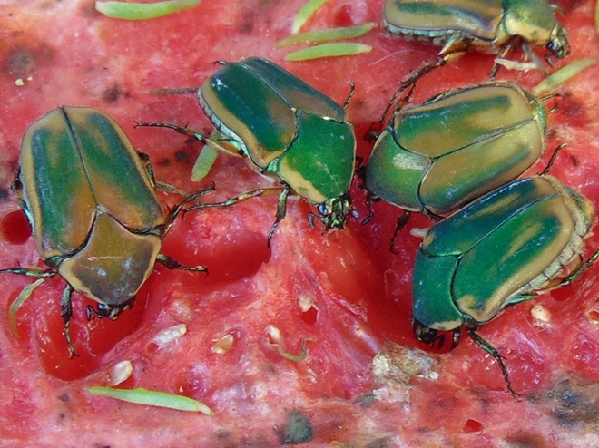
Morphological variation among individuals in a population of beetles is easily observed. These differences often manifest into adaptations that provide a survival advantage and speciation. It therefore comes as no surprise that beetles were among the life forms studied by Charles Darwin as he pondered natural selection and preparation of The Origin of Species.

If it’s organic, living or dead, a beetle has probably become specially adapted to fill the role of reducing it or consuming it. Beetles are indispensable members of the ecosystems they inhabit. Many function as scavengers, breaking down dead plants or animals into the basic nutrients that renew life. There are those that consume rotting wood, dung, and carrion. Sometimes they eat these things when people would rather they didn’t—such as moist wood that’s part of a house. Then there are species of beetles that are herbivores, consuming parts of the plants that get their energy directly from the sun. There are beetles that eat stems, roots, leaves, buds, flowers, nectar, sap, seeds, and fruit—many specializing in particular plant species or families. Some of these herbivorous primary consumers come to our attention because their populations explode in response to our creation of monocultures of their favored food, but many more act as pollinators for plants critical to human survival. Linnaean Society treasurer Rathvon made these herbivore-plant relationships the focus of many of his nineteenth-century writings, particularly as they affected agriculture. On the upper trophic levels, there are the predatory beetles that feed on herbivores or other carnivores. Many of these species have narrowed their choice of prey to one or fewer species. For example, there is a beetle that feeds only on the subterranean nymphs of cicadas.

Ladies and gentlemen, the beetles…


 Leucrocuta aphrodite")
 Leucrocuta aphrodite")
 Leucrocuta minerva")
 Leucrocuta minerva")
 Ephemerella dorothea")


 Leucrocuta aphrodite")

 Leucrocuta aphrodite")


")


")
")


