
Severe thunderstorms with hail, torrential rain, and flooding passed through the lower Susquehanna valley this evening. The National Weather Service in State College issued a warning for a radar-indicated tornado shown crossing the Susquehanna River downstream of Conewago Falls at 6:55 P.M. E.D.T. The rascal revealed itself about ten minutes later.
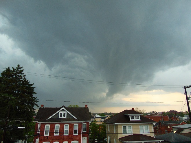
The staff at a retirement community west of Elizabethtown was on the alert and had the fortitude to quickly sound a warning siren. It was howling away as this image was taken. What could have been a disaster was instead a spectacular close call.