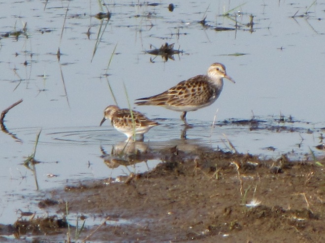
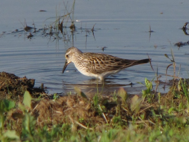
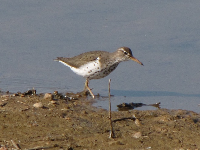
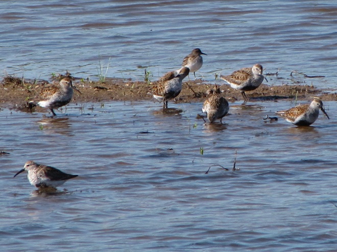
As they travel between coastal wintering ranges and breeding territories in Canada and Alaska, vast numbers of shorebirds pass through the lower Susquehanna region each spring and fall—though few stop here to rest, feed, and provide us with an opportunity to observe them. Prior to the construction of man-made dams and other alterations on our lotic (flowing) waterways including the river, shorebirds took advantage of lateral bars, stream deltas, and other alluvial deposits as places to loaf and re-energize. Before they were drained and filled, some of the valley’s wetlands probably included sparsely vegetated flats where shorebirds could drop in for a brief visit. Previous to their extirpation from our region, North American Beavers were the primary providers of quality habitat for shorebirds and other migrating waders on our lotic waters. Their widespread network of dams, pools, and marshes maximized floodplain function by keeping streams thoroughly connected to their wetlands, nurturing plant communities that not only provided food and shelter for the beavers and other wildlife, but provided superb buffering against erosion while protecting against sediment and nutrient imbalances in lower Susquehanna waterways.
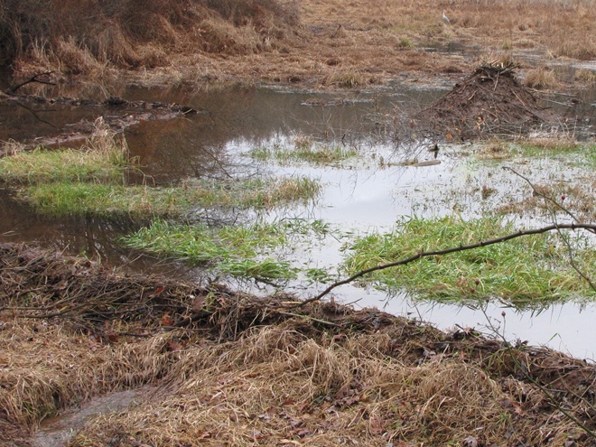
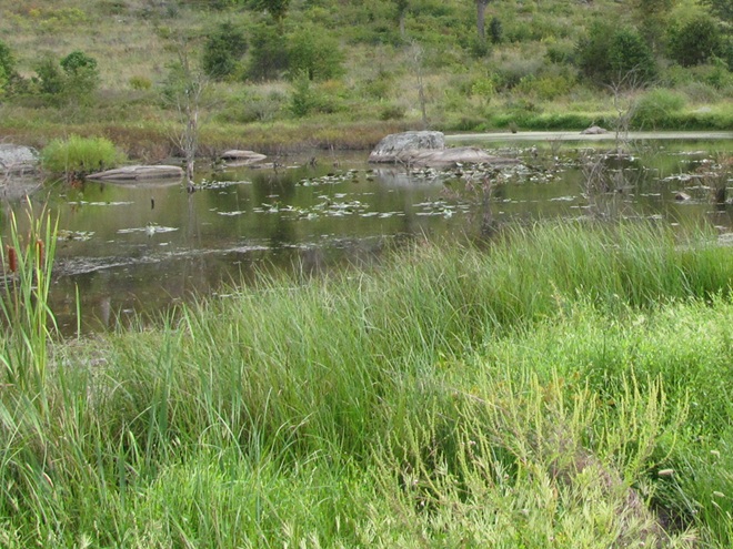
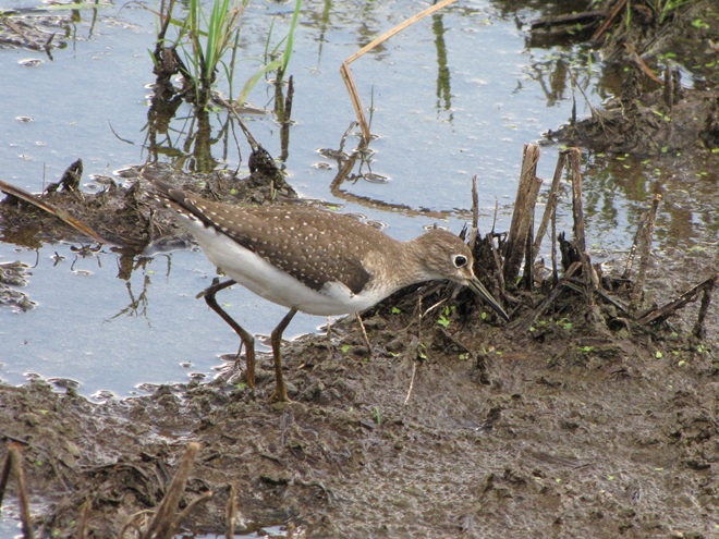
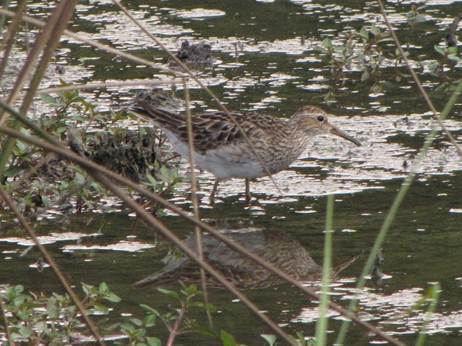
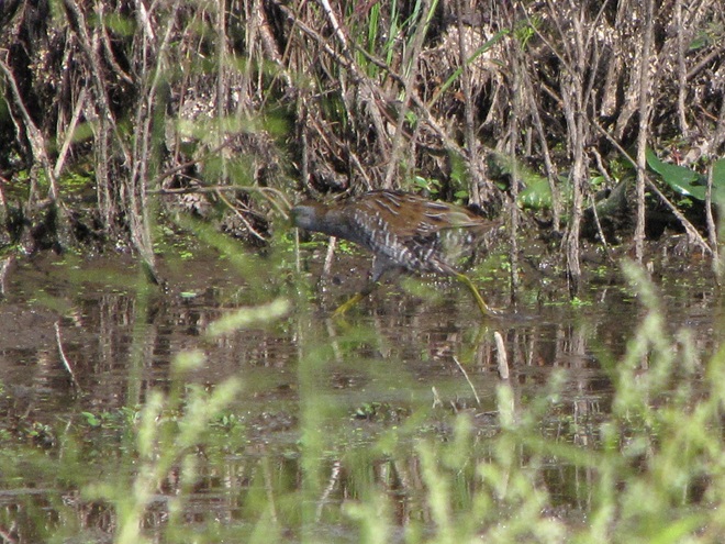
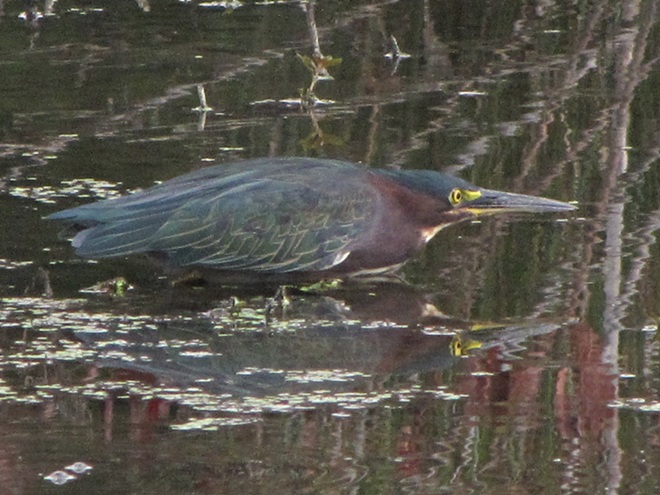
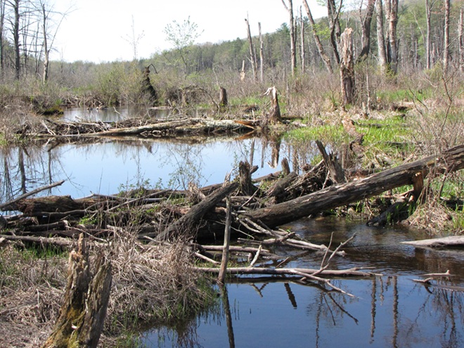
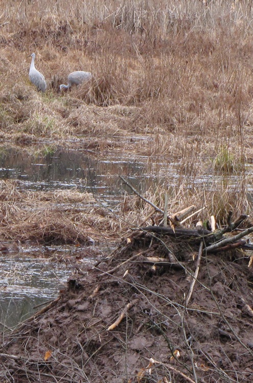
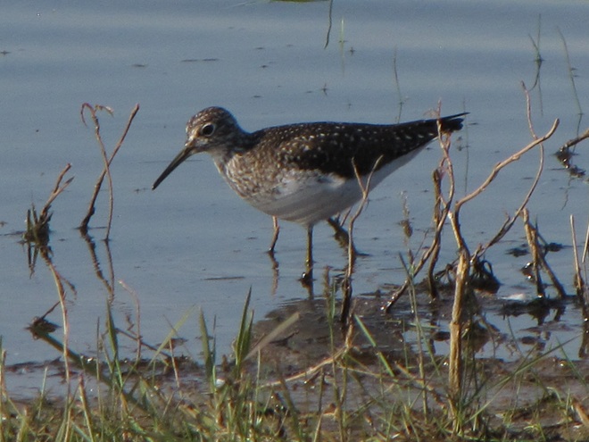
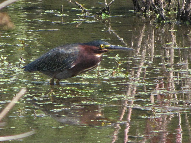
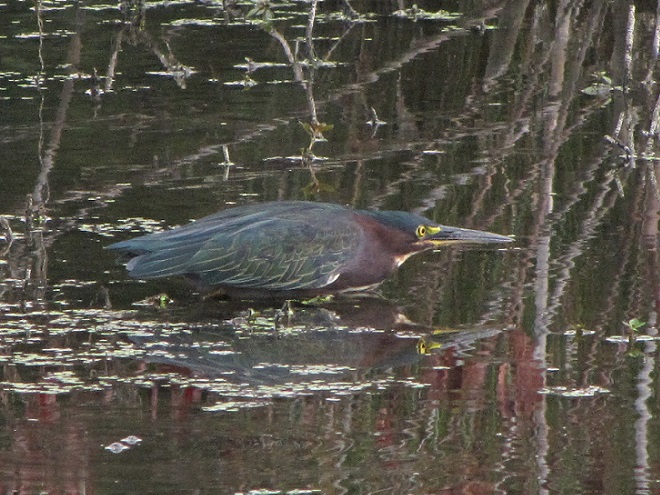
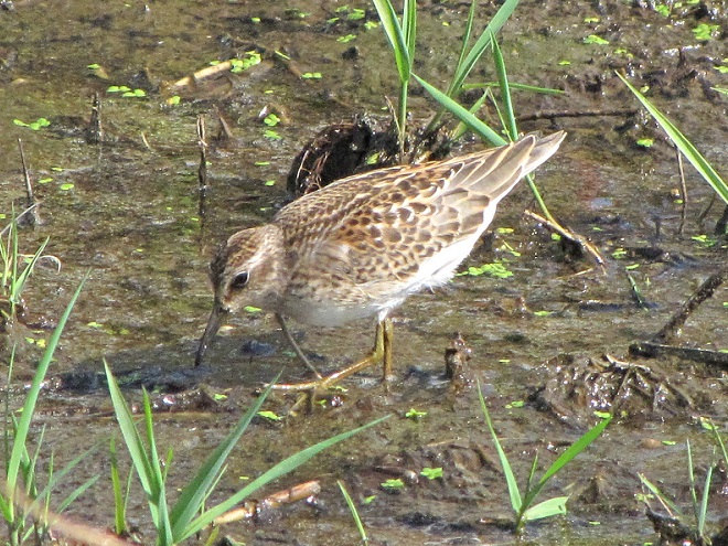
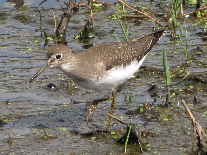
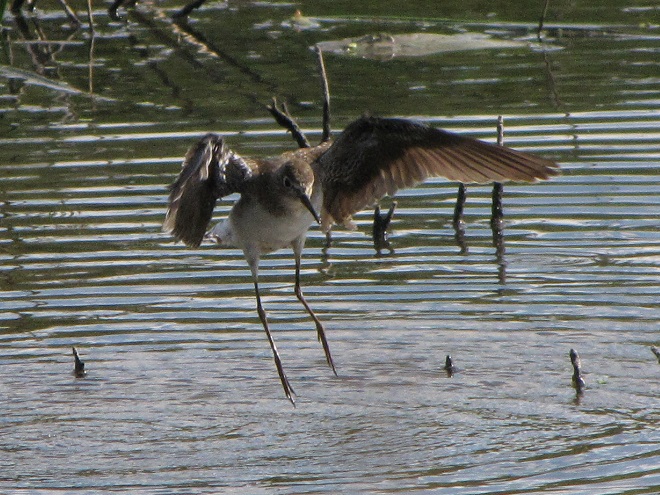
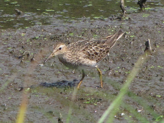
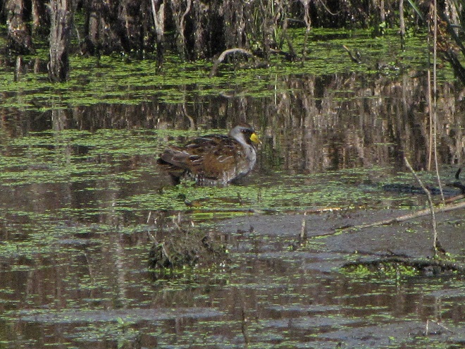
Beaver dams need not be large, particularly on low-gradient streams where a structure like this is sufficient to create a pool with depth adequate for building and maintaining a lodge and transporting leafy branches and other food items by water.A beaver lodge assembled in a pool with less than three feet of water, deep enough to provide the family with a measure of protection against terrestrial predators.Beaver pool ecosystems provide homes for hundreds of species of plants and animals, including migrating shorebirds and other waders.Mud flats in the margins between emergent shrubs and herbaceous plant growth attract migrating shorebirds like this Solitary Sandpiper to the abundance of invertebrate life. Seasonal movements of migrating shorebirds regularly coincide with the reductions of water levels in beaver pools which typically occur between May and September each year.During its southbound migration in September, a Least Sandpiper searches for arthropods and annelids as it visits a food-rich puddle along the periphery of a beaver pool.A Pectoral Sandpiper feeds in shallow water near a stand of Common Cattails in a beaver pool.During migration, rails including the Sora are attracted to dense emergent vegetation in beaver pools. Some will nest in these rodent-managed refugia.Green Herons visit beaver pools during migration and, due to the reliability of the food supply, will often nest in their vicinity.
So how did this happen? How did the North American Beaver become a keystone species—an animal upon which the majority of other life forms within its ecosystem are so reliant? Well, it’s largely due to the fact that our beavers aren’t particularly fond of a constant stream of noise. More specifically, they don’t like the sound of running water in places where they intend to build and maintain a lodge. And so, as they begin to place sticks, mud, limbs, stones, and other materials within a noisy riffle on a stream, they create a dam, and behind it a pool—a pool that is particularly advantageous for protecting their home and providing a means of conveyance for their construction materials and food supplies.
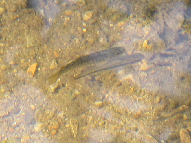
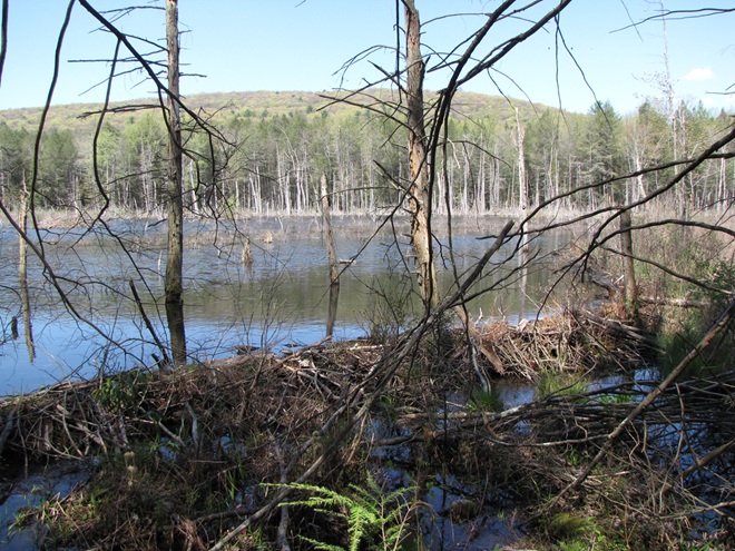
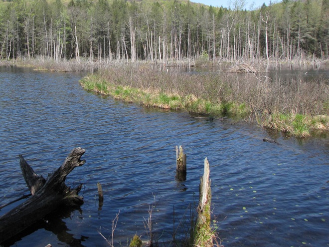
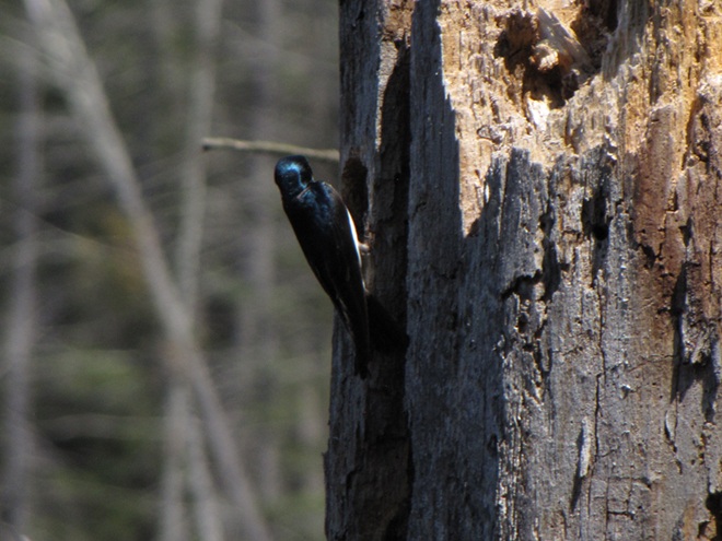
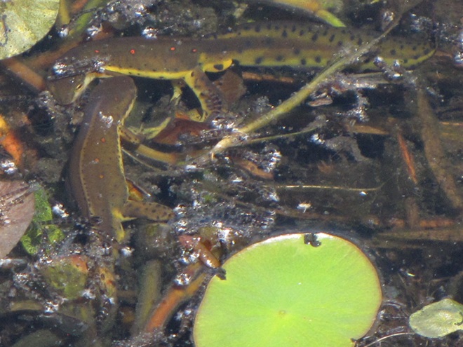
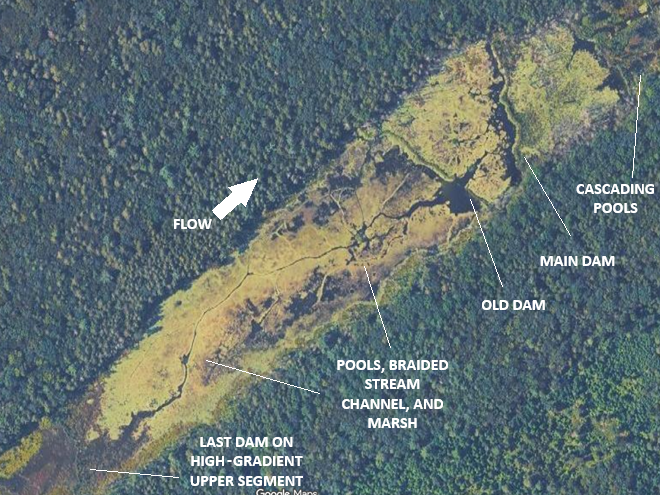
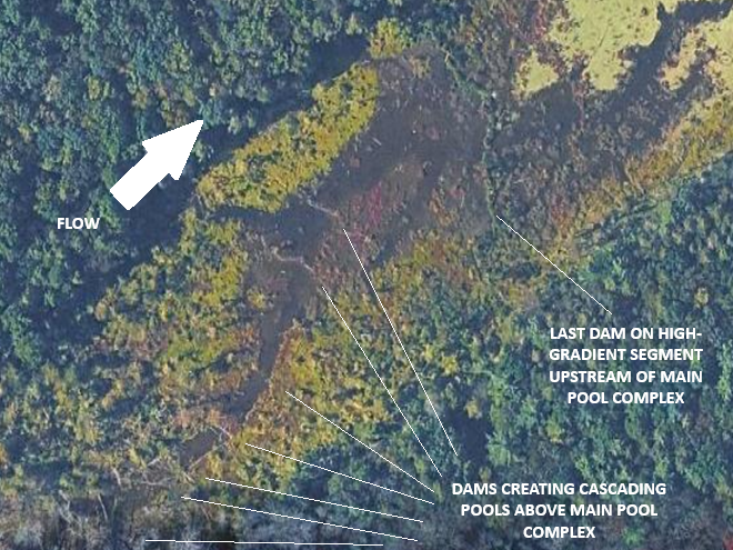
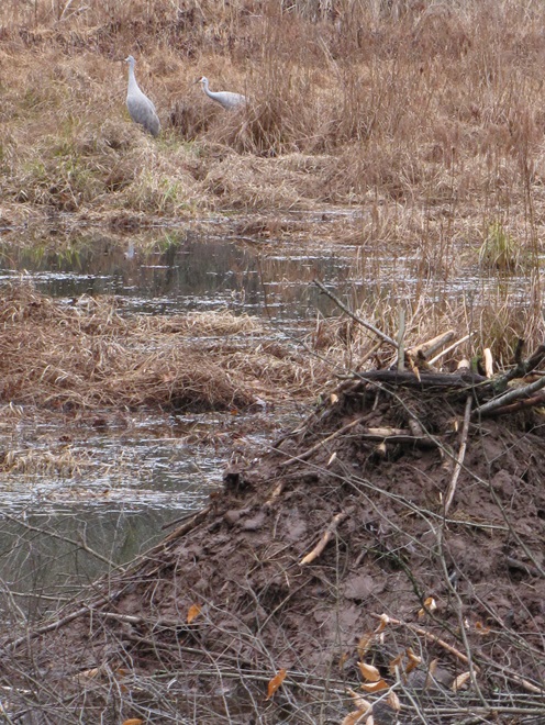
On a high-gradient segment of stream, beavers will create a cascading series of pools. Because water filters through a beaver dam instead of spilling over it, the work of these meticulous rodents soon silences the sounds of water changing altitude. No more sonorous riffle.Quiet please. High seasonal stream flow and damage from storms may create areas where water begins to erode the structure of the dam. Where this condition persists, an adult beaver will soon mend the breach, just to quiet things down. Why would beavers demand such a hush upon their domain? Well, they have poor eyesight, but their hearing is excellent, and they rely upon it to detect danger.The Louisiana Waterthrush (Parkesia motacilla), one of our earliest-arriving warblers, nests in forests along clear, high-gradient streams. In mid-April, we found this individual and three others squabbling over a breeding territory adjacent to the series of cascading beaver pools shown in the previous images.Native denizens of coldwater streams, neither the Brook Trout nor the Eastern Blacknose Dace has any difficulty finding its way through the voids in beaver dams to ascend and descend the sequence of pools.On a low-gradient segment of stream, a dam just over a foot in height may be sufficient to create a beaver pool of considerable size. Resembling the water-logged muskeg of the far north, well-established beaver pools form boggy habitats familiar to migrating shorebirds.Water levels in the pools usually drop along with the stream’s base flow as soon as the effects of the spring thaw and rain showers subside. Feeding areas in shallow water and on muddy ground are often revealed just in time for northbound shorebirds and other waders to stop by in late April and May. These conditions often persist through the growing season and the fall migration of these birds which begins as early as late June and sometimes extends into October.Where the pool inundates standing timber such as Red Maple and other species not used by beavers, the dead snags provide vital feeding areas for birds and other wildlife. Cavity nesters like this Tree Swallow seldom find suitable natural housing elsewhere.The mosaic of marshlands and braided stream channels within the beaver pool complex supports an abundance of aquatic life including these breeding Eastern Newts, seen here surrounded by the exuvia left behind following a massive hatch of alderflies (Sialinae). Alderflies are a stream inhabitant during their larval stage and are indicator of clean water conditions.A modern-day example of the way fully functional stream floodplains used to look in the Lower Susquehanna River Watershed. Though the pools may appear pond-like during the cooler and wetter months of the year, by summer the water levels behind the beaver dams recede as the base flow of the stream wanes. Now the true nature of the marsh, shallow pool, and braided stream complex is revealed. Unlike most man-made dams that set a fixed pool elevation regardless of flow by discharging water over the top of the structure or through a spillway or gate, beaver dams merely throttle the flow through their porous construction. Unless the beaver begins plugging small leaks as fast as the stream flow ebbs, the water level in the pools will drop. So they’re not left high and dry, lodges are located in the deepest pools, usually in close proximity to the dam and/or one of the stream courses. Though not inundated during the dry season, the soil in the pool complex is almost always damp and plants grow vigorously there, sequestering nutrients and retaining sediments in beneficial deposition patterns that actually inhibit erosion of the riparian landscape. These streams and floodplains retain their hyporheic zone and freely exchange water with the underlying water table and aquifer. It’s the ultimate floodplain management system, and the beavers don’t even know their doing all the work. (Google Maps base image)Where another high-gradient segment of stream enters the main pool complex, beavers have created an additional series of cascading pools. The impoundments created by these dams help diffuse stormwater energy and process more nutrients and sediments within the floodplain’s wetland vegetation system. (Google Maps base image)Beaver pools often refill as stream flows increase following autumn rains. The stockpiles of vegetative foods that grew within the beaver’s domain through the summer then become flooded and are a prime source of nutrition for not only the beavers, but waterfowl during both their autumn and spring migrations. Gleaning and probing Sandhill Cranes often find these habitats to their liking as well.
While North American Beavers have returned to the region, most live as “bank beavers”, residing in the river and larger creeks of the valley where they excavate shelters among the roots of Black Willows and other shoreline trees and shrubs. Floodplain encroachment, legacy sediment deposits, and just plain human intolerance have all conspired to prohibit North American Beavers from performing their magic on smaller local streams. For migrating shorebirds, this continued absence of beaver dam ecosystems has turned much of the lower Susquehanna valley into “flyover country”. Those travelers that do stop to rest and feed concentrate at the few favorable locations such as the lateral bars and the hydroelectric dam-created delta at the Conejohela Flats on the river in Lancaster County. But centralization has its drawbacks. Migrants spending time at concentration points may have a greater chance of contracting and spreading disease. Protracted heavy foraging can degrade these habitats. And over time, features such the lateral bars and delta deposits, including those on the Conejohela Flats, transition into other habitats—riparian forests. A more widespread selection of favorable stopover points for shorebirds, waders, waterfowl, and other migrants is certainly desirable.
IMITATION IS THE SINCEREST FORM OF FLATTERY
Until public sentiment sways in favor of the North American Beaver, wildlife managers are mimicking some of the attributes of their sound-inspired installations.
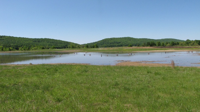
Created by excavating a depression in heavy clay soils, this new impoundment at the Pennsylvania Game Commission’s Middle Creek Wildlife Management Area collects water directly from rainfall and from surface runoff. Its depth at no point is greater than about two or three feet. During the driest times of the year, this space will be a mudflat, and a haven for migrating shorebirds.
Shallow-water conservation impoundments designed, constructed, and managed for migratory waterfowl and waders including shorebirds are not what we typically refer to as ponds—though they are lentic (still) waters. Similar shallow freshwater impoundments at our National Wildlife Refuges are referred to as pools by the United States Fish and Wildlife Service, but smaller versions like this example at Middle Creek very closely resemble the prairie potholes created by glacial scour in the north-central United States and adjacent portions of Canada. Many populations of migratory birds are familiar with pothole ecosystems and, like the beaver pools and marshes, have relied upon them as waypoints along their journeys for centuries.
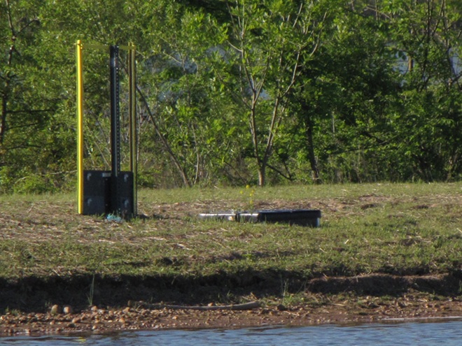
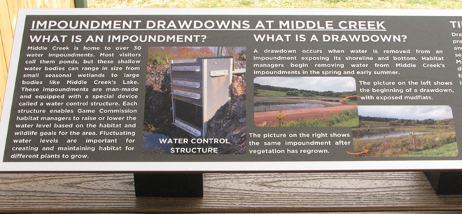
Impoundments most beneficial to migrating waterfowl and waders including shorebirds are shallow in depth. They lack the deeper waters of a pond or lake and thus have no limnetic (open water) or aphotic zones. Managed throughout as a littoral zone, impoundments grow plants in shallow water or on damp soil through the summer months to chew up nutrients accumulated in waste deposited by visiting birds. This vegetation is then flooded from late fall through early spring as forage habitat for migratory waterfowl. The timing of the fluctuations in water levels approximates those of the beaver pools and marshes on lotic (flowing) waters.A gate assembly is a water control structure installed to provide seasonal management of the water levels in a conservation impoundment. More than once, beavers have heard the sounds of tumbling waters inside these types of devices and tried to dam them up!
You’ve heard the line, “If you build it, they will come.” Well, it’s true. Here is a sample of the activity witnessed during the past two weeks at the new impoundment completed just several months ago at Middle Creek Wildlife Management Area along the tour route just beyond the “Stop 3” overlook.
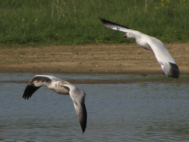
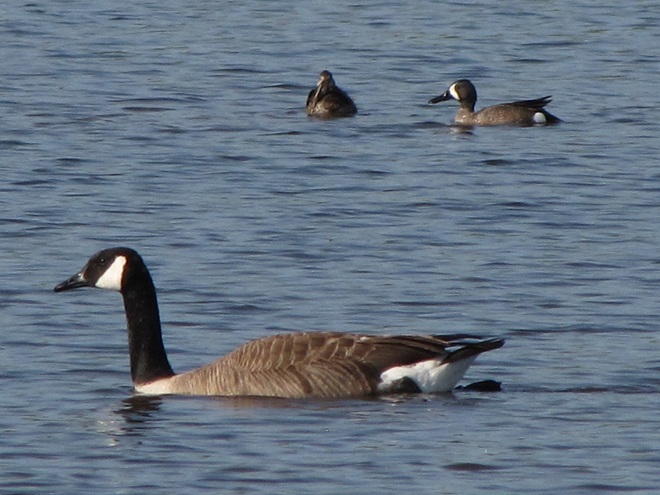
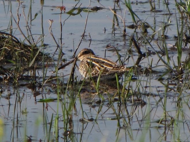
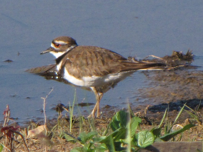
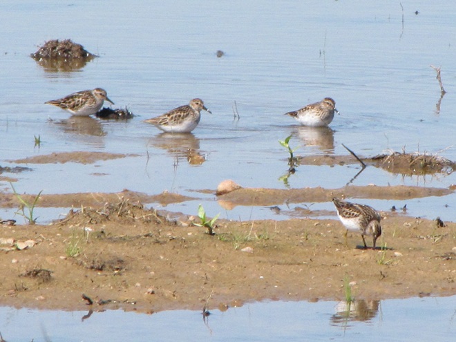
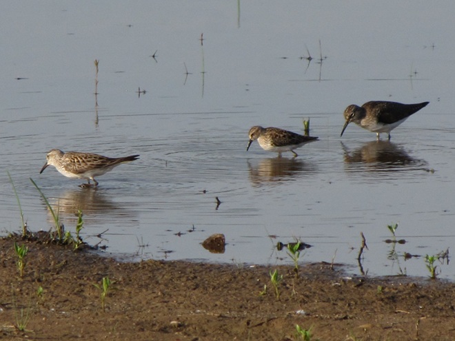
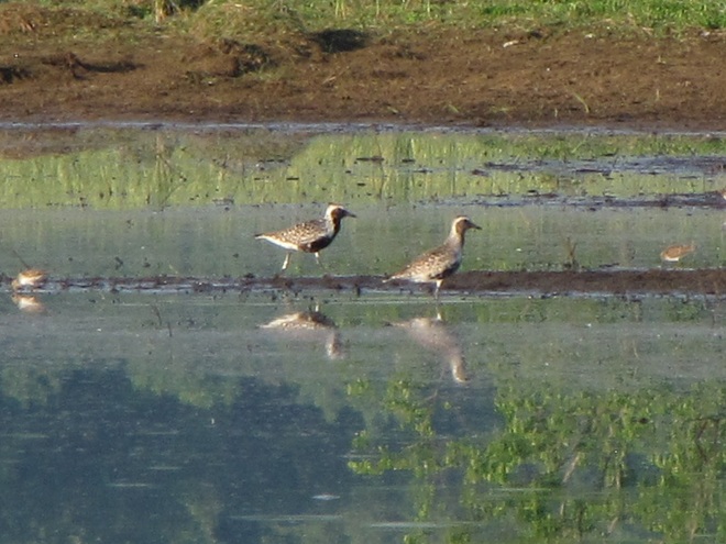
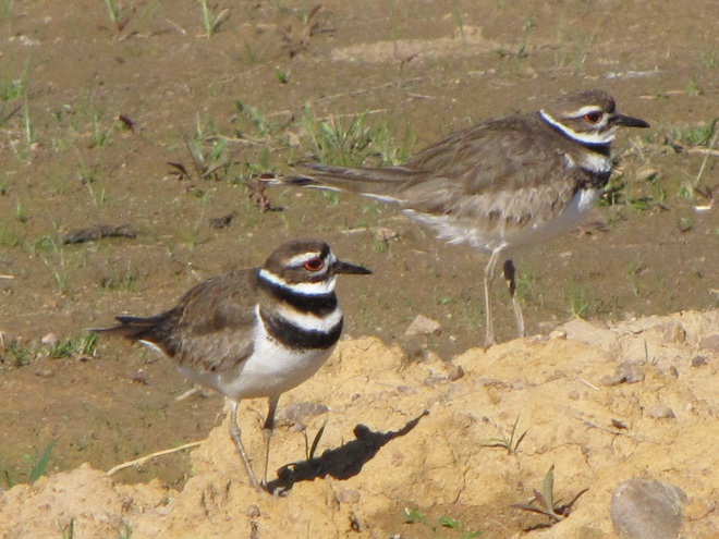
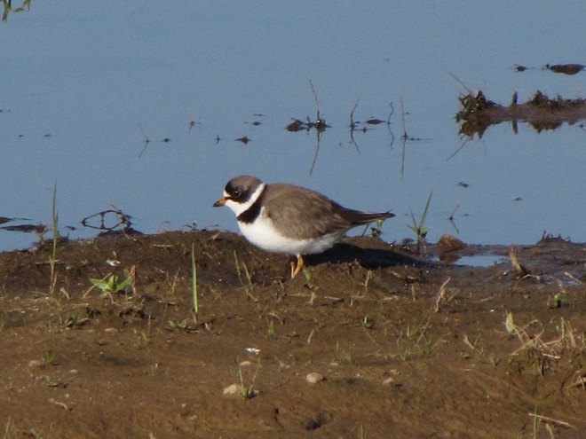
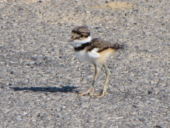
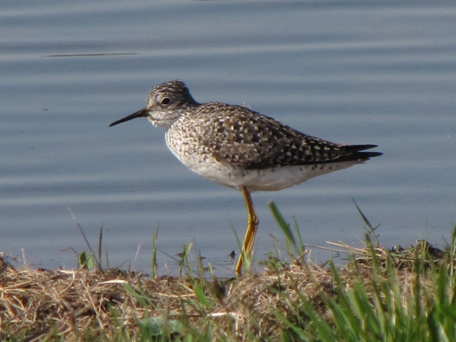
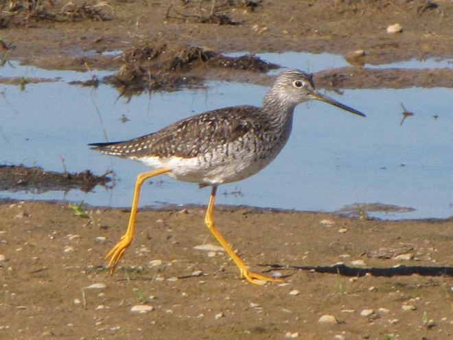
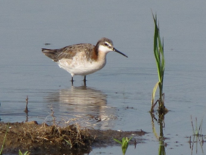
The ubiquitous Snow Geese were among the first migratory occupants of the new impoundment. A few are currently lingering in the vicinity.Ducks soon followed. These Blue-winged Teal were among the last to pass through earlier this month.Wilson’s Snipe were among the first species of migratory shorebirds to visit the new impoundment at Middle Creek……as were Killdeer, a species which nests nearby.Then, earlier this month, flocks of shorebirds including these Least Sandpipers were arriving to feed and rest.Least Sandpipers search for small invertebrates in shallow water and exposed soil.A Least Sandpiper (left) and a Semipalmated Sandpiper (right).Not all shorebirds seen by themselves are alone, and that includes the Solitary Sandpiper.Here’s a Solitary Sandpiper (right) feeding alongside a Least Sandpiper (center) and a White-rumped Sandpiper (left).A Least Sandpiper (left) and a White-rumped Sandpiper (right).Rare in our area during spring, the White-rumped Sandpiper (Calidris fuscicollis) flies north using the central flyway, then heads south along the Atlantic flyway in the fall, when it tends to be more regular here.Rocking and teetering along as it looks for food, the Spotted Sandpiper may be one of the easiest of shorebirds to identify.Chunky little Dunlin (Calidris alpina) with their conspicuously down-curved bills are another easy-to-identify species, particularly in the spring when their breeding (alternate) plumage includes a black belly.Black-bellied Plovers acquire a handsome set of plumage in the spring as well.Killdeer too are plovers and this pair appears to have taken up residence on barren ground along the periphery of the new impoundment.The Semipalmated Plover doesn’t have nearly the flair for ornament its close relatives the Killdeer do; these little shorebirds wear only one ring around their neck instead of two. Think this plover is cute?,……then check out this newly hatched Killdeer. It starts life with just one necklace too, but acquires a second as it grows. Look at those legs! (If you visit the new impoundment at Middle Creek, drive slowly and please watch where you’re going. Baby Killdeer and other young birds, as well as mammals and turtles, are commonly crossing the paved surfaces right now.)Speaking of legs, here’s one of dozens of Lesser Yellowlegs that visited the new impoundment during their recent northbound travels.Though less numerous than the smaller Lesser Yellowlegs, a Greater Yellowlegs seldom goes unnoticed when dropping by the man-made pothole habitat.Have trouble telling a Greater Yellowlegs like this one from a Lesser Yellowlegs? Look for the heavier, longer bill on the former, as well as dark barring along its flanks below the wings while the bird is in breeding (alternate) plumage during the spring migration.Everyone likes to see something unusual every now and then, and this impoundment delivers. Just yesterday, we photographed this migrating Wilson’s Phalarope (top center) among two Least Sandpipers (top left and right), a Lesser Yellowlegs (left and slightly forward of the phalarope), and a White-rumped Sandpiper (foreground).Renowned for spinning in circles as they feed in shallow water, Wilson’s Phalaropes (Phalaropus tricolor) passing through the lower Susquehanna basin are headed toward nesting areas in the prairie wetlands, including potholes, of the northern United States and adjacent sections of southern Canada.
Species of wildlife in addition to shorebirds and waterfowl have already found the new impoundment favorable…
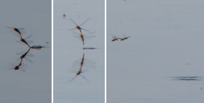
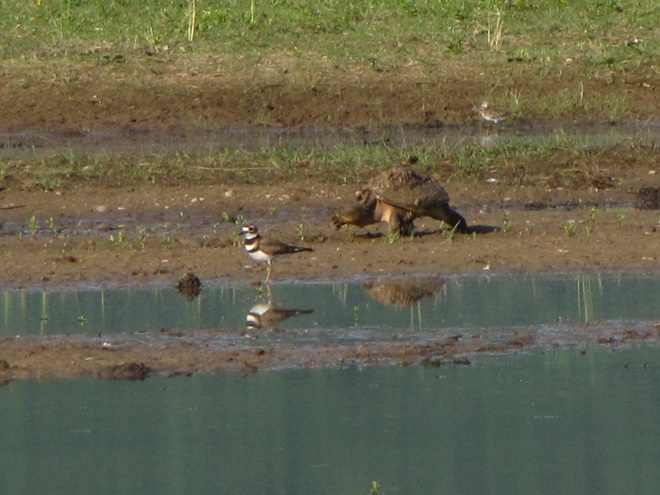
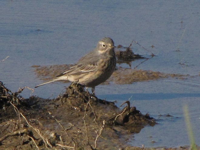
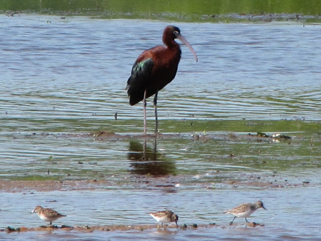
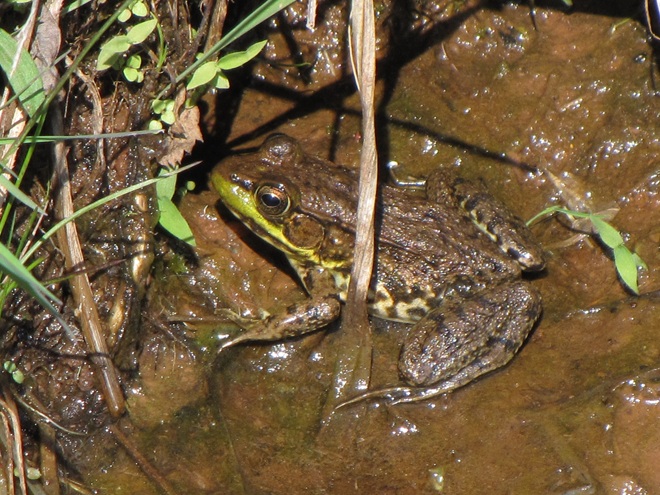
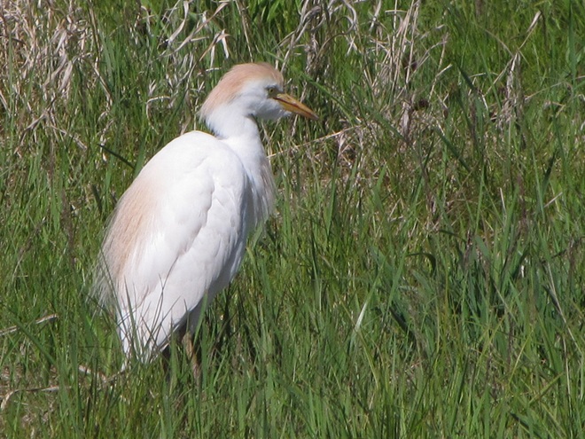
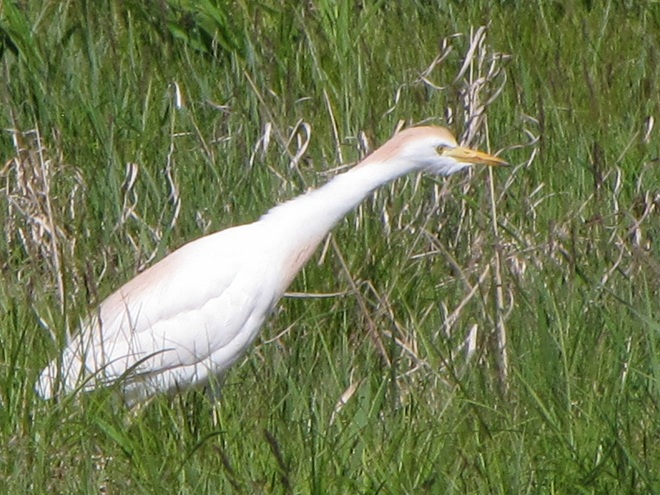
Pairs of breeding Spot-winged Gliders (Pantala hymenaea), seen here in tandem while ovipositing, were swarming the impoundment after arriving earlier this week. These dragonflies are ofttimes unpredictable nomads and are similar in appearance to the usually more numerous Wandering Gliders. To recolonize seasonal portions of their range, both are famous for hitching a ride en masse on storm systems. They share the behavior of finding ephemeral and new bodies of water favorable for egg laying due to their low density of aquatic predators.We watched this Snapping Turtle arrive to apparently find the newly created waters to its liking. Snapping Turtles are important consumers in a wetland ecosystem. Larger specimens may fill the role of an upper trophic level or apex predator, eliminating vulnerable mid-level consumers including other Snapping Turtles.Because it bounces its tail up and down like a Spotted Sandpiper, you may at first glance mistake an American Pipit for a shorebird. Long known as the Water Pipit, these songbirds have been visiting the impoundment while migrating north and stopping to feed in nearby croplands.Seen here with Least Sandpipers is a visiting Glossy Ibis.Sometimes twenty or more of these mostly coastal waders have made a pit stop at the “new Middle Creek pothole”, though none have thus far chosen to remain long. Apparently, food sources sufficient to sustain a bird of their size have yet to develop in its benthos.Western Cattle Egrets visiting Middle Creek this spring have been frequenting the new impoundment.With still little in the way of insects such as grasshoppers available in the surrounding landscape,……cattle egrets are looking to find prey like this Green Frog.Many have been observed hunting the adjacent grasslands..Where small mammals, mostly Meadow Voles, are being taken in abundance.
Managing saturation levels in shallow-water impoundments to resemble the seasonal variations in beaver pool and marsh systems can create lush growth and wildlife-rich environments. Take a look at some images from a project in a headwaters area of a tributary to Conewago Creek (west)…
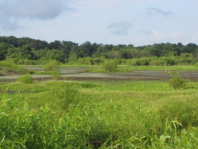
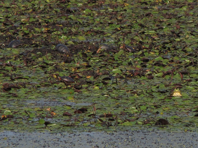
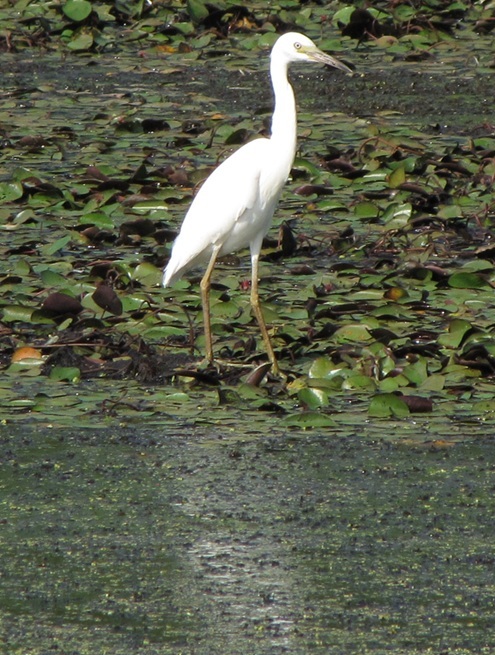
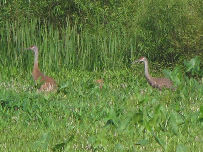
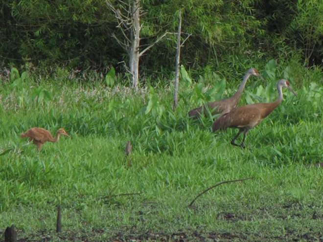
By late July, southbound shorebirds were already using these mudflats to feed and rest. Other sections of the impoundment were dense with emergent and aquatic plants, the latter kept hydrated in deeper pools of the project by the inflow from several captured springs that supplement direct rainfall and sheet runoff to supply its water. During a seasonal drawdown, the exposure of the impoundment’s soils to direct sunlight can provide a measure of disinfection to reduce the chances of disease transmission among its populations of visiting birds and other animals.In the deeper pools of the impoundment, water lilies and other aquatic plants grow in lush mats to provide cover and feeding areas for resident populations of breeding reptiles and amphibians.An abundance of foods are available for waders including this Green Heron……and this immature Little Blue Heron, a wanderer typical of more southern latitudes.While walking the road among tall grasses in the supporting landscape surrounding this impoundment, we were at first startled when these Sandhill Cranes strode by going the other direction. We quietly kept moving,……then spotted them again as we looked across the impoundment to realize they weren’t alone, but were escorting a colt.The hatching of this colt is testimony to the vital role wetland ecosystems play in the lives of hundreds of species. Whether they be beaver pools and marshes on lotic waters or man-made shallow lentic waters, each of these habitats is filling a void that left floodplains and other critical lowland biomes faltering. While they can’t replace the full-function floodplain management provided by an active beaver colony, shallow-water impoundments can provide relief for habitat-starved populations of the animals and plants that rely upon them. A constellation of these projects on lands public or private across the lower Susquehanna watershed could help provide refuge for many of our flora and fauna with the most desperately fragmented of ranges.
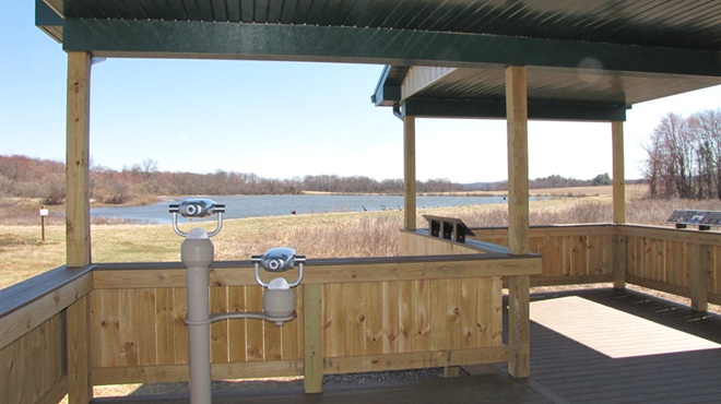
So that you can relax while observing the comings and goings at a pair of the lower Susquehanna valley’s man-made impoundments, the Pennsylvania Game Commission has erected two viewing pavilions for public use on its lands…
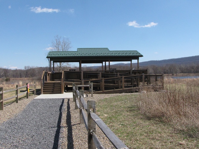
The Haldeman Island observation pavilion is located on State Game Lands 290 just upstream from the Juniata River’s mouth on the Susquehanna at Clark’s Ferry in Dauphin County.It overlooks not only the island’s man-made shallow-water impoundments and neighboring grasslands, but the hacking tower used in the 1970s to reintroduce Bald Eagles from Saskatchewan to the lower Susquehanna. Interpretive signs explain the conservation stories of habitats and the eagle reintroduction program.The observation pavilion at Middle Creek Wildlife Management Area is of similar construction to the one at Haldeman Island. It is accessed from the parking pull-off along the tour road at its intersection with Chapel Road, just before the right turn and incline that leads to the “Stop 3” grassland overlook.It too includes numerous interpretive signs to help visitors understand impoundment management.
During the next two weeks, the exodus of migrating shorebirds now staged and feeding upon Atlantic Horseshoe Crab eggs on Delaware Bay will commence. During the evening of their departure from the bay, many of these birds cross portions of the Lower Susquehanna River Watershed, particularly east of the river. Stormy weather and other climatic conditions may force some of them to seek a place to put down temporarily, so keeping a close eye on the new pothole-like impoundment at Middle Creek may be a prudent move. After that, waders known as “post-breeding wanderers” can show up at any time. Then, beginning as early as late June, shorebirds begin moving south on a migration that can provide us with viewing opportunities into September and beyond. See you out there!
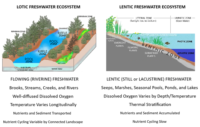
Some comparative attributes of unspoiled lotic vs. lentic freshwater ecosystems. Low-gradient (slow-moving) lotic waters often create, and remain connected to, accompanying riverine wetlands (a lentic freshwater ecosystem). These swamps, marshes, and ditches absorb, purify, and infiltrate flood waters while supporting a diverse number of plant and animal species.
We frequently perceive all waterfowl migration to be synchronized with the conspicuous movements of familiar species like Snow Geese, Tundra Swans, and Canada Geese—big flights coming south in October and November, then a return to the north in late February and March. And we’re all quite aware of the occurrence of large gatherings of some of these migrants while they make stopovers on some of our largest lentic (still) waters—the man-made lakes and reservoirs created by damming local streams. But did you know that there are populations of colorful waterfowl with dynamic migrations that extend throughout the winter and early spring with movements that are often continuous. Under favorable conditions, these birds favor the lotic (flowing) waters of the river and its larger tributaries as they transit the lower Susquehanna valley. That’s because unpolluted lotic freshwater ecosystems support a greater diversity of plants and animals than lentic waters, and therefore offer more opportunities for hungry migrating waterfowl to find food. Let’s have a look at some of the species that visit the river during their seasonal journeys…
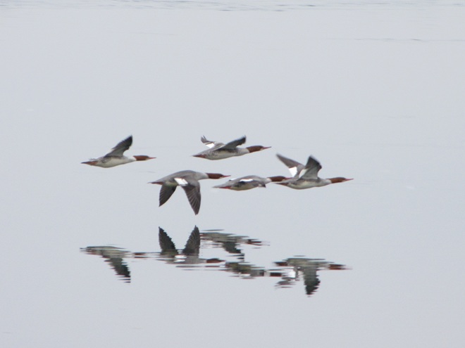
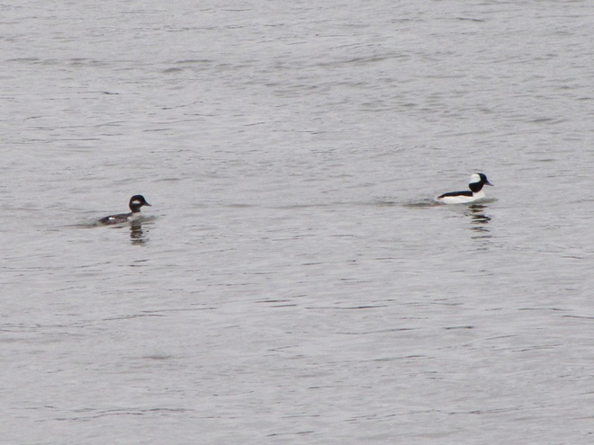
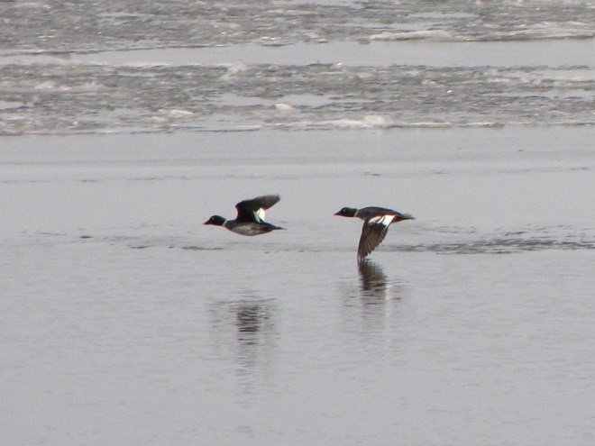
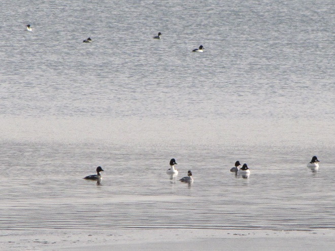
While the urge to head south in the autumn is largely stimulated by the shortening of the photoperiod, it is the presence of ice, particularly on glacial lakes throughout the lands to the north of the lower Susquehanna River basin, that pushes many diving ducks to finally make their way south toward the guarantee of open-water feeding areas along the coast. This movement may occur at anytime between November and late February or, as we have seen during some of the mild winters of recent decades, it may scarcely be noticed at all.Common Mergansers often lead they way when it comes to migratory diving ducks. They regularly move south in conspicuous numbers by late November and December and are regularly pushing north as soon as the ice begins to melt. During a typical year, it is not unusual for some populations of these large diving birds to remain north of us during the winter. Then, in the days after a sudden rush of frigid polar air, an appreciable increase in ice cover will force a mid-winter movement of birds down the Susquehanna.Temperatures in lotic fresh waters vary over the length of the stream or river. They are largely determined by the collective impact of the numerous sources of heat flux depicted in this graphic. (Environmental Protection Agency image)Buffleheads begin passing through the lower Susquehanna region in Novemeber on their way to coastal saltwater bays for the winter. Lingering populations feed by diving in the river’s pools and riffles for benthic invertebrates including snails and insect larvae. Lesser quantities of aquatic plant matter supplement their diet.Many Common Goldeneyes will remain on shallow, ice-free waters of the northern lakes and rivers sculpted by the most recent glacial event, but only until they are forced south into and through the lower Susquehanna valley by the encroachment of freezing conditions. On the river, they are among the dozen or so species of diving ducks we see visiting or passing through during the typical late fall and early river.
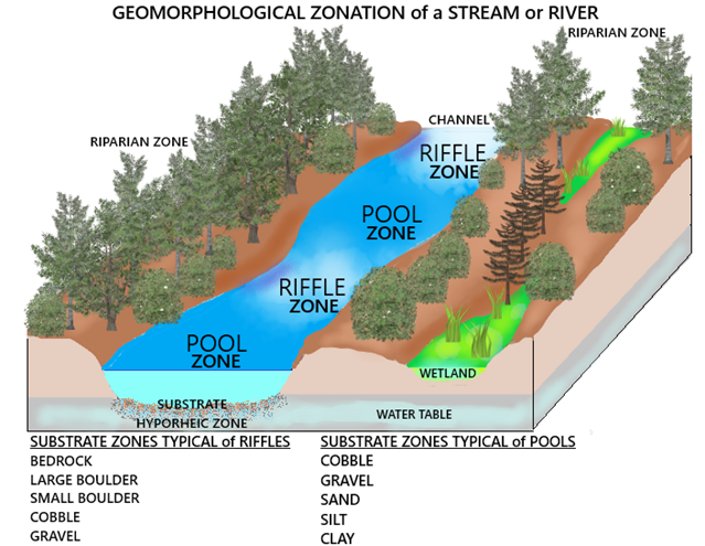
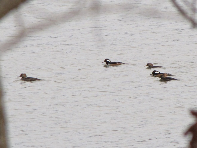
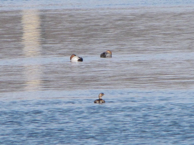
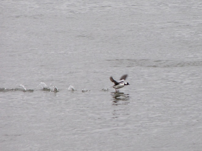
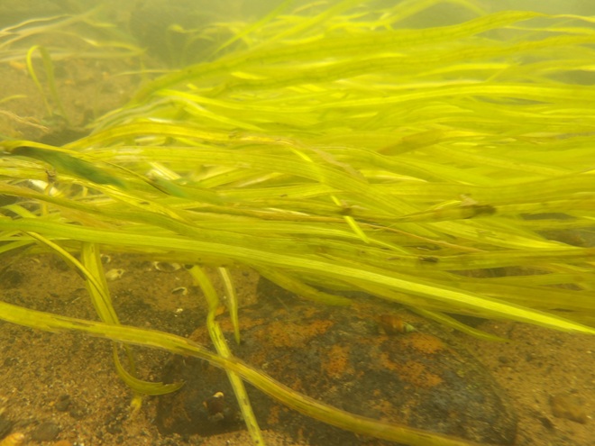
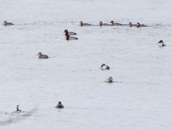
During their visits to the lotic (also known as riverine) fresh waters of the Susquehanna and its largest tributaries, benthic-feeding waterfowl make short dives to take advantage of the plants, small fish, invertebrates, and other food sources inhabiting the stream bottom in the riffles and pools of the free-flowing waterway. Substrates, listed here by size (in descending order), along with other parameters influenced by this flow regime zonation determine the variety and abundance of the forage available to migrating waterfowl and other consumers. Ice or high water and poor visibility due to flooding can render the riffles and pools of the channel unusable for feeding. The birds must then choose to either linger and rest without feeding or leave the lotic freshwater habitat to seek sustenance. During a flood, this may require relocation to a nearby lentic (still) body of fresh water such as a lake or reservoir. The presence of ice will almost invariably force the birds to fly on to the Atlantic Coastal Plain and the tidal waters of its bays and estuaries.Hooded Mergansers are one of the few species of diving ducks likely to utilize flooded shoreline timber and riverine (fluvial) wetlands as refuge from high water on Susquehanna.A Pied-billed Grebe and a pair of Canvasbacks on an ice-free stretch of the lower Susquehanna in mid-winter feed and loaf in a riffle-flanked pool where a large mat of American Eelgrass, a submerged aquatic plant also known as Tapegrass or Wild Celery, grows during the summer. The vast mosaic of riffles and pools in a river this size offers tremendous opportunities for a diverse array of aquatic species to find their niche wherein they can survive and flourish.The presence of ice forces Buffleheads and other diving ducks to gather in turbulent open water, often below a riffle or dam. Another alternative is to continue on toward the salty bays and estuaries of the coast. High water may push these birds into the shallows among the flooded woods to feed, but they seldom utilize heavily forested riparian wetlands as a refuge due to their need for a running start to get airborne.
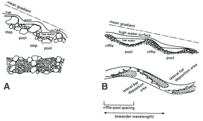
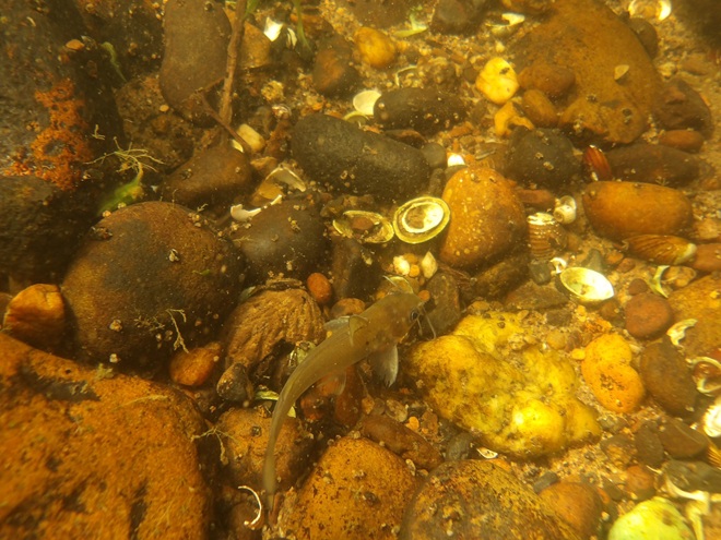
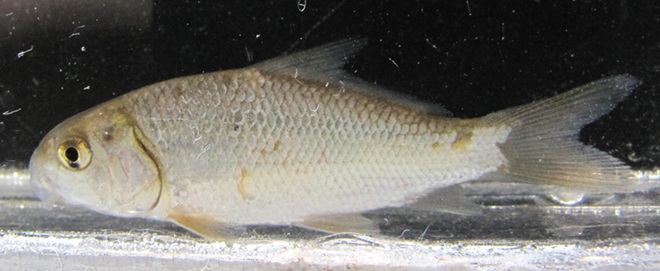
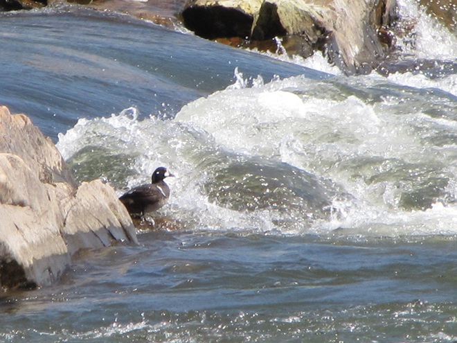
Riffle and Pool Characteristics of High Gradient (A) and Low Gradient (B) Streams. This graphic illustrates the change in deposition characteristics of a stream or river as its gradient decreases. A high-gradient stream (A) has a rapid velocity, often forms falls, and tends to carry away a high volume of all but the largest of particles of potential substrates as they erode from the surrounding landscape. On a low-gradient stream, the loss in water velocity reduces the water column’s ability to transport even the smallest of substrate particles. Deposition of this gravel, sand, silt, and clay forms lateral bars that over time create the familiar meandering path of a naturally flowing lowland stream. (National Park Service image)Benthic substrates in lotic freshwater pools and riffles support an abundance of life forms ranging from colorful diatoms on rocks and cobble, to invertebrates including snails and insect larvae, to fishes like this young Channel Catfish. Free of accumulations of sediment, this river bottom not only provides habitat for a healthy fishery, it facilitates the bidirectional exchange of water between the Susquehanna and its underlying aquifer.On the lower Susquehanna, populations of young Quillback suckers are found almost exclusively in clear, high-gradient pools.The Harlequin Duck winters along the rocky shores and man-made jetties of the Atlantic coast. In summer, they nest on fast-moving, headwater streams well to our north. Very rare on the Susquehanna, this is the first of two individuals found during March and April of 2025. It was observed feeding in the swift waters of the high-gradient riffles and pools where the river cuts through Blue Mountain north of Harrisburg. During previous weeks, Harlequin Ducks were being seen along the coast as far south as the mouth of the Chesapeake at Cape Charles, Virginia. It’s very possible that some of these birds traveled north through the bay area and up the Susquehanna on their way north.
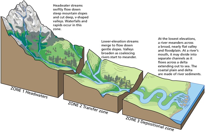
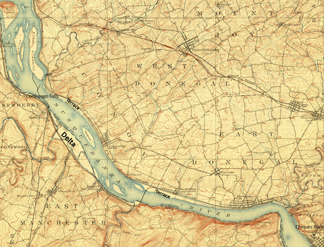
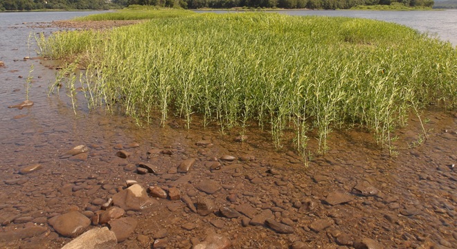
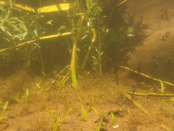
Fluvial Geomorphology of a Stream. Many of the Susquehanna’s tributaries pass through each of these three erosional zones. Along the way, they carry out the process of breaking down the mountains formed by the Allegheny orogeny, the collision of North America and Africa that created the supercontinent Pangea about 325 to 260 million years ago (during portions of both the Carboniferous and Permian periods). Today’s main stem of the lower Susquehanna passes through a transfer zone (Zone 2), carrying eroded materials to a depositional zone (Zone 3) located within the ancient Susquehanna canyon stretching from Havre de Grace, Maryland, to Norfolk Canyon on the edge of the continental shelf. Within this zone, more than a 10,000-year accumulation of post-glacial sediments lies submerged by the rising waters of the Atlantic Ocean and Chesapeake Bay. Although the present-day lower Susquehanna is largely a transfer zone, some deposition occurs along low-gradient segments of the river, particularly where its course parallels the watershed’s ridges both above and below the high-gradient rapids where its path has eroded passage through the highlands. (National Park Service image)Although the present-day lower Susquehanna is largely a transfer zone, some deposition occurs along low-gradient segments of the river, particularly where its course parallels the watershed’s ridges both above and below the high-gradient rapids where its path continues to erode passage through the bedrock. On this 1908 map of the Susquehanna at Conewago Falls, alluvial terraces of gravel, sand, silt, and clay can readily been seen as pale areas nearly lacking brown contour lines along the shorelines and islands of the river. Deposits within most of these terraces date back to the melt period following the most recent glacial event and beyond. The delta shown at the mouth of Conewago Creek (west) includes massive volumes of material deposited by both the creek and the river. This delta is currently known as Brunner Island, much of it developed as the site of a coal/gas-fired electric generating station. Terrace deposits along the Susquehanna’s shorelines created extensive perched marshes and swamps (wooded marshes) fed by rains, high river water, small streams, and springs, the latter often seeping from the base of the rocky escarpments carved by the ancient Susquehanna and defining the present-day inland border of the floodplain. We call these sites “Alluvial Terrace Wetlands”. Few of these critical components of river morphology survive. Those not drained for farmland were obliterated by urbanization and canal, railroad, and highway construction. (United States Geological Survey base image: Middletown, PA, quadrangle, 1908)Water Willow is a familiar emergent plant that colonizes lateral bars and other alluvial deposits in low-gradient segments of the Susquehanna.The fine roots of Water Willow collect sediment and absorb nutrients while creating dense cover for young fish and numerous species of invertebrates including the Virginian River Horn Snails seen here.
Prior to the nineteenth century, the low-gradient flow regime of the river both above and below the riffles at Chiques/Chickies Rock (lower right on map) created prime wildlife habitat. The natural accumulations of nutrients and substrates carried into and through the lotic waterway’s pools and riffles were cycled into an ideal growing medium for extensive mats of American Eelgrass and other aquatic plants. This underwater forest hosted a seemingly endless abundance of invertebrates and fishes (both resident and migratory)—supporting a variety of consumer species including various populations of humans. But soon after the mass clearing of much of the watershed’s land for farming and lumber, the mill ponds created by dams constructed on streams to power saw and grain mills became brimful with sediments eroded from the unprotected ground. During storm events, torrents of these sediments then flowed full bore toward the Susquehanna, and began accumulating in the low-gradient segments of the river.
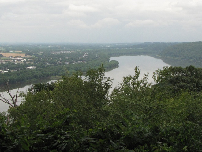
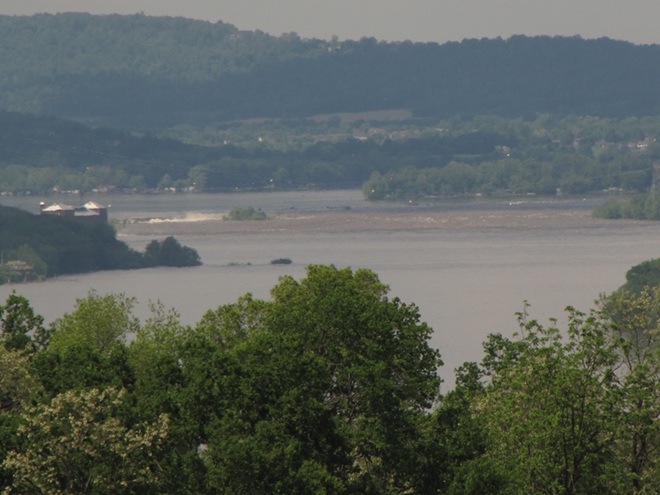
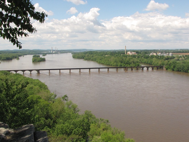
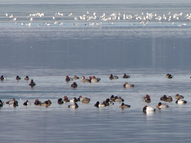
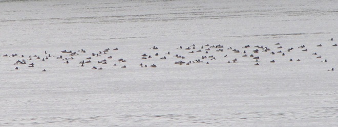
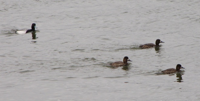
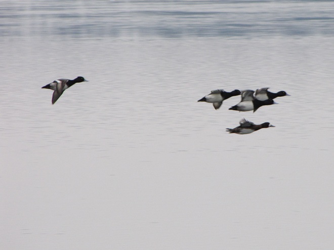
Sediments left behind after the removal of mill dams are known as legacy sediments. They disconnect the stream from its historic floodplain and riverine (fluvial) wetlands, thus intensifying the impact of high water in the surrounding landscape. As these nutrient-charged deposits wash away, they become a source of pollution in the waters of the Susquehanna and Chesapeake.A mat of American Eelgrass growing in the flowing waters of the Susquehanna below Conewago Falls. Eelgrass and other submerged aquatic plants provide essential habitat for a wide variety of small fish and invertebrates while also consuming nutrients deposited in the cobble, gravel, and sand substrate of the river’s pools. Excess quantities of smaller particles of silt and clay can clog the substrate and thus inhibit the hyporheic exchange of water between the stream channel and the underlying aquifer, often diminishing the biomass and diversity of organisms inhabiting this benthic habitat. Buried in these life-choking sediments, the river bottom becomes inhospitable to growth of submerged aquatics including eelgrass.This low-gradient stretch of the Susquehanna at Marietta flows parallel to the Chickies Quartzite “Hellam Hills” before making a sharp right turn to punch through the ridge as a series of rapids at Chiques Rock. Formerly a fully functional lotic ecosystem and a paradise for migrating waterfowl, this river segment is now impaired by accumulations of nutrient-laden sediments from agricultural and urban runoff.Nutrient and sediment-loaded flood waters roar across the diabase boulders at the York Haven Dam and Conewago Falls, a high-gradient segment of the Susquehanna.They continue past Brunner Island (left power plant stacks) and through Haldeman Riffles and the Shocks Mills Railroad Bridge……into the stretch of river known as the “Marietta broads” along the base of the Chickies Quartzite “Hellam Hills”. The low stream gradient here produces a slower current and increased deposition of sediments.As the flood surges through the riffle and pool complex at Chiques Rock, the high stream gradient maintains a velocity in the water column sufficient to keep additional sediments in suspension until they reach the low-gradient river segment just downstream at Washington Boro, site of a naturally occurring lateral bar area known as the Conejohela Flats. These bars now lie within the man-made depositional zone known as “Lake Clarke”. Created nearly a century ago by construction of the Safe Harbor Dam, this impoundment is accumulating astounding volumes of nutrient-loaded sediments that continue to encapsulate the flats within a stream-impairing delta.Anytime from November to April on the lower Susquehanna, a group of Redheads, Canvasbacks (3 birds to right of the middle of the picture), and a Horned Grebe (lower left) is a welcome sight in a riverine pool known to have a summertime growth of American Eelgrass. Noted Dr. Herbert Beck in 1924 when describing the Canvasback, “Like all ducks, …, it stops to feed within the county (Lancaster) less frequently than formerly, principally because the vast beds of wild celery which existed earlier on broads of the Susquehanna, as at Marietta and Washington Borough, have now been almost entirely wiped out by sedimentation of culm. Prior to 1875 the four or five square miles of quiet water off Marietta were often as abundantly spread with wild fowl as the Susquehanna Flats are now. Sometimes there were as many as 500,000 ducks of various kinds on the Marietta broad at one time.”Today, seeing just dozens of Aythya genus ducks (Redheads, Canvasbacks, scaup) on the lower Susquehanna is a notable event. If they happen to be forced down by inclement weather while migrating through, you might get lucky enough to see several hundred.While the recovery of eelgrass/wild celery beds on the Susquehanna is trivial in scale and offers little support for numbers of waterfowl to return to historic levels, restorations on the upper Chesapeake in the vicinity of the Susquehanna Flats between Havre de Grace and Aberdeen Proving Grounds may have helped refuel a gathering of mostly Aythya genus ducks during the final days of February. This mass of ducks, many of which were forced south from the frozen Great Lakes during the previous weeks (some by way of the ice-choked Susquehanna) were apparently making an abrupt turn to make their way back north. Their stay was brief, but estimates by local birders put their numbers as high as one half million. The vast majority of the concentration consisted of Aythya species: Redheads, Canvasbacks, Ring-necked Ducks, and both Lesser and Greater Scaup. It probably included a mix of birds including both northbound migrants from further down the coast and the aforementioned refugees that had just arrived to pay a quick visit while escaping the late-season ice before turning around.During the past two centuries, as food supplies in the Susquehanna grew increasingly compromised for benthic feeders like these Lesser Scaup and other diving ducks, a change in distribution was necessary for survival.As individual species, Lesser Scaup and other waterfowl that fail to adapt to natural or man-made changes in their habitats and food supplies may see their overall global numbers falter.
Despite being located in the transfer zone, the lower Susquehanna has become a significant depositional zone along much of its length, mostly courtesy of the placement of sediment-trapping man-made dams.
Following construction of the mill dams and ponds on nearly every mile of the lower Susquehanna’s low-gradient tributary streams, enterprising parties moved on to the river. The first significant spans were constructed using wide timber cribs filled with large rock. They were placed to create water deep enough to allow canal boats to cross the Susquehanna at both Clark’s Ferry at the mouth of the Juniata River in Dauphin County and at Columbia/Wrightsville. These dams also diverted water into the newly excavated canals—the Pennsylvania Eastern Division Canal (completed in 1833) which followed the river’s east shore from Clark’s Ferry to Columbia, and the Susquehanna and Tidewater Canal (completed in 1840) along the west shore from Wrightsville to Havre de Grace, Maryland. Placement of these sediment-trapping man-made dams began a process of converting vast mileage of the lower Susquehanna from a transfer zone into a deposition zone. In addition, layout of the canals and locks followed the contours along the base of the riverside ridges, seriously altering most of the alluvial terrace wetlands that the river had created as a feature of its floodplain during the post-glacial period.
Construction of the canal dams was just the beginning. During the twentieth century, more massive dams would be added to the main stem of the river for hydroelectric energy production at York Haven, Safe Harbor, Holtwood, and Conowingo. Upon their completion, the days of unassisted anadromous fish migrations were over. On both the river and its tributaries, smaller dams including dangerous low-head dams maintain water levels for boating and recreation. They too create current-diminishing, pseudo-lentic waters that blanket the lotic riffle and pool substrates with polluted sediments.
MAN-MADE DAMS TURN LOTIC WATERS INTO UNFLUSHED TOILETS
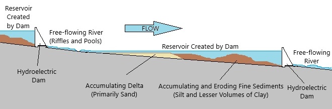
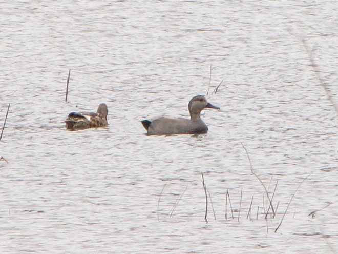
The construction of dams on the lower Susquehanna has converted vast mileage of the river from a lotic freshwater system into a series of man-made lentic freshwater reservoirs. These areas have lost their function as a lotic transfer zone and are now a sort of dysfunctional series of depositional zones collecting vast volumes of sediment containing nutrients and other pollutants. Within each impoundment, the reduced velocity of the river causes it to drop suspended sand first, then the finer particles of silt and clay closer to the dam. The flow regime of riffles and pools is lost and the hyporheic zone that exchanges water between the river and the underlying aquifer is clogged. These impaired segments of river become ripe for eutrophication: algal blooms followed by die offs that can lead to a fatal reduction of dissolved oxygen in the water column.Deposits of lateral bars of sediment in low-gradient segments of the Susquehanna can create shallow water feeding habitat for puddle/dabbling ducks like these Gadwall. Where sediment pollution is severe, benthic foods in these areas often consist mostly of invertebrates and plant matter deposited by the current, the buried substrates devoid of a functioning ecosystem and the waters subject to eutrophication.Common Goldeneyes on a patch of open water on an otherwise ice-covered “Lake Clarke”, the impoundment created by Safe Harbor Dam. While they may find this spot advantageous for loafing, the food supply over the sediment-buried substrate will be limited.
Dredging of sections of the lower Susquehanna for spilled, discarded, and washed-out anthracite coal sediment went on for nearly 100 years and was a particularly active enterprise in the Harrisburg area and in Lake Clarke until 1973. The recurrent substrate disturbances that accompanied waste coal recovery in these segments of the river repetitively damaged habitat for benthic life and may have been the catastrophic factor leading to the extirpation of two species of freshwater mussels: the Eastern Lampmussel (Lampsilis radiata) and the Dwarf Wedgemussel (Alasmidonta heterodon).
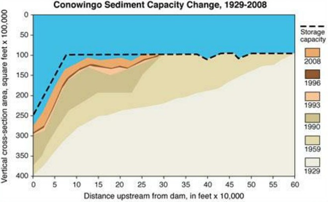
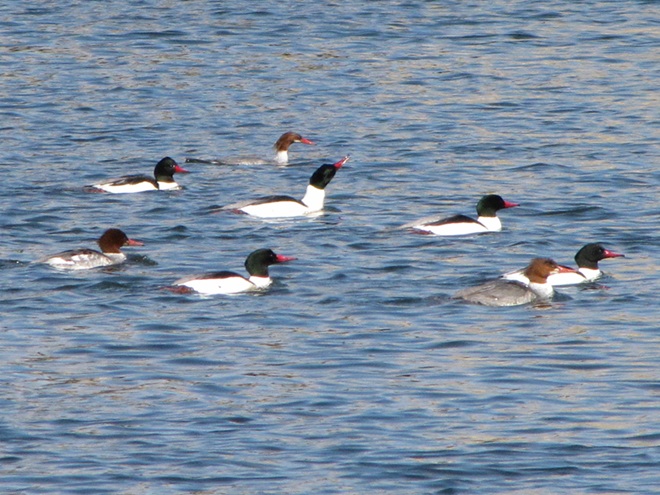
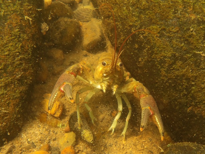
By the end of the twentieth century, accumulations of polluted sediments behind lower Susquehanna dams were nearing capacity. There is no working plan to attenuate the massive release of these pollutants that may be triggered by a catastrophic flood. The effort to reduce nutrient and sediment runoff remains the focus so that new loading is kept to a minimum and won’t add to the capacity problems at the dams or continue downriver to the Chesapeake at full strength when the dams are full. Alleviating the sediment aggregation problem within the river’s impoundments is a tall order and a dilemma not easily solved. (United States Geological Survey image)Common Mergansers will feed where benthic substrate supports the small fish and invertebrates they prefer. They will, however, gather in extraordinary numbers on the “lakes” created by riverine dams. Though they can only feed on what floats in with the current, hundreds or sometimes thousands of Common Mergansers will concentrate on “Conowingo Pond” during the late fall or early winter. There, safety in numbers gives them some guarantee of protection against the multitudes of eagles that simultaneously frequent the vicinity. Another advantage of staging on “Conowingo Pond” is its close proximity to favorable feeding areas on upper Chesapeake Bay and stretches of the Susquehanna where lotic riffles and pools offer abundant opportunities below the river’s dams.Fortunately for everything else living in the benthos, Common Mergansers are big enough to devour invasive, non-native Rusty Crayfish when they find them in our lotic waterways.
TIME TO CLEAN UP OUR ACT
WHERE DOES YOUR STORMWATER GO?
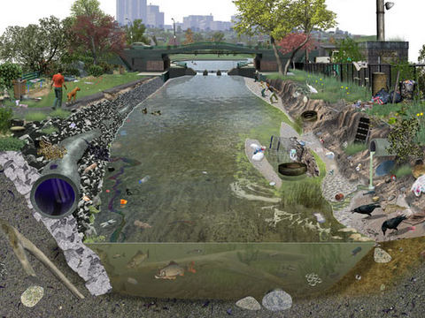
Channelized Urban/Suburban Streams Function as Sewers. They have no attached lowlands or floodplains to absorb, purify, and infiltrate runoff from rain events. Pollutants including litter, pet waste, lawn chemicals, tire-wear particles, hazardous fluids, and sometimes untreated human excrement flush unchecked from the municipal storm drainage system into the waterway. Thermal shock from summer downpours washing across sun-heated pavements can kill temperature sensitive fishes and other aquatic life. Nutrient and sediment loads from these impaired tributaries later accumulate downstream in low-gradient segments of the Susquehanna, turning the river into an open-air cesspool. Aggressively working to implement projects that eliminate these sources of pollution are the only effective way to keep the problem from getting worse. Making things better requires a lot more dedication and effort. (United States Geological Survey image by Frank Ippolito)
RIPARIAN BUFFERS MAKE A DIFFERENCE…WIDER IS BETTER
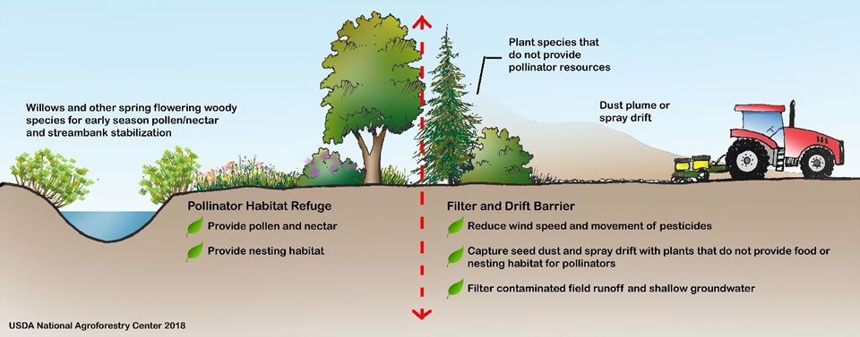
To sequester sediment and cycle nutrients (primarily nitrogen and phosphorus) contained in farm runoff, the U.S.D.A. recommends installing riparian buffers between streams and lands used for grazing and raising crops. To protect pollinating species including bees and butterflies from pesticide drift and eroding soils rich in fertilizers, they further recommend installing a stand of wind-pollinating plants such as conifers, oaks, and birches between the field and streamside plantings. These same conservation practices improve water quality and wildlife habitat on waterways located in residential and commercial areas as well. (United States Department of Agriculture image, click to enlarge)
FLOODPLAIN RESTORATION
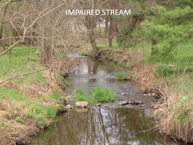
Regardless OF HOW LONG YOU’VE BEEN CONDITIONED TO THINK OTHERWISE, THIS IS A DYSFUNCTIONAL, POLLUTED CREEK—AND IT NEEDS HELP
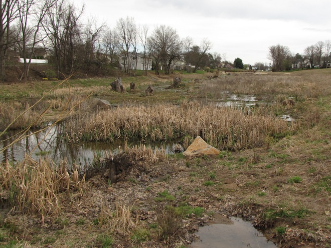
A channelized low-gradient stream eroding a path through deposits of legacy sediments displaces flood waters into previously unaffected areas and provides a continuing source of nutrient and sediment pollution during storm events. These impaired waters have a diminished capacity for supporting aquatic life including fishes.
RESTORED TO ITS HISTORIC FUNCTIONS
On an adjacent segment of the same creek, this legacy sediment removal project restored a braided meandering channel and connected it to its newly liberated, historic floodplain. In just their second year, the fluvial wetlands are effectively absorbing stormwater and sequestering nutrients as an attached component of the stream’s riffle and pool complex. During our visit earlier this week, we found American Toads, Northern Leopard Frogs (Lithobates pipiens), and Northern Spring Peepers breeding here. It’s just as Castor canadensis would have it!
“STOP HEMMING AND HAWING AROUND ALREADY”
“HEY COWBOY, HOW ‘BOUT GETTIN’ THEM FILTHY LITTLE DOGIES OUTTA DAT CRICK?”
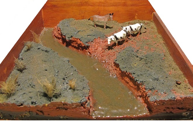
Here’s a polluted stream in a pasture with grazing livestock. The site is a former mill pond within which the creek eroded a channel following removal of the dam. The animals defecate and urinate where access to water is gained at a broken down embankment of the nutrient-loaded legacy sediments deposited in the pond more than a century ago. It’s a haphazard form of animal husbandry and a reminder that all it takes is just one stubborn jackass to foul up the whole waterway.
DIRECT SOURCES OF NITROGEN (AMMONIA) POLLUTION IN STREAMS
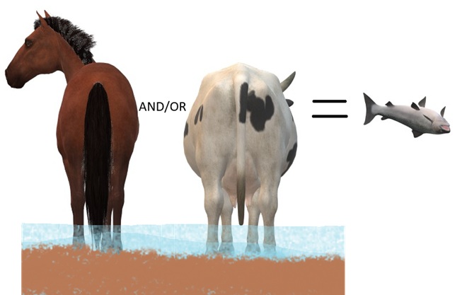
DID YOU KNOW that a dairy cow produces about 80 pounds of waste (excrement and urine) every day?
DID YOU KNOW that a horse produces about 50 pounds of waste (excrement and urine) every day?
DID YOU KNOW that a human produces about 3 to 4 pounds of waste (excrement and urine) every day? The exceptions, of course, are those who continue to insist that raising farm animals in and alongside a body of water is okey-doke—a harmless practice. These individuals tend to retain the former constituent of human waste and are thus full of it.
“ATTABOY TEX, THAT’S MORE LIKE IT!”
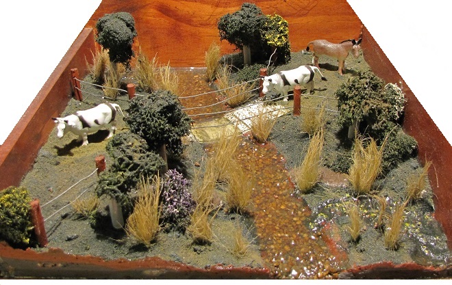
Now that’s better. Legacy sediments have been removed to reconnect the stream to its floodplain. A livestock crossing and exclusion fencing has been installed, and a nutrient-consuming riparian buffer has been planted. This creek segment’s pollution woes have been mitigated. Do you have a neighbor needing this type of remedial work on their farm? Encourage them to contact your local county conservation district office or volunteer waterways restoration organization for assistance. Various programs provide financial assistance covering all or most of the costs of stream improvement as well as monetary incentives for helping to clean up the water.
AND FINALLY
WHEN IT COMES TO BUILDING DAMS ON LOTIC FRESH WATERS…
…LEAVE IT TO THE BEAVERS
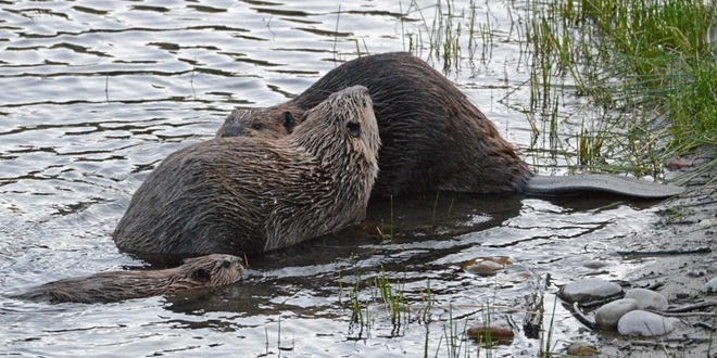
North American Beavers (Castor canadensis) create habitats that connect the riffle and pool regime of a low-gradient stream to a surrounding fluvial wetland that retains sediments, cycles nutrients, and provides essential habitat for hundreds of plant and animal species. Floodplains are for flooding, and if a beaver floods an area, you can be guaranteed that it was already part of a floodplain. You see, beavers don’t encroach upon humans, it’s humans engaging in the encroachment upon beavers. (National Park Service image)
MAD HATTERS
DID YOU KNOW that even before the landscape was cleared for farms and a supply of timber, and before mill dams on local creeks began accumulating soil runoff from the consequently barren hillsides, all the North American Beavers, the keystone species of lower Susquehanna stream ecology, were killed and sold to make hats? It’s no wonder things are fubar!
COMING SOON…
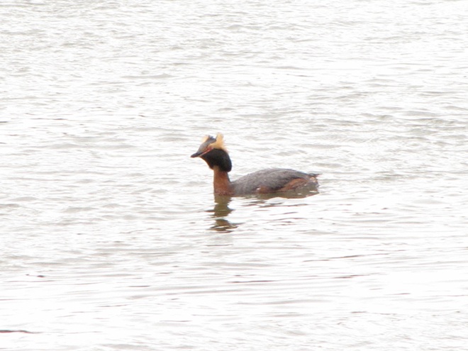
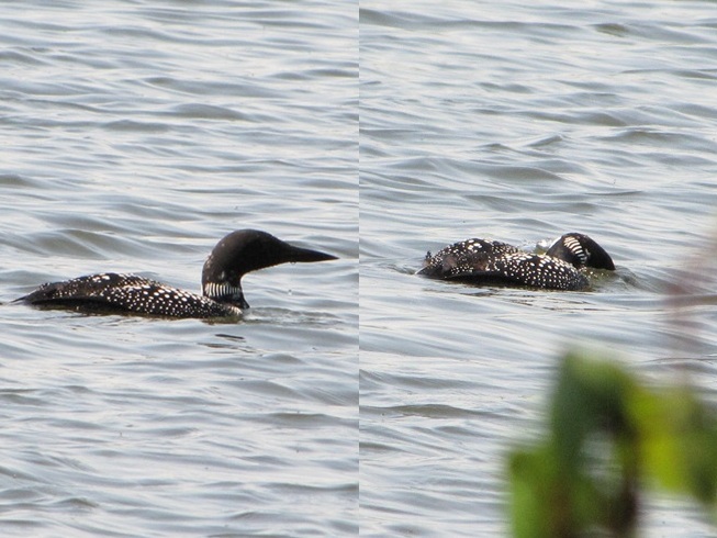
Horned Grebes are regular migrants and sometimes winter residents on ice-free stretches of the lower Susquehanna. They spend their time plying the benthic substrate of the river’s clear riffles and pools for a variety of invertebrates and small fish. Look for them moving north in coming days sporting this beautiful breeding plumage.April and early May are prime time for observing Common Loons on the Susquehanna as they undertake a journey from the Atlantic surf where they spent the winter to nesting sites on northern lakes. For this migrant in breeding plumage, clear water for sighting plenty of benthic life in the river’s riffles and pools assures a successful dive in search of energy-replenishing forage.
Soon after their arrival during the late 1600s, the earliest trans-Atlantic human migrants to settle the Lower Susquehanna River Watershed began the process of eliminating many of our largest native fish species. They started by extirpating nature’s steward of lowland streams and wetlands, the North American Beaver. The beaver’s meticulously maintained dams and fisheries-friendly pools were promptly replaced by man-made impoundments designed to permanently divert water for powering lumber and grain mills. Behind these structures, silt deposits accumulated as the forests were clear cut and the land subjected to highly erosive farming methods. Mill dams would eventually be located on nearly every mile of suitable low-gradient stream in the basin. Populations of native coldwater fishes including Brook Trout were quickly lost or left isolated in scattered headwaters.
With their navigation of creeks blocked by nearly impenetrable mill dams, seasonally migratory freshwater and anadromous fish were denied access to their traditional spawning waters. The latter then had their populations seriously depleted, and in some cases extirpated, following construction of hydroelectric dams on the lower Susquehanna during the first half of the twentieth century. The loss these latter species, including the herrings, Striped Bass, and sturgeons, all of which attain great size only because of their ability to make a sea run to access the year-round food energy available in the Atlantic, constitute a tremendous reduction in the numbers, variety, and mass of fish occurring in the river and its tributaries.
Add to these events the various sources of pollution entering the lower Susquehanna’s waterways during the intervening years including acid mine drainage, agricultural nutrients and sediments, stormwater runoff, untreated domestic and industrial sewage, illegal dumping, pesticides, etc., and one can easily understand how the watershed’s native fishery was lost as a commercial, food, and recreational resource.
Presently, the effort to restore populations of self-sustaining anadromous fishes to the lower Susquehanna is stalled due to the presence of introduced invasive species, particularly Northern Snakeheads, in the river’s waters below Conowingo Dam. Lifts that carry migrating fishes over the lower river’s hydroelectric dams during the spring run are shut down to avoid extending the range of the hoards of non-native snakeheads to waters upstream of their present location. Any translocation of anadromous fish must now be completed by manually separating desired species from among the invaders and loading them into a tank truck for transport to waters upstream of the dams. But Northern Snakeheads are currently so prevalent at Conowingo that they are overwhelming the lift used for collecting and sorting fish as well.
Any slight hope that had existed for a return of harvestable stocks of American Shad or other sea-run native species to the Susquehanna and its tributaries seems to be fading. And widespread improvements to water quality that would promote reestablishment of sustained populations of native coldwater fishes like Brook Trout are strictly a long-range goal.
Recreational anglers, however, still remain in the game—but their reward is a bit of a booby prize. To compensate fisherman for the loss of their quarry on the river and in streams, and to promote an interest in the fishing pastime and conserving waterways, the stocking of various species of “game fish” has been a continuous undertaking, particular since the middle decades of the twentieth century. Some of these introductions are planned, others, like the release of Northern Snakeheads, are unsanctioned and outright illegal. The one thing most introductions have in common is that they consist of hardy, aggressive, predatory fishes that are non-native species (or native transplants from watersheds such as the Mississippi). Their presence, especially in large concentrations and particularly during the time immediately following introduction, can have a deleterious impact on native stream inhabitants. Some introduced fish, the Flathead Catfish for example, are upon discovery deemed invasive species; others, like the Smallmouth Bass, escape such a label not because they lack negative impacts on stream communities and ecosystems, but because they have been present for extended periods of time and have thus been accepted as part of the local fishing culture.
Hatchery-raised Rainbow Trout stocked by the hundreds in a lower Susquehanna valley creek for angling. The Rainbow Trout is native to the streams and rivers of the Pacific coast of North America. An anadromous form is known as the “Steelhead”. These sea-run trout with access to marine food sources during their growth years attain more than twice the size of freshwater forms and acquire oversized hooked jaws before ascending waterways to spawn.
The creation of recreational fisheries comprised of introduced species has certainly helped maintain an interest in the fishing hobby and in the conservation of waterways. It has even been a driving force for spectacular restorations of streams that otherwise would have languished in an impaired condition with little in the way of diversity of species—native or non-native. As anglers, we are especially indebted to those who’ve devoted their time, energies, and, in some cases, a lot of money to projects that specifically seek to reestablish native waterways within the challenging landscape of the Lower Susquehanna River Watershed. With an eye on the future, perhaps now is a good time to join them and focus our passion for freshwater angling on steering fisheries management more toward the native ecosystems approach—quality instead of quantity.
In that spirit, here are three items we can add to our tackle boxes this season to be better fisheries conservationists, instead of our own worst enemies.
Lead-free Weights- Replace the lead in your tackle box with tungsten or other lead-free alternatives to eliminate the potential impact this poisonous metal can have on you and wildlife like waterfowl and Bald Eagles. Make a special effort to rid your inventory of small pieces of shot that can easily be ingested by animals as they feed. Realistic Lures- Add sport to your fishing by using artificial lures. Today’s selections include very realistic versions of native fishes, crayfish, frogs, and other aquatic creatures. Use these life-like imitations and you won’t need to harvest native minnows and other wildlife from populations that are already being subjected to negative impacts from stocked legions of predatory “game fish”. You’ll also eliminate the risk of introducing non-native bait species into your favorite fishing waters!Trash Bag- Always bring a trash bag and carry out your litter. Be especially vigilant about monofilament fishing line.Fishermen are their own worst enemies, so you’ll need to pick up after the other guy too. Show the landowners and land managers who are our hosts a little consideration.
Best of luck this fishing season. We hope your time outdoors will motivate you to get involved with efforts to keep your local waterways clean. You might even be inspired to assist with projects that are planned or currently underway in the Lower Susquehanna River Watershed to restore stream segments, wetlands, and floodplains. Many of these projects are grassroots efforts and they’d love to have your participation. Your local county conservation district can steer you towards an active restoration group near you. Give them a ring.
Hatchery-raised Rainbow Trout and a “Golden Rainbow Trout” stocked for anglers in a restored segment of a stream in Lebanon County, Pennsylvania. The “Golden Rainbow Trout”, also known as the “Banana Trout”, is a Rainbow Trout color variant developed through multi-generational selective breeding of offspring produced by crossing a typical male with a yellow-mottled female mutant discovered in a hatchery in West Virginia in 1955. Today, “Golden Rainbow Trout” breed true, golden males crossed with golden females yielding golden young. The less colorful “Palomino Rainbow Trout” is produced by crossing a “Golden Rainbow Trout” with a typical Rainbow Trout.
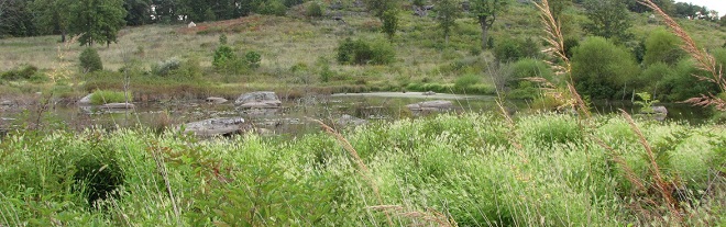
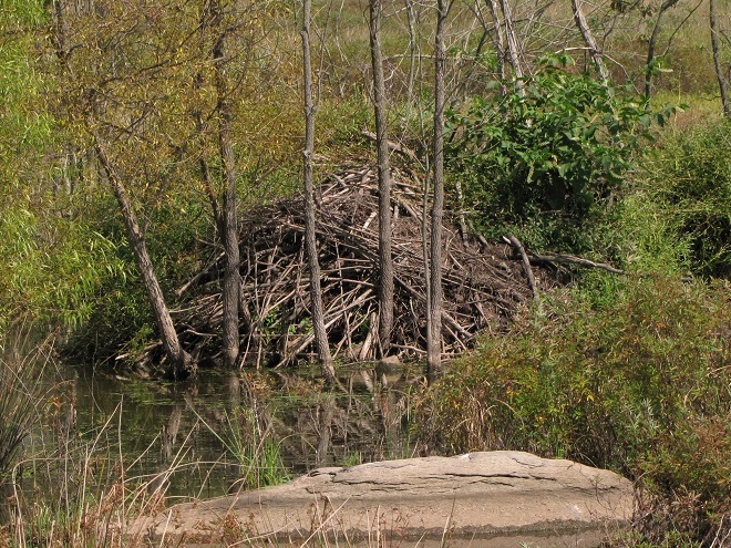
To pass the afternoon, we sat quietly along the edge of a pond, or more accurately a pool, created recently by North American Beavers (Castor canadensis). They first constructed their dam on this small stream about five years ago. Since then, a flourishing wetland has become established. Have a look.
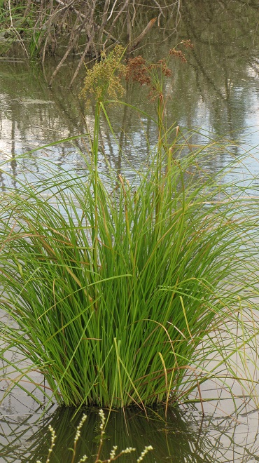
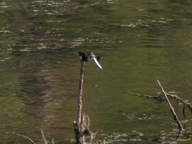
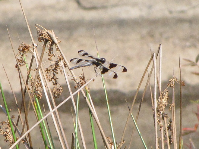
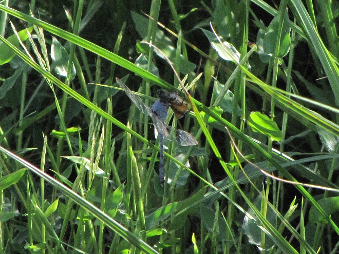
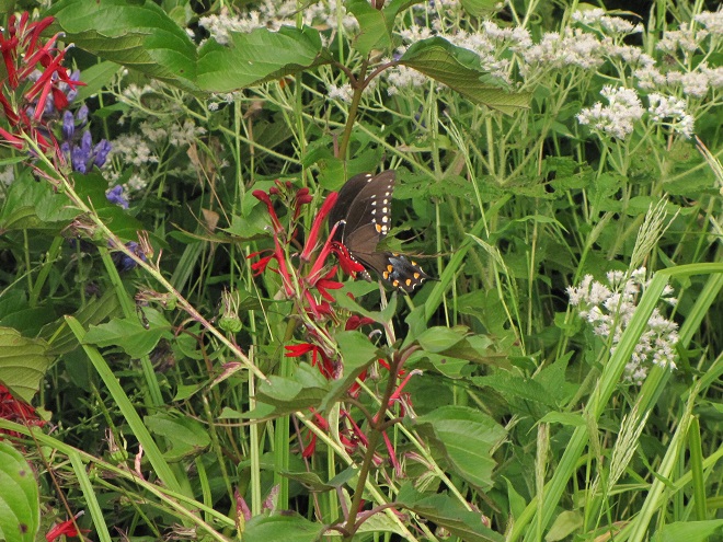
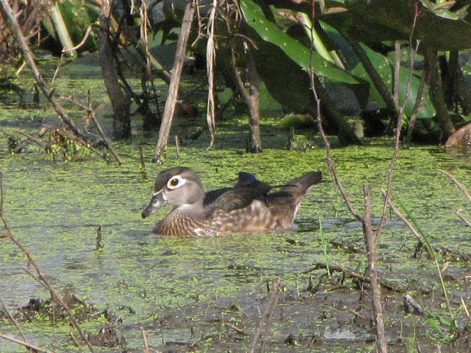
Vegetation surrounding the inundated floodplain helps sequester nutrients and sediments to purify the water while also providing excellent wildlife habitat.The beaver lodge was built among shrubs growing in shallow water in the middle of the pond.Woolgrass (Scirpus cyperinus) is a bulrush that thrives as an emergent and as a terrestrial plant in moist soils bordering the pond.A male Common Whitetail dragonfly keeping watch over his territory.A Twelve-spotted Skimmer perched on Soft Rush.A Blue Dasher dragonfly seizing a Fall Field Cricket (Gryllus pennsylvanicus).A Spicebush Swallowtail visiting a Cardinal Flower.A Green Heron looking for small fish, crayfish, frogs, and tadpoles.The Green Heron stalking potential prey.A Wood Duck feeding on the tiny floating plant known as Lesser Duckweed (Lemna minor).A Least Sandpiper poking at small invertebrates along the muddy edge of the beaver pool.A Solitary Sandpiper.A Solitary Sandpiper testing the waters for proper feeding depth.A Pectoral Sandpiper searches for its next morsel of sustenance.The Sora (Porzana carolina) is a seldom seen rail of marshlands including those created by North American Beavers. Common Cattails, sedges, and rushes provide these chicken-shaped wetland birds with nesting and loafing cover.
Isn’t that amazing? North American Beavers build and maintain what human engineers struggle to master—dams and pools that reduce pollution, allow fish passage, and support self-sustaining ecosystems. Want to clean up the streams and floodplains of your local watershed? Let the beavers do the job!
Along the lower Susquehanna, an unseasonably mild day in early spring can provide an observer with the opportunity to witness an annual spectacle seldom seen by the average visitor to the river—concentrations of dozens, sometimes hundreds, of turtles as they emerge from their winter slumber to bathe in the year’s first surge of warm air and sunshine.
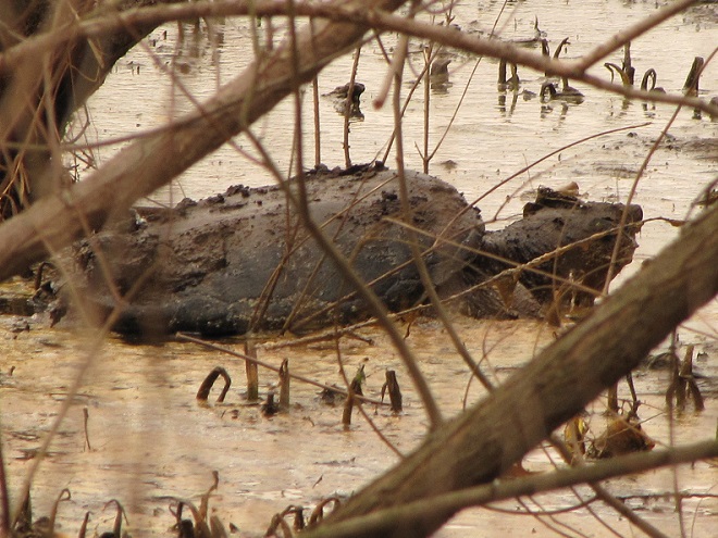
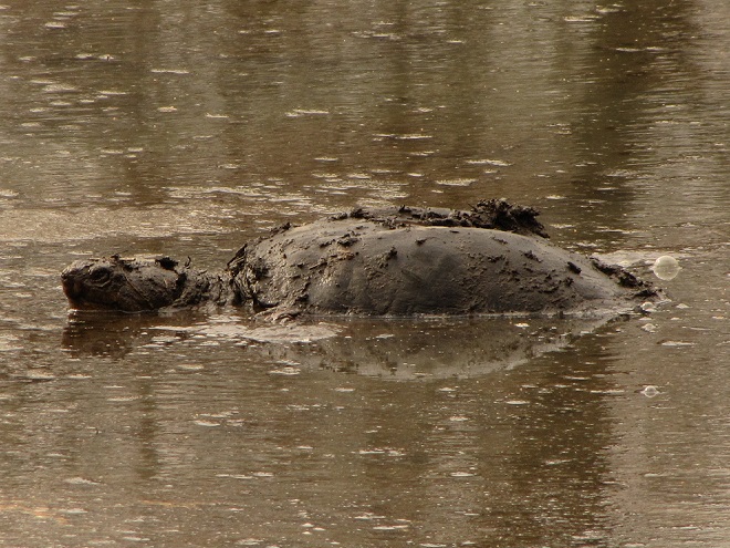
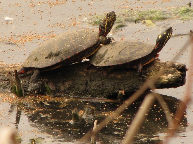
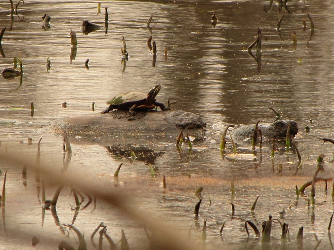
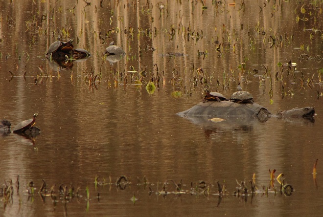
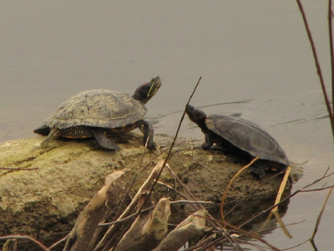
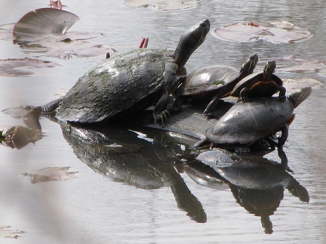
Snapping Turtles (Chelydra serpentina) spend the winter buried in mud along the river shoreline and in nearby Alluvial Terrace Wetlands. We photographed this one just as it was digging its way out.A cold and stiff Snapping Turtle crawls away from the shade toward sun-drenched shallows where it will have a chance to limber up.A cruise in open water loosens up the muscles and gets rid of some of the accumulations of sticky mud and muck.Freshly emerged Painted Turtles clamber onto a log to bask in the cloud-filtered sun.A Painted Turtle looking for a place to get out of the chilly water soon discovered the obvious solution.It’s catching on, more Painted Turtles atop a Snapping Turtle in an Alluvial Terrace Wetland.The Common Map Turtle (right) is the turtle most frequently observed basking on rocks and logs along the main stem of the Susquehanna. To the left is a Red-eared Slider (Trachemys scripta elegans), an increasingly numerous invasive species. The first Red-eared Sliders arrived in the river as, you guessed it, unwanted pets. Editor’s Note: Special thanks to the local North American Beaver (Castor canadensis) for trimming the trees and providing a clear shot for this photograph!And now, a quick quiz. Name the things that don’t belong in this picture? Here’s a hint: a non-native Red-eared Slider (left) joins indigenous Painted Turtles atop a discarded tire in an Alluvial Terrace Wetland in Dauphin County, Pennsylvania.