It’s tough being good-looking and liked by so many. You’ve got to watch out, because popularity makes you a target. Others get jealous and begin a crusade to have you neutralized and removed from the spotlight. They’ll start digging to find your little weaknesses and flaws, then they’ll exploit them to destroy your reputation. Next thing you know, people look at you as some kind of hideous scoundrel.
Today, bright afternoon sunshine and a profusion of blooming wildflowers coaxed butterflies into action. It was one of those days when you don’t know where to look first.
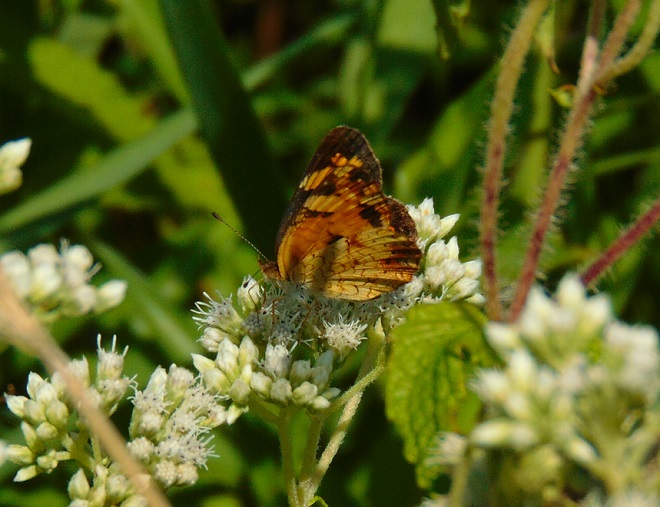
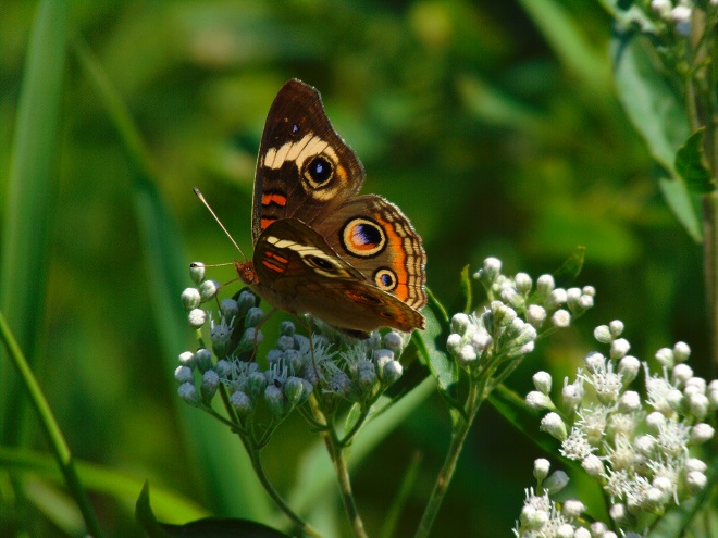
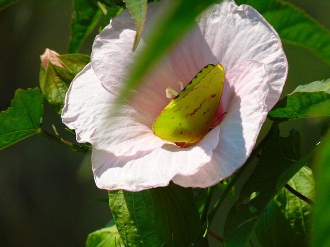
A Pearl Crescent (Phyciodes tharos) sipping nectar from Rough Boneset (Eupatorium pilosum) flowers. Asters (Aster) are the host plants for the larvae of this butterfly.A Common Buckeye (Junonia coenia) on Rough Boneset. Its caterpillars are known to feed on members of the Acanthus family, possibly including the Water Willow (Justicia americana) which is so abundant in Conewago Falls.Visitors from south of the Mason-Dixon Line arrived on the recent warm winds. Two Cloudless Sulphurs (Phoebis sennae) patrolled the Riverine Grasslands, especially near the stands of Partridge Pea, a possible host plant. One is seen here visiting a Halbred-leaved Rose Mallow blossom. These large yellow butterflies are always a standout.
Purple Loosestrife (Lythrum salicaria) has a bad reputation. Not native to the Americas, this prolific seed producer began spreading aggressively into many wetlands following its introduction. It crowds out native plant species and can have a detrimental impact on other aquatic life. Stands of loosestrife in slow-moving waters can alter flows, trap sediment, and adversely modify the morphology of waterways. Expensive removal and biological control are often needed to protect critical habitat.
The dastardly Purple Loosestrife may have only two positive attributes. First, it’s a beautiful plant. And second, it’s popular; butterflies and other pollinators find it to be irresistible and go wild over the nectar.
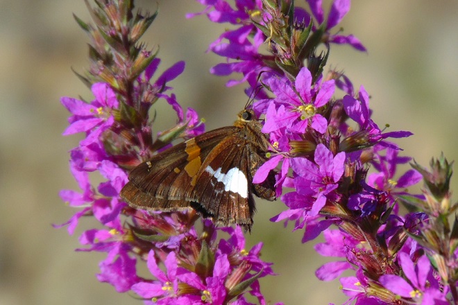
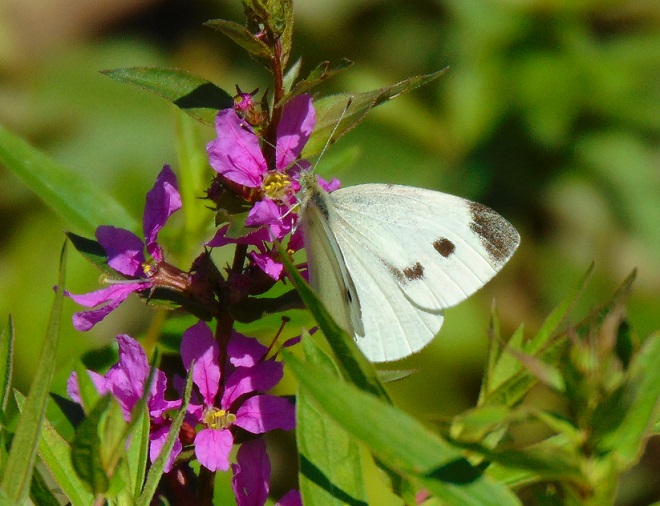
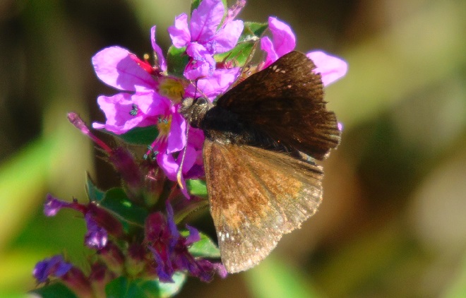
A Silver-spotted Skipper (Epargyreus clarus) feeding on Purple Loosestrife nectar. The host plants for this common butterfly’s caterpillars are a wide variety of Legumes.A Cabbage White (Pieris rapae), a butterfly introduced from Europe in the 1800s, feeds on introduced Purple Loosestrife.A Wild Indigo Duskywing (Erynnis baptisiae) feeding on Purple Loosestrife. This butterfly has expanded its population and range by using the introduced Crown Vetch as a host plant.
Don’t you just adore the wonderful butterflies. Everybody does. Just don’t tell anyone that they’re pollinating those dirty filthy no-good Purple Loosestrife plants.
SOURCES
Brock, Jim P., and Kenn Kaufman. 2003. Butterflies of North America. Houghton Mifflin Company. New York.
Newcomb, Lawrence. 1977. Newcomb’s Wildflower Guide. Little, Brown and Company. Boston, Massachusetts.
The tall seed-topped stems swaying in a summer breeze are a pleasant scene. And the colorful autumn shades of blue, orange, purple, red, and, of course, green leaves on these clumping plants are nice. But of the multitude of flowering plants, Big Bluestem, Freshwater Cordgrass, and Switchgrass aren’t much of a draw. No self-respecting bloom addict is going out of their way to have a gander at any grass that hasn’t been subjugated and tamed by a hideous set of spinning steel blades. Grass flowers…are you kidding?
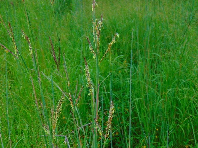
Big Bluestem in flower in the Riverine Grasslands at Conewago Falls.
O.K., so you need something more. Here’s more.
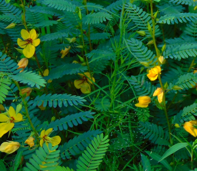
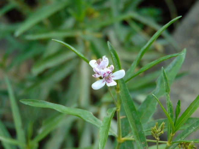
Meet the Partridge Pea (Chamaecrista fasciculata). It’s an annual plant growing in the Riverine Grasslands at Conewago Falls as a companion to Big Bluestem. It has a special niche growing in the sandy and, in summertime, dry soils left behind by earlier flooding and ice scour. The divided leaves close upon contact and also at nightfall. Bees and other pollinators are drawn to the abundance of butter-yellow blossoms. Like the familiar pea of the vegetable garden, the flowers are followed by flat seed pods.
The Partridge Pea can tolerate dry sandy soils.
But wait, here’s more.
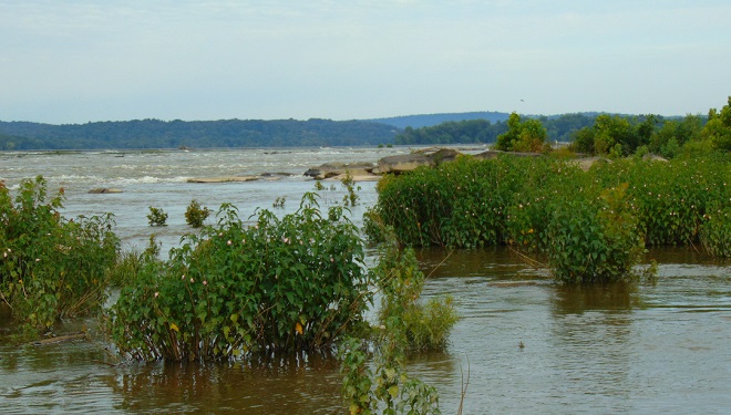
In addition to its abundance in Conewago Falls, the Halberd-leaved Rose Mallow (Hibiscus laevis) is the ubiquitous water’s edge plant along the free-flowing Susquehanna River for miles downstream. It grows in large clumps, often defining the border between the emergent zone and shore-rooted plants. It is particularly successful in accumulations of alluvium interspersed with heavier pebbles and stone into which the roots will anchor to endure flooding and scour. Such substrate buildup around the falls, along mid-river islands, and along the shores of the low-lying Riparian Woodlands immediately below the falls are often quite hospitable to the species.
Halberd-leaved Rose Mallow is a durable inhabitant of the falls. Regular flooding keeps competing species at bay. A taproot helps to safeguard against dislocation, allowing plants to grow in places subjected to turbulent currents.Halberd-leaved Rose Mallow in bloom. The similarity to cultivated members of the Hibiscus genus can readily be seen. It is one of the showiest of perennial wildflowers in the floodplain. Note the lobed, halberd-shaped leaves, source of its former species name militaris.The seeds of Halberd-leaved Rose Mallow are contained in bladders which can float to assist in their distribution. Some of these bladders cling to the dead leafless stems in winter, making it an easy plant to identify in nearly any season.
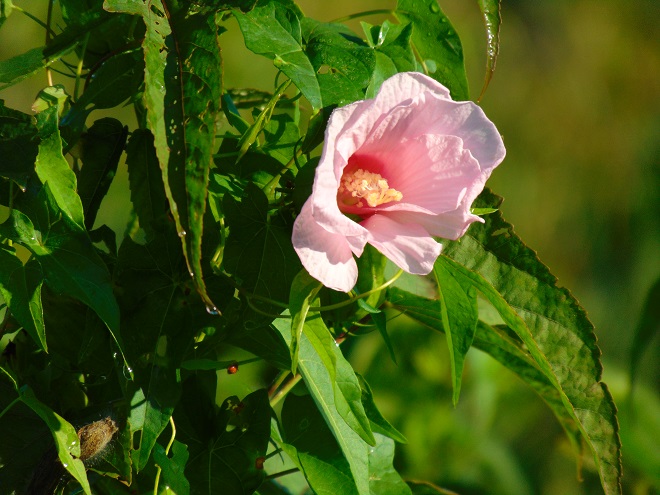
A second native wildflower species in the genus Hibiscus is found in the Conewago Falls floodplain, this one in wetlands. The Swamp Rose Mallow (H. moscheutos) is similar to Halberd-leaved Rose Mallow, but sports more variable and colorful blooms. The leaves are toothed without the deep halberd-style lobes and, like the stems, are downy. As the common name implies, it requires swampy habitat with ample water and sunlight.
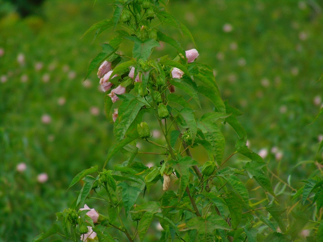
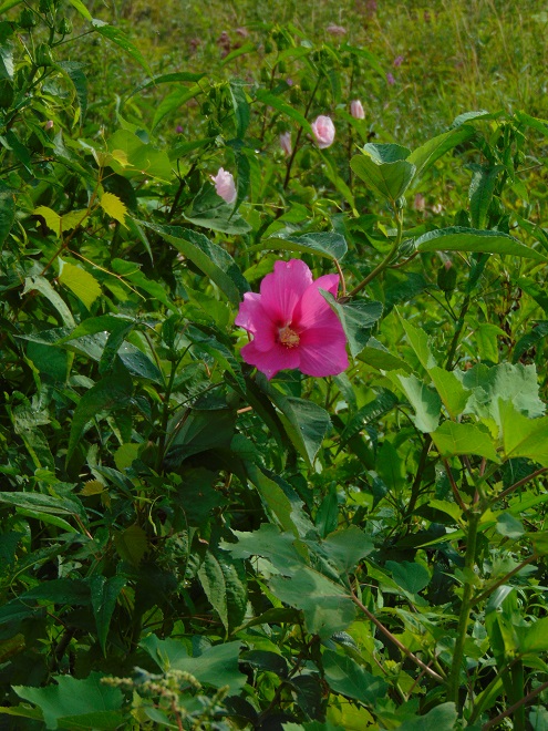
Swamp Rose Mallow in a sunny wetland. This variety with solid-colored flowers (without dark centers) and pale green leaves and stems was formerly known as a separate species of Swamp Rose Mallow, H. palustris. Note that the flowers are terminal on the stems.A few scattered specimens of a more typical variety of Swamp Rose Mallow are found on the shoreline and in the Riverine Grasslands of Conewago Falls. The blooms are bright pink with darker centers and the leaf stems are robust and reddish. This one is seen growing among Halberd-leaved Rose Mallow, with which it shares the characteristic of having flower stems growing from some of the upper leaf axils. A variety with red-centered white flowers is often found throughout the plant’s range.
In summary, we find Partridge Pea in the Riverine Grasslands growing in sandy deposits left by flood and ice scour. We find Halberd-leaved Rose Mallow rooted at the border between shore and the emergent zone. We find Swamp Rose Mallow as an emergent in the wetlands of the floodplain. And finally, we find marshmallows in only one location in the area of Conewago Falls. Bon ap’.
Here’s S’more
SOURCES
Newcomb, Lawrence. 1977. Newcomb’s Wildflower Guide. Little, Brown and Company. Boston, Massachusetts.
It has not been a good summer if you happen to be a submerged plant species in the lower Susquehanna River. Regularly occurring showers and thunderstorms have produced torrents of rain and higher than usual river stages. The high water alone wouldn’t prevent you from growing, colonizing a wider area, and floating several small flowers on the surface, however, the turbidity, the suspended sediment, would. The muddy current casts a dirty shadow on the benthic zone preventing bottom-rooted plants from getting much headway. There will be smaller floating mats of the uppermost leaves of these species. Fish and invertebrates which rely upon this habitat for food and shelter will find sparse accommodation…better luck next year.
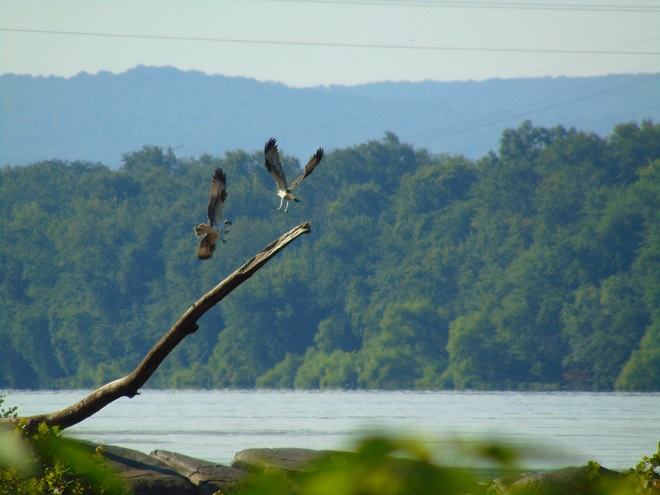
Due to the dirty water, fish-eating birds are having a challenging season as they try to catch sufficient quantities of prey to feed themselves and their offspring. A family of Ospreys (Pandion haliaetus) at Conewago Falls, including recently fledged young, were observed throughout this morning and had no successful catches. Of the hundred or more individual piscivores of various species present, none were seen retrieving fish from the river. The visibility in the water column needs to improve before fishing is a viable enterprise again.
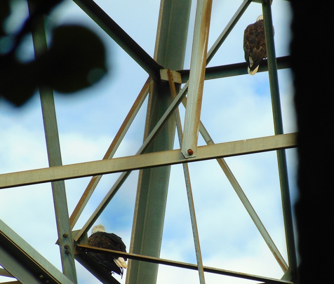
Ospreys competing for a suitable fishing perch. Improving water conditions in the coming week should increase their success as predators.Versatile at finding food, adult Bald Eagles are experienced and know to be on the lookout for Ospreys with fish, a meal they can steal through intimidation.
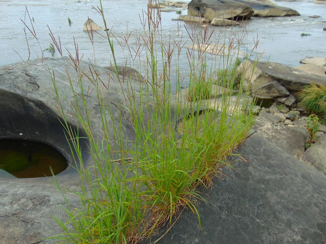
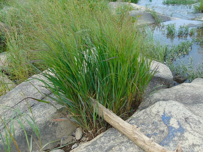
While the submerged plant communities may be stunted by 2017’s extraordinary water levels, there is a very unique habitat in Conewago Falls which endures summer flooding and, in addition, requires the scouring effects of river ice to maintain its mosaic of unique plants. It is known as a Riverine Grassland or scour grassland.
The predominant plants of the Riverine Grasslands are perennial warm-season grasses. The deep root systems of these hardy species have evolved to survive events which prevent the grassland from reverting to woodland through succession. Fire, intense grazing by wild herd animals, poor soils, drought, and other hardships, including flooding and ice scour, will eliminate intolerant plant species and prevent an area from reforesting. In winter and early spring, scraping and grinding by flood-driven chunk ice mechanically removes large woody and poorly rooted herbaceous growth from susceptible portions of the falls. These adverse conditions clear the way for populations of species more often associated with North America’s tall grass prairies to take root. Let’s have a look at some of the common species found in the “Conewago Falls Pothole Rocks Prairie”.
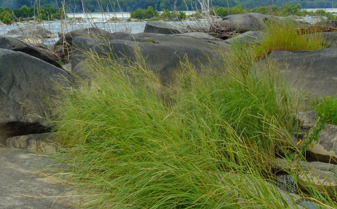
Big Bluestem (Andropogon gerardi), seen heregrowing in the cracks of a pothole rock. High water nourishes the plant by filling the crevices with nutrient-loaded sediment. This species evolved with roots over three feet deep to survive fires, trampling by bison, and drought.Freshwater Cordgrass (Spartina pectinata) does well with its roots in water. It creates exceptional bird habitat and grows in the falls and on ice-scoured small islands in free-flowing segments of the Susquehanna River downstream.Switchgrass (Panicum virgatum), like Big Bluestem, is one of the tall grass prairie species and, like Freshwater Cordgrass, grows in near pure stands on ice-scoured islands. It takes flooding well and its extensive root system prevents erosion.Though not a grass, Water Willow (Justicia americana) is familiar as a flood-enduring emergent plant of river islands, gravel bars, and shorelines where its creeping rhizome root system spreads the plant into large masses. These stands are often known locally as “grass beds”. This member of the acanthus family provides habitat for fish and invertebrates among its flooded leaves and stems. Its presence is critical to aquatic life in a year such as this.
The Conewago Falls Riverine Grassland is home to numerous other very interesting plants. We’ll look at more of them next time.
SOURCES
Brown, Lauren. 1979. Grasses, An Identification Guide. Houghton Mifflin Company. New York, NY.
She ate only toaster pastries…that’s it…nothing else. Every now and then, on special occasions, when a big dinner was served, she’d have a small helping of mashed potatoes, no gravy, just plain, thank you. She received all her nutrition from several meals a week of macaroni and cheese assembled from processed ingredients found in a cardboard box. It contains eight essential vitamins and minerals, don’t you know? You remember her, don’t you?
Adult female butterflies must lay their eggs where the hatched larvae will promptly find the precise food needed to fuel their growth. These caterpillars are fussy eaters, with some able to feed upon only one particular species or genus of plant to grow through the five stages, the instars, of larval life. The energy for their fifth molt into a pupa, known as a chrysalis, and metamorphosis into an adult butterfly requires mass consumption of the required plant matter. Their life cycle causes most butterflies to be very habitat specific. These splendid insects may visit the urban or suburban garden as adults to feed on nectar plants, however, successful reproduction relies upon environs which include suitable, thriving, pesticide-free host plants for the caterpillars. Their survival depends upon more than the vegetation surrounding the typical lawn will provide.
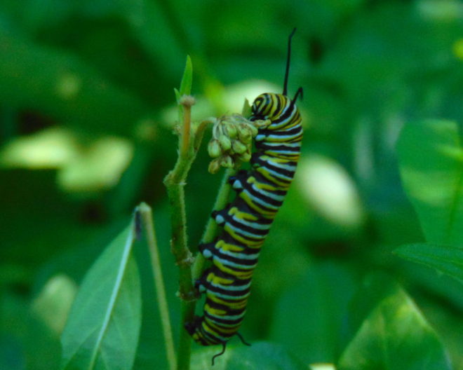
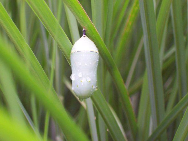
The Monarch (Danaus plexippus), a butterfly familiar in North America for its conspicuous autumn migrations to forests in Mexico, uses the milkweeds (Asclepias) almost exclusively as a host plant. Here at Conewago Falls, wetlands with Swamp Milkweed (Asclepias incarnata) and unsprayed clearings with Common Milkweed (A. syriaca) are essential to the successful reproduction of the species. Human disturbance, including liberal use of herbicides, and invasive plant species can diminish the biomass of the Monarch’s favored nourishment, thus reducing significantly the abundance of the migratory late-season generation.
Monarch caterpillar after a fourth molt. The fifth instar feeding on Swamp Milkweed.A fifth molt begets the Monarch pupa, the chrysalis, from which the showy adult butterfly will emerge.Adult Monarch feeding on Goldenrod (Solidago) nectar.
Butterflies are good indicators of the ecological health of a given environment. A diversity of butterfly species in a given area requires a wide array of mostly indigenous plants to provide food for reproduction. Let’s have a look at some of the species seen around Conewago Falls this week…
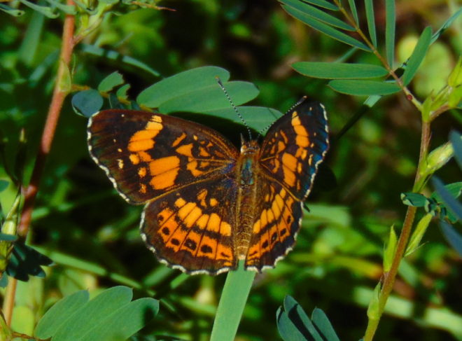
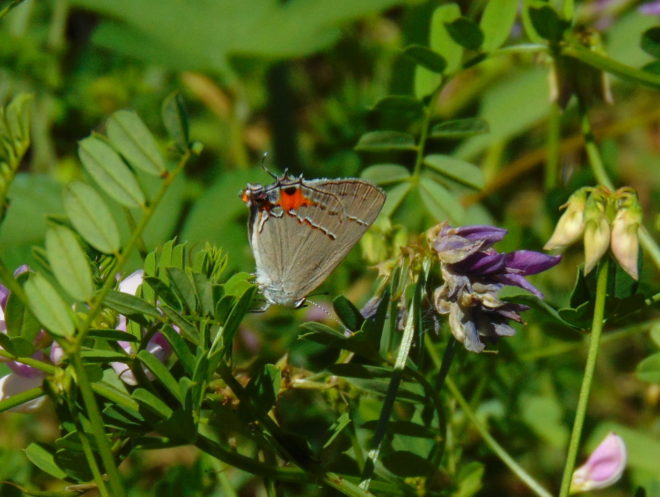
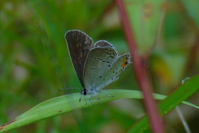
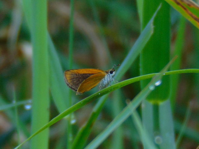
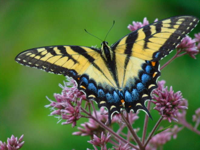
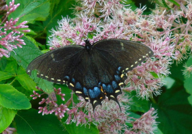
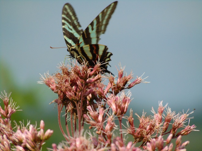
An adult Silvery Checkerspot (Chlosyne nycteis) visiting a nectar plant, Partridge Pea (Chamaecrista fasciculata). Wingstem (Verbesina alternifolia), a plant of the Riparian Woodlands, is among the probable hosts for the caterpillars.A Gray Hairstreak (Strymon melinus) visits Crown Vetch, a possible host plant. Other potential larval food in the area includes Partridge Pea, Halberd-leaved Rose Mallow (Hibiscus laevis) of the river shoreline, and Swamp Rose Mallow (Hibiscus moscheutos), a plant of wetlands.The Eastern Tailed Blue (Cupido comyntas) may use Partridge Pea , a native wildflower species, and the introduced Crown Vetch (Securigera/Coronilla varia) as host and nectar plants at Conewago Falls.The Least Skipper (Ancyloxypha numitor) is at home among tall grasses in woodland openings, at riverside, and in the scoured grassland habitat of the Pothole Rocks in the falls. Host plants available include Switchgrass (Panicum vigatum), Freshwater Cordgrass (Spartina pectinata), and Foxtails (Setaria).The Zabulon Skipper (Poanes zabulon) is an inhabitant of moist clearings where the caterpillars may feed upon Lovegrasses (Eragrostis) and Purpletop (Tridens flavus).The Eastern Tiger Swallowtail (Papilio glaucus), a female seen here gathering nectar from Joe-Pye Weed (Eutrochium), relies upon several forest trees as hosts. Black Cherry (Prunus serotina), Willow (Salix), Yellow Poplar (Liriodendron tulipifera), also known as Tuliptree, and Green Ash (Fraxinus pennsylvanica) are among the local species known to be used. The future of the latter food species at Conewago Falls is doubtful. Fortunately for the Eastern Tiger Swallowtail, the “generalist” feeding requirements of this butterfly’s larvae enable the species to survive the loss of a host plant.A female Eastern Tiger Swallowtail, black morph, gathering nectar from Joe-Pye Weed.The Zebra Swallowtail (Protographium marcellus), an adult seen here on Joe-Pye Weed, feeds exclusively upon Pawpaw (Asimina) trees as a caterpillar. This butterfly species may wander, but its breeding range is limited to the moist Riparian Woodlands where colonial groves of Pawpaw may be found. The Common Pawpaw (Asimina triloba), our native species in Pennsylvania, and the Zebra Swallowtail occur at the northern edge of their geographic ranges in the Lower Susquehanna River Watershed. Planting Pawpaw trees as an element of streamside reforestation projects certainly benefits this marvelous butterfly.
The spectacularly colorful butterflies are a real treat on a hot summer day. Their affinity for showy plants doubles the pleasure.
By the way, I’m certain by now you’ve recalled that fussy eater…and how beautiful she grew up to be.
SOURCES
Brock, Jim P., and Kaufman, Kenn. 2003. Butterflies of North America. Houghton Mifflin Company. New York, NY.
It was one of the very first of my memories. From the lawn of our home I could look across the road and down the hill through a gap in the woodlands. There I could see water, sometimes still with numerous boulders exposed, other times rushing, muddy, and roaring. Behind these waters was a great stone wall and beyond that a wooded hillside. I recall my dad asking me if I could see the dam down there. I couldn’t see a dam, just fascinating water and the gray wall behind it. I looked and searched but not a trace of a structure spanning the near to far shore was to be seen. Finally, at some point, I answered in the affirmative to his query; I could see the dam…but I couldn’t.
We lived in a small house in the village of Falmouth along the Susquehanna River in the northwest corner of Lancaster County over fifty years ago. A few years after we had left our riverside domicile and moved to a larger town, the little house was relocated to make way for an electric distribution sub-station and a second set of electric transmission wires in the gap in the woodlands. The Brunner Island coal-fired electric generating station was being upgraded downstream and, just upstream, a new nuclear-powered generating station was being constructed on Three Mile Island. To make way for the expanding energy grid, our former residence was trucked to a nearby boat landing where there were numerous other river shacks and cabins. Because it was placed in the floodplain, the building was raised onto a set of wooden stilts to escape high water. It didn’t help. The record-breaking floods of Hurricane Agnes in June of 1972 swept the house away.
The view through the cut in the woodland, a little wider than in the early 1960s with the addition of the newer electric transmission wire towers. The “Wall” is the same.
During the time we lived along the Susquehanna, the river experienced record-low flow rates, particularly in the autumn of 1963 and again in 1964. My dad was a dedicated 8mm home-movie photographer. Among his reels was film of buses parked haphazardly along the road (PA Route 441 today) near our home. Sightseers were coming to explore the widely publicized dry riverbed and a curious moon-like landscape of cratered rocks and boulders. It’s hard to fathom, but people did things like that during their weekends before Sunday-afternoon football was invented. Scores of visitors climbed through the rocks and truck-size boulders inspecting this peculiar scene. My dad, his friends, and so many others with camera in hand were experiencing the amazing geological feature known as the Pothole Rocks of Conewago Falls.
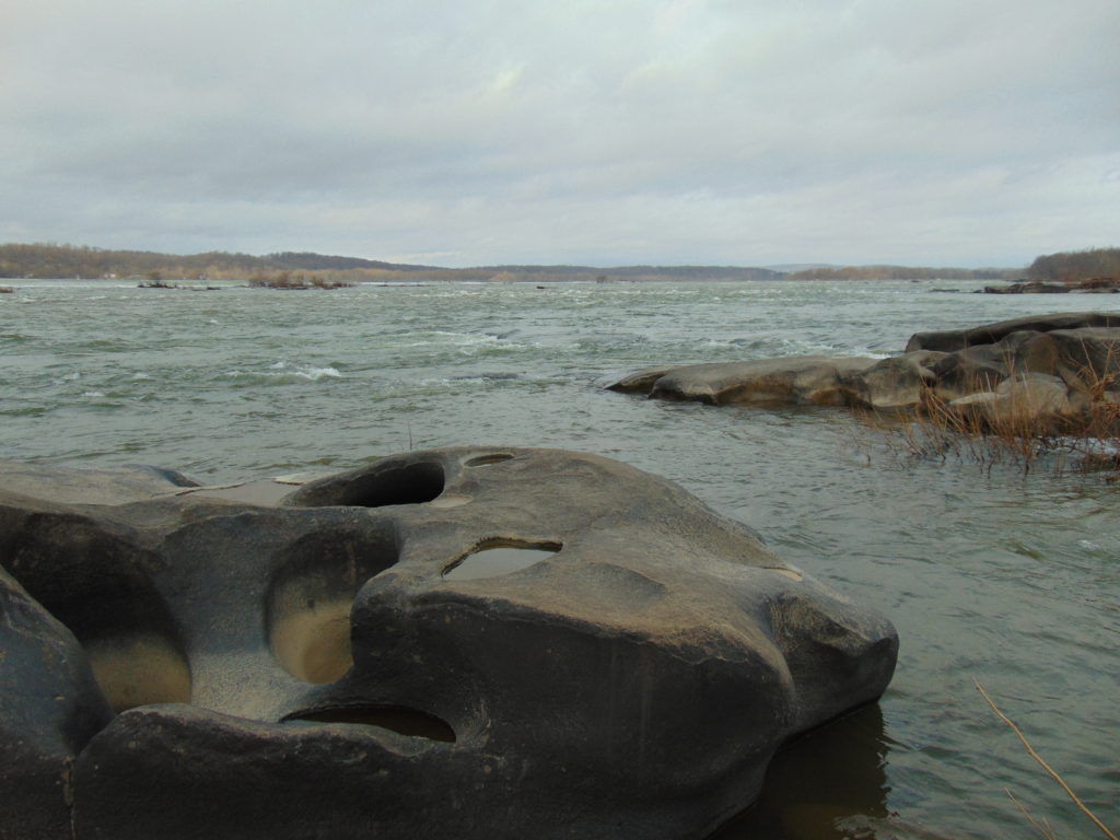
Conewago Falls on the Susquehanna River and several exposed York Haven Diabase Pothole Rocks. Lancaster (foreground) and Dauphin (center) Counties meet along a southwest to northeast borderline through the rapids. Lands on the west shoreline in the background are in York County. Three Mile Island is seen in the upper right.
The river here meets serious resistance as it pushes its way through the complex geology of south-central Pennsylvania. These hard dark-gray rocks, York Haven Diabase, are igneous in origin. Diabase sheets and sills intruded the Triassic sediments of the Gettysburg Formation here over 190 million years ago. It may be difficult to visualize, but these sediments were eroded from surrounding mountains into the opening rift valley we call the Gettysburg Basin. This rift and others in a line from Nova Scotia to Georgia formed as the supercontinent Pangaea began dividing into the continents we know today. Eventually the Atlantic Ocean rift would dominate as the active dynamic force and open to separate Africa from North America. The inactive Gettysburg Basin, filled with sediments and intruded by igneous diabase, would henceforth, like the mountainous highlands surrounding it, be subjected to millions of years of erosion. Of the regional rocks, the formations of Triassic redbeds, sandstones, and particularly diabase in the Gettysburg Basin are among the more resistant to the forces of erosion. Many less resistant older rocks, particularly those of surrounding mountains, are gone. Today, the remains of the Gettysburg Basin’s rock formations stand as rolling highlands in the Piedmont Province.
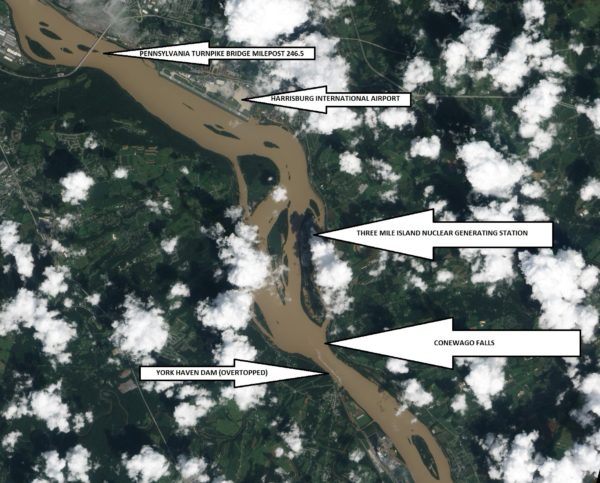
Flooded from the heavy rains of Tropical Storm Lee, the sediment-laden Susquehanna River flows through the Gettysburg Basin just south of Harrisburg, PA, September 10, 2011. The “Wall” as seen from space. (NASA Earth Observatory Image)
The weekend visitors in 1963 and 1964 marveled at evidence of the river’s fight to break down the hard York Haven Diabase. Scoured bedrock traced the water’s turbulent flow patterns through the topography of the falls. Meltwater from the receding glaciers of the Pleistocene Ice Ages thousands to tens of thousands of years ago raged in high-volume, abrasive-loaded torrents to sculpt the Pothole Rocks into the forms we see today. Our modern floodwaters with ice and fine suspended sediments continue to wear at the smooth rocks and boulders, yet few are broken or crumbled to be swept away. It’s a very slow process. The river elevation here drops approximately 19 feet in a quarter of a mile, a testament to the bedrock’s persisting resistance to erosion. Conewago Falls stands as a natural anomaly on a predominantly uniform gradient along the lower Susquehanna’s downhill path from the Appalachian Mountains to the Chesapeake Bay.
Normally the scene of dangerous tumbling rapids, the drought and low water of 1963 and 1964 had left the falls to resemble a placid scene—a moonscape during a time when people were obsessed with mankind’s effort to visit earth’s satellite. Visitors saw the falls as few others had during the twentieth century. Dr. Herbert Beck of Franklin and Marshall College described an earlier period of exposure, “…pot holes…were uncovered during the third week in October, 1947, for the first time in the memory of man, when the drought parched Susquehanna River retreated far below its normal low stage”. Then, as in 1963 and on occasions more recent, much of it was due to the presence of the wall. I had to be a bit older than four years old to grasp it. You see the wall and the dam are one and the same. The wall is the York Haven Dam. And it is responsible for channeling away the low flow of the Susquehanna during periods of drought so that we might have the opportunity to visit and explore the Pothole Rocks of Conewago Falls along the river’s east shore.
The initial segment of the dam, a crib structure built in 1885 by the York Haven Paper Company to supply water power to their mill, took advantage of the geomorphic features of the diabase bedrock of Conewago Falls to divert additional river flow into the abandoned Conewago Canal. The former canal, opened in 1797 to allow passage around the rapids along the west shore, was being used as a headrace to channel water into the grinding mill’s turbines. Strategic placement of this first wall directed as much water as possible toward the mill with the smallest dam practicable. The York Haven Power Company incorporated the paper mill’s crib dam into the “run-of-the-river” dam built through the falls from the electric turbine powerhouse they constructed on the west shore to the southern portion of Three Mile Island more than a mile away. The facility began electric generation in 1904. The construction of the “Red Hill Dam” from the east shore of Three Mile Island to the river’s east shore made York Haven Dam a complete impoundment on the Susquehanna. The pool, “Lake Frederic”, thus floods that portion of the Pothole Rocks of Conewago Falls located behind the dam. On the downstream side, water spilling over or through the dam often inundates the rocks or renders them inaccessible.
During the droughts of the early 1960s, diversion of nearly all river flow to the York Haven Dam powerhouse cleared the way for weekend explorers to see the Pothole Rocks in detail. Void of water, the intriguing bedrock of Conewago Falls below the dam greeted the curious with its ripples, cavities, and oddity. It was an opportunity nature alone would not provide. It was all because of the wall.
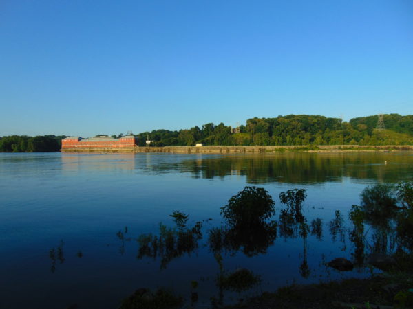
York Haven Dam and powerhouse. The “Wall” traverses Conewago Falls upstream to Three Mile Island to direct water to the powerhouse on the west shore of the Susquehanna River.
SOURCES
Beck, Herbert H. 1948. “The Pot Holes of Conewago Falls”. Proceedings of the Pennsylvania Academy of Science. Penn State University Press. 22: pp. 127-130.
Smith, Stephen H. 2015. #6 York Haven Paper Company; on the Site of One of the Earliest Canals in America. York Past website www.yorkblog.com/yorkpast/2015/02/17/6-york-haven-paper-company-on-the-site-of-one-of-the-earliest-canals-in-america/ as accessed July 17, 2017.
Stranahan, Susan Q. 1993. Susquehanna, River of Dreams. The Johns Hopkins University Press. Baltimore, Maryland.
Van Diver, Bradford B. 1990. Roadside Geology of Pennsylvania. Mountain Press Publishing Company. Missoula, Montana.