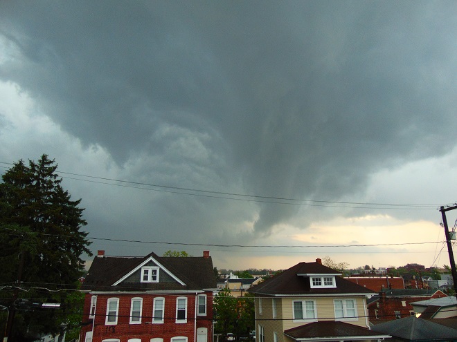
Severe thunderstorms with hail, torrential rain, and flooding passed through the lower Susquehanna valley this evening. The National Weather Service in State College issued a warning for a radar-indicated tornado shown crossing the Susquehanna River downstream of Conewago Falls at 6:55 P.M. E.D.T. The rascal revealed itself about ten minutes later.
At 7:05 P.M. E.D.T., this tornado descended to within 500 to 1000 feet of ground level six miles east of Conewago Falls above Elizabethtown in Lancaster County. There was strong rotation in the warm updraft (seen above the red house) and a short-lived cool downdraft descending toward the ground (dark cloud mass above the tan-colored house). Fortunately, prior to getting wrapped up tight, the consolidating vortex dissipated and the clouds retreated skyward while the storm continued to the east.
The staff at a retirement community west of Elizabethtown was on the alert and had the fortitude to quickly sound a warning siren. It was howling away as this image was taken. What could have been a disaster was instead a spectacular close call.
If you were a regular visitor to this website during the autumn of 2017, you will recall the proliferation of posts detailing the bird migration at Conewago Falls during the season. The lookout site among the Pothole Rocks remained high and dry for most of the count’s duration.
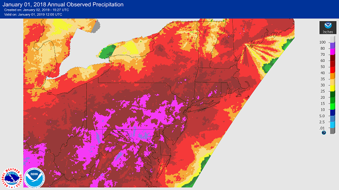
In the fall of 2018, those lookout rocks were never to be seen. There was to be no safe perch for a would-be observer. There was no attempt to conduct a tally of passing migrants. If you live in the lower Susquehanna River drainage basin, you know why—rain—record setting rain.
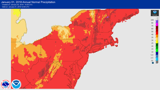
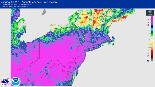
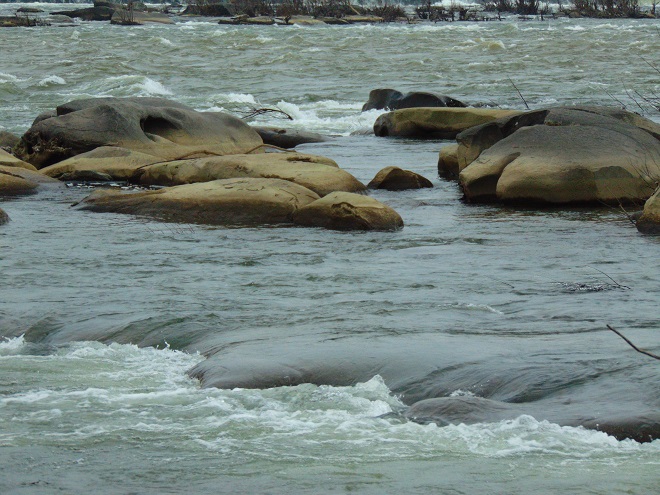
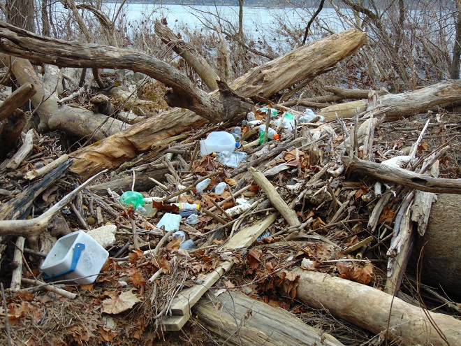
Annual precipitation during 2018 as indicated by radar. Note the extensive areas in pink. They received in excess of 70 inches of precipitation during 2018, much of it during the second half of the year. (NOAA/National Weather Service image)Average annual rainfall. Most of the lower Susquehanna drainage basin receives an average of just over 40 inches of rain each year. (NOAA/National Weather Service image)Departure from normal annual precipitation totals. Note the extensive areas of greater than 20 inches of precipitation above normal (pink). Severe flooding occurred on many streams during numerous events throughout the second half of 2018. Note the closer to normal totals in central New York in the upper Susquehanna watershed. The lesser amounts of rain there and the localized pattern of the flooding events in Pennsylvania prevented the main stem of the lower Susquehanna from experiencing catastrophic high water in 2018. (NOAA/National Weather Service image) Though there has been no severe flooding, frequent rain events in the Susquehanna watershed have maintained persistently high river levels in Conewago Falls. Pothole Rocks seen here on December 9 during an ebb in the flow were soon inundated again as rains fell in the Susquehanna basin upstream. Of course, each time the river receded it left behind a fresh pile of plastic garbage. What didn’t end up on the shoreline found its way to Chesapeake Bay…then on to the Atlantic. Is that your cooler?
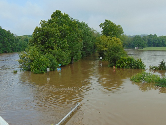
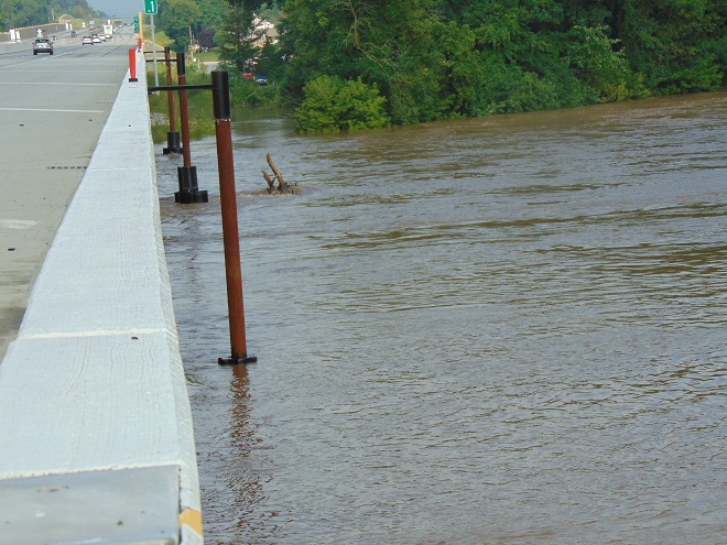
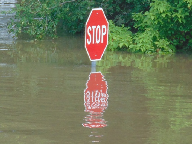
It was a routine occurrence in many communities along tributaries of the lower Susquehanna River during the most recent two months. The rain falls like it’s never going to stop—inches an hour. Soon there is flash flooding along creeks and streams. Roads are quickly inundated. Inevitably, there are motorists caught in the rising waters and emergency crews are summoned to retrieve the victims. When the action settles, sets of saw horses are brought to the scene to barricade the road until waters recede. At certain flood-prone locations, these events are repeated time and again. The police, fire, and Emergency Medical Services crews seem to visit them during every torrential storm—rain, rescue, rinse, and repeat.
We treat our local streams and creeks like open sewers. Think about it. We don’t want rainwater accumulating on our properties. We pipe it away and grade the field, lawn, and pavement to roll it into the neighbor’s lot or into the street—or directly into the waterway. It drops upon us as pure water and we instantly pollute it. It’s a method of diluting all the junk we’ve spread out in its path since the last time it rained. A thunderstorm is the big flush. We don’t seem too concerned about the litter, fertilizer, pesticides, motor fluids, and other consumer waste it takes along with it. Out of sight, out of mind.
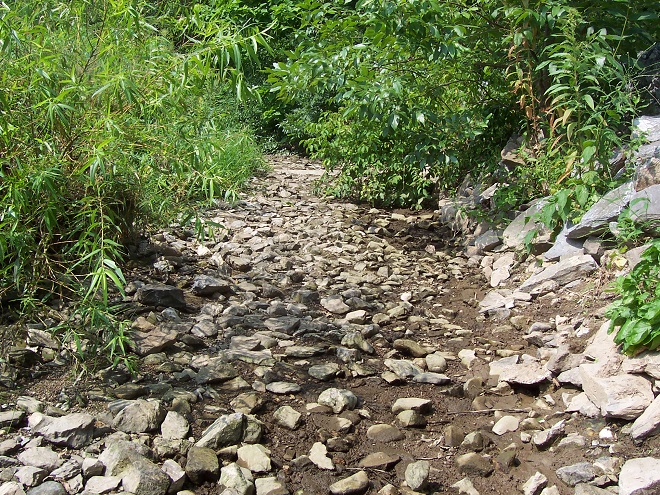
Failure to retain and infiltrate stormwater to recharge aquifers can later result in well failures and reduced base flow in streams. (Conoy Creek’s dry streambed in June, 2007)
Perhaps our lack of respect for streams and creeks is the source of our complete ignorance of the function of floodplains.
Floodplains are formed over time as hydraulic forces erode bedrock and soils surrounding a stream to create adequate space to pass flood waters. As floodplains mature they become large enough to reduce flood water velocity and erosion energy. They then function to retain, infiltrate, and evaporate the surplus water from flood events. Microorganisms, plants, and other life forms found in floodplain wetlands, forests, and grasslands purify the water and break down naturally-occurring organic matter. Floodplains are the shock-absorber between us and our waterways. And they’re our largest water treatment facilities.
Why is it then, that whenever a floodplain floods, we seem motivated to do something to fix this error of nature? Man can’t help himself. He has a compulsion to fill the floodplain with any contrivance he can come up with. We dump, pile, fill, pave, pour, form, and build, then build some more. At some point, someone notices a stream in the midst of our new creation. Now it’s polluted and whenever it storms, the darn thing floods into our stuff—worse than ever before. So the project is crowned by another round of dumping, forming, pouring, and building to channelize the stream. Done! Now let’s move all our stuff into our new habitable space.
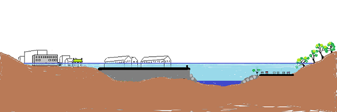
Natural Floodplain- Over a period of hundreds or thousands of years, the stream (dark blue) has established a natural floodplain including wetlands and forest. In this example, buildings and infrastructure are located outside the zone inundated by high water (light blue) allowing the floodplain to function as an effective water-absorbing buffer.
Impaired Floodplain- Here the natural floodplain has been filled for building (left) and paved for recreation area parking (right). The stream has been channelized. Flood water (light blue) displaced by these alterations is likely to inundate areas not previously impacted by similar events. Additionally, the interference with natural flow will create new erosion points that could seriously damage older infrastructure and properties.
The majority of the towns in the lower Susquehanna valley with streams passing through them have impaired floodplains. In many, the older sections of the town are built on filled floodplain. Some new subdivisions highlight streamside lawns as a sales feature—plenty of room for stockpiling your accoutrements of suburban life. And yes, some new homes are still being built in floodplains.
When high water comes, it drags tons of debris with it. The limbs, leaves, twigs, and trees are broken down by natural processes over time. Nature has mechanisms to quickly cope with these organics. Man’s consumer rubbish is another matter. As the plant material decays, the embedded man-made items, particularly metals, treated lumber, plastics, Styrofoam, and glass, become more evident as an ever-accumulating “garbage soil” in the natural floodplains downstream of these impaired areas. With each storm, some of this mess floats away again to move ever closer to Chesapeake Bay and the Atlantic. Are you following me? That’s our junk from the curb, lawn, highway, or parking lot bobbing around in the world’s oceans.
A shed, mobile home, or house can be inundated or swept away during a flood. Everything inside (household chemicals, gasoline, fuel oil, pesticides, insulation, all those plastics, etc.) instantly pollutes the water. Many communities that rely on the Susquehanna River for drinking water are immediately impacted, including Lancaster, PA and Baltimore, MD. This dumpster was swept away from a parking lot in a floodplain. It rolled in the current, chipping away at the bridge before spilling the rubbish into the muddy water. After the flood receded, the dumpster was found a mile downstream. Its contents are still out there somewhere.
Floodplains along the lower Susquehanna River are blanketed with a layer of flotsam that settles in place as high water recedes. These fresh piles can be several feet deep and stretch for miles. Nature decomposes the organic twigs and driftwood to build soil-enriching humus. However, the plastics and other man-made materials that do not readily decay or do not float away toward the sea during the next flood are incorporated into the alluvium and humus creating a “garbage soil”. Over time, the action of abrasives in the soil will grind small particles of plastics from the larger pieces. These tiny plastics can become suspended in the water column each time the river floods. What will be the long-term impact of this type of pollution?
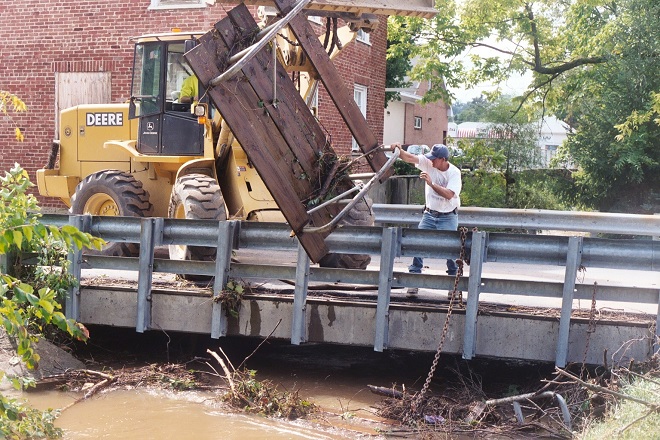
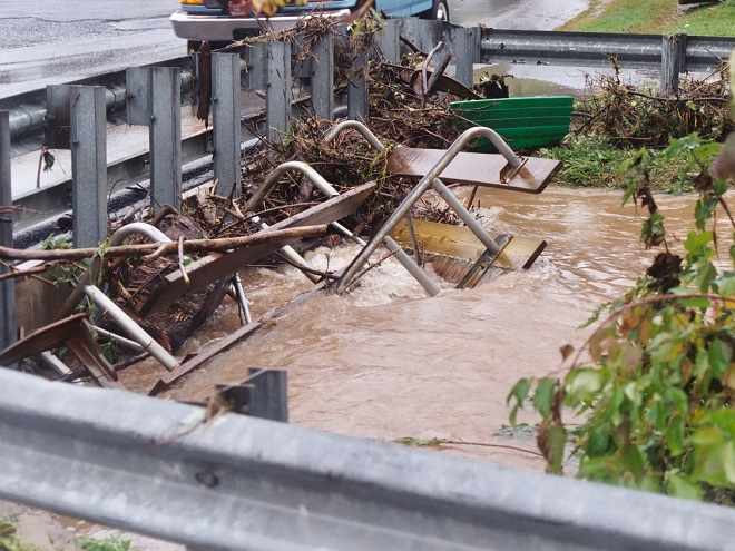
Anything can be swept away by the powerful hydraulic forces of flowing water. Large objects like this utility trailer can block passages through bridges and escalate flooding problems.
The cost of removing debris often falls upon local government and is shared by taxpayers.
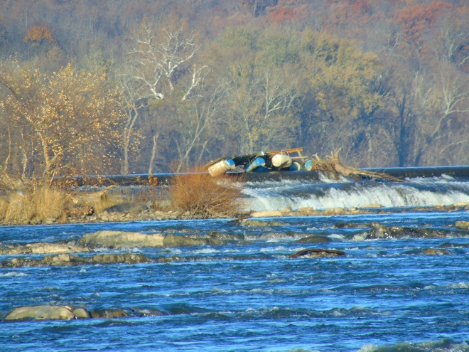
Here, a junked boat dock is snagged on the crest of the York Haven Dam at Conewago Falls. Rising water eventually carried it over the dam and into the falls where it broke up. This and tons of other junk are often removed downstream at the Safe Harbor Dam to prevent damage to turbine equipment. During periods of high water, the utility hauls debris by the truck-load to the local waste authority for disposal. For the owners of garbage like this dock, it’s gone and it’s somebody else’s problem now.
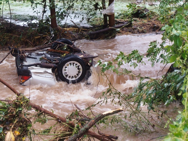
Motor vehicles found after floating away from parking areas in floodplains can create a dangerous dilemma for police, fire, and E.M.S. personnel, particularly when no one witnesses the event. Was someone driving this car or was it vacant when it was swept downstream? Should crews be put at risk to locate possible victims?
Beginning in 1968, participating municipalities, in exchange for having coverage provided to their qualified residents under the National Flood Insurance Program, were required to adopt and enforce a floodplain management ordinance. The program was intended to reduce flood damage and provide flood assistance funded with premiums paid by potential victims. The program now operates with a debt incurred during severe hurricanes. Occurrences of repetitive damage claims and accusations that the program provides an incentive for rebuilding in floodplains have made the National Flood Insurance Program controversial.
In the Lower Susquehanna River Watershed there are municipalities that still permit new construction in floodplains. Others are quite proactive at eliminating new construction in flood-prone zones, and some are working to have buildings removed that are subjected to repeated flooding.
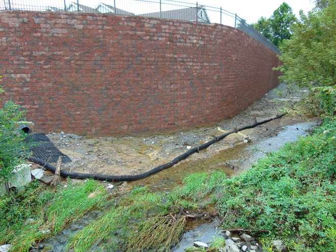
Another Wall— Here’s an example of greed by the owner, engineer, and municipality… placing their financial interests first. The entire floodplain on the north side of this stream was filled, then the wall was erected to contain the material. A financial institution’s office and parking lot was constructed atop the mound. This project has channelized the stream and completely displaced half of the floodplain to a height of 15 to 20 feet. Constructed less than five years ago, the wall failed already and has just been totally reconstructed. The photo reveals how recent flooding has begun a new erosion regime where energy is focused along the base of the wall. Impairment of a floodplain to this degree can lead to flooding upstream of the site and erosion damage to neighboring infrastructure including roads and bridges.
The floodplain along this segment of the lower Swatara Creek in Londonderry Township, Dauphin County is free to flood. Ordinances prohibit new construction here and 14 older houses that repeatedly flooded were purchased, dismantled, and removed using funding from the Federal Emergency Management Agency (F.E.M.A). A riparian buffer was planted and some wetland restorations were incorporated into stormwater management installations along the local highways. When the waters of the Swatara rise, the local municipality closes the roads into the floodplain. Nobody lives or works there anymore, so no one has any reason to enter. There’s no need to rescue stubborn residents who refused advice to evacuate. Sightseers can park and stand on the hill behind the barricades and take all the photographs they like.
A new Pennsylvania Turnpike bridge across Swatara Creek features wide passage for the stream below. Water flowing in the floodplain can pass under the bridge without being channelized toward the path where the stream normally flows in the center. The black asterisk-shaped floats spin on the poles to help deflect debris away from the bridge piers. (flood crest on July 26, 2018)
People are curious when a waterway floods and they want to see it for themselves. Wouldn’t it be wise to anticipate this demand for access by being ready to accommodate these citizens safely? Isn’t a parking lot, picnic area, or manicured park safer and more usable when overlooking the floodplain as opposed to being located in it? Wouldn’t it be a more prudent long-term investment, both financially and ecologically, to develop these improvements on higher ground outside of flood zones?
Now would be a good time to stop the new construction and the rebuilding in floodplains. Aren’t the risks posed to human life, water quality, essential infrastructure, private property, and ecosystems too great to continue?
Isn’t it time to put up the white flag and surrender the floodplains to the floods? That’s why they’re there. Floodplains are for flooding.
It’s been an atypical summer. The lower Susquehanna River valley has been in a cycle of heavy rains for over a month and stream flooding has been a recurring event. At Conewago Falls, the Pothole Rocks have been inundated for weeks. The location used as a lookout for the Autumn Migration Count last fall is at the moment submerged in ten feet of roaring water. Any attempt to tally the migrants which are passing thru in 2018 will thus be delayed indefinitely. Of greater import, the flooding at Conewago Falls is impacting many of the animals and plants there at a critical time in their annual life cycle. Having been displaced from its usual breeding sites on the river, one insect species in particular seems to be omnipresent in upland areas right now, and few people have ever heard of it.
So, you take a cruise in the motorcar to your favorite store and arrive at the sprawling parking lot. Not wishing to have your doors dented or paint chipped because you settled for a space tightly packed among other shopper’s conveyances, you park out there in the “boondocks”. You know the place, the lightly-used portion of the lot where sometimes brush grows from cracks in the asphalt and you must be on alert for impatient consumers who throttle-up to high speeds and dash diagonally across the carefully painted grids on the pavement to reach their favorite parking destination in the front row. Coming to a stop, you take the car out of gear, set the brake, disengage the safety belt, and gather your shopping list. You grasp the door handle and, not wanting to be flattened by one of the aforementioned motorists, you have a look around before exiting.
It was then that you saw the thing, hovering above your shiny bright hood. For a brief moment, it seemed to be peering right through the windshield at you with big reddish-brown eyes. In just a second or two, it turned its whole bronze body ninety degrees to the left and darted away on its cellophane wings. Maybe you didn’t really get a good look at it. It was so fast. But it certainly was odd. Oh well, time to walk inside a grab a few provisions. Away you go.
Upon completion of your shopping, you’re taking the long stroll back to your car and you notice more of these peculiar creatures. Two are coupled together and are hovering above someone’s automobile hood, then they drop down, and the lower of the two taps its abdomen on the paint. You ask yourself, “What are these bizarre things?”
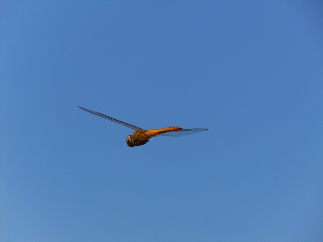
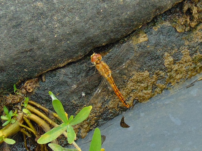
Meet the Wandering Glider (Pantala flavescens), also known as the Globe Wanderer or Globe Skimmer, a wide-ranging dragonfly known to occur on every continent with the exception of Antarctica.
Wandering Gliders sometimes arrive in the lower Susquehanna River valley in large numbers after catching a ride on sustained winds from southerly directions and will often fly and migrate in storm systems. Conditions for such movements have been optimal in our region since mid-July. These dragonflies will often hover above motor vehicle hoods and, after mating, females will deposit eggs upon them, apparently mistaking their glossy surface for small pools of water.
Wandering Gliders travel the globe, and as such are accomplished fliers. Adults spend most of the day on the wing, feeding upon a variety of flying insects. Days ago, I watched several intercepting a swarm of flying ants. As fast as ants left the ground they were grabbed and devoured by the gliders. Wandering Gliders are adept at taking day-flying mosquitos, often zipping stealthily past a person’s head or shoulders to grab one of the little pests—the would-be skeeter victim usually unaware of the whole affair.
Due to their nomadic life history, Wandering Gliders are opportunists when breeding and will lay eggs in most any body of freshwater. Their larvae do not overwinter prior to maturity; adults can be expected in a little more than one to two months. Repetitive flooding in the Lower Susquehanna River Watershed this summer may be reducing the availability of the best local breeding sites for this species—riverine, stream, and floodplain pools of standing water with prey. This may explain why thousands of Wandering Gliders are patrolling parking lots, farmlands, and urban areas this summer. And it’s the likely reason for their use of puddles on asphalt pavement, on rubber roofs, and in fields as places to try to deposit eggs. Unfortunately, they may be as likely to succeed there as they are on your motor vehicle hood.
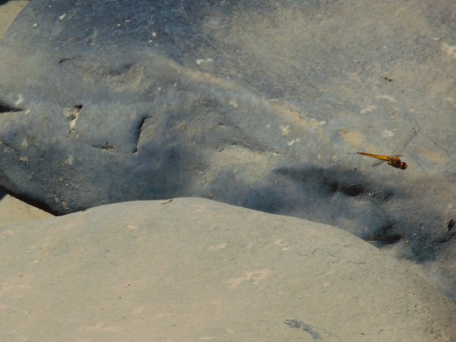
At this time a year ago, the airspace above the Diabase Pothole Rocks at Conewago Falls was jammed with territorial male Wandering Gliders. Each male hovered at various locations around his breeding territory consisting of pools and water-filled potholes. Intruders would quickly be dispatched from the area, then the male would resume his patrols from a set of repetitively-used hovering positions about six feet above the rocks. Mating and egg-laying continued into late September. The larvae, also called nymphs or naiads, were readily observed in many pools and potholes in early October and the emergence of juveniles was noted in mid-October. The absence of flooding, the mild autumn weather, and the moderation of water temperatures in the pools and potholes courtesy of the sun-drenched diabase boulders helped to extend the 2017 breeding season for Wandering Gliders in Conewago Falls. They aren’t likely to experience the same favor this year, but their great ability to travel and adapt should overcome this momentary misfortune.
A male Wandering Glider aggressively patrols his territory in the Diabase Pothole Rocks Microhabitat at Conewago Falls. August 20, 2017.
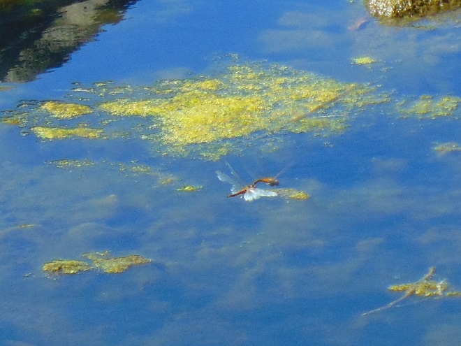
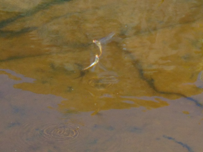
A mating pair of Wandering Gliders continue flying non-stop above one of thousands of suitable breeding pools among the Diabase Pothole Rocks at Conewago Falls. September 23, 2017.
A female (bottom)Wandering Glider has deposited eggs in a pool while flying in tandem with a male (top). They’ll do the same thing on your automobile hood! Conewago Falls Diabase Pothole Rocks Microhabitat. September 23, 2017.
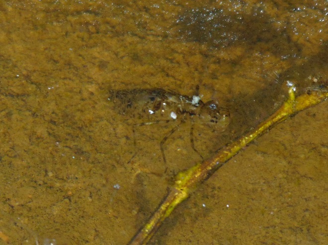
Wandering Glider larvae are at the top of the food chain in flooded potholes. As they grew, these dragonfly larvae decimated the mosquito larvae which were abundant there earlier in the summer. October 7, 2017.
A juvenile male Wandering Glider emerges from the pool where it fed and grew as a larva. It remained at water’s edge on the surface of a sun-warmed diabase rock for several hours to dry its wings. It soon flew away to parts unknown, possibly traveling hundreds or thousands of miles. Look carefully at the wings for the beige dash marks on the forward edge near the terminal end. Females lack this marking. Conewago Falls Diabase Pothole Rocks Microhabitat. October 14, 2017.
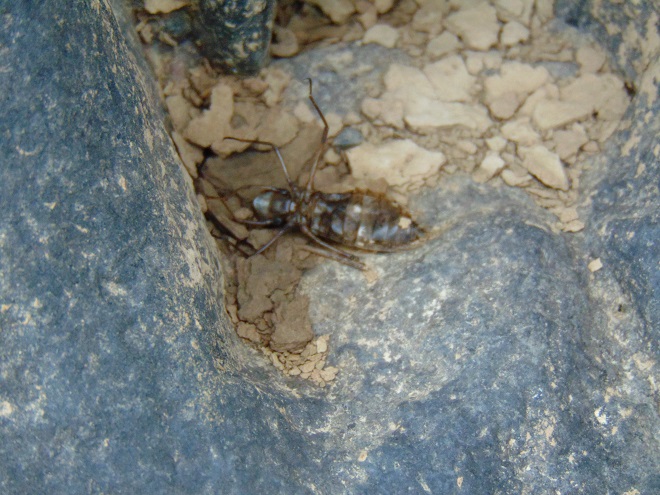
A Wandering Glider exuviae, the shed exoskeleton of a creature gone, but not forgotten. October 14, 2017.
There are two Conewago Creek systems in the Lower Susquehanna River Watershed. One drains the Gettysburg Basin west of the river, mostly in Adams and York Counties, then flows into the Susquehanna at the base of Conewago Falls. The other drains the Gettysburg Basin east of the river, flowing through Triassic redbeds of the Gettysburg Formation and York Haven Diabase before entering Conewago Falls near the south tip of Three Mile Island. Both Conewago Creeks flow through suburbia, farm, and forest. Both have their capacity to support aquatic life impaired and diminished by nutrient and sediment pollution.
This week, some of the many partners engaged in a long-term collaboration to restore the east shore’s Conewago Creek met to have a look at one of the prime indicators of overall stream habitat health—the fishes. Kristen Kyler of the Lower Susquehanna Initiative organized the effort. Portable backpack-mounted electrofishing units and nets were used by crews to capture, identify, and count the native and non-native fishes at sampling locations which have remained constant since prior to the numerous stream improvement projects which began more than ten years ago. Some of the present-day sample sites were first used following Hurricane Agnes in 1972 by Stambaugh and Denoncourt and pre-date any implementation of sediment and nutrient mitigation practices like cover crops, no-till farming, field terracing, stormwater control, nutrient management, wetland restoration, streambank fencing, renewed forested stream buffers, or modernized wastewater treatment plants. By comparing more recent surveys with this baseline data, it may be possible to discern trends in fish populations resulting not only from conservation practices, but from many other variables which may impact the Conewago Creek Warmwater Stream ecosystem in Dauphin, Lancaster, and Lebanon Counties.
So here they are. Enjoy these shocking fish photos.
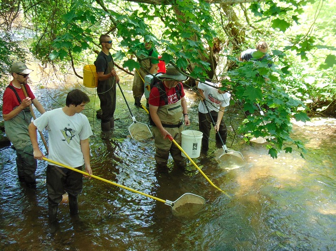
Matt Kofroth, Watershed Specialist with the Lancaster County Conservation District, operates the electrofishing wand in Conewago Creek while his team members prepare to net and collect momentarily-stunned fish. Three other electrofishing units operated by staff from the Susquehanna River Basin Commission and aided by teams of netters were in action at other sample locations along the Conewago on this day.
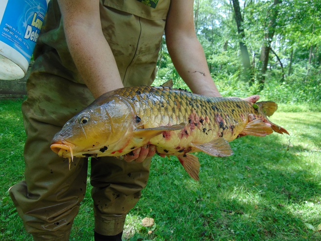
Really big fish, such as this Common Carp (Cyprinus carpio), were identified, counted, and immediately returned to the water downstream of the advancing electrofishing team.
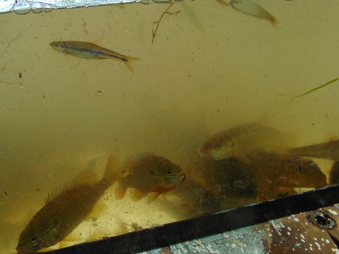
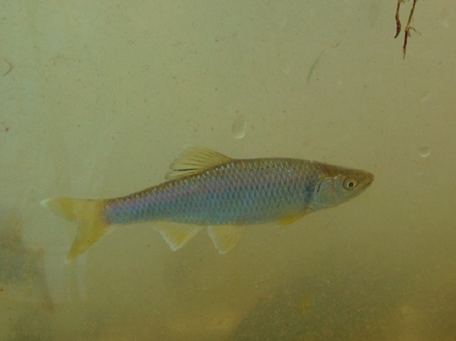
Other fish, such as the Swallowtail Shiner, Redbreast Sunfish (Lepomis auritus), Fallfish, and suckers seen here, were placed in a sorting tank.
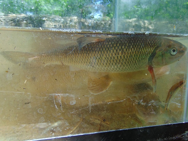
Fallfish (Semotilus corporalis) are very active and require plenty of dissolved oxygen in the water to survive. Fallfish, Rainbow Trout (Oncorhynchus mykiss), and Smallmouth Bass (Micropterus dolomieu) were quickly identified and removed from the sorting tank for release back into the stream. Other larger, but less active fish, including suckers, quickly followed.
Small fish like minnows were removed from the sorting tank for a closer look in a hand-held viewing tank. This Fathead Minnow (Pimephales promelas) was identified, added to the tally sheet, and released back into the Conewago. The Fathead Minnow is not native to the Susquehanna drainage. It is the minnow most frequently sold as bait by vendors.
A breeding condition male Bluntnose Minnow (Pimephales notatus).
The Cutlips Minnow (Exoglossum maxillingua) is a resident of clear rocky streams. Of the more than 30 species collected during the day, two native species which are classified as intolerant of persisting stream impairment were found: Cutlips Minnow and Swallowtail Shiner.
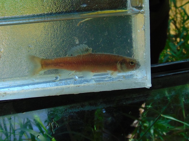
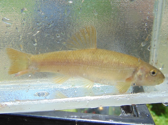
The Central Stoneroller (Campostoma anomalum) is a benthic feeder in creeks over gravel and sand.
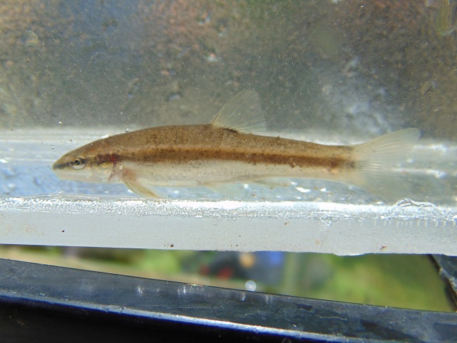
The Eastern Blacknose Dace (Rhinichthys atratulus) is found in clear water over pebble and stone substrate.
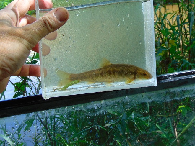
The Longnose Dace (Rhinichthys cataractae) is another species of pebbly rocky streams.
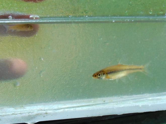
A juvenile Golden Shiner (Notemigonus crysoleucas). Adults lack the side stripe and grow to the size of a sunfish.
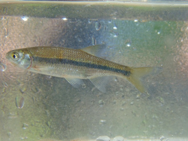
A Swallowtail Shiner (Notropis procne) and a very young White Sucker (Catostomus commersonii) in the upper left of the tank.
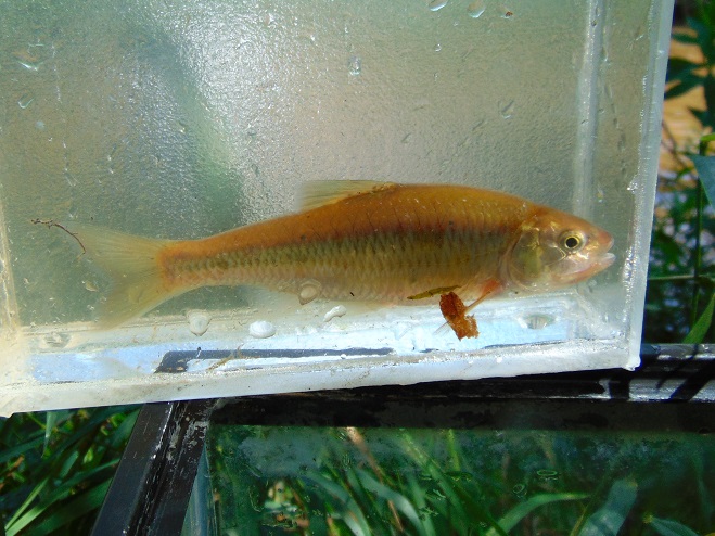
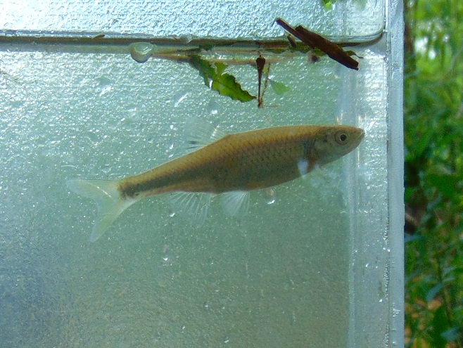
A probable Spotfin Shiner (Cyprinella spiloptera).
A breeding male Cyprinella shiner, probably a Spotfin Shiner. Show-off!
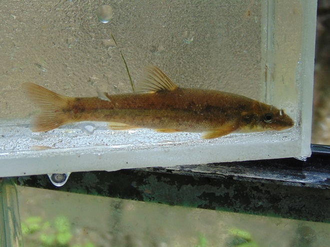
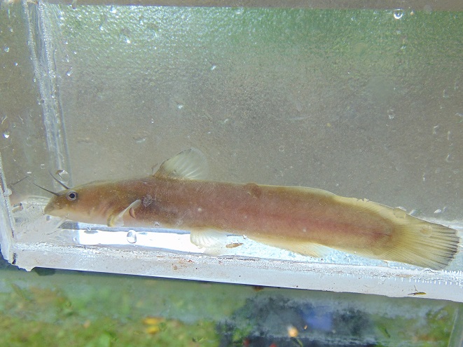
The Margined Madtom (Noturus insignis) is a small native catfish of pebbly streams.
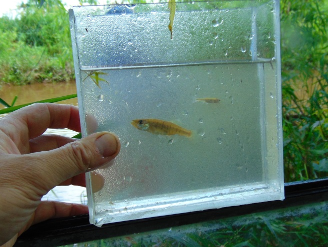
The Banded Killifish (Fundulus diaphanus) is adept at feeding upon insects, including mosquitos.
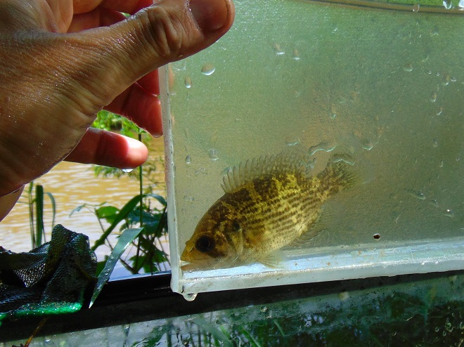
A young Rock Bass (Ambloplites rupestris). This species was introduced to the Susquehanna and its tributaries.
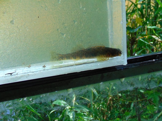
The Greenside Darter (Etheostoma blennioides) is not native to the Susquehanna basin. The species colonized the Conewago Creek (east) from introduced local populations within the last five years.
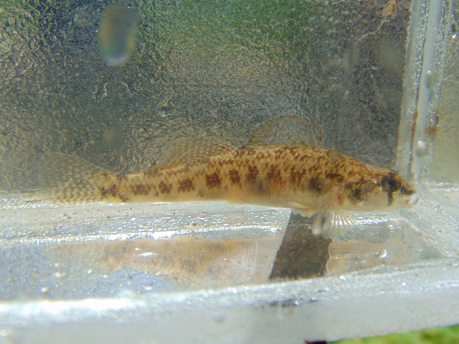
The Tessellated Darter (Etheostoma olmstedi) is a native inhabitant of the Susquehanna and its tributaries.
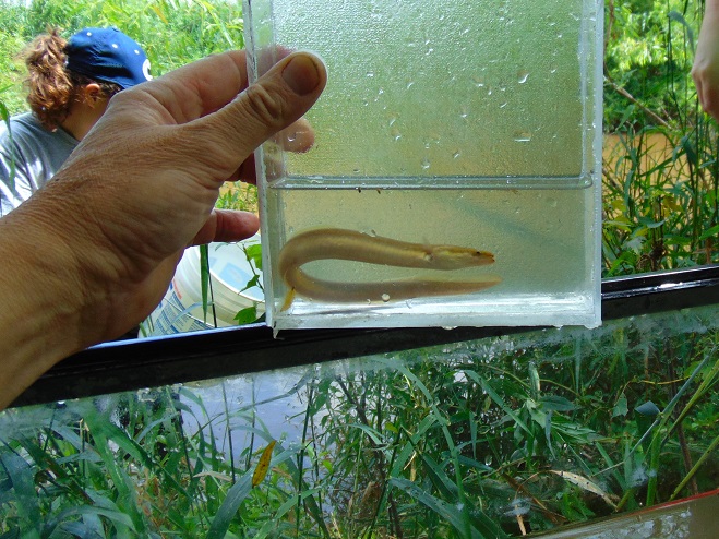
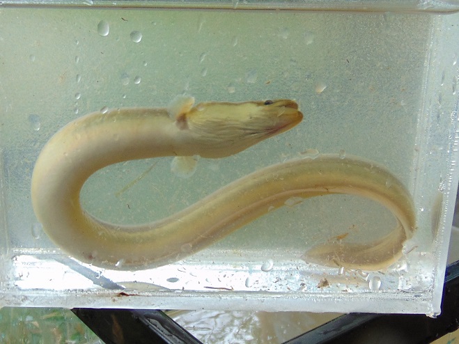
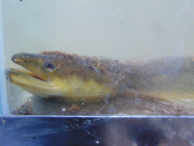
The stars of the day were the American Eels (Anguilla rostrata).
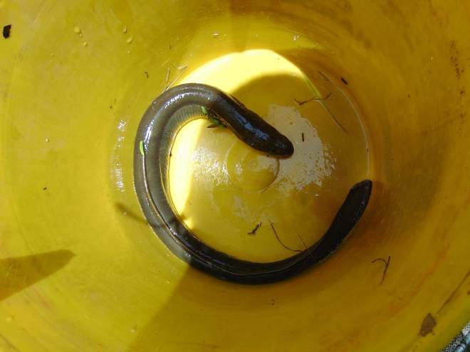
After collection, each eel was measured and weighed using a scale and dry bucket. This specimen checked in at 20 inches and one pound before being released.
Prior to the construction of large dams, American Eels were plentiful in the Susquehanna and its tributaries, including the Conewago. They’ve since been rarities for more than half a century. Now they’re getting a lift.
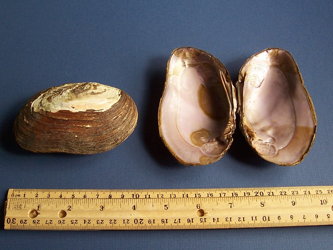
American Eels serve as an intermediate host for the microscopic parasitic glochidia (larvae) of the Eastern Elliptio (Elliptio complanata), a declining native freshwater mussel of the Lower Susquehanna River Watershed. While feeding on their host (usually in its gills), the glochidia cause little injury and soon drop off to continue growth, often having assured distribution of their species by accepting the free ride. Freshwater mussels are filter feeders and improve water quality. They grow slowly and can live for decades.
American Eels are a catadromous species, starting life as tiny glass eels in the saltwater of the Atlantic Ocean, then migrating to tidal brackish marshes and streams (males) or freshwater streams (females) to mature. This 20-incher probably attempted to ascend the Susquehanna as an elver in 2016 or 2017. After hitching a ride with some friendly folks, she bypassed the three largest dams on the lower Susquehanna (Conowingo, Holtwood, and Safe Harbor) and arrived in the Conewago where she may remain and grow for ten years or more. To spawn, a perilous and terminally fatal journey to the Sargasso Sea awaits her. (You may better know the area of the Sargasso Sea as The Bermuda Triangle…a perilous place to travel indeed!)
SOURCES
Normandeau Associates, Inc. and Gomez and Sullivan. 2018. Muddy Run Pumped Storage Project Conowingo Eel Collection Facility FERC Project 2355. Prepared for Exelon.
Stambaugh, Jr., John W., and Robert P. Denoncourt. 1974. A Preliminary Report on the Conewago Creek Faunal Survey, Lancaster County, Pennsylvania. Proceedings of the Pennsylvania Academy of Sciences. 48: 55-60.
Two days ago, widespread rain fell intermittently through the day and steadily into the night in the Susquehanna drainage basin. The temperature was sixty degrees, climbing out of a three-week-long spell of sub-freezing cold in a dramatic way. Above the ice-covered river, a very localized fog swirled in the southerly breezes.
By yesterday, the rain had ended as light snow and a stiff wind from the northwest brought sub-freezing air back to the region. Though less than an inch of rain fell during this event, much of it drained to waterways from frozen or saturated ground. Streams throughout the watershed are being pushed clear of ice as minor flooding lifts and breaks the solid sheets into floating chunks.
Today, as their high flows recede, the smaller creeks and runs are beginning to freeze once again. On larger streams, ice is still exiting with the cresting flows and entering the rising river.
Ice chunks on Swatara Creek merge into a dense flow of ice on the river in the distance. Swatara Creek is the largest tributary to enter the Susquehanna in the Gettysburg Basin. The risk of an ice jam impounding the Swatara here at its mouth is lessened because rising water on the river has lifted and broken the ice pack to keep it moving without serious impingement by submerged obstacles. Immovable ice jams on the river can easily block the outflow from tributaries, resulting in catastrophic flooding along these streams.
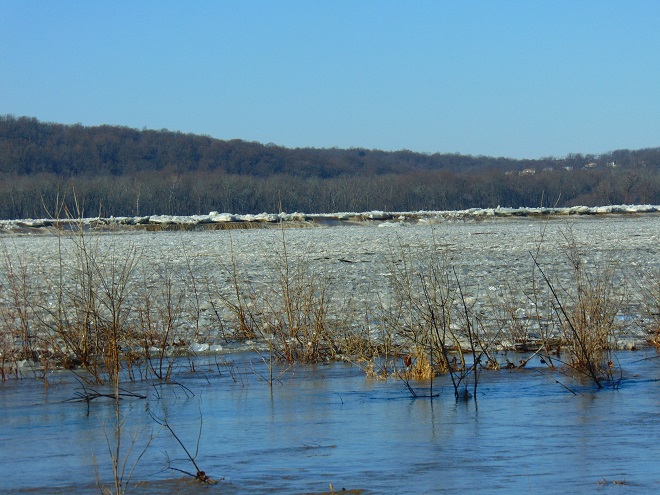
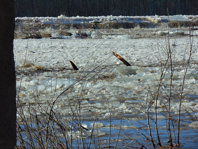
Fast-moving flows of jagged ice race toward Three Mile Island and Conewago Falls. The rising water began relieving the compression of ice along the shoreline during the mid-morning. Here on the river just downstream of the mouth of Swatara Creek, ice-free openings allowed near-shore piles to separate and begin floating away after 10:30 A.M. E.S.T. Moving masses of ice created loud rumbles, sounding like a distant thunderstorm.
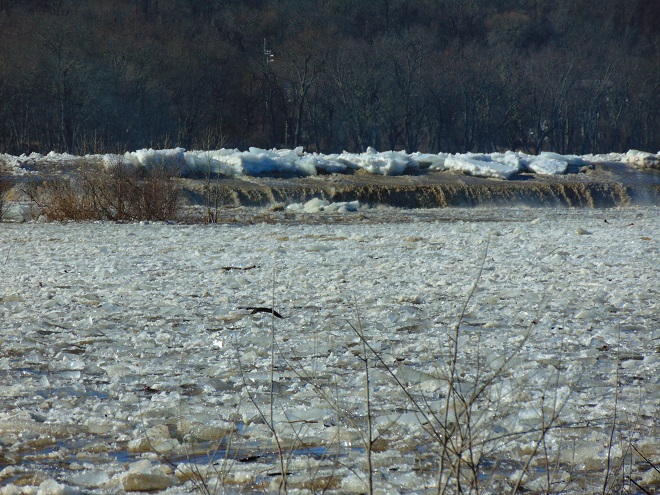
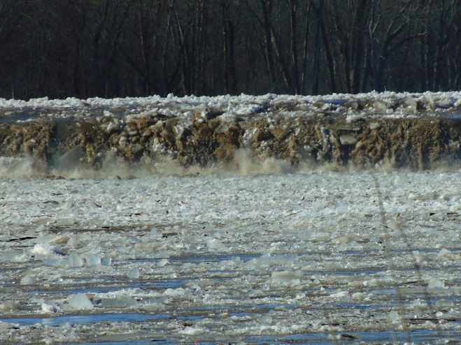
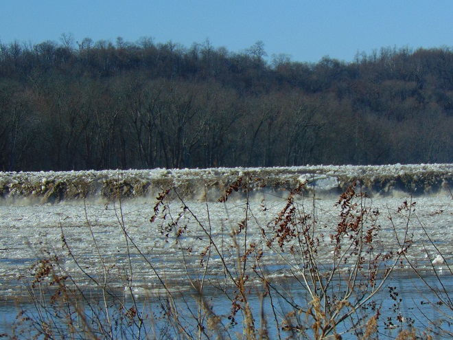
Ice being pushed and heaved over the crest of the York Haven Dam at Conewago Falls due to compression and rising water levels.
Enormous chunks of ice being forced up and over the York Haven Dam into Conewago Falls and the Pothole Rocks below.
Ice scours Conewago Falls, as it has for thousands of years.
The action of ice and suspended abrasives has carved the York Haven Diabase boulders and bedrock of Conewago Falls into the amazing Pothole Rocks.
The roaring torrents of ice-choked water will clear some of the woody growth from the Riverine Grasslands of Conewago Falls.
To the right of center in this image, a motorcar-sized chunk of ice tumbles over the dam and crashes into the Pothole Rocks. It was one of thousands of similar tree-and-shrub-clearing projectiles to go through the falls today.
The events of today provide a superb snapshot of how Conewago Falls, particularly the Diabase Pothole Rocks, became such a unique place, thousands of years in the making. Ice and flood events of varying intensity, duration, and composition have sculpted these geomorphologic features and contributed to the creation of the specialized plant and animal communities we find there. Their periodic occurrence is essential to maintaining the uncommon habitats in which these communities thrive.
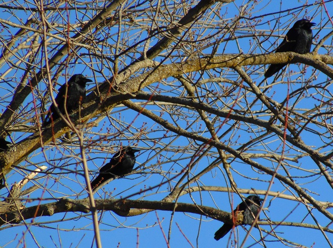
Fish Crows (Corvus ossifragus) gather along the flooding river shoreline. Soon there’ll be plenty of rubbish to pick through, some carrion maybe, or even a displaced aquatic creature or two to snack upon.
Is this the same Conewago Falls I visited a week ago? Could it really be? Where are all the gulls, the herons, the tiny critters swimming in the potholes, and the leaping fish? Except for a Bald Eagle on a nearby perch, the falls seems inanimate.
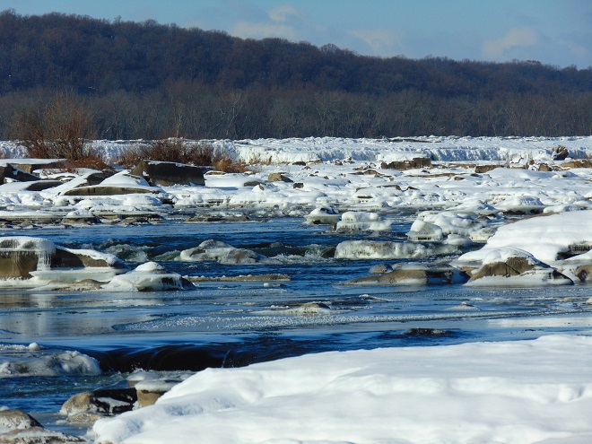
Yes, a week of deep freeze has stifled the Susquehanna and much of Conewago Falls. A hike up into the area where the falls churns with great turbulence provided a view of some open water. And a flow of open water is found downstream of the York Haven Dam powerhouse discharge. All else is icing over and freezing solid. The flow of the river pinned beneath is already beginning to heave the flat sheets into piles of jagged ice which accumulate behind obstacles and shallows.
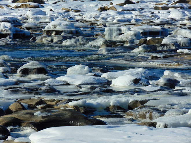
Ice and snow surround a small zone of open water in a high-gradient area of Conewago Falls.
Ice chunks and sheets accumulate atop the York Haven Dam. The weight of miles of ice backed up behind the dam eventually forces the accumulation over the top and into the Pothole Rocks below. The popping and cracking sounds of ice both above and below the dam could be heard throughout the day as hydraulic forces continuously break and move ice sheets.
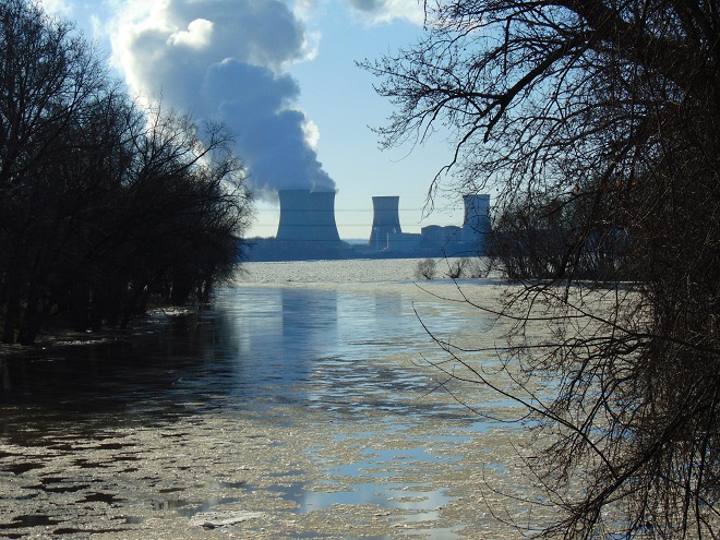
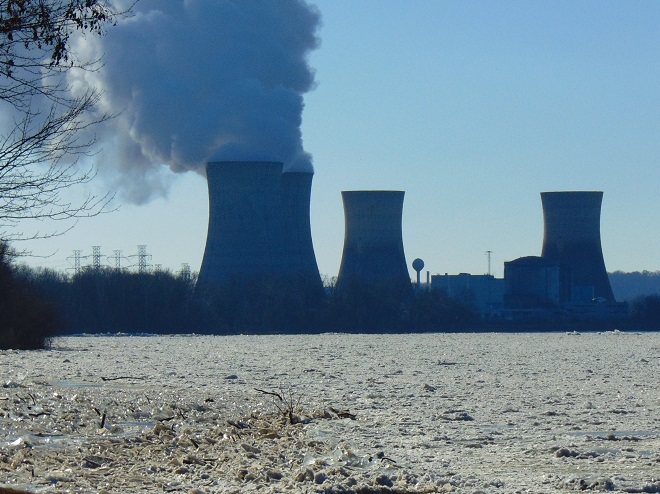
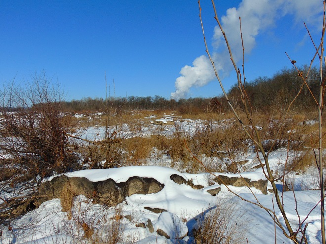
Steam from the Unit 1 cooling towers at the Three Mile Island Nuclear Generating Station rises above the frozen Riverine Grasslands at Conewago Falls. The scouring action of winter ice keeps the grasslands clear of substantial woody growth and prevents succession into forest.
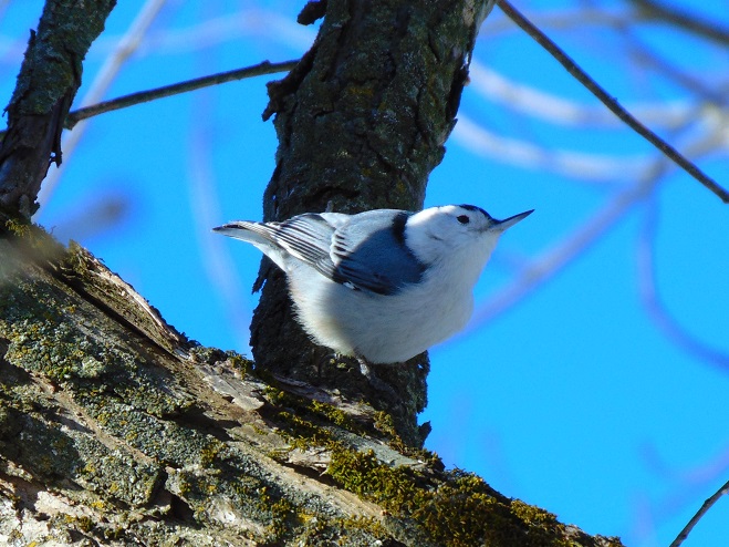
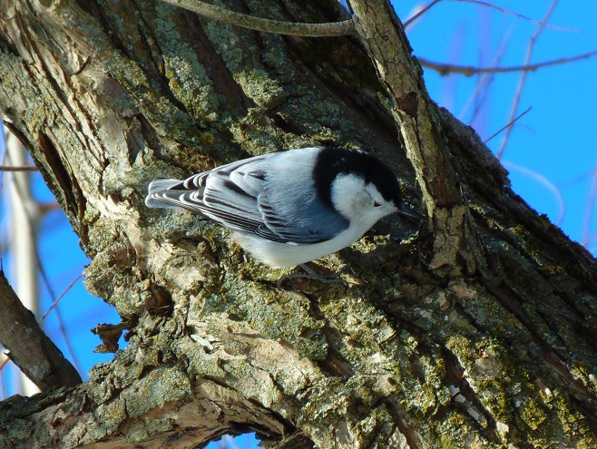
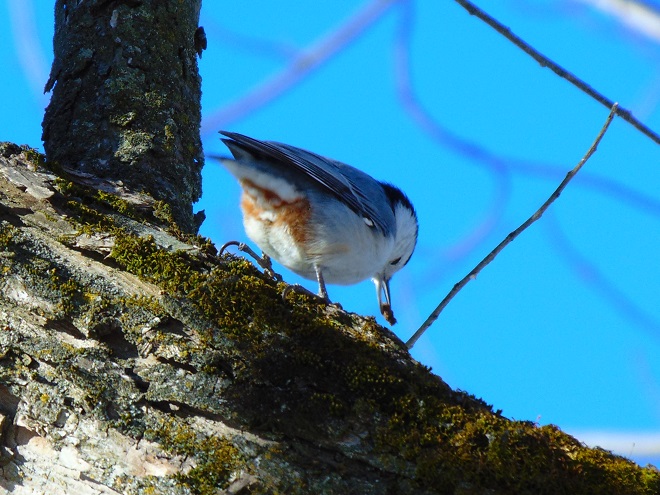
Despite a lack of activity on the river, mixed flocks of resident and wintering birds, including this White-breasted Nuthatch (Sitta carolinensis), were busy feeding in the Riparian Woodlands. The White-breasted Nuthatch is a cavity nester and year-round denizen of hardwoods, often finding shelter during harsh winter nights in small tree holes.
The White-breasted Nuthatch is often seen working its way head-first down a tree trunk as it probes with its well-adapted bill for insects among the bark.
Jackpot!
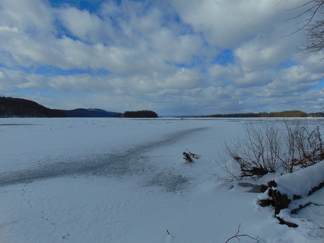
Looking upstream from the river’s east shore at ice and snow cover on the Susquehanna above Conewago Falls and the York Haven Dam. The impoundment, known as Lake Frederic, and its numerous islands of the Gettysburg Basin Archipelago were locked in winter’s frosty grip today. Hill Island (Left) and Poplar Island (Center) consist of erosion-resistant York Haven Diabase, as does the ridge on the far shoreline seen rising in the distance between them. To the right of Poplar Island in this image, the river passes by the Harrisburg International Airport. At the weather station there, the high temperature was eighteen degrees Fahrenheit on this first day of 2018.
We all know that birds (and many other animals) migrate. It’s a survival phenomenon which, above all, allows them to utilize their mobility to translocate to a climate which provides an advantage for obtaining food, enduring seasonal weather, and raising offspring.
In the northern hemisphere, most migratory birds fly north in the spring to latitudes with progressively greater hours of daylight to breed, nest, and provide for their young. In the southern hemisphere there are similar movements, these to the south during their spring (our autumn). The goal is the same, procreation, though the landmass offering sustenance for species other than seabirds is limited “down under”. Interestingly, there are some seabirds that breed in the southern hemisphere during our winter and spend our summer (their winter) feeding on the abundant food sources of the northern oceans.
Each autumn, migratory breeding birds leave their nesting grounds as the hours of sunlight slowly recede with each passing day. They fly to lower latitudes where the nights aren’t so long and the climate is less brutal. There, they pass their winter season.
Food supply, weather, the start/finish of the nesting cycle, and other factors motivate some birds to begin their spring and autumn journeys. But overall, the hours of daylight and the angle of the sun prompt most species to get going.
But what happens after birds begin their trips to favorable habitats? Do they follow true north and south routes? Do they fly continuously, day and night? Do they ease their way from point to point, stopping to feed along the way? Do they all migrate in flocks? Well, the tactics of migration differ widely from bird species to species, from population to population, and sometimes from individual to individual. The variables encountered when examining the dynamics of bird migration are seemingly endless, but fascinatingly so. Bird migration is well-studied, but most of its intricacies and details remain a mystery.
Consider for a moment that just 10,000 years ago, an Ice Age was coming to an end, with the southernmost edge of the most recent glaciers already withdrawn into present-day Canada from points as near as the upper Susquehanna River watershed. Back then, the birds migrating to the lower portion of the drainage basin each spring probably weren’t forest-dwelling tropical warblers, orioles, and other songbirds. The migratory birds that nested in the lower Susquehanna River valley tens of millennia ago were probably those species found nesting today in taiga and tundra much closer to the Arctic Circle. And the ancestors of most of the tropical migrants that nest here now surely spent their entire lives much closer to the Equator, finding no advantage by journeying to the frigid Susquehanna valley to nest. It’s safe to say that since those times, and probably prior to them, migration patterns have been in a state of flux.
During the intervening years since the great ice sheets, birds have been able to adapt to the shifts in their environment on a gradual basis, often using their unmatched mobility to exploit new opportunities. Migration patterns change slowly, but continuously, resulting in differences that can be substantial over time. If the natural transformations of habitat and climate have kept bird migration evolving, then man’s impact on the planet shows great potential to expedite future changes, for better or worse.
Now, let’s look at two different bird migration strategies, that of day-fliers or diurnal migrants, and that of night-fliers, the nocturnal migrants.
Diurnal migrants are the most familiar to people who notice birds on the move. The majority of these species have one thing in common, some form of defense to lessen the threat of becoming the victim of a predator while flying in daylight. Of course the vultures, hawks, and eagles fly during the day. Swallows and swifts employ speed and agility on the wing to avoid becoming prey, as do hummingbirds. Finches have an undulating flight, never flying on a horizontal plane, which makes their capture more difficult. Other songbirds seen migrating by day, Red-winged Blackbirds for example, congregate into flocks soon after breeding season to avoid being alone. Defense flocks change shape constantly as birds position themselves toward the center and away from the vulnerable fringes of the swarm. The larger the flock, the safer the individual. For a lone bird, large size can be a form of protection against all but the biggest of predators. Among the more unusual defenses is that of birds like Indigo Buntings and other tropical migrants that fly across the Gulf of Mexico each autumn (often completing a portion of the flight during the day), risking exhaustion at sea to avoid the daylight hazards, including numerous predators, found in the coastal and arid lands of south Texas. Above all, diurnal migrants capture our attention and provide a spectacle which fascinates us. Perhaps diurnal migrants attract our favor because we can just stand or sit somewhere and watch them go by. We can see, identify, and even count them. It’s fantastic.
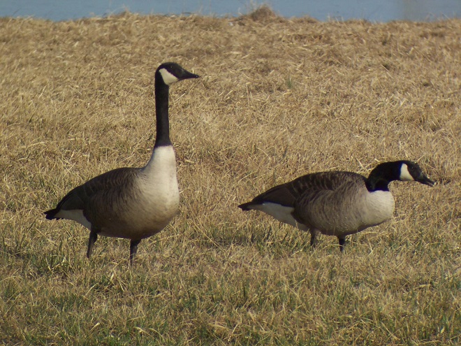
What about a bird like the Canada Goose (Branta canadensis)? It is often seen migrating in flocks during the day (the truly migratory ones flying much higher than the local year-round resident “transplants”), but then, during the big peak movements of spring and fall, they can be heard overhead all through the night. Perhaps the Canada Goose and related waterfowl bridge the gap between day and night, introducing us to the secretive starlight and moonshine commuters, the nocturnal migrants.
The high-flying migratory Canada Goose can be seen during the daytime and heard at night when passing over the lower Susquehanna River valley. A large flight exiting from Chesapeake Bay in late February or early March often results in a 12 to 24 hour-long stream of northbound flocks.
The skies are sometimes filled with thousands of them, mostly small perching birds and waders. These strangers in the night fly inconspicuously in small groups or individually, and most can be detected when passing above us only when heard making short calls to remain in contact with their travel partners. They need not worry about predators, but instead must have a method of finding their way. Many, like the Indigo Bunting, can navigate by the stars, a capability which certainly required many generations to refine. The nocturnal migrants begin moving just after darkness falls and ascend without delay to establish a safe flight path void of obstacles (though lights and tall structures can create a deadly counter to this tactic). Often, the only clue we have that a big overnight flight has occurred is the sudden appearance of new bird species or individuals, on occasion in great numbers, in a place where we observe regularly. Just days ago, the arrival of various warbler species at Conewago Falls indicated that there was at least a small to moderate movement of these birds during previous nights.
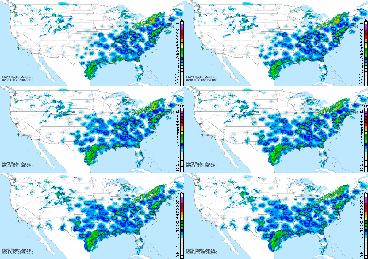
In recent years, the availability of National Weather Service radar has brought the capability to observe nocturnal migrants into easy reach. Through the night, you can log on to your local National Oceanic and Atmospheric Administration’s National Weather Service radar page (State College for the Conewago Falls area) and watch on the map as the masses of migrating bird pass through the sweep of the radar beam. As they lift off just after nightfall, rising birds will create an echo as they enter the sweeping beam close to the radar site. Then, due to the incline of the transmitted signal and the curvature of the earth, migrants will be displayed as an expanding donut-like ring around the radar’s map location as returns from climbing birds are received from progressively higher altitudes at increasing distances from the center of the site’s coverage area. On a night with a local or regional flight, several radar locations may show signs of birds in the air. On nights with a widespread flight, an exodus of sorts, the entire eastern half of the United States may display birds around the sites. You’ll find the terrain in the east allows it to be well-covered while radars in the west are less effective due to the large mountains. At daybreak, the donut-shaped displays around each radar site location on the map contract as birds descend out of the transmitted beam and are no longer detected.
Weather systems sometimes seem to motivate some flights and stifle others. The first example seen below is a northbound spring exodus, the majority of which is probably migrants from the tropics, the Neotropical migrants, including our two dozen species of warblers. A cold front passing into the northeastern United States appears to have stifled any flight behind it, while favorable winds from the southwest are motivating a heavy concentration ahead of the front.
National Oceanic and Atmospheric Administration/National Weather Service radar image from May 5, 2010, at 11:18 PM EDT, shows rain associated with a cold front moving east from the border of Ontario, Canada, and the United States into New England and the Mid-Atlantic region. The heavy blue and green reflections surrounding the radar locations ahead of the front are nocturnal migrating birds taking advantage of favorable conditions for flight including a tail wind from the southwest. Note the lighter migration behind the advancing front. Heavy radar echoes on the gulf coast, particularly in Texas, indicate dense bird concentrations exiting the tropics to fan out into North American breeding areas. The westward progression of expanding echoes surrounding individual radar sites indicates birds rising into the radar beam at local nightfall.
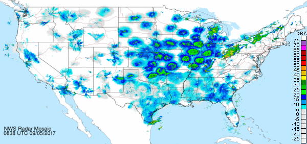
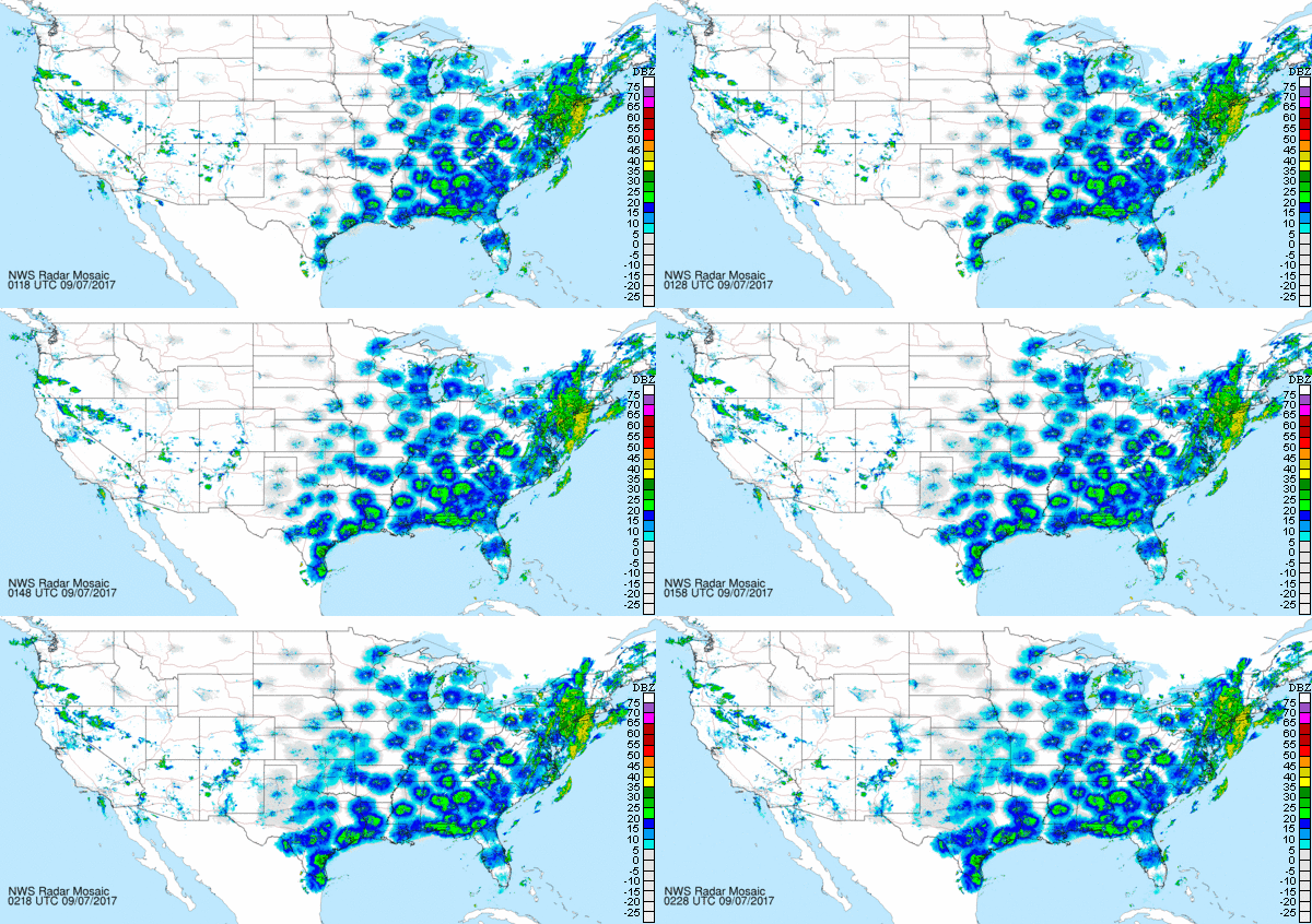
The second and third examples seen below are an autumn nocturnal migration movement, probably composed of many of the same tropics-bound species which were on the way north in the previous example. Note that during autumn, the cold front seems to motivate the flight following its passage. Ahead of the front, there is a reduced and, in places, undetectable volume of birds. The two images below are separated by about 42 hours.
National Oceanic and Atmospheric Administration/National Weather Service radar image (still) from September 5, 2017, at 2:38 AM EDT, shows rain in the northeast associated with a slow-moving cold front stretching from Maine southwest to New Mexico. Heaviest nocturnal bird flights can be seen behind the advancing front where there are favorable tail winds from the north or northwest.
Nearly two full days later, the slow-moving cold front from the previous image has crossed Pennsylvania. As nightfall progresses from east to west, ascending nocturnal migrants enter NEXRAD radar beams, their echoes creating expanding rings around individual sites. Concentrations of southbound birds can be seen along the gulf coast. Many will follow the Texas coastline into Mexico. The Neotropical migrants that try to cross the Gulf of Mexico this night could be in for a perilous voyage. Hurricane Katia is churning in the southern gulf and a much stronger storm, Hurricane Irma, is rolling toward the Bahamas and Florida from the southeast. Masses of birds that follow learned routes or instinct to venture offshore and cross seas under such circumstances could suffer catastrophic losses. (NOAA/National Weather Service image)
You can easily learn much more about birds (and insects and bats) on radar, including both diurnal and nocturnal migrants, by visiting the Clemson University Radar Ornithology Laboratory (CUROL) website. There you’ll find information on using the various mode settings on NEXRAD (Next-Generation Radar) to differentiate between birds, other flying animals, and inanimate airborne or grounded objects. It’s superbly done and you’ll be glad you gave it a try.
SOURCES
Clemson University Radar Ornithology Laboratory (CUROL) website: http://virtual.clemson.edu/groups/birdrad/ as accessed September 6, 2017.
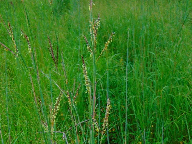
The tall seed-topped stems swaying in a summer breeze are a pleasant scene. And the colorful autumn shades of blue, orange, purple, red, and, of course, green leaves on these clumping plants are nice. But of the multitude of flowering plants, Big Bluestem, Freshwater Cordgrass, and Switchgrass aren’t much of a draw. No self-respecting bloom addict is going out of their way to have a gander at any grass that hasn’t been subjugated and tamed by a hideous set of spinning steel blades. Grass flowers…are you kidding?
Big Bluestem in flower in the Riverine Grasslands at Conewago Falls.
O.K., so you need something more. Here’s more.
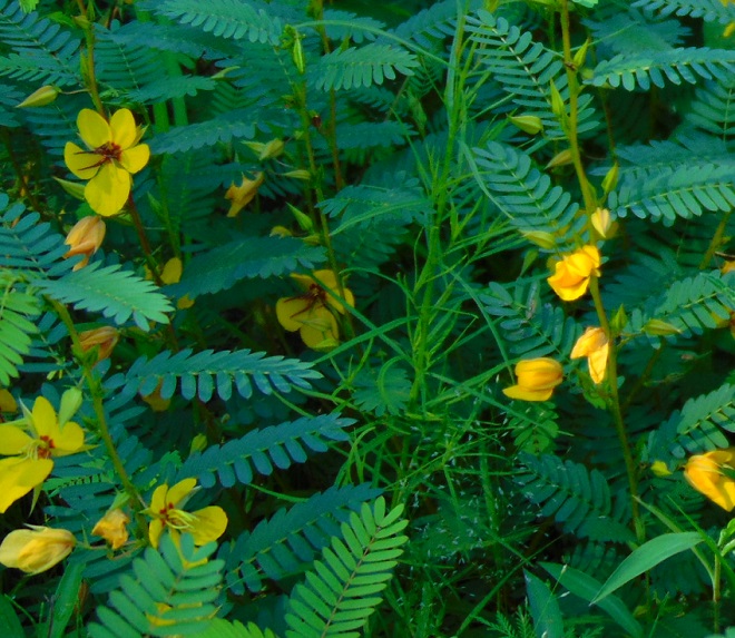
Meet the Partridge Pea (Chamaecrista fasciculata). It’s an annual plant growing in the Riverine Grasslands at Conewago Falls as a companion to Big Bluestem. It has a special niche growing in the sandy and, in summertime, dry soils left behind by earlier flooding and ice scour. The divided leaves close upon contact and also at nightfall. Bees and other pollinators are drawn to the abundance of butter-yellow blossoms. Like the familiar pea of the vegetable garden, the flowers are followed by flat seed pods.
The Partridge Pea can tolerate dry sandy soils.
But wait, here’s more.
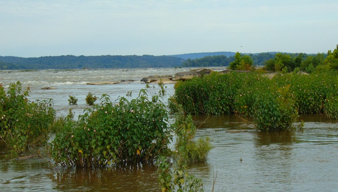
In addition to its abundance in Conewago Falls, the Halberd-leaved Rose Mallow (Hibiscus laevis) is the ubiquitous water’s edge plant along the free-flowing Susquehanna River for miles downstream. It grows in large clumps, often defining the border between the emergent zone and shore-rooted plants. It is particularly successful in accumulations of alluvium interspersed with heavier pebbles and stone into which the roots will anchor to endure flooding and scour. Such substrate buildup around the falls, along mid-river islands, and along the shores of the low-lying Riparian Woodlands immediately below the falls are often quite hospitable to the species.
Halberd-leaved Rose Mallow is a durable inhabitant of the falls. Regular flooding keeps competing species at bay. A taproot helps to safeguard against dislocation, allowing plants to grow in places subjected to turbulent currents.
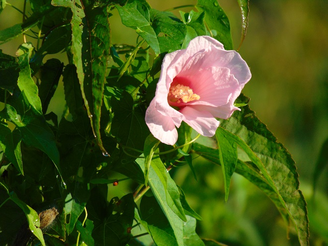
Halberd-leaved Rose Mallow in bloom. The similarity to cultivated members of the Hibiscus genus can readily be seen. It is one of the showiest of perennial wildflowers in the floodplain. Note the lobed, halberd-shaped leaves, source of its former species name militaris.
The seeds of Halberd-leaved Rose Mallow are contained in bladders which can float to assist in their distribution. Some of these bladders cling to the dead leafless stems in winter, making it an easy plant to identify in nearly any season.
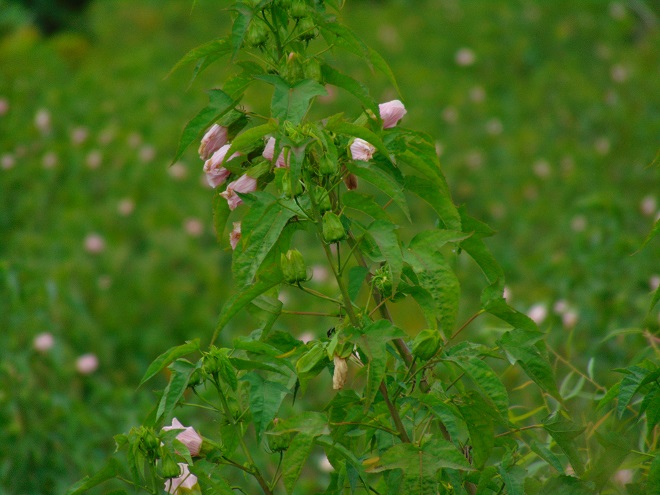
A second native wildflower species in the genus Hibiscus is found in the Conewago Falls floodplain, this one in wetlands. The Swamp Rose Mallow (H. moscheutos) is similar to Halberd-leaved Rose Mallow, but sports more variable and colorful blooms. The leaves are toothed without the deep halberd-style lobes and, like the stems, are downy. As the common name implies, it requires swampy habitat with ample water and sunlight.
Swamp Rose Mallow in a sunny wetland. This variety with solid-colored flowers (without dark centers) and pale green leaves and stems was formerly known as a separate species of Swamp Rose Mallow, H. palustris. Note that the flowers are terminal on the stems.
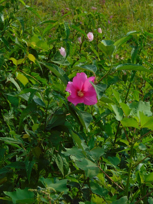
A few scattered specimens of a more typical variety of Swamp Rose Mallow are found on the shoreline and in the Riverine Grasslands of Conewago Falls. The blooms are bright pink with darker centers and the leaf stems are robust and reddish. This one is seen growing among Halberd-leaved Rose Mallow, with which it shares the characteristic of having flower stems growing from some of the upper leaf axils. A variety with red-centered white flowers is often found throughout the plant’s range.
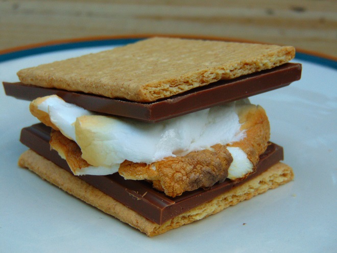
In summary, we find Partridge Pea in the Riverine Grasslands growing in sandy deposits left by flood and ice scour. We find Halberd-leaved Rose Mallow rooted at the border between shore and the emergent zone. We find Swamp Rose Mallow as an emergent in the wetlands of the floodplain. And finally, we find marshmallows in only one location in the area of Conewago Falls. Bon ap’.
Here’s S’more
SOURCES
Newcomb, Lawrence. 1977. Newcomb’s Wildflower Guide. Little, Brown and Company. Boston, Massachusetts.
It has not been a good summer if you happen to be a submerged plant species in the lower Susquehanna River. Regularly occurring showers and thunderstorms have produced torrents of rain and higher than usual river stages. The high water alone wouldn’t prevent you from growing, colonizing a wider area, and floating several small flowers on the surface, however, the turbidity, the suspended sediment, would. The muddy current casts a dirty shadow on the benthic zone preventing bottom-rooted plants from getting much headway. There will be smaller floating mats of the uppermost leaves of these species. Fish and invertebrates which rely upon this habitat for food and shelter will find sparse accommodation…better luck next year.
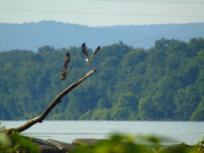
Due to the dirty water, fish-eating birds are having a challenging season as they try to catch sufficient quantities of prey to feed themselves and their offspring. A family of Ospreys (Pandion haliaetus) at Conewago Falls, including recently fledged young, were observed throughout this morning and had no successful catches. Of the hundred or more individual piscivores of various species present, none were seen retrieving fish from the river. The visibility in the water column needs to improve before fishing is a viable enterprise again.
Ospreys competing for a suitable fishing perch. Improving water conditions in the coming week should increase their success as predators.
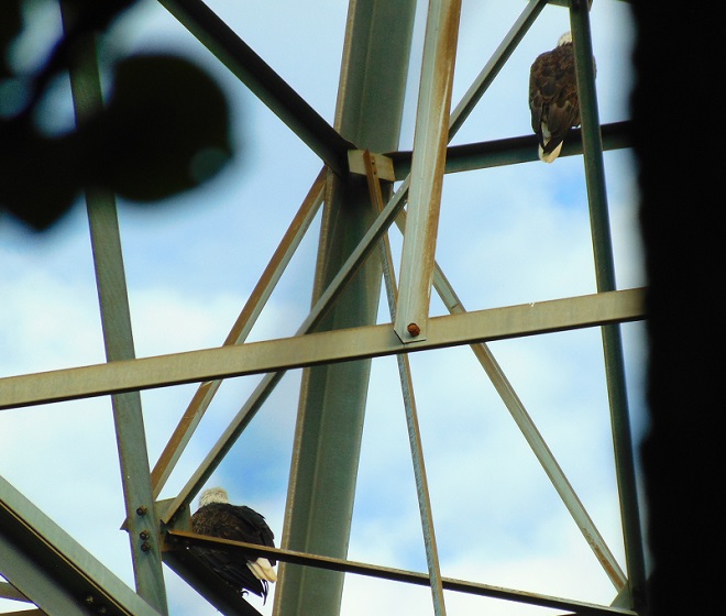
Versatile at finding food, adult Bald Eagles are experienced and know to be on the lookout for Ospreys with fish, a meal they can steal through intimidation.
While the submerged plant communities may be stunted by 2017’s extraordinary water levels, there is a very unique habitat in Conewago Falls which endures summer flooding and, in addition, requires the scouring effects of river ice to maintain its mosaic of unique plants. It is known as a Riverine Grassland or scour grassland.
The predominant plants of the Riverine Grasslands are perennial warm-season grasses. The deep root systems of these hardy species have evolved to survive events which prevent the grassland from reverting to woodland through succession. Fire, intense grazing by wild herd animals, poor soils, drought, and other hardships, including flooding and ice scour, will eliminate intolerant plant species and prevent an area from reforesting. In winter and early spring, scraping and grinding by flood-driven chunk ice mechanically removes large woody and poorly rooted herbaceous growth from susceptible portions of the falls. These adverse conditions clear the way for populations of species more often associated with North America’s tall grass prairies to take root. Let’s have a look at some of the common species found in the “Conewago Falls Pothole Rocks Prairie”.
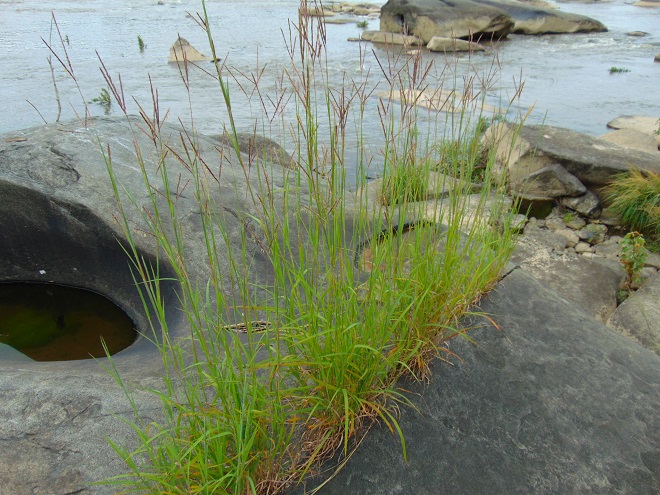
Big Bluestem (Andropogon gerardi), seen heregrowing in the cracks of a pothole rock. High water nourishes the plant by filling the crevices with nutrient-loaded sediment. This species evolved with roots over three feet deep to survive fires, trampling by bison, and drought.
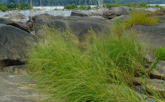
Freshwater Cordgrass (Spartina pectinata) does well with its roots in water. It creates exceptional bird habitat and grows in the falls and on ice-scoured small islands in free-flowing segments of the Susquehanna River downstream.
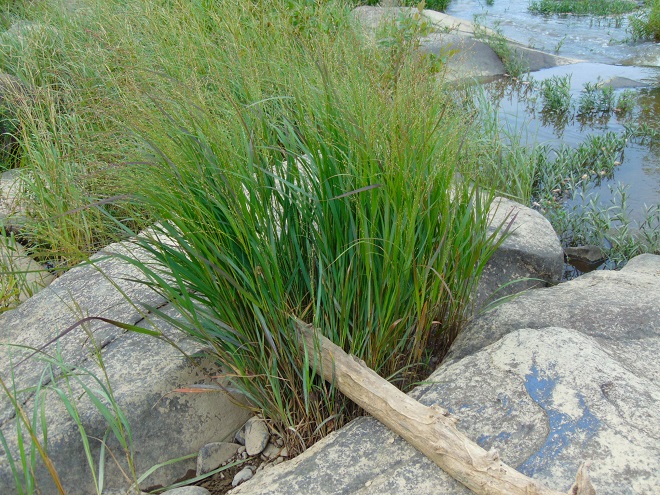
Switchgrass (Panicum virgatum), like Big Bluestem, is one of the tall grass prairie species and, like Freshwater Cordgrass, grows in near pure stands on ice-scoured islands. It takes flooding well and its extensive root system prevents erosion.
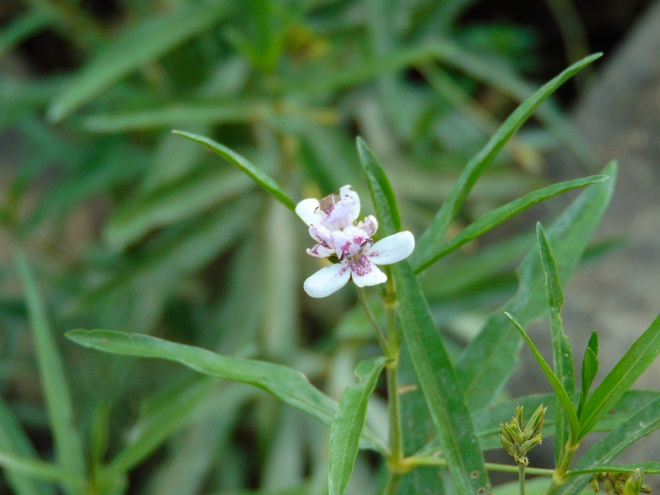
Though not a grass, Water Willow (Justicia americana) is familiar as a flood-enduring emergent plant of river islands, gravel bars, and shorelines where its creeping rhizome root system spreads the plant into large masses. These stands are often known locally as “grass beds”. This member of the acanthus family provides habitat for fish and invertebrates among its flooded leaves and stems. Its presence is critical to aquatic life in a year such as this.
The Conewago Falls Riverine Grassland is home to numerous other very interesting plants. We’ll look at more of them next time.
SOURCES
Brown, Lauren. 1979. Grasses, An Identification Guide. Houghton Mifflin Company. New York, NY.
She ate only toaster pastries…that’s it…nothing else. Every now and then, on special occasions, when a big dinner was served, she’d have a small helping of mashed potatoes, no gravy, just plain, thank you. She received all her nutrition from several meals a week of macaroni and cheese assembled from processed ingredients found in a cardboard box. It contains eight essential vitamins and minerals, don’t you know? You remember her, don’t you?
Adult female butterflies must lay their eggs where the hatched larvae will promptly find the precise food needed to fuel their growth. These caterpillars are fussy eaters, with some able to feed upon only one particular species or genus of plant to grow through the five stages, the instars, of larval life. The energy for their fifth molt into a pupa, known as a chrysalis, and metamorphosis into an adult butterfly requires mass consumption of the required plant matter. Their life cycle causes most butterflies to be very habitat specific. These splendid insects may visit the urban or suburban garden as adults to feed on nectar plants, however, successful reproduction relies upon environs which include suitable, thriving, pesticide-free host plants for the caterpillars. Their survival depends upon more than the vegetation surrounding the typical lawn will provide.
The Monarch (Danaus plexippus), a butterfly familiar in North America for its conspicuous autumn migrations to forests in Mexico, uses the milkweeds (Asclepias) almost exclusively as a host plant. Here at Conewago Falls, wetlands with Swamp Milkweed (Asclepias incarnata) and unsprayed clearings with Common Milkweed (A. syriaca) are essential to the successful reproduction of the species. Human disturbance, including liberal use of herbicides, and invasive plant species can diminish the biomass of the Monarch’s favored nourishment, thus reducing significantly the abundance of the migratory late-season generation.
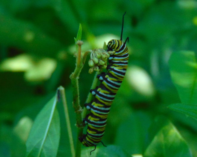
Monarch caterpillar after a fourth molt. The fifth instar feeding on Swamp Milkweed.
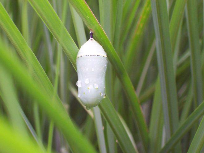
A fifth molt begets the Monarch pupa, the chrysalis, from which the showy adult butterfly will emerge.
Adult Monarch feeding on Goldenrod (Solidago) nectar.
Butterflies are good indicators of the ecological health of a given environment. A diversity of butterfly species in a given area requires a wide array of mostly indigenous plants to provide food for reproduction. Let’s have a look at some of the species seen around Conewago Falls this week…
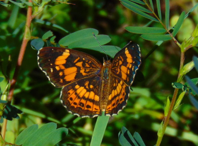
An adult Silvery Checkerspot (Chlosyne nycteis) visiting a nectar plant, Partridge Pea (Chamaecrista fasciculata). Wingstem (Verbesina alternifolia), a plant of the Riparian Woodlands, is among the probable hosts for the caterpillars.
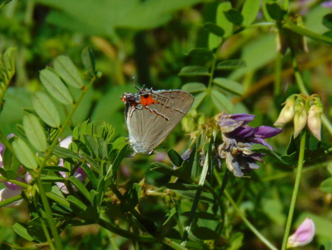
A Gray Hairstreak (Strymon melinus) visits Crown Vetch, a possible host plant. Other potential larval food in the area includes Partridge Pea, Halberd-leaved Rose Mallow (Hibiscus laevis) of the river shoreline, and Swamp Rose Mallow (Hibiscus moscheutos), a plant of wetlands.
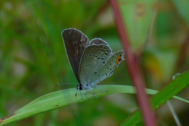
The Eastern Tailed Blue (Cupido comyntas) may use Partridge Pea , a native wildflower species, and the introduced Crown Vetch (Securigera/Coronilla varia) as host and nectar plants at Conewago Falls.
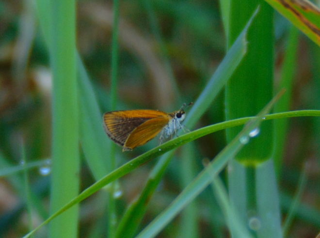
The Least Skipper (Ancyloxypha numitor) is at home among tall grasses in woodland openings, at riverside, and in the scoured grassland habitat of the Pothole Rocks in the falls. Host plants available include Switchgrass (Panicum vigatum), Freshwater Cordgrass (Spartina pectinata), and Foxtails (Setaria).
The Zabulon Skipper (Poanes zabulon) is an inhabitant of moist clearings where the caterpillars may feed upon Lovegrasses (Eragrostis) and Purpletop (Tridens flavus).
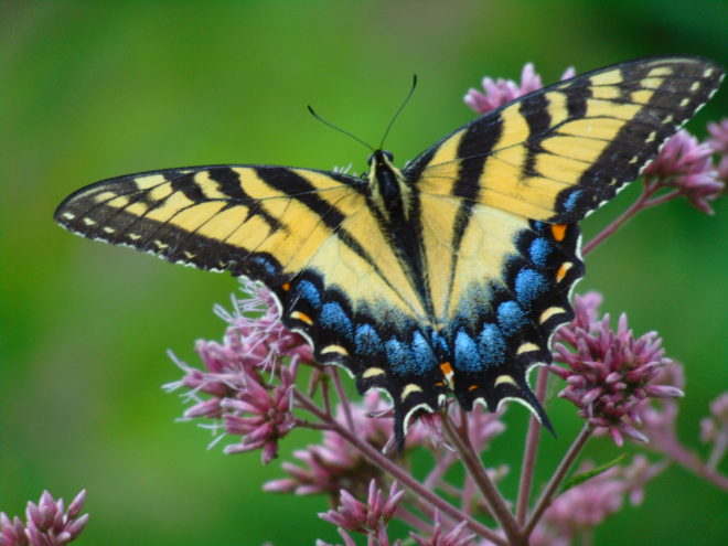
The Eastern Tiger Swallowtail (Papilio glaucus), a female seen here gathering nectar from Joe-Pye Weed (Eutrochium), relies upon several forest trees as hosts. Black Cherry (Prunus serotina), Willow (Salix), Yellow Poplar (Liriodendron tulipifera), also known as Tuliptree, and Green Ash (Fraxinus pennsylvanica) are among the local species known to be used. The future of the latter food species at Conewago Falls is doubtful. Fortunately for the Eastern Tiger Swallowtail, the “generalist” feeding requirements of this butterfly’s larvae enable the species to survive the loss of a host plant.
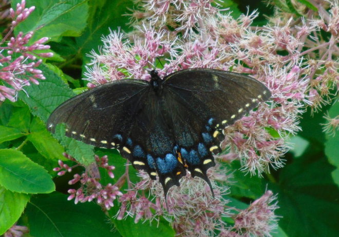
A female Eastern Tiger Swallowtail, black morph, gathering nectar from Joe-Pye Weed.
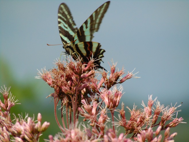
The Zebra Swallowtail (Protographium marcellus), an adult seen here on Joe-Pye Weed, feeds exclusively upon Pawpaw (Asimina) trees as a caterpillar. This butterfly species may wander, but its breeding range is limited to the moist Riparian Woodlands where colonial groves of Pawpaw may be found. The Common Pawpaw (Asimina triloba), our native species in Pennsylvania, and the Zebra Swallowtail occur at the northern edge of their geographic ranges in the Lower Susquehanna River Watershed. Planting Pawpaw trees as an element of streamside reforestation projects certainly benefits this marvelous butterfly.
The spectacularly colorful butterflies are a real treat on a hot summer day. Their affinity for showy plants doubles the pleasure.
By the way, I’m certain by now you’ve recalled that fussy eater…and how beautiful she grew up to be.
SOURCES
Brock, Jim P., and Kaufman, Kenn. 2003. Butterflies of North America. Houghton Mifflin Company. New York, NY.
It was one of the very first of my memories. From the lawn of our home I could look across the road and down the hill through a gap in the woodlands. There I could see water, sometimes still with numerous boulders exposed, other times rushing, muddy, and roaring. Behind these waters was a great stone wall and beyond that a wooded hillside. I recall my dad asking me if I could see the dam down there. I couldn’t see a dam, just fascinating water and the gray wall behind it. I looked and searched but not a trace of a structure spanning the near to far shore was to be seen. Finally, at some point, I answered in the affirmative to his query; I could see the dam…but I couldn’t.
We lived in a small house in the village of Falmouth along the Susquehanna River in the northwest corner of Lancaster County over fifty years ago. A few years after we had left our riverside domicile and moved to a larger town, the little house was relocated to make way for an electric distribution sub-station and a second set of electric transmission wires in the gap in the woodlands. The Brunner Island coal-fired electric generating station was being upgraded downstream and, just upstream, a new nuclear-powered generating station was being constructed on Three Mile Island. To make way for the expanding energy grid, our former residence was trucked to a nearby boat landing where there were numerous other river shacks and cabins. Because it was placed in the floodplain, the building was raised onto a set of wooden stilts to escape high water. It didn’t help. The record-breaking floods of Hurricane Agnes in June of 1972 swept the house away.
The view through the cut in the woodland, a little wider than in the early 1960s with the addition of the newer electric transmission wire towers. The “Wall” is the same.
During the time we lived along the Susquehanna, the river experienced record-low flow rates, particularly in the autumn of 1963 and again in 1964. My dad was a dedicated 8mm home-movie photographer. Among his reels was film of buses parked haphazardly along the road (PA Route 441 today) near our home. Sightseers were coming to explore the widely publicized dry riverbed and a curious moon-like landscape of cratered rocks and boulders. It’s hard to fathom, but people did things like that during their weekends before Sunday-afternoon football was invented. Scores of visitors climbed through the rocks and truck-size boulders inspecting this peculiar scene. My dad, his friends, and so many others with camera in hand were experiencing the amazing geological feature known as the Pothole Rocks of Conewago Falls.
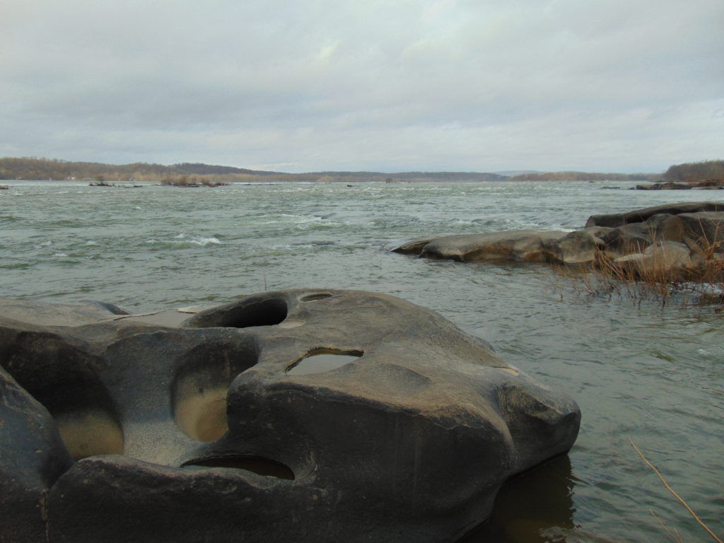
Conewago Falls on the Susquehanna River and several exposed York Haven Diabase Pothole Rocks. Lancaster (foreground) and Dauphin (center) Counties meet along a southwest to northeast borderline through the rapids. Lands on the west shoreline in the background are in York County. Three Mile Island is seen in the upper right.
The river here meets serious resistance as it pushes its way through the complex geology of south-central Pennsylvania. These hard dark-gray rocks, York Haven Diabase, are igneous in origin. Diabase sheets and sills intruded the Triassic sediments of the Gettysburg Formation here over 190 million years ago. It may be difficult to visualize, but these sediments were eroded from surrounding mountains into the opening rift valley we call the Gettysburg Basin. This rift and others in a line from Nova Scotia to Georgia formed as the supercontinent Pangaea began dividing into the continents we know today. Eventually the Atlantic Ocean rift would dominate as the active dynamic force and open to separate Africa from North America. The inactive Gettysburg Basin, filled with sediments and intruded by igneous diabase, would henceforth, like the mountainous highlands surrounding it, be subjected to millions of years of erosion. Of the regional rocks, the formations of Triassic redbeds, sandstones, and particularly diabase in the Gettysburg Basin are among the more resistant to the forces of erosion. Many less resistant older rocks, particularly those of surrounding mountains, are gone. Today, the remains of the Gettysburg Basin’s rock formations stand as rolling highlands in the Piedmont Province.
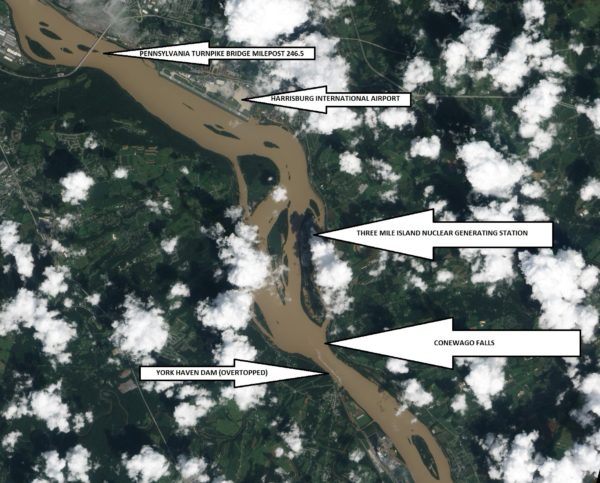
Flooded from the heavy rains of Tropical Storm Lee, the sediment-laden Susquehanna River flows through the Gettysburg Basin just south of Harrisburg, PA, September 10, 2011. The “Wall” as seen from space. (NASA Earth Observatory Image)
The weekend visitors in 1963 and 1964 marveled at evidence of the river’s fight to break down the hard York Haven Diabase. Scoured bedrock traced the water’s turbulent flow patterns through the topography of the falls. Meltwater from the receding glaciers of the Pleistocene Ice Ages thousands to tens of thousands of years ago raged in high-volume, abrasive-loaded torrents to sculpt the Pothole Rocks into the forms we see today. Our modern floodwaters with ice and fine suspended sediments continue to wear at the smooth rocks and boulders, yet few are broken or crumbled to be swept away. It’s a very slow process. The river elevation here drops approximately 19 feet in a quarter of a mile, a testament to the bedrock’s persisting resistance to erosion. Conewago Falls stands as a natural anomaly on a predominantly uniform gradient along the lower Susquehanna’s downhill path from the Appalachian Mountains to the Chesapeake Bay.
Normally the scene of dangerous tumbling rapids, the drought and low water of 1963 and 1964 had left the falls to resemble a placid scene—a moonscape during a time when people were obsessed with mankind’s effort to visit earth’s satellite. Visitors saw the falls as few others had during the twentieth century. Dr. Herbert Beck of Franklin and Marshall College described an earlier period of exposure, “…pot holes…were uncovered during the third week in October, 1947, for the first time in the memory of man, when the drought parched Susquehanna River retreated far below its normal low stage”. Then, as in 1963 and on occasions more recent, much of it was due to the presence of the wall. I had to be a bit older than four years old to grasp it. You see the wall and the dam are one and the same. The wall is the York Haven Dam. And it is responsible for channeling away the low flow of the Susquehanna during periods of drought so that we might have the opportunity to visit and explore the Pothole Rocks of Conewago Falls along the river’s east shore.
The initial segment of the dam, a crib structure built in 1885 by the York Haven Paper Company to supply water power to their mill, took advantage of the geomorphic features of the diabase bedrock of Conewago Falls to divert additional river flow into the abandoned Conewago Canal. The former canal, opened in 1797 to allow passage around the rapids along the west shore, was being used as a headrace to channel water into the grinding mill’s turbines. Strategic placement of this first wall directed as much water as possible toward the mill with the smallest dam practicable. The York Haven Power Company incorporated the paper mill’s crib dam into the “run-of-the-river” dam built through the falls from the electric turbine powerhouse they constructed on the west shore to the southern portion of Three Mile Island more than a mile away. The facility began electric generation in 1904. The construction of the “Red Hill Dam” from the east shore of Three Mile Island to the river’s east shore made York Haven Dam a complete impoundment on the Susquehanna. The pool, “Lake Frederic”, thus floods that portion of the Pothole Rocks of Conewago Falls located behind the dam. On the downstream side, water spilling over or through the dam often inundates the rocks or renders them inaccessible.
During the droughts of the early 1960s, diversion of nearly all river flow to the York Haven Dam powerhouse cleared the way for weekend explorers to see the Pothole Rocks in detail. Void of water, the intriguing bedrock of Conewago Falls below the dam greeted the curious with its ripples, cavities, and oddity. It was an opportunity nature alone would not provide. It was all because of the wall.
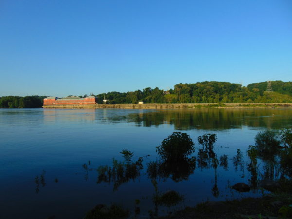
York Haven Dam and powerhouse. The “Wall” traverses Conewago Falls upstream to Three Mile Island to direct water to the powerhouse on the west shore of the Susquehanna River.
SOURCES
Beck, Herbert H. 1948. “The Pot Holes of Conewago Falls”. Proceedings of the Pennsylvania Academy of Science. Penn State University Press. 22: pp. 127-130.
Smith, Stephen H. 2015. #6 York Haven Paper Company; on the Site of One of the Earliest Canals in America. York Past website www.yorkblog.com/yorkpast/2015/02/17/6-york-haven-paper-company-on-the-site-of-one-of-the-earliest-canals-in-america/ as accessed July 17, 2017.
Stranahan, Susan Q. 1993. Susquehanna, River of Dreams. The Johns Hopkins University Press. Baltimore, Maryland.
Van Diver, Bradford B. 1990. Roadside Geology of Pennsylvania. Mountain Press Publishing Company. Missoula, Montana.