
Photo of the Day

LIFE IN THE LOWER SUSQUEHANNA RIVER WATERSHED
A Natural History of Conewago Falls—The Waters of Three Mile Island
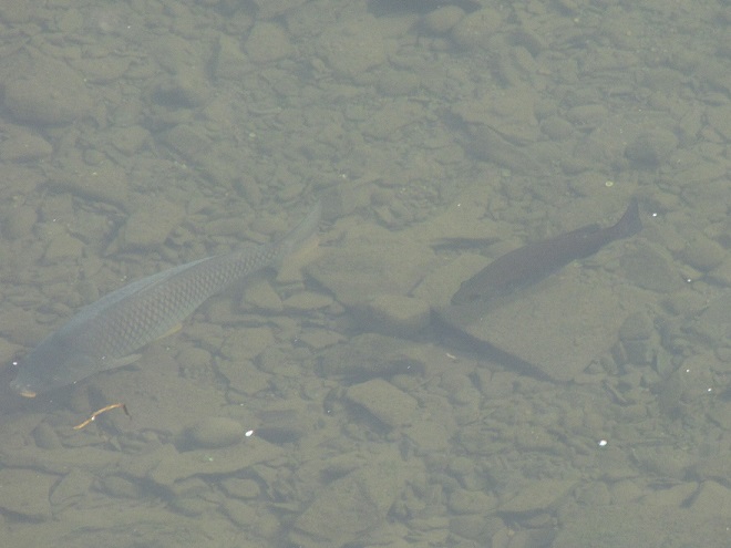
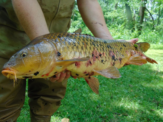
One of the earliest non-native fish species to be widely released into North American waterways was the Common Carp. Stocks brought to the United States were likely sourced from populations already naturalized throughout much of western Europe after introductions originating from the fish’s native range in Eurasia, probably including the Danube and other watersheds east through the Volga. In western Europe, the species promised to be an abundant and easily cultivated food source. Under the same premise, carp were transported to the United States during the early 1800s and widely introduced into streams, lakes, and rivers throughout the country.
Common Carp thrive in nutrient-rich waters, particularly those subjected to sewage discharge and agricultural runoff, conditions which were already prevalent during the Common Carp’s initial introduction and have remained widespread ever since. Within these polluted streams, lakes, and ponds, introduced carp feed aggressively on benthic organisms and plants, stirring up decaying organic matter (mulm) from the substrate. This process raises turbidity in the water column and releases excessive amounts of the nutrient phosphorus resulting in unusually large algal blooms. Algal blooms can block sunlight from the longer-lived oxygen-producing vascular plants that grow in submerged environs. Growing beneath a dense cloud or blanket of algae can compromise the vigor of oxygen-producing vascular plants and disable their biochemical functions within the aquatic ecosystem. As the short-lived algae die, the bacteria that decay them begin to place increased oxygen demands on the water. With less oxygen being produced by both the vascular plants and the algae, and with oxygen consumption increased by the activity of decomposers, conditions can become fatal for fish and other organisms. This process is known as eutrophication. Because Common Carp are among the species most tolerant of eutrophic conditions, they tend to thrive in the conditions they create while the native fishes perish.
Common Carp spawn in the spring, usually from late April through June, when the water temperature is as low as 58 degrees and as high as 83 degrees Fahrenheit. This activity is often triggered by a rapid increase in water temperature. In a small lake, this may be brought on by a string of sunny days in late April or May. On larger streams and rivers, the temperature spike that initiates the spawn may not occur until warm rains and runoff enter the stream during June.


Common Carp are one of the most widely farmed and eaten fish in all the world. Here in the United States, they were introduced beginning two hundred years ago because they were favorable to the palate, grew to large size quickly, and were a source of much needed food. Today, the Common Carp is seldom found on the American dinner plate. Yet, pound for pound, it is one of the most abundant fish in many of our waters, particularly in man-made lakes. Like some of our other most invasive species—including Blue Catfish, Flathead Catfish, and Northern Snakehead—Common Carp are perhaps the most edible of our freshwater fishes. For many cultures, they are an important staple. For others, they are a delicacy or holiday treat. In America, they do horrendous damage to aquatic ecosystems following establishment as a food crop that almost never gets harvested. Did you realize that on the internet, there are literally hundreds of recipes and culinary videos available to show you how to prepare delicious dishes made with Common Carp? It’s true. And for the cost of a fishing license, you can catch all you want, usually several pounds at a time. So why not give the marine fisheries a break? Take the big leap and learn to eat invasive freshwater species instead.

You say you really don’t want to take a look back at 2020? Okay, we understand. But here’s something you may find interesting, and it has to do with the Susquehanna River in 2020.
As you may know, the National Weather Service has calculated the mean temperature for the year 2020 as monitored just upriver from Conewago Falls at Harrisburg International Airport. The 56.7° Fahrenheit value was the highest in nearly 130 years of monitoring at the various stations used to register official climate statistics for the capital city. The previous high, 56.6°, was set in 1998.
Though not a prerequisite for its occurrence, record-breaking heat was accompanied by a drought in 2020. Most of the Susquehanna River drainage basin experienced drought conditions during the second half of the year, particularly areas of the watershed upstream of Conewago Falls. A lack of significant rainfall resulted in low river flows throughout late summer and much of the autumn. Lacking water from the northern reaches, we see mid-river rocks and experience minimal readings on flow gauges along the lower Susquehanna, even if our local precipitation happens to be about average.
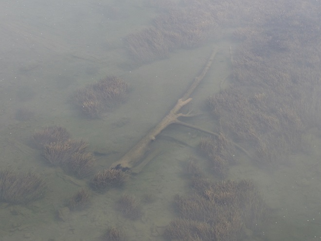
Back in October, when the river was about as low as it was going to get, we took a walk across the Susquehanna at Columbia-Wrightsville atop the Route 462/Veteran’s Memorial Bridge to have a look at the benthos—the life on the river’s bottom.
These improvements in water quality and wildlife habitat can have a ripple effect. In 2020, the reduction in nutrient loads entering Chesapeake Bay from the low-flowing Susquehanna may have combined with better-than-average flows from some of the bay’s lesser-polluted smaller tributaries to yield a reduction in the size of the bay’s oxygen-deprived “dead zones”. These dead zones typically occur in late summer when water temperatures are at their warmest, dissolved oxygen levels are at their lowest, and nutrient-fed algal blooms have peaked and died. Algal blooms can self-enhance their severity by clouding water, which blocks sunlight from reaching submerged aquatic plants and stunts their growth—making quantities of unconsumed nutrients available to make more algae. When a huge biomass of algae dies in a susceptible part of the bay, its decay can consume enough of the remaining dissolved oxygen to kill aquatic organisms and create a “dead zone”. The Chesapeake Bay Program reports that the average size of this year’s dead zone was 1.0 cubic miles, just below the 35-year average of 1.2 cubic miles.
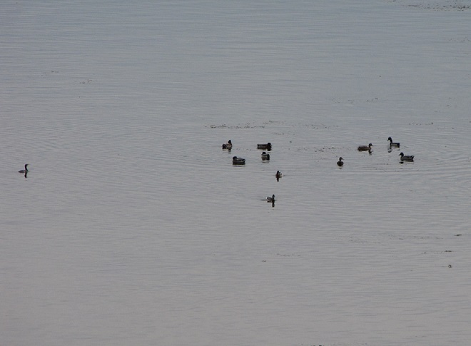
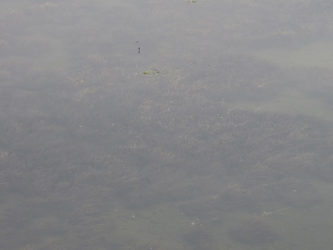
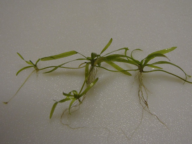
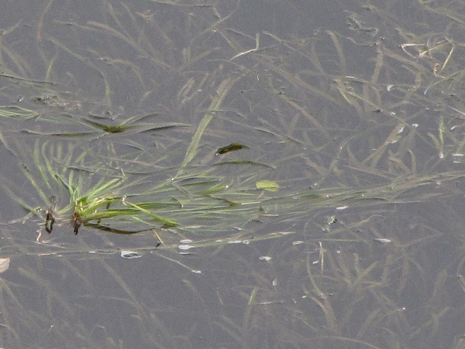
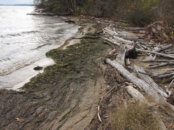
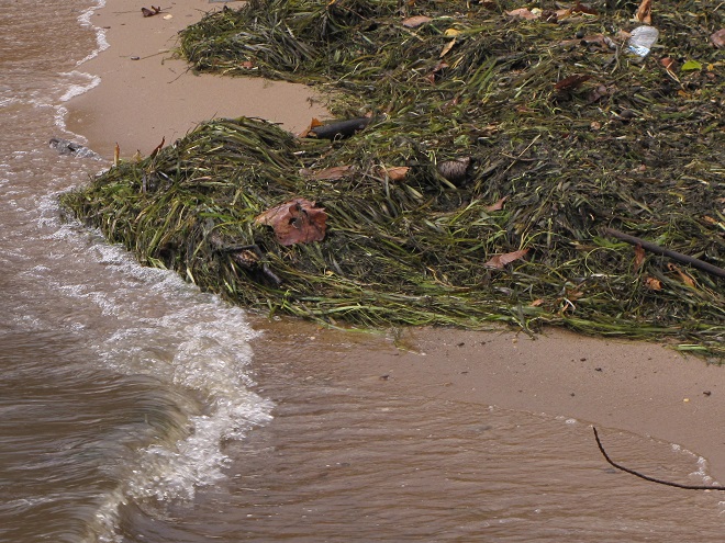
Back on a stormy day in mid-November, 2020, we took a look at the tidal freshwater section of Chesapeake Bay, the area known as Susquehanna Flats, located just to the southwest of the river’s mouth at Havre de Grace, Maryland. We wanted to see how the restored American Eelgrass beds there might have fared during a growing season with below average loads of nutrients and life-choking sediments spilling out of the nearby Susquehanna River. Here’s what we saw.

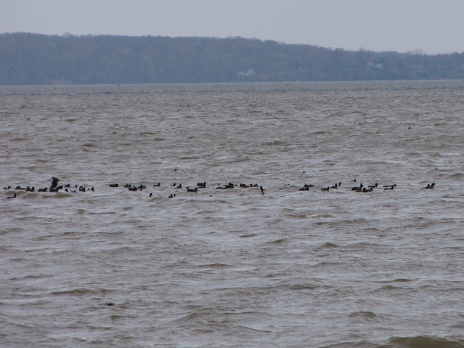
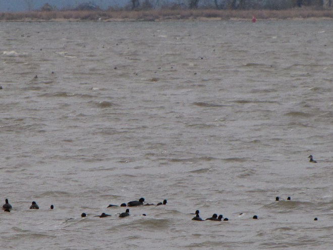
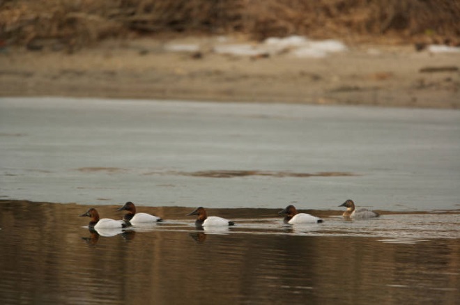
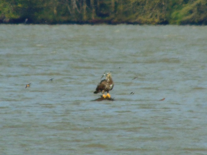
We noticed a few Canvasbacks (Aythya valisineria) on the Susquehanna Flats during our visit. Canvasbacks are renowned as benthic feeders, preferring the tubers and other parts of submerged aquatic plants (a.k.a. submersed aquatic vegetation or S.A.V.) including eelgrass, but also feeding on invertebrates including bivalves. The association between Canvasbacks and eelgrass is reflected in the former’s scientific species name valisineria, a derivitive of the genus name of the latter, Vallisneria.
The plight of the Canvasback and of American Eelgrass on the Susquehanna River was described by Herbert H. Beck in his account of the birds found in Lancaster County, Pennsylvania, published in 1924:
“Like all ducks, however, it stops to feed within the county less frequently than formerly, principally because the vast beds of wild celery which existed earlier on broads of the Susquehanna, as at Marietta and Washington Borough, have now been almost entirely wiped out by sedimentation of culm (anthracite coal waste). Prior to 1875 the four or five square miles of quiet water off Marietta were often as abundantly spread with wild fowl as the Susquehanna Flats are now.”
Beck quotes old Marietta resident and gunner Henry Zink:
“Sometimes there were as many as 500,000 ducks of various kinds on the Marietta broad at one time.”
The abundance of Canvasbacks and other ducks on the Susquehanna Flats would eventually plummet too. In the 1950s, there were an estimated 250, 000 Canvasbacks wintering on Chesapeake Bay, primarily in the area of the American Eelgrass, a.k.a. Wild Celery, beds on the Susquehanna Flats. When those eelgrass beds started disappearing during the second half of the twentieth century, the numbers of Canvasbacks wintering on the bay took a nosedive. As a population, the birds moved elsewhere to feed on different sources of food, often in saltier estuarine waters.
Canvasbacks were able to eat other foods and change their winter range to adapt to the loss of habitat on the Susquehanna River and Chesapeake Bay. But not all species are the omnivores that Canvasbacks happen to be, so they can’t just change their diet and/or fly away to a better place. And every time a habitat like the American Eelgrass plant community is eliminated from a region, it fragments the range for each species that relied upon it for all or part of its life cycle. Wildlife species get compacted into smaller and smaller suitable spaces and eventually their abundance and diversity are impacted. We sometimes marvel at large concentrations of birds and other wildlife without seeing the whole picture—that man has compressed them into ever-shrinking pieces of habitat that are but a fraction of the widespread environs they once utilized for survival. Then we sometimes harass and persecute them on the little pieces of refuge that remain. It’s not very nice, is it?
By the end of 2020, things on the Susquehanna were getting back to normal. Near normal rainfall over much of the watershed during the final three months of the year was supplemented by a mid-December snowstorm, then heavy downpours on Christmas Eve melted it all away. Several days later, the Susquehanna River was bank full and dishing out some minor flooding for the first time since early May. Isn’t it great to get back to normal?


SOURCES
Beck, Herbert H. 1924. A Chapter on the Ornithology of Lancaster County, Pennsylvania. The Lewis Historical Publishing Company. New York, NY.
White, Christopher P. 1989. Chesapeake Bay, Nature of the Estuary: A Field Guide. Tidewater Publishers. Centreville, MD.
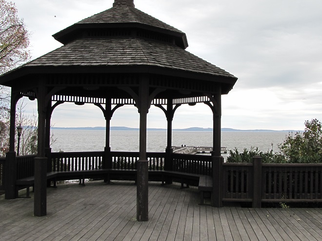
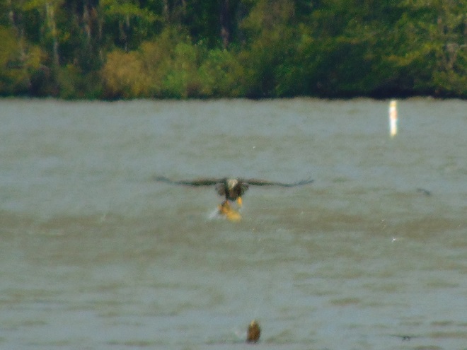
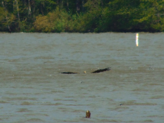
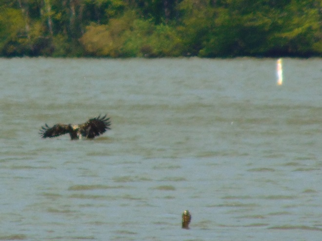
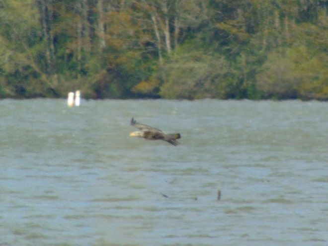
Here it is—just as it happened, recently in the lower Susquehanna valley.


SOURCES
Sedaghat, Safoura, Seyed Abbas Hoseini, Mohammad Larijani, and Khadijeh Shamekhi Ranjbar. 2013. “Age and Growth of Common Carp (Cyprinus carpio Linnaeus, 1758) in Southern Caspian Sea, Iran”. World Journal of Fish and Marine Sciences. 5:1. pp.71-73.
There are two Conewago Creek systems in the Lower Susquehanna River Watershed. One drains the Gettysburg Basin west of the river, mostly in Adams and York Counties, then flows into the Susquehanna at the base of Conewago Falls. The other drains the Gettysburg Basin east of the river, flowing through Triassic redbeds of the Gettysburg Formation and York Haven Diabase before entering Conewago Falls near the south tip of Three Mile Island. Both Conewago Creeks flow through suburbia, farm, and forest. Both have their capacity to support aquatic life impaired and diminished by nutrient and sediment pollution.
This week, some of the many partners engaged in a long-term collaboration to restore the east shore’s Conewago Creek met to have a look at one of the prime indicators of overall stream habitat health—the fishes. Kristen Kyler of the Lower Susquehanna Initiative organized the effort. Portable backpack-mounted electrofishing units and nets were used by crews to capture, identify, and count the native and non-native fishes at sampling locations which have remained constant since prior to the numerous stream improvement projects which began more than ten years ago. Some of the present-day sample sites were first used following Hurricane Agnes in 1972 by Stambaugh and Denoncourt and pre-date any implementation of sediment and nutrient mitigation practices like cover crops, no-till farming, field terracing, stormwater control, nutrient management, wetland restoration, streambank fencing, renewed forested stream buffers, or modernized wastewater treatment plants. By comparing more recent surveys with this baseline data, it may be possible to discern trends in fish populations resulting not only from conservation practices, but from many other variables which may impact the Conewago Creek Warmwater Stream ecosystem in Dauphin, Lancaster, and Lebanon Counties.
So here they are. Enjoy these shocking fish photos.


SOURCES
Normandeau Associates, Inc. and Gomez and Sullivan. 2018. Muddy Run Pumped Storage Project Conowingo Eel Collection Facility FERC Project 2355. Prepared for Exelon.
Stambaugh, Jr., John W., and Robert P. Denoncourt. 1974. A Preliminary Report on the Conewago Creek Faunal Survey, Lancaster County, Pennsylvania. Proceedings of the Pennsylvania Academy of Sciences. 48: 55-60.