Some comparative attributes of unspoiled lotic vs. lentic freshwater ecosystems. Low-gradient (slow-moving) lotic waters often create, and remain connected to, accompanying riverine wetlands (a lentic freshwater ecosystem). These swamps, marshes, and ditches absorb, purify, and infiltrate flood waters while supporting a diverse number of plant and animal species.
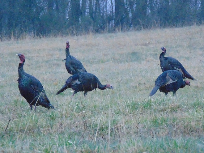
We frequently perceive all waterfowl migration to be synchronized with the conspicuous movements of familiar species like Snow Geese, Tundra Swans, and Canada Geese—big flights coming south in October and November, then a return to the north in late February and March. And we’re all quite aware of the occurrence of large gatherings of some of these migrants while they make stopovers on some of our largest lentic (still) waters—the man-made lakes and reservoirs created by damming local streams. But did you know that there are populations of colorful waterfowl with dynamic migrations that extend throughout the winter and early spring with movements that are often continuous. Under favorable conditions, these birds favor the lotic (flowing) waters of the river and its larger tributaries as they transit the lower Susquehanna valley. That’s because unpolluted lotic freshwater ecosystems support a greater diversity of plants and animals than lentic waters, and therefore offer more opportunities for hungry migrating waterfowl to find food. Let’s have a look at some of the species that visit the river during their seasonal journeys…
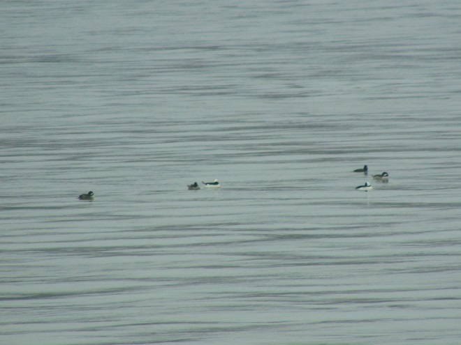
While the urge to head south in the autumn is largely stimulated by the shortening of the photoperiod, it is the presence of ice, particularly on glacial lakes throughout the lands to the north of the lower Susquehanna River basin, that pushes many diving ducks to finally make their way south toward the guarantee of open-water feeding areas along the coast. This movement may occur at anytime between November and late February or, as we have seen during some of the mild winters of recent decades, it may scarcely be noticed at all.Common Mergansers often lead they way when it comes to migratory diving ducks. They regularly move south in conspicuous numbers by late November and December and are regularly pushing north as soon as the ice begins to melt. During a typical year, it is not unusual for some populations of these large diving birds to remain north of us during the winter. Then, in the days after a sudden rush of frigid polar air, an appreciable increase in ice cover will force a mid-winter movement of birds down the Susquehanna.Temperatures in lotic fresh waters vary over the length of the stream or river. They are largely determined by the collective impact of the numerous sources of heat flux depicted in this graphic. (Environmental Protection Agency image)Buffleheads begin passing through the lower Susquehanna region in Novemeber on their way to coastal saltwater bays for the winter. Lingering populations feed by diving in the river’s pools and riffles for benthic invertebrates including snails and insect larvae. Lesser quantities of aquatic plant matter supplement their diet.Many Common Goldeneyes will remain on shallow, ice-free waters of the northern lakes and rivers sculpted by the most recent glacial event, but only until they are forced south into and through the lower Susquehanna valley by the encroachment of freezing conditions. On the river, they are among the dozen or so species of diving ducks we see visiting or passing through during the typical late fall and early river.
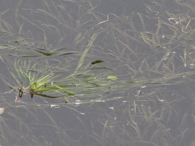
During their visits to the lotic (also known as riverine) fresh waters of the Susquehanna and its largest tributaries, benthic-feeding waterfowl make short dives to take advantage of the plants, small fish, invertebrates, and other food sources inhabiting the stream bottom in the riffles and pools of the free-flowing waterway. Substrates, listed here by size (in descending order), along with other parameters influenced by this zonation determine the variety and abundance of the forage available to migrating waterfowl and other consumers. Ice or high water and poor visibility due to flooding can render the riffles and pools of the channel unusable for feeding. The birds must then choose to either linger and rest without feeding or leave the lotic freshwater habitat to seek sustenance. During a flood, this may require relocation to a nearby lentic (still) body of fresh water such as a lake or reservoir. The presence of ice will almost invariably force the birds to fly on to the Atlantic Coastal Plain and the tidal waters of its bays and estuaries.Hooded Mergansers are one of the few species of diving ducks likely to utilize flooded shoreline timber and riverine (fluvial) wetlands as refuge from high water on Susquehanna.A Pied-billed Grebe and a pair of Canvasbacks on an ice-free stretch of the lower Susquehanna in mid-winter feed and loaf in a riffle-flanked pool where a large mat of American Eelgrass, a submerged aquatic plant also known as Tapegrass or Wild Celery, grows during the summer. The vast mosaic of riffles and pools in a river this size offers tremendous opportunities for a diverse array of aquatic species to find their niche wherein they can survive and flourish.The presence of ice forces Buffleheads and other diving ducks to gather in turbulent open water, often below a riffle or dam. Another alternative is to continue on toward the salty bays and estuaries of the coast. High water may push these birds into the shallows among the flooded woods to feed, but they seldom utilize heavily forested riparian wetlands as a refuge due to their need for a running start to get airborne.
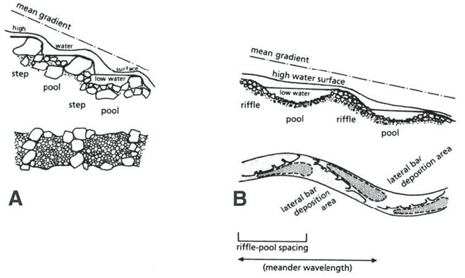
Riffle and Pool Characteristics of High Gradient (A) and Low Gradient (B) Streams. This graphic illustrates the change in deposition characteristics of a stream or river as its gradient decreases. A high-gradient stream (A) has a rapid velocity, often forms falls, and tends to carry away a high volume of all but the largest of particles of potential substrates as they erode from the surrounding landscape. On a low-gradient stream, the loss in water velocity reduces the water column’s ability to transport even the smallest of substrate particles. Deposition of this gravel, sand, silt, and clay forms lateral bars that over time create the familiar meandering path of a naturally flowing lowland stream. (National Park Service image)Benthic substrates in lotic freshwater pools and riffles support an abundance of life forms ranging from colorful diatoms on rocks and cobble, to invertebrates including snails and insect larvae, to fishes like this young Channel Catfish. Free of accumulations of sediment, this river bottom not only provides habitat for a healthy fishery, it facilitates the bidirectional exchange of water between the Susquehanna and its underlying aquifer.On the lower Susquehanna, populations of young Quillback suckers are found almost exclusively in clear, high-gradient pools.The Harlequin Duck winters along the rocky shores and man-made jetties of the Atlantic coast. In summer, they nest on fast-moving, headwater streams well to our north. Very rare on the Susquehanna, this is the first of two individuals found during March and April of 2025. It was observed feeding in the swift waters of the high-gradient riffles and pools where the river cuts through Blue Mountain north of Harrisburg. During previous weeks, Harlequin Ducks were being seen along the coast as far south as the mouth of the Chesapeake at Cape Charles, Virginia. It’s very possible that some of these birds traveled north through the bay area and up the Susquehanna on their way north.
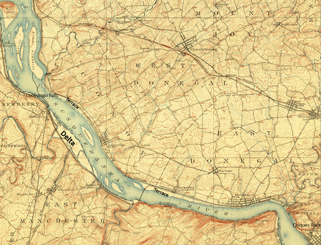
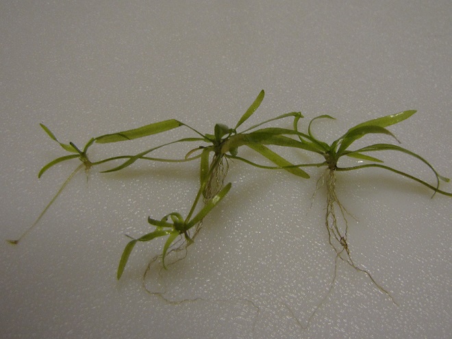
Fluvial Geomorphology of a Stream. Many of the Susquehanna’s tributaries pass through each of these three erosional zones. Along the way, they carry out the process of breaking down the mountains formed by the Allegheny orogeny, the collision of North America and Africa that created the supercontinent Pangea about 325 to 260 million years ago (during portions of both the Carboniferous and Permian periods). Today’s main stem of the lower Susquehanna passes through a transfer zone (Zone 2), carrying eroded materials to a depositional zone (Zone 3) located within the ancient Susquehanna canyon stretching from Havre de Grace, Maryland, to Norfolk Canyon on the edge of the continental shelf. Within this zone, more than a 10,000-year accumulation of post-glacial sediments lies submerged by the rising waters of the Atlantic Ocean and Chesapeake Bay. Although the present-day lower Susquehanna is largely a transfer zone, some deposition occurs along low-gradient segments of the river, particularly where its course parallels the watershed’s ridges both above and below the high-gradient rapids where its path has eroded passage through the highlands. (National Park Service image)Although the present-day lower Susquehanna is largely a transfer zone, some deposition occurs along low-gradient segments of the river, particularly where its course parallels the watershed’s ridges both above and below the high-gradient rapids where its path continues to erode passage through the bedrock. On this 1908 map of the Susquehanna at Conewago Falls, alluvial terraces of gravel, sand, silt, and clay can readily been seen as pale areas nearly lacking brown contour lines along the shorelines and islands of the river. Deposits within most of these terraces date back to the melt period following the most recent glacial event and beyond. The delta shown at the mouth of Conewago Creek (west) includes massive volumes of material deposited by both the creek and the river. This delta is currently known as Brunner Island, much of it developed as the site of a coal/gas-fired electric generating station. Terrace deposits along the Susquehanna’s shorelines created extensive perched marshes and swamps (wooded marshes) fed by rains, high river water, small streams, and springs, the latter often seeping from the base of the rocky escarpments carved by the ancient Susquehanna and defining the present-day inland border of the floodplain. We call these sites “Alluvial Terrace Wetlands”. Few of these critical components of river morphology survive. Those not drained for farmland were obliterated by urbanization and canal, railroad, and highway construction. (United States Geological Survey base image: Middletown, PA, quadrangle, 1908)Water Willow is a familiar emergent plant that colonizes lateral bars and other alluvial deposits in low-gradient segments of the Susquehanna.The fine roots of Water Willow collect sediment and absorb nutrients while creating dense cover for young fish and numerous species of invertebrates including the Virginian River Horn Snails seen here.
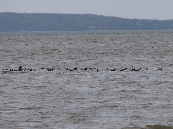
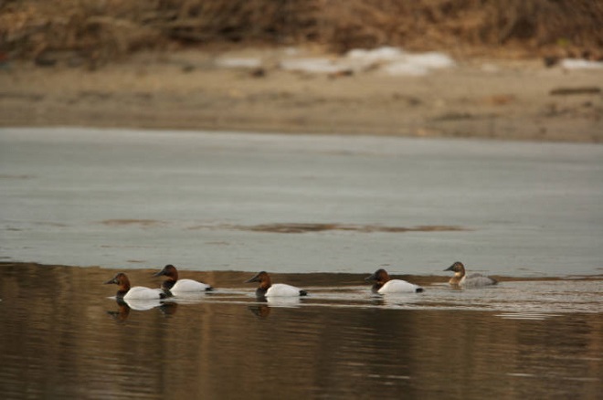
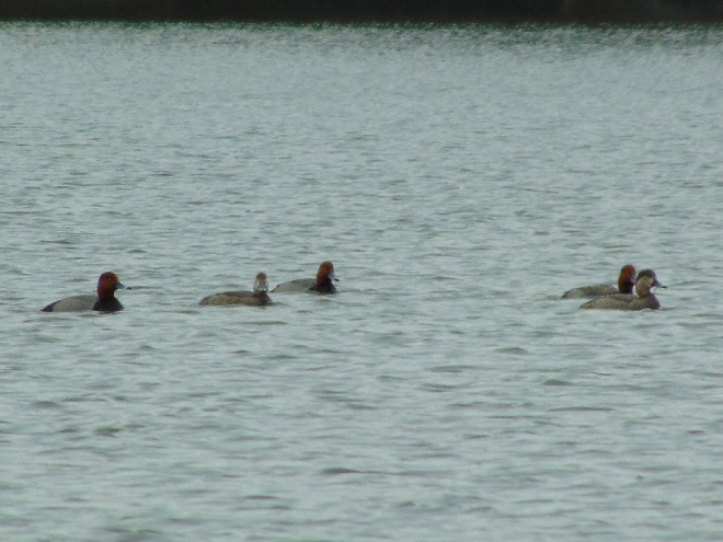
Prior to the nineteenth century, the low-gradient flow regime of the river both above and below the riffles at Chiques Rock (lower right on map) created prime wildlife habitat. The natural accumulations of nutrients and substrates carried into and through the lotic waterway’s pools and riffles were cycled into an ideal growing medium for extensive mats of American Eelgrass and other aquatic plants. This underwater forest hosted a seemingly endless abundance of invertebrates and fishes (both resident and migratory)—supporting a variety of consumer species including various populations of humans. But soon after the mass clearing of much of the watershed’s land for farming and lumber, the mill ponds created by dams constructed on streams to power saw and grain mills became brimful with sediments eroded from the unprotected ground. During storm events, torrents of these sediments then flowed full bore toward the Susquehanna, and began accumulating in the low-gradient segments of the river.
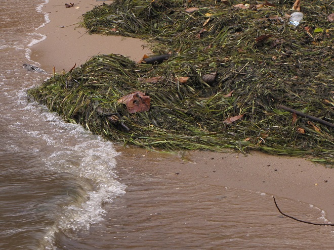
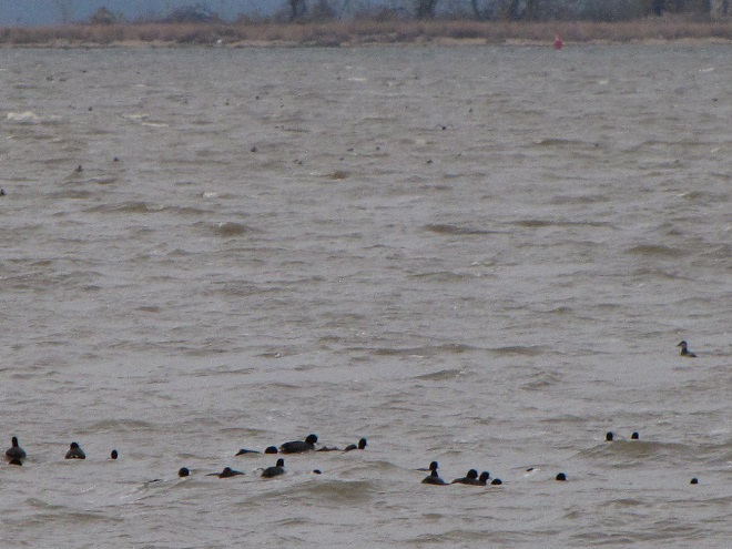
Sediments left behind after the removal of mill dams are known as legacy sediments. They disconnect the stream from its historic floodplain and riverine (fluvial) wetlands, thus intensifying the impact of high water in the surrounding landscape. As these nutrient-charged deposits wash away, they become a source of pollution in the waters of the Susquehanna and Chesapeake.A mat of American Eelgrass growing in the flowing waters of the Susquehanna below Conewago Falls. Eelgrass and other submerged aquatic plants provide essential habitat for a wide variety of small fish and invertebrates while also consuming nutrients deposited in the cobble, gravel, and sand substrate of the river’s pools. Excess quantities of smaller particles of silt and clay can clog the substrate and thus inhibit the hyporheic exchange of water between the stream channel and the underlying aquifer, often diminishing the biomass and diversity of organisms inhabiting this benthic habitat. Buried in these life-choking sediments, the river bottom becomes inhospitable to growth of submerged aquatics including eelgrass.This low-gradient stretch of the Susquehanna at Marietta flows parallel to the Chickies Quartzite “Hellam Hills” before making a sharp right turn to punch through the ridge as a series of rapids at Chiques Rock. Formerly a fully functional lotic ecosystem and a paradise for migrating waterfowl, this river segment is now impaired by accumulations of nutrient-laden sediments from agricultural and urban runoff.Nutrient and sediment-loaded flood waters roar across the diabase boulders at the York Haven Dam and Conewago Falls, a high-gradient segment of the Susquehanna.They continue past Brunner Island (left power plant stacks) and through Haldeman Riffles and the Shocks Mills Railroad Bridge……into the stretch of river known as the “Marietta broads” along the base of the Chickies Quartzite “Hellam Hills”. The low stream gradient here produces a slower current and increased deposition of sediments.As the flood surges through the riffle and pool complex at Chiques Rock, the high stream gradient maintains a velocity in the water column sufficient to keep additional sediments in suspension until they reach the low-gradient river segment just downstream at Washington Boro, site of a naturally occurring lateral bar area known as the Conejohela Flats. These bars now lie within the man-made depositional zone known as “Lake Clarke”. Created nearly a century ago by construction of the Safe Harbor Dam, this impoundment is accumulating astounding volumes of nutrient-loaded sediments that continue to encapsulate the flats within a stream-impairing delta.Anytime from November to April on the lower Susquehanna, a group of Redheads, Canvasbacks (3 birds to right of the middle of the picture), and a Horned Grebe (lower left) is a welcome sight in a riverine pool known to have a summertime growth of American Eelgrass. Noted Dr. Herbert Beck in 1924 when describing the Canvasback, “Like all ducks, …, it stops to feed within the county (Lancaster) less frequently than formerly, principally because the vast beds of wild celery which existed earlier on broads of the Susquehanna, as at Marietta and Washington Borough, have now been almost entirely wiped out by sedimentation of culm. Prior to 1875 the four or five square miles of quiet water off Marietta were often as abundantly spread with wild fowl as the Susquehanna Flats are now. Sometimes there were as many as 500,000 ducks of various kinds on the Marietta broad at one time.”Today, seeing just dozens of Aythya genus ducks (Redheads, Canvasbacks, scaup) on the lower Susquehanna is a notable event. If they happen to be forced down by inclement weather while migrating through, you might get lucky enough to see several hundred.While the recovery of eelgrass/wild celery beds on the Susquehanna is trivial in scale and offers little support for numbers of waterfowl to return to historic levels, restorations on the upper Chesapeake in the vicinity of the Susquehanna Flats between Havre de Grace and Aberdeen Proving Grounds may have helped refuel a gathering of mostly Aythya genus ducks during the final days of February. This mass of ducks, many of which were forced south from the frozen Great Lakes during the previous weeks (some by way of the ice-choked Susquehanna) were apparently making an abrupt turn to make their way back north. Their stay was brief, but estimates by local birders put their numbers as high as one half million. The vast majority of the concentration consisted of Aythya species: Redheads, Canvasbacks, Ring-necked Ducks, and both Lesser and Greater Scaup. It probably included a mix of birds including both northbound migrants from further down the coast and the aforementioned refugees that had just arrived to pay a quick visit while escaping the late-season ice before turning around.During the past two centuries, as food supplies in the Susquehanna grew increasingly compromised for benthic feeders like these Lesser Scaup and other diving ducks, a change in distribution was necessary for survival.As individual species, Lesser Scaup and other waterfowl that fail to adapt to natural or man-made changes in their habitats and food supplies may see their overall global numbers falter.
Despite being located in the transfer zone, the lower Susquehanna has become a significant depositional zone along much of its length, mostly courtesy of the placement of sediment-trapping man-made dams.
Following construction of the mill dams and ponds on nearly every mile of the lower Susquehanna’s low-gradient tributary streams, enterprising parties moved on to the river. The first significant spans were constructed using wide timber cribs filled with large rock. They were placed to create water deep enough to allow canal boats to cross the Susquehanna at both Clark’s Ferry at the mouth of the Juniata River in Dauphin County and at Columbia/Wrightsville. These dams also diverted water into the newly excavated canals—the Pennsylvania Eastern Division Canal (completed in 1833) which followed the river’s east shore from Clark’s Ferry to Columbia, and the Susquehanna and Tidewater Canal (completed in 1840) along the west shore from Wrightsville to Havre de Grace, Maryland. Placement of these sediment-trapping man-made dams began a process of converting vast mileage of the lower Susquehanna from a transfer zone into a deposition zone. In addition, layout of the canals and locks followed the contours along the base of the riverside ridges, seriously altering most of the alluvial terrace wetlands that the river had created as a feature of its floodplain during the post-glacial period.
Construction of the canal dams was just the beginning. During the twentieth century, more massive dams would be added to the main stem of the river for hydroelectric energy production at York Haven, Safe Harbor, Holtwood, and Conowingo. Upon their completion, the days of unassisted anadromous fish migrations were over. On both the river and its tributaries, smaller dams including dangerous low-head dams maintain water levels for boating and recreation. They too create current-diminishing, pseudo-lentic waters that blanket the lotic riffle and pool substrates with polluted sediments.
MAN-MADE DAMS TURN LOTIC WATERS INTO UNFLUSHED TOILETS
The construction of dams on the lower Susquehanna has converted vast mileage of the river from a lotic freshwater system into a series of man-made lentic freshwater lakes. These areas have lost their function as a lotic transfer zone and are now a sort of dysfunctional series of depositional zones collecting vast volumes of sediment containing nutrients and other pollutants. Within each impoundment, the reduced velocity of the river causes it to drop suspended sand first, then the finer particles of silt and clay closer to the dam. The flow regime of riffles and pools is lost and the hyporheic zone that exchanges water between the river and the underlying aquifer is clogged. These impaired segments of river become ripe for eutrophication: algal blooms followed by die offs that can lead to a fatal reduction of dissolved oxygen in the water column.Deposits of lateral bars of sediment in low-gradient segments of the Susquehanna can create shallow water feeding habitat for puddle/dabbling ducks like these Gadwall. Where sediment pollution is severe, benthic foods in these areas often consist mostly of invertebrates and plant matter deposited by the current, the buried substrates devoid of a functioning ecosystem and the waters subject to eutrophication.Common Goldeneyes on a patch of open water on an otherwise ice-covered “Lake Clarke”, the impoundment created by Safe Harbor Dam. While they may find this spot advantageous for loafing, the food supply over the sediment-buried substrate will be limited.By the end of the twentieth century, accumulations of polluted sediments behind lower Susquehanna dams were nearing capacity. There is no working plan to attenuate the massive release of these pollutants that may be triggered by a catastrophic flood. The effort to reduce nutrient and sediment runoff remains the focus so that new loading is kept to a minimum and won’t add to the capacity problems at the dams or continue downriver to the Chesapeake at full strength when the dams are full. Alleviating the sediment aggregation problem within the river’s impoundments is a tall order and a dilemma not easily solved. (United States Geological Survey image)Common Mergansers will feed where benthic substrate supports the small fish and invertebrates they prefer. They will, however, gather in extraordinary numbers on the “lakes” created by riverine dams. Though they can only feed on what floats in with the current, hundreds or sometimes thousands of Common Mergansers will concentrate on “Conowingo Pond” during the late fall or early winter. There, safety in numbers gives them some guarantee of protection against the multitudes of eagles that simultaneously frequent the vicinity. Another advantage of staging on “Conowingo Pond” is its close proximity to favorable feeding areas on upper Chesapeake Bay and stretches of the Susquehanna where lotic riffles and pools offer abundant opportunities below the river’s dams.Fortunately for everything else living in the benthos, Common Mergansers are big enough to devour invasive, non-native Rusty Crayfish when they find them in our lotic waterways.
TIME TO CLEAN UP OUR ACT
WHERE DOES YOUR STORMWATER GO?
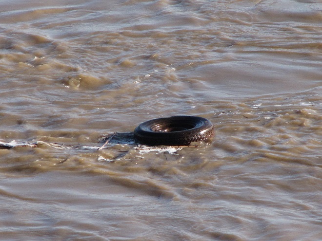
Channelized Urban/Suburban Streams Function as Sewers. They have no attached lowlands or floodplains to absorb, purify, and infiltrate runoff from rain events. Pollutants including litter, pet waste, lawn chemicals, tire-wear particles, hazardous fluids, and sometimes untreated human excrement flush unchecked from the municipal storm drainage system into the waterway. Thermal shock from summer downpours washing across sun-heated pavements can kill temperature sensitive fishes and other aquatic life. Nutrient and sediment loads from these impaired tributaries later accumulate downstream in low-gradient segments of the Susquehanna, turning the river into an open-air cesspool. Aggressively working to implement projects that eliminate these sources of pollution are the only effective way to keep the problem from getting worse. Making things better requires a lot more dedication and effort. (United States Geological Survey image by Frank Ippolito)
RIPARIAN BUFFERS MAKE A DIFFERENCE…WIDER IS BETTER
To sequester sediment and cycle nutrients (primarily nitrogen and phosphorus) contained in farm runoff, the U.S.D.A. recommends installing riparian buffers between streams and lands used for grazing and raising crops. To protect pollinating species including bees and butterflies from pesticide drift and eroding soils rich in fertilizers, they further recommend installing a stand of wind-pollinating plants such as conifers, oaks, and birches between the field and streamside plantings. These same conservation practices improve water quality and wildlife habitat on waterways located in residential and commercial areas as well. (United States Department of Agriculture image, click to enlarge)
FLOODPLAIN RESTORATION
Regardless OF HOW LONG YOU’VE BEEN CONDITIONED TO THINK OTHERWISE, THIS IS A DYSFUNCTIONAL, POLLUTED CREEK—AND IT NEEDS HELP
A channelized low-gradient stream eroding a path through deposits of legacy sediments displaces flood waters into previously unaffected areas and provides a continuing source of nutrient and sediment pollution during storm events. These impaired waters have a diminished capacity for supporting aquatic life including fishes.
RESTORED TO ITS HISTORIC FUNCTIONS
On an adjacent segment of the same creek, this legacy sediment removal project restored a braided meandering channel and connected it to its newly liberated, historic floodplain. In just their second year, the fluvial wetlands are effectively absorbing stormwater and sequestering nutrients as an attached component of the stream’s riffle and pool complex. During our visit earlier this week, we found American Toads, Northern Leopard Frogs (Lithobates pipiens), and Northern Spring Peepers breeding here. It’s just as Castor canadensis would have it!
“STOP HEMMING AND HAWING AROUND ALREADY”
“HEY COWBOY, HOW ‘BOUT GETTIN’ THEM FILTHY LITTLE DOGIES OUTTA DAT CRICK?”
Here’s a polluted stream in a pasture with grazing livestock. The site is a former mill pond within which the creek eroded a channel following removal of the dam. The animals defecate and urinate where access to water is gained at a broken down embankment of the nutrient-loaded legacy sediments deposited in the pond more than a century ago. It’s a haphazard form of animal husbandry and a reminder that all it takes is just one stubborn jackass to foul up the whole waterway.
DIRECT SOURCES OF NITROGEN (AMMONIA) POLLUTION IN STREAMS
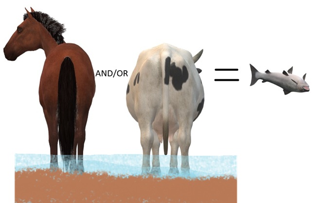
DID YOU KNOW that a dairy cow produces about 80 pounds of waste (excrement and urine) every day?
DID YOU KNOW that a horse produces about 50 pounds of waste (excrement and urine) every day?
DID YOU KNOW that a human produces about 3 to 4 pounds of waste (excrement and urine) every day? The exceptions, of course, are those who continue to insist that raising farm animals in and alongside a body of water is okey-doke—a harmless practice. These individuals tend to retain the former constituent of human waste and are thus full of it.
“ATTABOY TEX, THAT’S MORE LIKE IT!”
Now that’s better. Legacy sediments have been removed to reconnect the stream to its floodplain. A livestock crossing and exclusion fencing has been installed, and a nutrient-consuming riparian buffer has been planted. This creek segment’s pollution woes have been mitigated. Do you have a neighbor needing this type of remedial work on their farm? Have them call your local conservation district office for advice. Some programs include financial assistance covering the costs of installation as well as monetary incentives for helping to clean up the water.
AND FINALLY
WHEN IT COMES TO BUILDING DAMS ON LOTIC FRESH WATERS…
…LEAVE IT TO THE BEAVERS
North American Beavers (Castor canadensis) create habitats that connect the riffle and pool regime of a low-gradient stream to a surrounding fluvial wetland that retains sediments, cycles nutrients, and provides essential habitat for hundreds of plant and animal species. Floodplains are for flooding. And if a beaver floods an area, you can be guaranteed that it was already part of a floodplain. You see, beavers don’t encroach upon humans, it’s humans doing the encroaching upon beavers. (National Park Service image)
MAD HATTERS
DID YOU KNOW that even before the landscape was cleared for farms and a supply of timber, and before mill dams on local creeks began accumulating soil runoff from the consequently barren hillsides, all the North American Beavers, the keystone species of lower Susquehanna stream ecology, were killed and sold to make hats? It’s no wonder things are fubar!
COMING SOON…
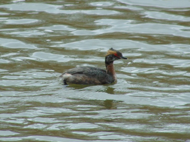
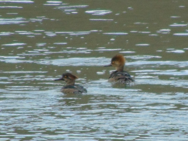
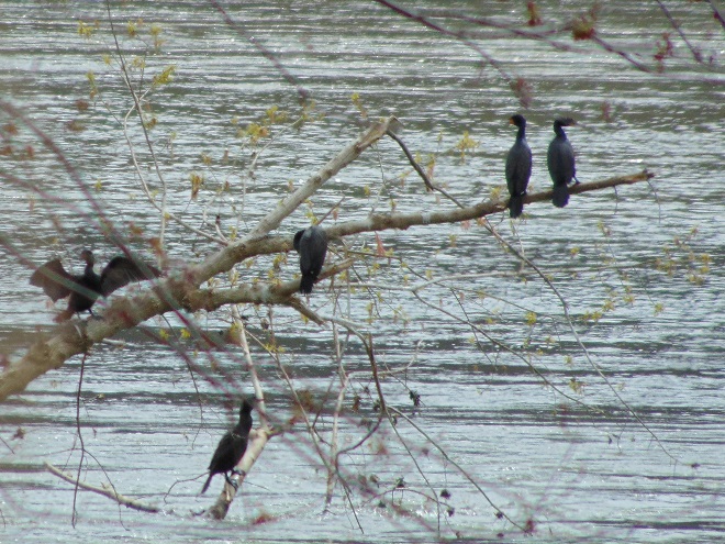
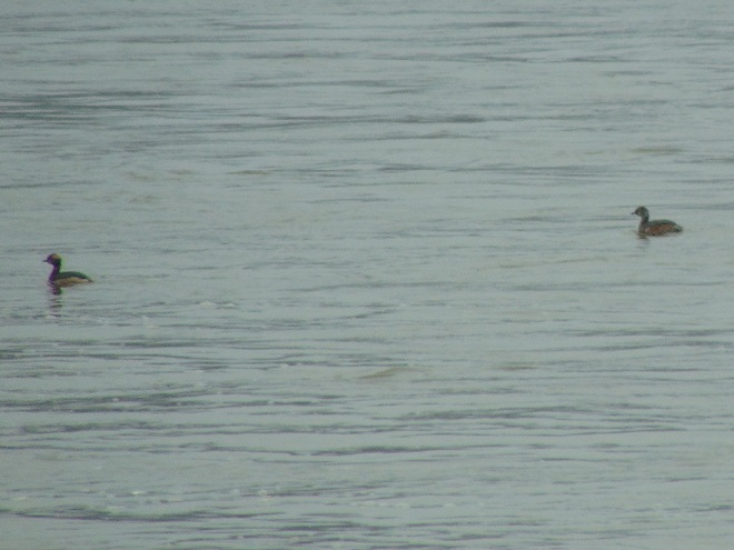
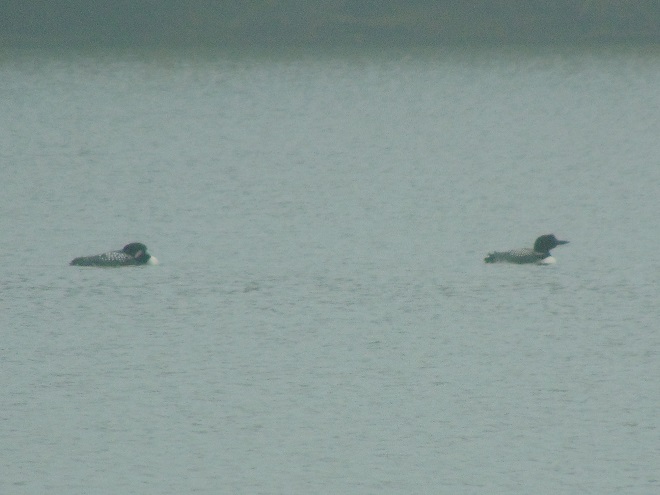
Horned Grebes are regular migrants and sometimes winter residents on ice-free stretches of the lower Susquehanna. They spend their time plying the benthic substrate of the river’s clear riffles and pools for a variety of invertebrates and small fish. Look for them moving north in coming days sporting this beautiful breeding plumage.April and early May are prime time for observing Common Loons on the Susquehanna as they undertake a journey from the Atlantic surf where they spent the winter to nesting sites on northern lakes. For this migrant in breeding plumage, clear water for sighting plenty of benthic life in the river’s riffles and pools assures a successful dive in search of energy-replenishing forage.
In early April of each year, we like to take a dreary-day stroll along the Susquehanna in Harrisburg to see if any waterfowl or seabirds have dropped in for a layover before continuing their journey from wintering waters along the Atlantic seaboard to breeding areas well to our north and northwest. As showers started to subside this Saturday morning past, here are some of the travelers we had the chance to see…
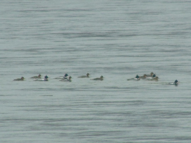
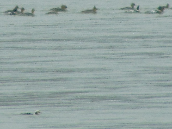
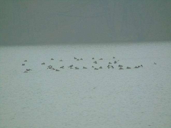
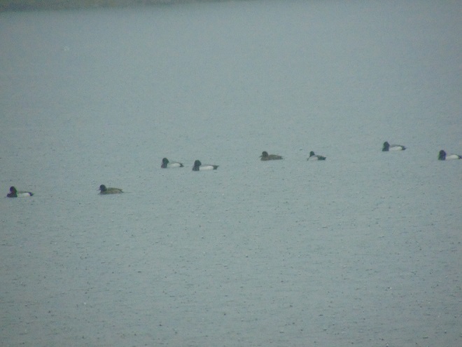
Hundreds of scaup were feeding at mid-river. To remain in suitable foraging habitat, the group is seen here flying upstream to the area of the Governor’s Mansion where they would commence yet another drift downstream to Independence Island before again repositioning to a favorable spot.By far, the majority of the ducks in this flock were Lesser Scaup showing white inner margins of the secondary flight feathers and more grayish margins in the primaries. Several Greater Scaup, including the one denoted by the hairline in this image, could be detected by the presence of bright white margins not only in the secondary flight feathers, but extending through the primaries as well.A pair of Lesser Scaup feeding along the river shoreline at the Governor’s Mansion. Both scaup species spend the colder months in bays and coastal estuaries, but the Lesser Scaup is the most likely to be found venturing inland to fresh water in the southern United States during winter. The Lesser Scaup nests in the northwestern United States and in the southern half of Canada. The Greater Scaup is the more northerly nesting species, spending its summers at the northern edges of the border provinces and beyond.Common Loons spend the winter in Atlantic surf. April is the best time to see them on the lower Susquehanna River as they drop in to rest and reenergize during a break in their annual northbound trip to nesting sites on the lakes and ponds left behind by the retreat of Pleistocene glaciers.We saw dozens of Buffleheads during our morning hike, often segregated into paired couples like this one. Being cavity nesters, these migrating ducks are headed no further north than southern Canada, to lakes and ponds within forests, for the summer.Harlequin Ducks (Histrionicus histrionicus) spend the summer nesting on turbulent high-gradient streams in Canada and Greenland. They mostly winter along rocky coastlines as far south as New England, but have adapted to feeding along man-made rock jetties in coastal New York and New Jersey. This winter, they were seen along jetties and sea walls at least as far south as Cape Charles, Virginia, and the mouth of Chesapeake Bay. During the past month, at least two Harlequin Ducks, including this male seen in flight on Saturday, have appeared on the river in the Harrisburg area, possibly as strays from this year’s wintering population at the mouth of the bay. These ducks are very rare habitat specialists, possibly (according to Behrens and Cox, 2013) numbering less than 1,500 birds along the entire east coast.In spring, the Horned Grebe transitions from a drab gray-brown winter (basic) plumage into rather surprisingly colorful breeding (alternate) plumage.An adult Horned Grebe in breeding (alternate) plumage. Horned Grebes spend the winter on large rivers, bays, and ocean waters from Nova Scotia to Texas. They are presently on their way to breeding areas on ponds and lakes in Alaska and Canada west of Ontario.
If you want a chance to see these seldom-observed visitors to the lower Susquehanna at Pennsylvania’s capital city, try a morning walk along mid-town’s Riverfront Park from Maclay Street to Forster Street. Also, try a stroll on City Island, particularly to the beach at the north end where you have a view of the mid-river areas upstream. To have better afternoon light, try the river’s west shore along Front Street in Wormleysburg from the Market Street Bridge upstream to Conodoguinet Creek. Once there, be certain to check the river from the Pennsylvania Fish and Boat Commission’s West Fairview Access Area at the mouth of the creek. And don’t be afraid to visit on a gloomy day; you never know what you might find!
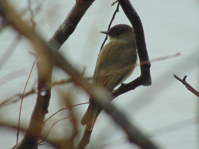
Don’t forget to check the trees along the river shoreline where early stonefly hatches can often attract hungry insectivores. We found this and six other Eastern Phoebes crowded into the trees at water’s edge just upriver from the Governor’s Mansion during Saturday’s migrant fallout.
SOURCES
Behrens, Ken, and Cameron Cox. 2013. Seawatching: Eastern Waterbirds in Flight. Houghton Mifflin Harcourt Publishing Company. New York, NY.
Tuesday’s collision of the container ship Dali into Baltimore’s Francis Scott Key Bridge and the nearly immediate collapse of the span into the chilly waters below reminds us just how unforgiving and deadly maritime accidents can be. Upon termination of rescue and recovery operations, salvage and cleanup will be prioritized as the next steps in the long-term process of reopening the navigable waters to ship traffic and construction of a new bridge. Part of the effort will include monitoring for leaks of fuels and other hazardous materials from the ship, its damaged cargo containers, and vehicles and equipment that were on the bridge when it failed.
Damage to the hull of the Dali and to the cargo containers on her deck could lead to leaks of hazardous liquids or other materials into Chesapeake Bay. (United States Army Corps of Engineers Baltimore image)
On the waters and shores of today’s Chesapeake, numerous county, state, and federal agencies, including the United States Coast Guard, monitor and inspect looking for conditions and situations that could lead to point-source or accidental discharges of petroleum products and other hazardous materials into the bay. Many are trained, equipped, and organized for emergency response to contain and mitigate spills upon detection. But this was not always the case.
Through much of the twentieth century, maritime spills of oil and other chemicals magnified the effects of routine discharges of hazardous materials and sanitary sewer effluent into the Chesapeake and its tributaries. The cumulative effect of these pollutants progressively impaired fisheries and bay ecosystems leading to noticeable declines in numbers of many aquatic species. Rather frequently, spills or discharges resulted in conspicuous fish and/or bird kills.
One of the worst spills occurred near the mouth of the Potomac River on February 2, 1976, when a barge carrying 250,000 gallons of number 6 oil sank in a storm and lost its cargo into the bay. During a month-long cleanup, the United States Coast Guard recovered approximately 167,000 gallons of the spilled oil, the remainder dispersed into the environment. A survey counted 8,469 “sea ducks” killed. Of the total number, the great majority were Horned Grebes (4,347 or 51.3%) and Long-tailed Ducks (2,959 or 34.9%). Other species included Surf Scoter (Melanitta perspicillata) (405 or 4.8%), Common Loon (195 or 2.3%), Bufflehead (166 or 2.0%), Ruddy Duck (107 or 1.3%), Common Goldeneye (78 or 0.9%), Tundra Swan (46 or 0.5%), Greater Scaup (19 or 0.2%), American Black Duck (12 or 0.2%), Common Merganser (11 or 0.1%), Canvasback (10 or 0.1%), Double-crested Cormorant (10 or 0.1%), Canada Goose (8 or 0.1%), White-winged Scoter (Melanitta deglandi) (7 or 0.1%), Redhead (5 or 0.1%), gull species (10 or 0.1%), miscellaneous ducks and herons (13 or 0.2%) and unidentified (61 or 0.7%). During the spring migration, a majority of these birds would have made their way north and passed through the lower Susquehanna valley. The accident certainly impacted the occurrence of the listed species during that spring in 1976, and possibly for a number of years after.
Of the 8,469 birds killed by the February 2, 1976, oil spill on the Chesapeake, 51.3% (4,347) were Horned Grebes. Many of them would have migrated north through the Lower Susquehanna River Watershed during the coming spring.
The Federal Water Pollution Control Act Amendments of 1972, commonly known as the Clean Water Act, put teeth into the original FWCPCA of 1948 and began reversing the accumulation of pollutants in the bay and other bodies of water around the nation. Additional amendments in 1977 and 1987 have strengthened protections and changed the culture of “dump-and-run” disposal and “dilution-is-the-solution” treatment of hazardous wastes. During the late nineteen-seventies and early nineteen-eighties, emergency response teams and agencies began organizing to control and mitigate spill events. The result has been a greater awareness and competency for handling accidental discharges of fuels and other chemicals into Chesapeake Bay and other waterways. These improvements can help minimize the environmental impact of the Dali’s collision with the Francis Scott Key Bridge in Baltimore.
Oil spills and other pollution in the Chesapeake can impact populations of migratory fish including the anadromous Hickory Shad which are presently transiting the bay on their way to the waters of the Susquehanna below Conowingo Dam.
SOURCES
Roland, John V., Moore, Glenn E., and Bellanca, Michael A. 1977. “The Chesapeake Bay Oil Spill—February 2, 1976: A Case History”. International Oil Spill Conference Proceedings (1977). 1977 (1): 523-527.
Back in late May of 1983, four members of the Lancaster County Bird Club—Russ Markert, Harold Morrrin, Steve Santner, and your editor—embarked on an energetic trip to find, observe, and photograph birds in the Lower Rio Grande Valley of Texas. What follows is a daily account of that two-week-long expedition. Notes logged by Markert some four decades ago are quoted in italics. The images are scans of 35 mm color slide photographs taken along the way by your editor.
DAY FOUR—May 24, 1983
“AOK Campground—South of Kingsville, Texas”
“Arose at 6:30 A.M. to the tune of Common Nighthawks. After breakfast, we headed for Harlingen. While driving south we saw six pairs of Black-bellied Whistling Ducks. At Harlingen we phoned Father Tom, who is an expert birder for the area.”
As we drove south to Harlingen, much our 100-mile route was through the Laureles division of the King Ranch, the largest ranch in the United States. It covers over 800,000 acres and is larger than the state of Rhode Island. The road there was as straight as an arrow with wire fences on both sides and scrubland as far as the eye could see. Things really are bigger in Texas.
Once in Harlingen, we did two things no one needs to do anymore:
Find a coin-operated telephone to place a call to Father Tom.
Ask Father Tom for the latest tips on the locations of rare and/or target birds.
Today, nearly everyone traveling such distances to find birds is carrying a cellular phone and many can use theirs to access internet sites and databases such as eBird to get current sighting information. Back in 1983, Father Tom Pincelli was a dear friend to birders visiting the Lower Rio Grande Valley. Few places had a person who was willing to answer the phone and field inquiries regarding the latest whereabouts of this or that bird. To remain current, he also had to religiously (forgive me for the pun) collect sighting information from the observers with whom he had contact. For locations elsewhere across the country, a birder in 1983 was happy just to have a phone number for a hotline with a tape-recorded message listing the unusual sightings for its covered region. If you were lucky, the volunteer logging the sightings would be able to update the tape once a week. For those who dialed his number, Father Tom provided an exceptionally personal experience.
Since 1983, Father Tom Pincelli, also known as “Father Bird”, has tirelessly promoted birding and conservation throughout the Lower Rio Grande Valley. His efforts have included hosting a P.B.S. television program and writing columns for local newspapers. He has been instrumental in developing the annual Rio Grande Valley Birding Festival. The public sentiment he has generated for the birding paradise that is the Lower Rio Grande Valley has helped facilitate the acquisition and/or protection of many key parcels of land in the region.
“After receiving information on locations of Tropical Parula, Ferruginous Pygmy Owl, Hook-billed Kite, Brown Jay, and Clay-colored Robin, we went on to check out the Brownsville Airport where we will meet Harold and Steve Thursday noon.”
If we were going to see these five species in the American Birding Association listing area, then we would have to see them in the Lower Rio Grande Valley. All five were target birds for each of us, including Harold who had few other possibilities for new species on the trip. Father Tom provided us with tips for finding each.
I noticed as we began moving around Harlingen and Brownsville that Russ was swiftly getting his bearings—he had been here before and was starting to remember where things were. His ability to navigate his way around allowed us to keep moving and see a lot in a short time.
In Harlingen, we easily found Mourning Doves and the non-native Rock Pigeons, species we see regularly in Pennsylvania. We became more enthusiastic about doves and pigeons soon after when we saw the first of the several other species native to south Texas, the fragile little Inca Dove (Columbina inca), also known as the Mexican Dove.
“Next, to the Brownsville Dump to see the White-necked Ravens — Then to Mrs. Benn’s in Brownsville for the Buff-bellied Hummingbird. Both lifers for Larry.”
For birders wanting to see a White-necked Raven in the Lower Rio Grande Valley, the Brownsville Dump was the place to go. With very little effort—excluding a trip of nearly 2,000 miles to get there—we found them. Today, birders still go to the Brownsville Dump to find White-necked Ravens, though the dump is now called the Brownsville Landfill and the bird is known as the Chihuahuan Raven (Corvus cryptoleucus).
Mrs. Benn’s home was in a verdant residential neighborhood in Brownsville. She welcomed birders to come and see the Buff-bellied Hummingbirds that visited her feeder filled with sugar water. I don’t recall whether or not she kept a guest book for visitors to sign, but if she did, it would have included hundreds—maybe thousands—of names of people from all over North America who came to her garden to get a look at a Buff-bellied Hummingbird. After arriving, we waited a short time and sure enough, we watched a Buff-bellied Hummingbird (Amazilia yucatanensis) sipping Mrs. Benn’s home-brewed nectar from her glass feeder. This emerald hummingbird is primarily a Mexican species with a breeding range that extends north into the Lower Rio Grande Valley of Texas. When not breeding, a few will wander north and east along the Gulf Coastal Plain as far as Florida.
Other finds at Mrs Benn’s included White-winged Dove (Zenaida asiatica), Ash-throated Flycatcher (Myiarchus cinerascens), Brown-crested Flycatcher (Myiarchus tyrannulus), and Black-crested Titmouse (Baeolophus atricristatus), a species also known as Mexican Titmouse.
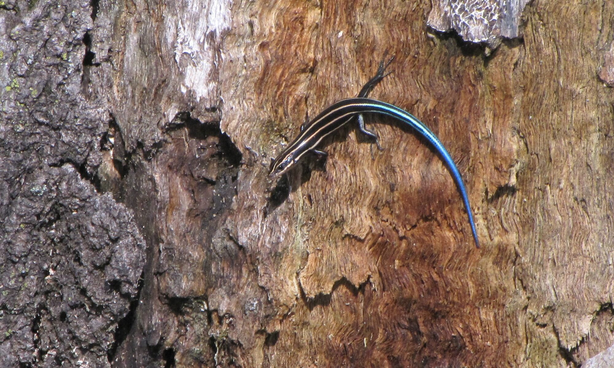
We identified this White-winged Dove at Mrs. Benn’s house in Brownsville.In Mrs. Benn’s lush subtropical garden beneath a canopy of tall trees we found this male Green Anole (Anolis carolinensis) displaying its red throat patch. (Vintage 35 mm image)
The Lower Rio Grande Valley from Rio Grande City east to the Gulf of Mexico is actually the river’s outflow delta. At least six historic channels have been delineated in Texas on the north side of the river’s present-day course. An equal number may exist south of the border in Mexico. Hundreds of oxbow lakes known as “resacas” mark the paths of the former channels through the delta. Many resacas are the centerpieces of parks, wildlife refuges, and housing developments. Still others are barely detectable after being buried in silt deposits left by the meandering river. Channelization, land disturbances related to agriculture, and a boom in urbanization throughout the valley have disconnected many of the most recently formed resacas from the river’s floodplain, preventing them from absorbing the impact of high-water events. These alterations to natural morphology can severely aggravate flooding and water pollution problems.
The Lower Rio Grande Valley is the site of a boom in urbanization. Undeveloped private holdings and government lands including numerous parks and refuges provide sanctuary for some of the valley’s unique wildlife. The parcels colored dark blue on the map are units of the Lower Rio Grande Valley National Wildlife Refuge. (United States Fish and Wildlife Service base image)
“On to Santa Ana National Wildlife Refuge. We walked to Pintail Lake and saw 6 Black-bellied Whistling Ducks and 2 Mississippi Kites and 1 Pied-billed Grebe. We drove the route thru the park with great results—Anhingas, Least Grebe, and more Black-bellied Whistling Ducks.
Santa Ana National Wildlife Refuge on the Rio Grande is not only a birder’s mecca, 300 species of butterflies have been identified there. That’s half the species known to occur in the United States! Its subtropical riparian forest and resaca lakes provide habitat for hundreds of migratory and resident bird species including many Central and South American species that reach the northern limit of their range in the Lower Rio Grande Valley. Two endangered cats occur in the park—the Ocelot (Leopardus pardalis) and the Jaguarundi (Herpailurus yagouaroundi).
In the Lower Rio Grande Valley, the secretive Ocelot, like the Jaguarundi, is at the northern limit of its eastern range. Time will tell how urban development including construction of the border wall will impact the distribution and survival of these and other terrestrial species there. (A modern digital image)Jaguarundi. (United States Fish and Wildlife Service image)
We saw no cats at Santa Ana, but did quite well with the birds. Our list included the species listed above plus Cattle Egret (Bubulcus ibis); Louisiana Heron, now known as Tricolored Heron (Egretta tricolor); Plain Chachalacas; Purple Gallinule; Common Gallinule (Gallinula galeata); American Coot; Killdeer; Greater Yellowlegs; the coastal Laughing Gull (Leucophaeus atricilla); and its close relative of the central flyway and continental interior, the Franklin’s Gull (Leucophaeus pipixcan). Others finds were White-winged Dove, Mourning Dove, Inca Dove, Yellow-billed Cuckoo, Golden-fronted Woodpecker, Ladder-backed Woodpecker (Dryobates scalaris), Brown-crested Flycatcher, Altamira Oriole, Great-tailed Grackle, and House Sparrow. A real standout was the colorful Green Jay (Cyanocorax luxosus), yet another tropical Central American species found north only as far as the Lower Rio Grande Valley.
During spring (April-May) and fall (August-September), Mississippi Kites migrate by the thousands through the skies of the Lower Rio Grande Valley. Both Santa Ana and nearby Bentsen-Rio Grande State Park have hosted formal hawk counts in recent years. (Vintage 35 mm image)A Black-necked Stilt at Santa Ana N.W.R. (Vintage 35 mm image)A Least Grebe (Tachybaptus dominicus) with young in a man-made canal that mimics flooded resaca habitat at Santa Ana National Wildlife Refuge. (Vintage 35 mm image)Black-bellied Whistling Ducks take off from a pond at Santa Ana National Wildlife Refuge. (Vintage 35 mm image)The spectacular colors of Altamira Orioles (Icterus gularis) dazzled us every time we saw them. This was my first, seen soon after arriving at Santa Ana N.W.R. where the checklist still had the species listed under its former name, Lichtenstein’s Oriole. The Altamira Oriole ranges north of Mexico only into the Lower Rio Grande Valley. (Vintage 35 mm image)
“We were unlucky not to find a campground at McAllen, so we went on to Bentsen State Park where we got a camp spot. After a sauerkraut supper, we birded till dark, then showered and wrote up the log. Very hot today.”
Bentsen-Rio Grande Valley State Park, like the Santa Ana National Wildlife Refuge, is located along the Rio Grande river and features dense subtropical riparian forest that grows in the naturally-deposited silt levees of the floodplain surrounding several lake-like oxbow resacas. Montezuma Bald Cypress (Taxodium mucronatum) is a native specialty found there but nowhere north of the Lower Rio Grande Valley. During our visit, we marveled at the epiphyte Spanish Moss (Tillandsia usneoides) adorning many of the more massive trees in the park. Willows lined much of the river shoreline.
Over time, flood control projects such as man-made dams, drainage ditches, and levees have impaired stormwater capture and aquifer recharge in the floodplain. These alterations to watershed hydrology have resulted in drier soils in many sections of the Lower Rio Grande Valley’s riparian forests. Where drier conditions persist, xeric (dry soil) scrubland plants are slowly overtaking the moisture-dependent species. As a result, the park’s woodlands are composed of trees with a variety of microclimatic requirements—Anaqua (Ehretia anacua), Cedar Elm (Ulmus crassifolia), Texas Ebony (Ebenopsis ebano), hackberry, mesquite, Mexican Ash (Fraxinus berlandieriana), retama, and tepeguaje are the principle species. The park’s subtropical Texas Wild Olive (Cordia boissieri) grows in the wild nowhere north of the Lower Rio Grande Valley.
While a majority of birders visiting Benten-Rio Grande State Park come to see the more tropical specialties of the riparian woods, searching the brushy habitat of the park’s scrubland can afford one the opportunity to see species typical of the southwestern United States and deserts of Mexico. This scrubland of the Lower Rio Grande Valley is part of the Tamaulipan Mezquital ecoregion, an area of xeric (dry soil) shrublands and deserts that extends northwest from the delta through most of south Texas and into the bordering provinces of northeastern Mexico.
Our campsite was located in prime birding habitat. We were a short walk away from one of the park’s flooded oxbow resacas and vegetation was thick along the roadsides. It was no surprise that the place abounded with birds. An evening stroll yielded Plain Chachalaca, White-winged Dove, Mourning Dove, White-fronted Dove, Golden-fronted Woodpecker, Brown-crested Flycatcher, Green Jay, Altamira Oriole, Great-tailed Grackle, and Bronzed Cowbird (Molothrus aeneus). At nightfall, we listened to the calls of an Eastern Screech Owl (Megascops asio), Common Nighthawks, and Common Pauraque (Nyctidromus albicollis), a nightjar of Central and South America that nests only as far north as the Lower Rio Grande Valley. The Common Pauraque is the tropical counterpart of the Eastern Whip-poor-will, a Neotropical migrant that nests in scattered forest locations throughout eastern North America.
The Plain Chachalaca (Ortalis vetula), a pheasant-like wildfowl of the dense riparian forest and scrubland at Bentsen-Rio Grande Valley State Park. (Vintage 35 mm image)Seldom did we see a Plain Chachalaca alone, there were always others nearby. (Vintage 35 mm image)Like the chachalacas, this White-fronted Dove was attracted to some birdseed scattered on a big log behind our campsite. This species is now known as White-tipped Dove (Leptotila verreauxi) and is at the northern tip of its range in the Lower Rio Grande Valley.
I would note that we saw no “snowbirds”—long-term vacationers from the northern states and Canada who fill the park through the cooler months of fall, winter, and spring. They were gone for the summer. But for a few other friendly folks, we had the entire campground to ourselves for the duration of our stay.
In late March and early April, a rainy night and fog at daybreak can lead to an ideal morning for spotting migratory waterfowl and seabirds during their layover on the lower Susquehanna. Visibility was just good enough to spot these birds at Harrisburg, Pennsylvania, most of them feeding at midriver.
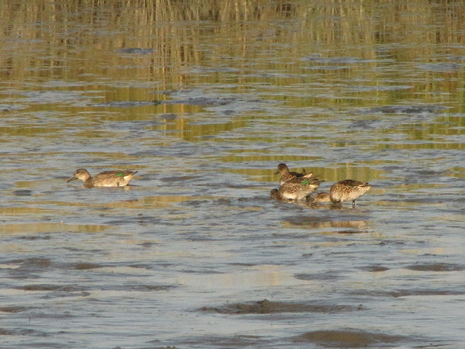
Northern Shovelers are regular migrants, more often seen on ponds and in wetlands than on the river.A pair of American Wigeons head upriver.A Horned Grebe.A small flock of northbound Buffleheads.Ring-necked Ducks.Lesser Scaup, eight of the more than 100 seen along Front Street in Harrisburg at the Pennsylvania Governor’s Residence. Note how the white bar on the wing’s secondaries becomes diffused and dusky in the primaries.Lesser Scaup spend the winter on bays and lakes to our south.More Scaup, the lead bird with bright white extending through the secondaries into the primaries is possibly a Greater Scaup (Aythya marila).Long-tailed Ducks, formerly known as Oldsquaw, are a diving duck that winters on the Great Lakes and on bays along the Atlantic Coast. They nest on freshwater ponds and lakes in the tundra of Canada and Alaska.A male Common Merganser.This pair of Hooded Mergansers may be nesting in a tree cavity nearby.The local Peregrine Falcon grabbed a passing Common Grackle……prompting the more than 100 Bonaparte’s Gulls in the vicinity to quickly depart and fly upstream.It pays to keep an eye on the trees along the shoreline too. Migrants like this Northern Flicker are beginning to come through in numbers.
The Red-necked Grebe (Podiceps grisegena) is a rare but regular spring migrant in the Susquehanna valley. After wintering along the coast, they journey to breeding locations on inland ponds in Canada and Alaska. For the past several days, this one has been feeding on minnows along the river’s west shore just downstream of the mouth of the Conodoguinet Creek near Wormleysburg, Pennsylvania.
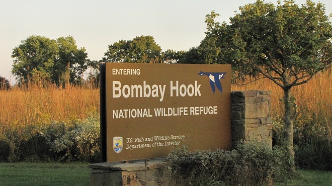
It’s surprising how many millions of people travel the busy coastal routes of Delaware each year to leave the traffic congestion and hectic life of the northeast corridor behind to visit congested hectic shore towns like Rehobeth Beach, Bethany Beach, and Ocean City, Maryland. They call it a vacation, or a holiday, or a weekend, and it’s exhausting. What’s amazing is how many of them drive right by a breathtaking national treasure located along Delaware Bay just east of the city of Dover—and never know it. A short detour on your route will take you there. It’s Bombay Hook National Wildlife Refuge, a quiet but spectacular place that draws few crowds of tourists, but lots of birds and other wildlife.
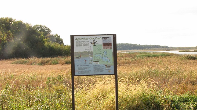
Bombay Hook National Wildlife Refuge is located just off Route 9, a lightly-traveled coastal road east of Dover, Delaware. Note the Big Bluestem and other warm season grasses in the background. Bombay Hook, like other refuges in the system, is managed for the benefit of the wildlife that relies upon it to survive. Within recent years, most of the mowed grass and tilled ground that once occurred here has been replaced by prairie grasses or successional growth, much to the delight of Northern Bobwhite (Colinus virginianus) and other species.
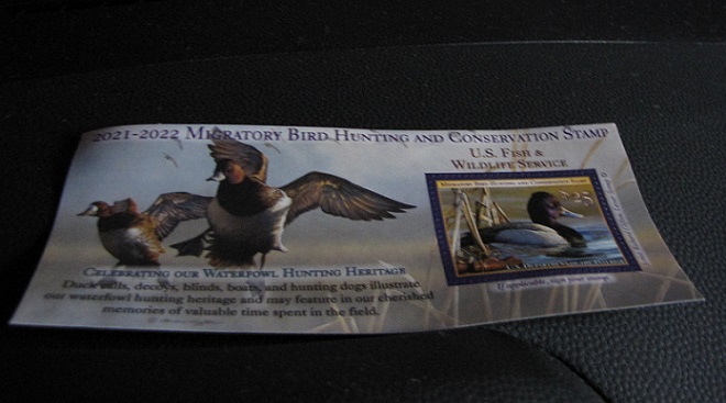
Let’s join Uncle Tyler Dyer and have a look around Bombay Hook. He’s got his duck stamp and he’s ready to go.
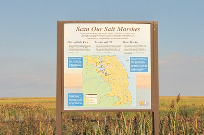
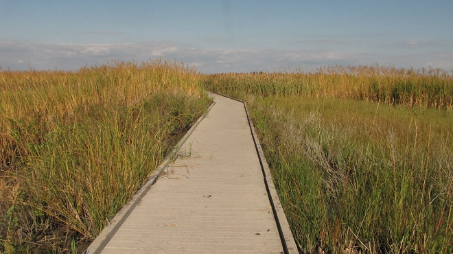
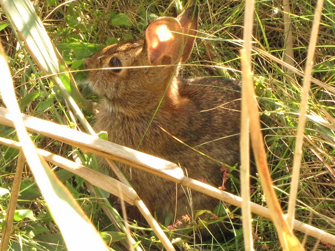
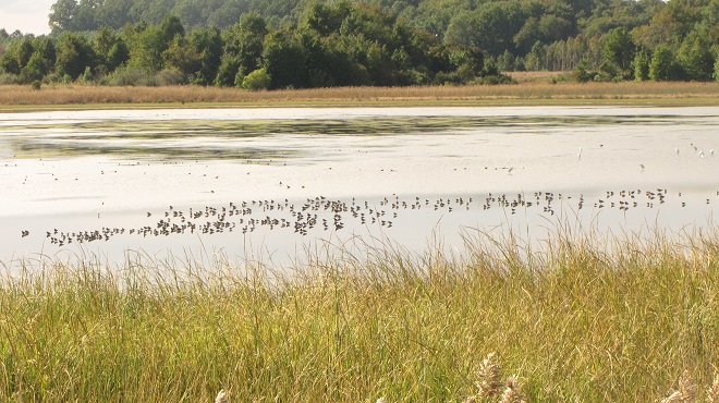
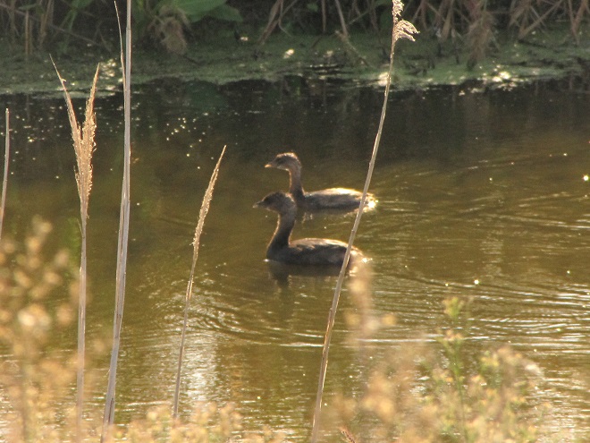
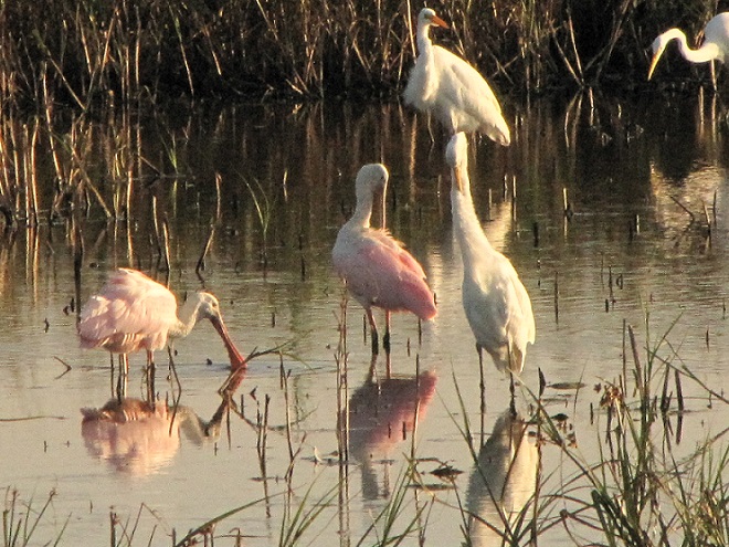
Uncle Ty’s current United States Fish and Wildlife Service Duck Stamp displayed on his dashboard is free admission to the tour road at Bombay Hook and other National Wildlife Refuges.The refuge at Bombay Hook includes woodlands, grasslands, and man-made freshwater pools, but it is predominately a protectorate of thousands of acres of tidal salt marsh bordering and purifying the waters of Delaware Bay. These marshes are renowned wintering areas for an Atlantic population of Snow Goose known as the “Greater Snow Goose” (Anser caerulescens atlanticus). Witnessing thousands of these birds rising over the marsh and glowing in the amber light of a setting sun is an unforgettable experience.Trails at various stops along the auto tour route lead to observation towers and other features. This boardwalk meanders into the salt marsh grasses and includes a viewing area alongside a tidal creek. Our visit coincided with a very high tide induced by east winds and a new moon.During high tide, an Eastern Cottontail (Sylvilagus floridanus) seeks higher ground near the boardwalk and the wooded edge of the salt marsh.As the tide rises, fast-flying shorebirds scramble from flooded mudflats in the salt marsh on the east side of the tour road.When high tide arrives in the salt marshes, shorebirds and waterfowl often concentrate in the man-made freshwater pools on the west side of the tour road. Glaring afternoon sun is not the best for viewing birds located west of the road. For ideal light conditions, time your visit for a day when high tide occurs in the morning and recedes to low tide in the afternoon.A view looking west into Shearness Pool, largest of the freshwater impoundments at Bombay Hook.Bombay Hook has many secretive birds hiding in its wetlands, but they can often be located by the patient observer. Here, two Pied-billed Grebes feed in an opening among the vegetation in a freshwater pool.One of Bombay Hook’s resident Bald Eagles patrols the wetlands.American Avocets (Recurvirostra americana) gather by the hundreds at Bombay Hook during the fall. A passing eagle will stir them into flight.An American Avocet, a delicate wader with a peculiar upturned bill.As soon as the tide begins receding, shorebirds and waterfowl like these Green-winged Teal begin dispersing into the salt marshes to feed on the exposed mudflats.The woodlands and forested areas of the refuge host resident songbirds and can be attractive to migrating species like this Yellow-rumped Warbler.For much of its course, the tour road at Bombay Hook is located atop the dike that creates the man-made freshwater pools on the western edge of the tidal salt marsh. If you drive slowly and make frequent stops to look and listen, you’ll notice an abundance of birds and other wildlife living along this border between two habitats. Here, a Swamp Sparrow has a look around.Savannah Sparrows are common along the tour road where native grasses grow wild.Bombay Hook is renowned for its rarities. One of the attractions during the late summer and autumn of 2021 was a group of Roseate Spoonbills (Platalea ajaja), vagrants from the southern states, seen here with Great Egrets and Snowy Egrets (Egretta thula).Roseate Spoonbills and Great Egrets at Bombay Hook.
Remember to go the Post Office and get your duck stamp. You’ll be supporting habitat acquisition and improvements for the wildlife we cherish. And if you get the chance, visit a National Wildlife Refuge. November can be a great time to go, it’s bug-free! Just take along your warmest clothing and plan to spend the day. You won’t regret it.
You say you really don’t want to take a look back at 2020? Okay, we understand. But here’s something you may find interesting, and it has to do with the Susquehanna River in 2020.
As you may know, the National Weather Service has calculated the mean temperature for the year 2020 as monitored just upriver from Conewago Falls at Harrisburg International Airport. The 56.7° Fahrenheit value was the highest in nearly 130 years of monitoring at the various stations used to register official climate statistics for the capital city. The previous high, 56.6°, was set in 1998.
Though not a prerequisite for its occurrence, record-breaking heat was accompanied by a drought in 2020. Most of the Susquehanna River drainage basin experienced drought conditions during the second half of the year, particularly areas of the watershed upstream of Conewago Falls. A lack of significant rainfall resulted in low river flows throughout late summer and much of the autumn. Lacking water from the northern reaches, we see mid-river rocks and experience minimal readings on flow gauges along the lower Susquehanna, even if our local precipitation happens to be about average.
Back in October, when the river was about as low as it was going to get, we took a walk across the Susquehanna at Columbia-Wrightsville atop the Route 462/Veteran’s Memorial Bridge to have a look at the benthos—the life on the river’s bottom.
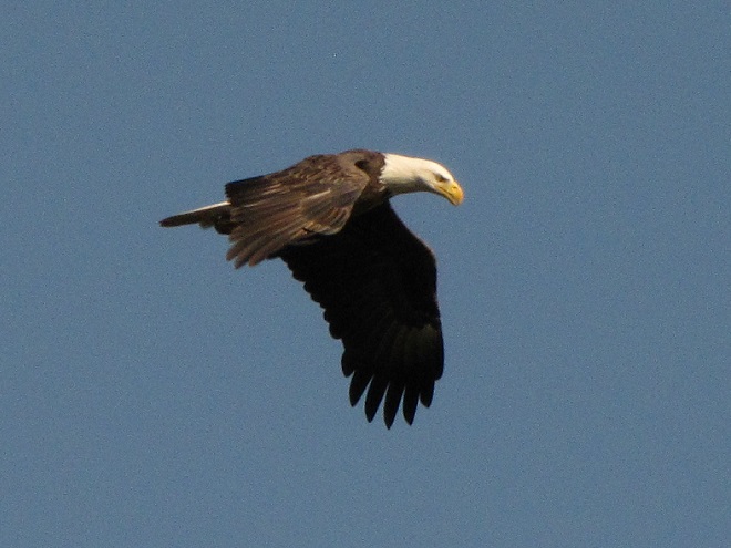
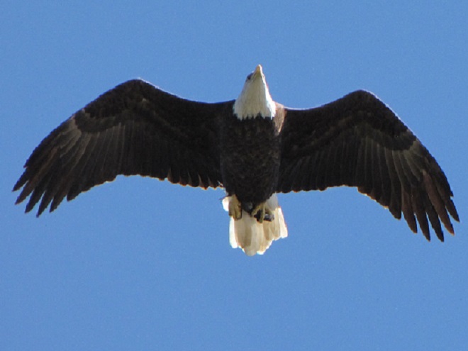
As we begin our stroll across the river, we quickly notice Mallards and a Double-crested Cormorant (far left) feeding among aquatic plants. You can see the leaves of the vegetation just breaking the water’s surface, particularly behind the feeding waterfowl. Let’s have a closer look.An underwater meadow of American Eelgrass (Vallisneria americana) as seen from atop the Veteran’s Memorial Bridge at Columbia-Wrightsville. Also known as Freshwater Eelgrass, Tapegrass, and Wild Celery, it is without a doubt the Susquehanna’s most important submerged aquatic plant. It grows in alluvial substrate (gravel, sand, mud, etc.) in river segments with moderate to slow current. Water three to six feet deep in bright sunshine is ideal for its growth, so an absence of flooding and the sun-blocking turbidity of muddy silt-laden water is favorable.Plants in the genus Vallisneria have ribbon-like leaves up to three feet in length that grow from nodes rooted along the creeping stems called runners. A single plant can, over a period of years, spread by runners to create a sizable clump or intertwine with other individual plants to establish dense meadows and an essential wildlife habitat.An uprooted segment of eelgrass floats over a thick bed of what may be parts of the same plant. Eelgrass meadows on the lower Susquehanna River were decimated by several events: deposition of anthracite coal sediments (culm) in the late-nineteenth and early-twentieth centuries, dredging of the same anthracite coal sediments during the mid-twentieth century, and the ongoing deposition of sediments from erosion occurring in farm fields, logged forests, abandoned mill ponds, and along denuded streambanks. Not only has each of these events impacted the plants physically by either burying them or ripping them out by the roots, each has also contributed to the increase in water turbidity (cloudiness) that blocks sunlight and impairs their growth and recovery.A submerged log surrounded by beds of eelgrass forms a haven for fishes in sections of the river lacking the structure found in rock-rich places like Conewago Falls. A period absent of high water and sediment runoff extended through the growing season in 2020 to allow lush clumps of eelgrass like these to thrive and further improve water quality by taking up nutrients, particularly nitrogen and phosphorus. Nutrients used by vascular plants including eelgrass become unavailable for feeding detrimental algal blooms in downstream waters including Chesapeake Bay.Small fishes and invertebrates attract predatory fishes to eelgrass beds. We watched this Smallmouth Bass leave an ambush site among eelgrass’s lush growth to shadow a Common Carp as it rummaged through the substrate for small bits of food. The bass would snatch up crayfish that darted away from the cover of stones disturbed by the foraging carp.Sunfishes are among the species taking advantage of eelgrass beds for spawning. They’ll build a nest scrape in the margins between clumps of plants allowing their young quick access to dense cover upon hatching. The abundance of invertebrate life among the leaves of eelgrass nourishes feeding fishes, and in turn provides food for predators including Bald Eagles, this one carrying a freshly-caught Bluegill.
These improvements in water quality and wildlife habitat can have a ripple effect. In 2020, the reduction in nutrient loads entering Chesapeake Bay from the low-flowing Susquehanna may have combined with better-than-average flows from some of the bay’s lesser-polluted smaller tributaries to yield a reduction in the size of the bay’s oxygen-deprived “dead zones”. These dead zones typically occur in late summer when water temperatures are at their warmest, dissolved oxygen levels are at their lowest, and nutrient-fed algal blooms have peaked and died. Algal blooms can self-enhance their severity by clouding water, which blocks sunlight from reaching submerged aquatic plants and stunts their growth—making quantities of unconsumed nutrients available to make more algae. When a huge biomass of algae dies in a susceptible part of the bay, its decay can consume enough of the remaining dissolved oxygen to kill aquatic organisms and create a “dead zone”. The Chesapeake Bay Program reports that the average size of this year’s dead zone was 1.0 cubic miles, just below the 35-year average of 1.2 cubic miles.
Back on a stormy day in mid-November, 2020, we took a look at the tidal freshwater section of Chesapeake Bay, the area known as Susquehanna Flats, located just to the southwest of the river’s mouth at Havre de Grace, Maryland. We wanted to see how the restored American Eelgrass beds there might have fared during a growing season with below average loads of nutrients and life-choking sediments spilling out of the nearby Susquehanna River. Here’s what we saw.
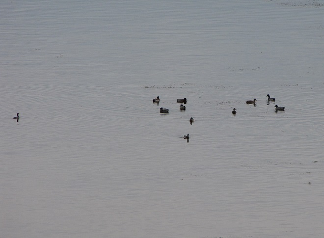
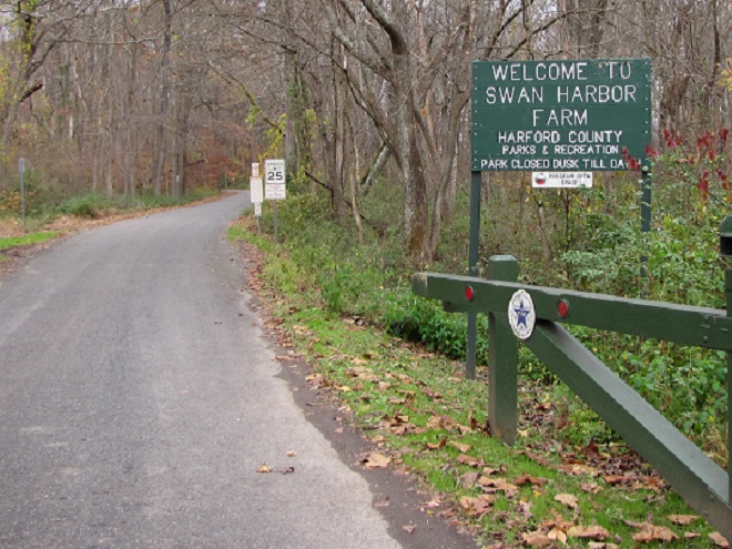
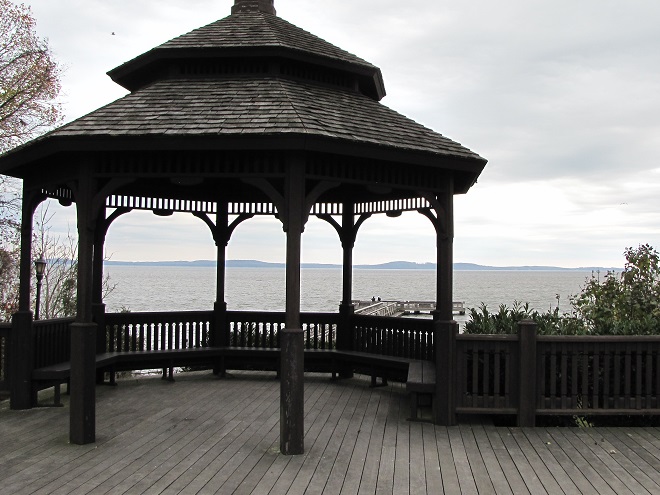
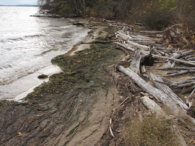
We followed the signs from Havre de Grace to Swan Harbor Farm Park.Harford County Parks and Recreation’s Swan Harbor Farm Park consists of a recently-acquired farming estate overlooking the tidal freshwater of Susquehanna Flats.Along the bay shore, a gazebo and a fishing pier have been added. Both provide excellent observation points.The shoreline looked the way it should look on upper Chesapeake Bay, a vegetated buffer and piles of trees and other organic matter at the high-water line. There was less man-made garbage than we might find following a summer that experienced an outflow from river flooding, but there was still more than we should be seeing.Judging by the piles of fresh American Eelgrass on the beach, it looks like it’s been a good year. Though considered a freshwater plant, eelgrass will tolerate some brackish water, which typically invades upper Chesapeake Bay each autumn due to a seasonal reduction in freshwater inflow from the Susquehanna and other tributaries. Saltwater can creep still further north when the freshwater input falls below seasonal norms during years of severe drought. The Susquehanna Flats portion of the upper bay very rarely experiences an invasion by brackish water; there was none in 2020.As we scanned the area with binoculars and a spotting scope, a raft of over one thousand ducks and American Coots (foreground) could be seen bobbing among floating eelgrass leaves and clumps of the plants that had broken away from their mooring in the mud. Waterfowl feed on eelgrass leaves and on the isopods and other invertebrates that make this plant community their home.While coots and grebes seemed to favor the shallower water near shore, a wide variety of both diving and dabbling ducks were widespread in the eelgrass beds more distant. Discernable were Ring-necked Ducks, scaup, scoters, Long-tailed Ducks, Redheads, American Wigeons, Gadwall, Ruddy Ducks, American Black Ducks, and Buffleheads.
We noticed a few Canvasbacks (Aythya valisineria) on the Susquehanna Flats during our visit. Canvasbacks are renowned as benthic feeders, preferring the tubers and other parts of submerged aquatic plants (a.k.a. submersed aquatic vegetation or S.A.V.) including eelgrass, but also feeding on invertebrates including bivalves. The association between Canvasbacks and eelgrass is reflected in the former’s scientific species name valisineria, a derivitive of the genus name of the latter, Vallisneria.
Canvasbacks on Chesapeake Bay. (United States Fish and Wildlife Service image by Ryan Hagerty)
The plight of the Canvasback and of American Eelgrass on the Susquehanna River was described by Herbert H. Beck in his account of the birds found in Lancaster County, Pennsylvania, published in 1924:
“Like all ducks, however, it stops to feed within the county less frequently than formerly, principally because the vast beds of wild celery which existed earlier on broads of the Susquehanna, as at Marietta and Washington Borough, have now been almost entirely wiped out by sedimentation of culm (anthracite coal waste). Prior to 1875 the four or five square miles of quiet water off Marietta were often as abundantly spread with wild fowl as the Susquehanna Flats are now.”
Beck quotes old Marietta resident and gunner Henry Zink:
“Sometimes there were as many as 500,000 ducks of various kinds on the Marietta broad at one time.”
The abundance of Canvasbacks and other ducks on the Susquehanna Flats would eventually plummet too. In the 1950s, there were an estimated 250, 000 Canvasbacks wintering on Chesapeake Bay, primarily in the area of the American Eelgrass, a.k.a. Wild Celery, beds on the Susquehanna Flats. When those eelgrass beds started disappearing during the second half of the twentieth century, the numbers of Canvasbacks wintering on the bay took a nosedive. As a population, the birds moved elsewhere to feed on different sources of food, often in saltier estuarine waters.
Canvasbacks were able to eat other foods and change their winter range to adapt to the loss of habitat on the Susquehanna River and Chesapeake Bay. But not all species are the omnivores that Canvasbacks happen to be, so they can’t just change their diet and/or fly away to a better place. And every time a habitat like the American Eelgrass plant community is eliminated from a region, it fragments the range for each species that relied upon it for all or part of its life cycle. Wildlife species get compacted into smaller and smaller suitable spaces and eventually their abundance and diversity are impacted. We sometimes marvel at large concentrations of birds and other wildlife without seeing the whole picture—that man has compressed them into ever-shrinking pieces of habitat that are but a fraction of the widespread environs they once utilized for survival. Then we sometimes harass and persecute them on the little pieces of refuge that remain. It’s not very nice, is it?
By the end of 2020, things on the Susquehanna were getting back to normal. Near normal rainfall over much of the watershed during the final three months of the year was supplemented by a mid-December snowstorm, then heavy downpours on Christmas Eve melted it all away. Several days later, the Susquehanna River was bank full and dishing out some minor flooding for the first time since early May. Isn’t it great to get back to normal?
The rain-and-snow-melt-swollen Susquehanna from Chickies Rock looking upriver toward Marietta during the high-water crest on December 27th.Cresting at Columbia as seen from the Route 462/Veteran’s Memorial Bridge. A Great Black-backed Gull monitors the waters for edibles.All back to normal on the Susquehanna to end 2020.Yep, back to normal on the Susquehanna. Maybe 2021 will turn out to be another good year, or maybe it’ll just be a Michelin or Firestone.
SOURCES
Beck, Herbert H. 1924. A Chapter on the Ornithology of Lancaster County, Pennsylvania. The Lewis Historical Publishing Company. New York, NY.
White, Christopher P. 1989. Chesapeake Bay, Nature of the Estuary: A Field Guide. Tidewater Publishers. Centreville, MD.
For those of you who dare to shed that filthy contaminated rag you’ve been told to breathe through so that you might instead get out and enjoy some clean air in a cherished place of solitude, here’s what’s around—go have a look.
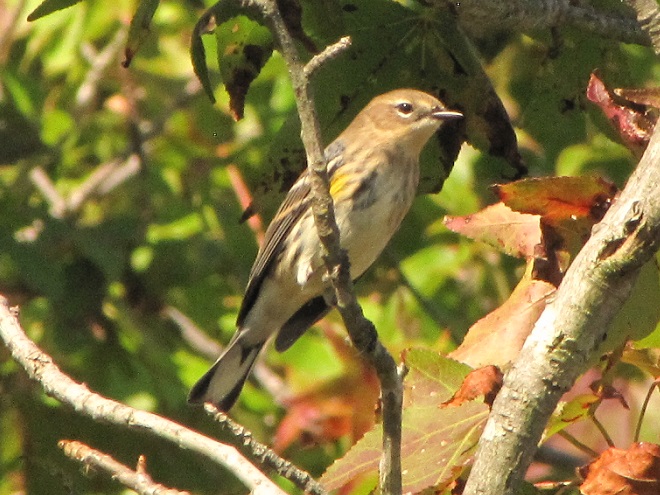
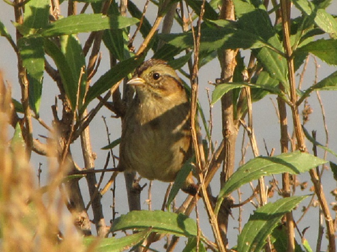
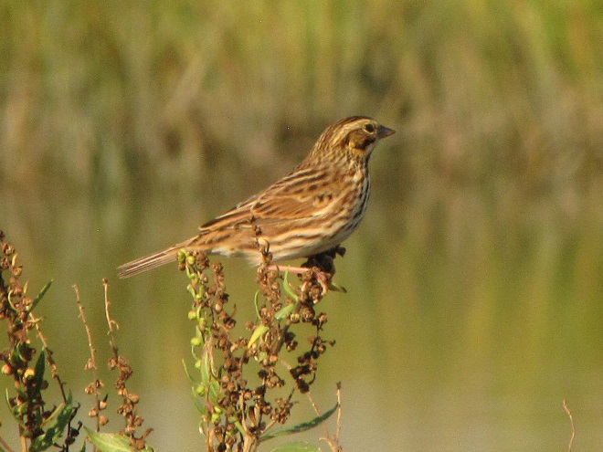
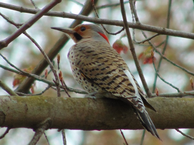
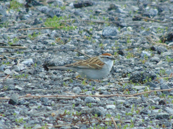
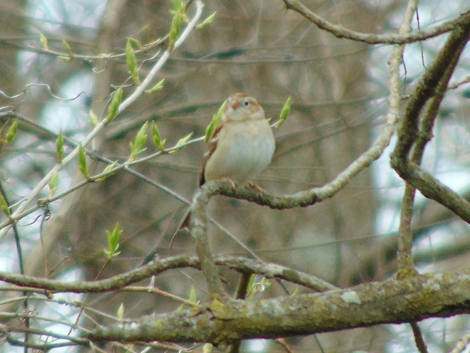
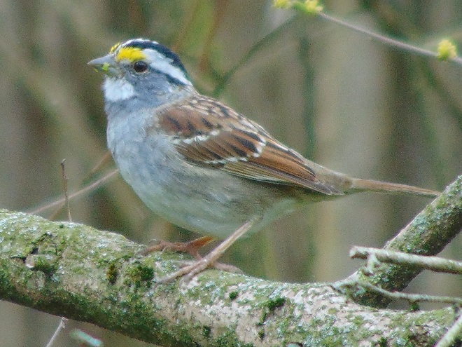
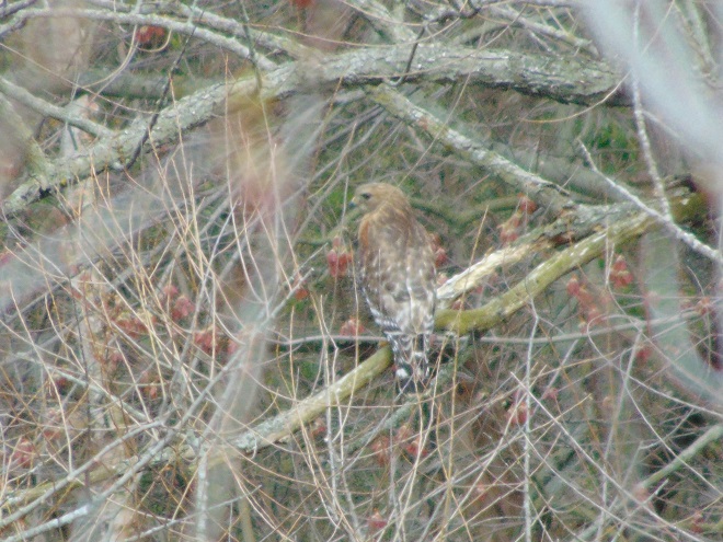
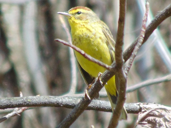
Northern Flickers have arrived. Look for them anywhere there are mature trees. Despite the fact that flickers are woodpeckers, they often feed on the ground. You’ll notice the white rump and yellow wing linings when they fly away.The tiny Chipping Sparrow frequently nests in small trees in suburban gardens. Lay off the lawn treatments to assure their success.Field Sparrows (Spizella fusilla) are a breeding species in abandoned fields where successional growth is underway.White-throated Sparrows spend the winter in the lower Susquehanna valley. Their numbers are increasing now as waves of migrants pass through on their way north.Northbound flocks of Rusty Blackbirds (Euphagus carolinus) are currently found feeding in forest swamps along the Susquehanna. Their noisy calls sound like a chorus of squeaking hinges.Migratory Red-shouldered Hawks are also making feeding stops at area wetlands.The Palm Warbler (Setophaga palmarum) is easily identified by its tail pumping behavior. Look for it in shrubs along the river shoreline or near lakes and streams. Palm Warblers are among the earliest of the warblers to move through in the spring.
The springtime show on the water continues…
Common Loons will continue migrating through the area during the upcoming month.Buffleheads are still transiting the watershed.Horned Grebes are occurring on the river and on local lakes.Seeing these one-year-old male Hooded Mergansers, the bachelors, wandering around without any adult males or females is a good sign. The adults should have moved on to the breeding grounds and local pairs should be well into a nesting cycle by now. Hatching could occur any day.Like Hooded Mergansers, Wood Ducks are cavity nesters, but their egg laying, incubation, and hatching often occurs a month or more later than that of the hoodies. Judging by the attentiveness of the drake, this pair of woodies is probably in the egg-laying stage of its breeding cycle right now.Redheads (Aythya americana) are stopping for a rest on their way north.In spring, Double-crested Cormorants proceed up the river in goose-like flocks with adult birds like these leading the way.
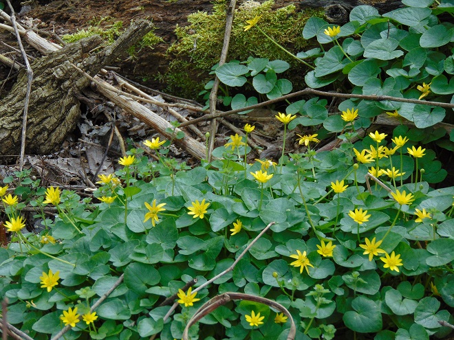
Hey, what are those showy flowers?
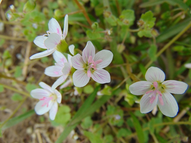
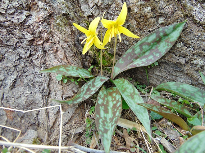
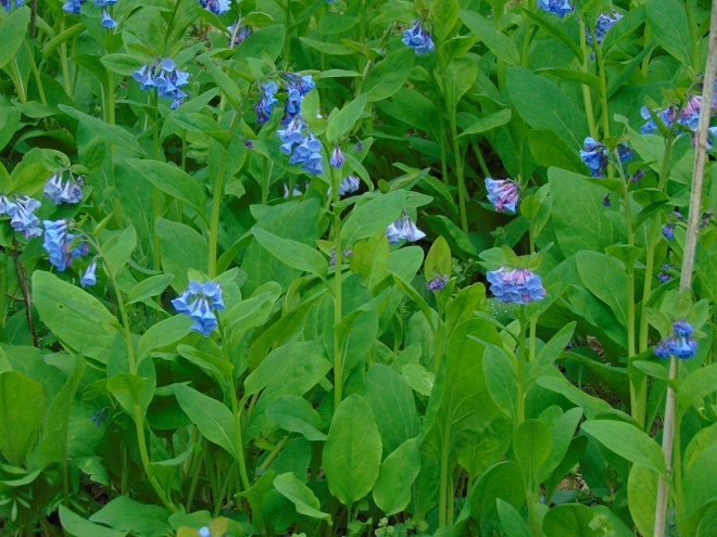
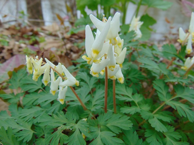
That’s Lesser Celandine (Ficaria verna). It’s often called Fig Buttercup. In early April it blankets stream banks throughout the lower Susquehanna region. If you don’t remember seeing it growing like that when you were younger, there’s a reason. Lesser Celandine is an escape from cultivation that has become invasive. While the appearance is tolerable; it’s the palatability that ruins everything. It’s poisonous if eaten by people or livestock.The Eastern Spring Beauty (Claytonia virginica) is a dainty native wildflower of riparian forests and other woodlands throughout the lower Susquehanna valley.The Trout Lily (Erythronium americanum) is beginning to bloom now. It’s a native of the region’s damp forests.Virginia Bluebells (Mertensia virginica) is not native to the Susquehanna watershed, but neither is it considered invasive. It creates colorful patches in riparian forests.Dutchman’s Breeches (Dicentra cucullaria) is a strikingly beautiful native wildflower that grows on undisturbed forested slopes throughout the Susquehanna valley.
Fog and mist lingered throughout the day, as did the migratory water birds on the river and lakes in the lower Susquehanna valley. As a continuation of yesterday’s post on the fallout, here’s a photo tour of some of the sites where ducks, loons, grebes, and other birds have gathered.
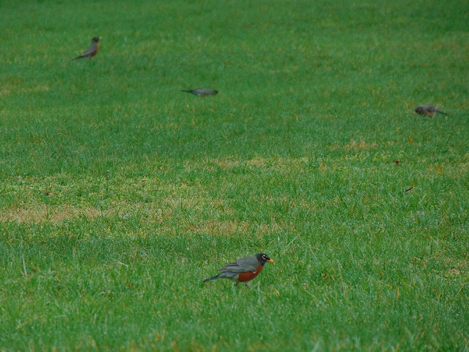
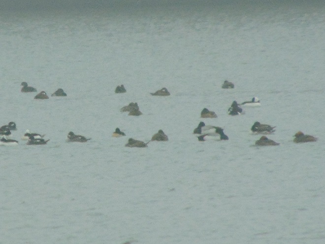
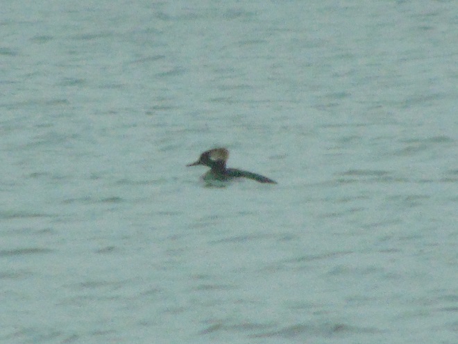
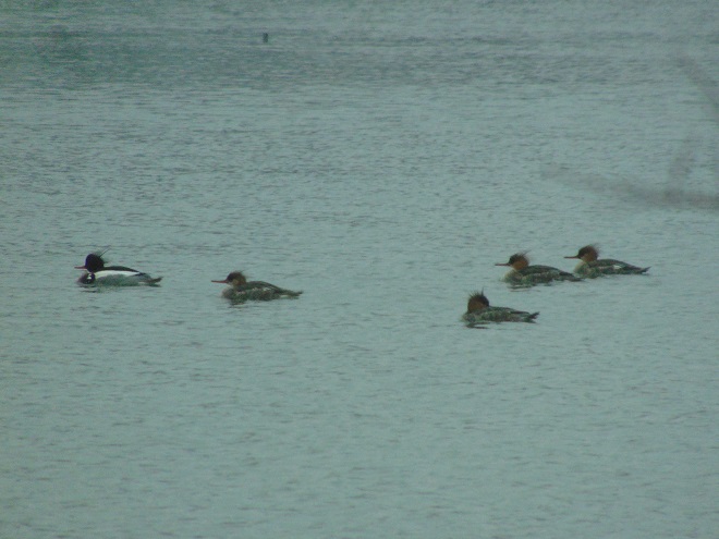
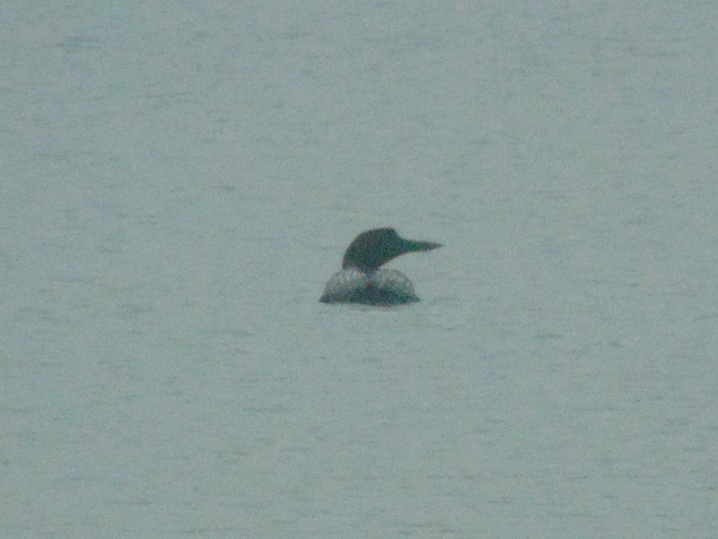
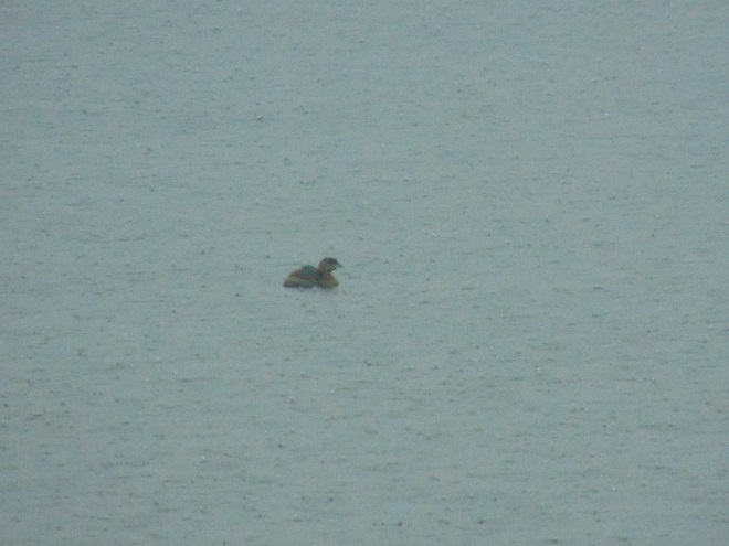
American Robins may have comprised a large portion of the northbound flight appearing on last evening’s radar images. Today, hundreds could be seen on soggy lawns where earthworms might be found near the surface. This flock was finding sustenance at Highspire’s Reservoir Park in Dauphin County.This drake Gadwall (Mareca strepera) and two hens had dropped in for a visit at the Highspire Reservoir Park.Hundreds of Buffleheads were on the fogged-in Susquehanna River at Harrisburg this afternoon. From Front Street and Maclay Street in front of the Pennsylvania Governor’s Mansion, they seemed to be everywhere in sight on the rain-swollen current. After passing downstream, flocks flew in a straight line formation just above the water’s surface as they made a short trip back up the river to then drift down through the channels once again.A portion of a raft consisting of about three dozen Red-breasted Mergansers floats by the Pennsylvania Governor’s Mansion. Several of the hundred or more Scaup on the river intermingled with these mergansers from time to time.A lone Long-tailed Duck (Clanqula hyemalis) near the aforementioned raft of mergansers. The Long-tailed Duck was formerly known as the Oldsquaw in North America. The common name used in Britain and Europe is now preferred.Two of at least a hundred Horned Grebes (Podiceps auritus) seen in the Susquehanna at Harrisburg this afternoon.American Coots (Fulica americana) at Memorial Lake State Park in Lebanon County.Buffleheads continue at Memorial Lake.One more Common Loon than yesterday at Memorial Lake.A mixed raft of diving ducks and grebes at Memorial Lake.A closeup of the same raft reveals Buffleheads, Scaup, Ring-necked Ducks, Ruddy Ducks (Oxyura jamaicensis), a Pied-billed Grebe, and Horned Grebes.
Local birders enjoy going to the Atlantic coast of New Jersey and Delmarva in the winter. The towns and beaches host far fewer people than birds, and many of the species seen are unlikely to be found anywhere else in the region. Unusual rarities add to the excitement.
The regular seaside attraction in winter is the variety of diving ducks and similar water birds that feed in the ocean surf and in the saltwater bays. Most of these birds breed in Canada and many stealthily cross over the landmass of the northeastern United States during their migrations. If an inland birder wants to see these coastal specialties, a trip to the shore in winter or a much longer journey to Canada in the summer is normally necessary—unless there is a fallout.
Migrating birds can show up in strange places when a storm interrupts their flight. Forest songbirds like thrushes and warblers frequently take temporary refuge in a wooded backyard or even in a city park when forced down by inclement weather. Loons have been found in shopping center parking lots after mistaking the wet asphalt for a lake. Fortunately though, loons, ducks, and other water birds usually find suitable ponds, lakes, and rivers as places of refuge when forced down. For inland birders, a fallout like this can provide an opportunity to observe these coastal species close to home.
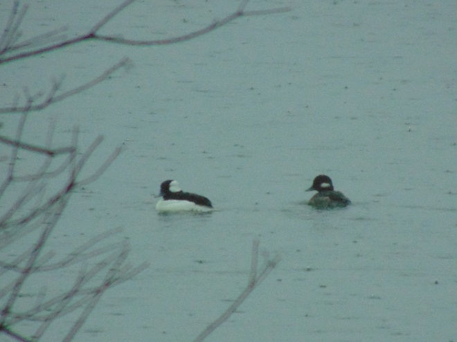
Not so coincidentally, it has rained throughout much of today in the Lower Susquehanna River Watershed, apparently interrupting a large movement of migrating birds. There is, at the time of this writing, a significant fallout of coastal water birds here. Hundreds of diving ducks and other benthic feeders are on the Susquehanna River and on some of the clearer lakes and ponds in the region. They can be expected to remain until the storm passes and visibility improves—then they’ll promptly commence their exodus.
The following photographs were taken during today’s late afternoon thundershower at Memorial Lake State Park at Fort Indiantown Gap, Lebanon County.
A one-year-old male Hooded Merganser (Lophodytes cucullatus).Red-breasted Mergansers (Mergus serrator) are a familiar sight in saltwater bays, not so familiar on inland bodies of water.A small raft of Scaup (Aythya species).A pair of Buffleheads.A Common Loon that lands in a parking lot is unable to take flight again. It must be transported to a body of water large enough for it to run across the surface and get the speed it needs to take off and resume its flight. This Common Loon at Memorial Lake has selected an ideal fallout haven. It will have plenty of runway space when it decides to leave.A Pied-billed Grebe (Podilymbus podiceps) in a heavy downpour.
Migrating land birds have also been forced down by the persistent rains.
The tail-pumping Eastern Phoebe is a common sight around the lower Susquehanna valley right now. Many will stay to breed, often building their nests under a man-made bridge, porch. or other structure.
Why not get out and take a slow quiet walk on a rainy day. It may be the best time of all for viewing certain birds and other wildlife.
Wild Turkeys (Meleagris gallopovo) will often leave the cover of woodlands and forest to forage in the open during a rain shower.During the final hours of this evening, wind-assisted flights of northbound migrating birds are indicated as blue masses around radar sites south of the Mason-Dixon Line. These nocturnal flights may constitute yet another fallout in the area of the showers and storms shown passing west to east through Pennsylvania, adding to the existing concentration of grounded migrants in the lower Susquehanna valley. (NOAA/National Weather Service image)